|
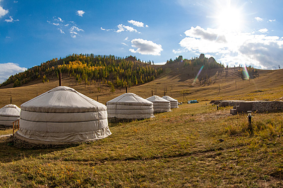
WE ARRIVED back into Guru camp with the tiny car still in one piece despite the rough roads. The sky was mostly covered in clouds again, but it was warm enough to explore the area. My guides were going to rest for the afternoon in their ger. A bus load of people had arrived while we had been away, but everyone seemed to be settled in their gers.
 |
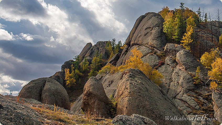
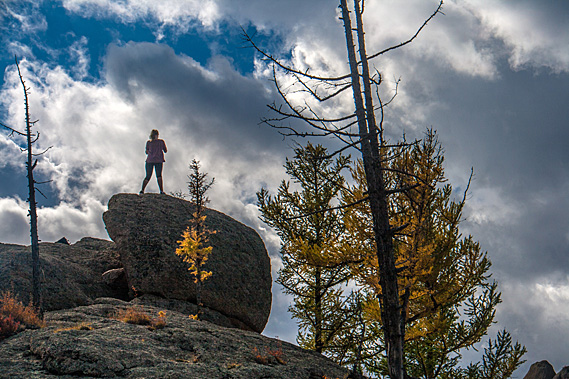
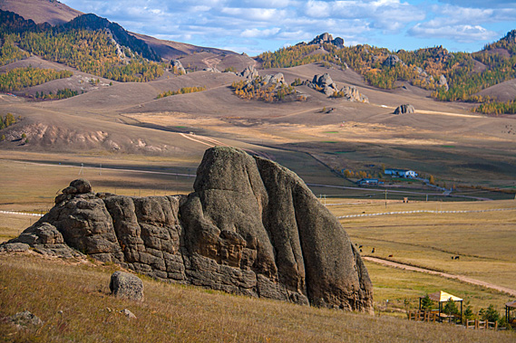
Monoliths above the camp |
I headed up the hill towards a saddle between some of the dramatic rocks. The spectacular outcrops reached up into the sky. A few pine trees were scattered behind some of the outcrops.
 |
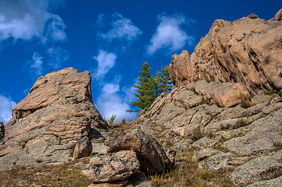
Granite outcrop close to saddle |
Although the temperature was well into the teens, the underground temperature was barely above freezing, with patches of permafrost buried in some sheltered locations. Although the grass looked healthy dying back for autumn, the conditions here are severe for much of the year, so the growing season is very short.
 |
View over the saddle |
A short fence needed to be crossed just before the saddle, but upon reaching the top the hills rolled up and down into large dales and valleys, and up into dramatic outcrops surrounded by green pine trees and yellow deciduous trees.
 |
Looking back through the saddle |
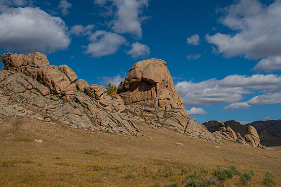
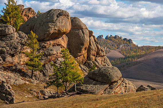
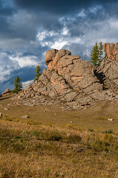
A solitary pillar outcrop towered at the summit of the next hill. Two scraggly pine trees grew on the exposed rock under the outcrop. Enormous boulders surrounded the outcrop almost appearing to reach up to it.
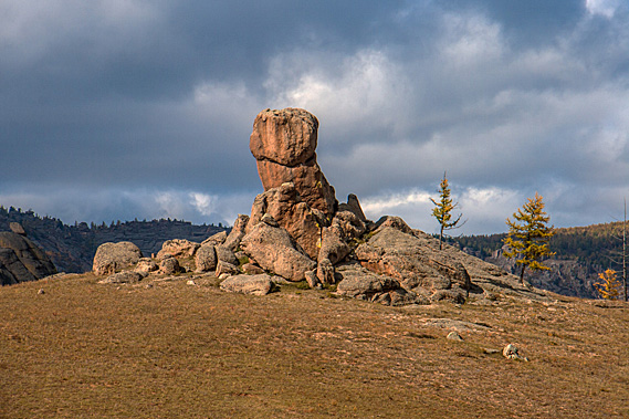 |
The solitary rock |
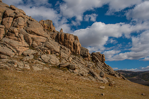
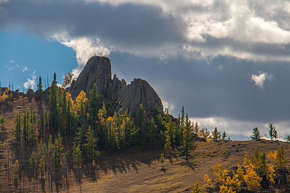
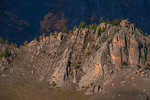
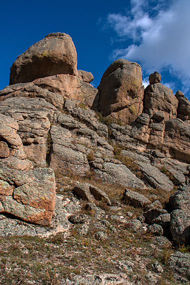
The outcrops running along the top of this ridge not only formed the dramatic cliffs above the gers, but they towered almost as high from this side. There was no easy way to climb them from any direction. This side of the rocks had stunted pine trees growing in the tiny spaces between them, growing vertical despite their direct exposure to the arctic winds. Fortunately, there was hardly a breath of wind up here today.
 |
Mountaintop |
The granite was formed from several volcanic intrusions of magma during the Triassic to Jurassic periods. The magma penetrated into a thick layer of Carboniferous sedimentary rock now completely eroded away. The granite never reached the surface to form a classic volcano. The granite intrusions would have happened unnoticed deep underground as the dinosaurs now making the southern half of the country over the Gobi Desert so famous walked on its forested surface.
 |
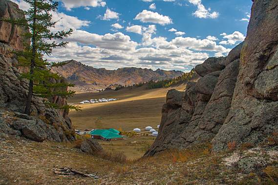
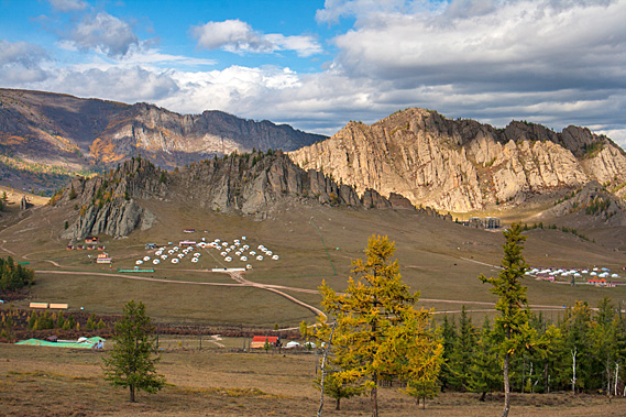
Looking down to ger camp |
As the land gradually rose from the Indian subcontinent slamming into the southern part of the Asian continent, sliding underneath forming the Himalayas and Tibetan Plateau, Mongolia also rose. The softer carboniferous rock completely eroded away leaving the Triassic to Jurassic granite formations exposed. Glaciers carved wide and deep valleys into the rock leaving the steep ridges and outcrops I was now exploring.
 |
A climber on a rock |
A group from the bus load came up through the saddle to explore the hills as I explored towards the Terelj River at the lower end of the outcrops. Looking out to the mountains behind I could see a row of vertical compression in the rocks where it is likely the interface between two different granite batholiths formed and compressed into each other deep beneath the earth’s surface at the time.
 |
Compression zone |
The line of vertical compression crossed over the hills I was standing on now, across the Terelj valley where an ancient glacier had ripped right through it, then onto another set of dramatic outcrops atop a high hill on the other side.
 |
Line of compression zones |
The rocks were difficult to climb, many of them overhanging, so I decided to return to the saddle and explore the hill on the other side. A few small mountain flowers were out making the most of the dying days of the short summer.
 |
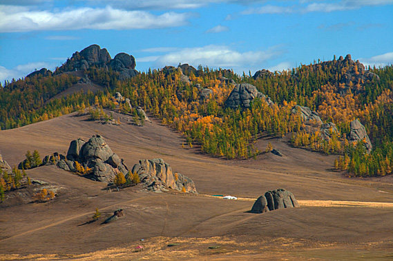
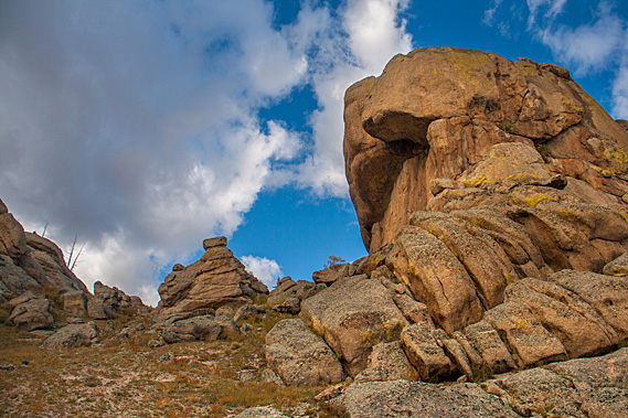
Outcrops |
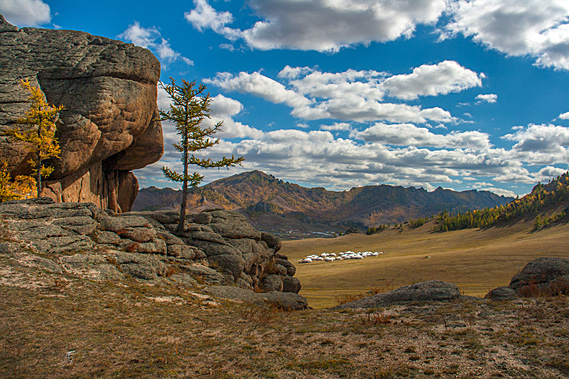
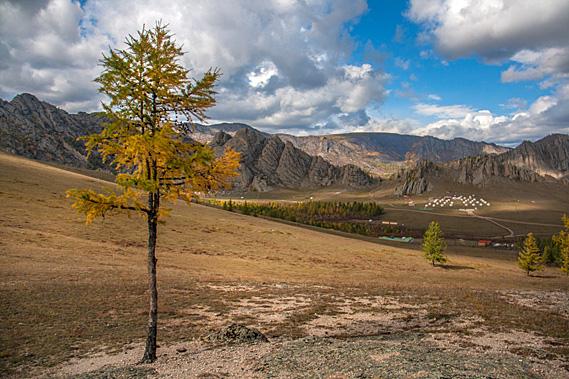
As I headed up the hill I could see more tourist ger villages. Some were accompanied by log buildings similar to Guru Camp. Some of these were substantial structures and others simple, depending on the size of the camp. Most camps were sheltered having their own rock formations towering above them, with human-like rock structures protecting them.
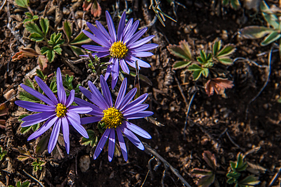 |
Mountain flowers |
Some of the outrops seemed to have the potential to have small caves in them. People have been living in this barren landscape for thousands of years since the Neolithic stone age times over ten thousand years ago. Back then they dug deep pit houses, covering them with an a-frame of logs and sealing the spaces with other vegetation. With the emergence of pit houses came rock art, in common with other stone age cultures around the world.
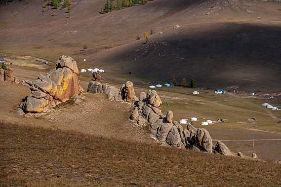 |
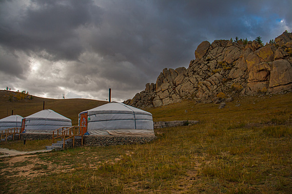
Outcrops watching over gers |
This continued through the paleolithic and bronze ages when the art increased, though little around this area. Some areas had rock carvings. Some of the paintings have been dated back to ten thousand years ago at the time when bows and arrows were first used and the people began domesticating cattle. They began using iron here around 7000 years ago.
 |
Hill slope |
After exploring the hill for a while I returned through the saddle to explore the base of the rock face above our camp. Giant house sized boulders overhung precariously overhead, looking ready to roll down at any time.
 |
Under the monoliths |
I headed down to a relatively small outcrop overlooking our log cabin. Large clouds were now rolling in over the hills, the dark underside bringing the threat of rain. A stone path with a flimsy fence led to the top of the small outcrop. I climbed the steps to a perfectly smooth surface near the summit.
 |
Outcrop with flat viewing platform |
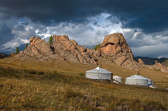
The clouds were barrelling in quickly now. The deep blue cloudless sky over the temple was long forgotten, so I returned to the shelter of my ger, wondering how it would cope with the coming tempest. I’m sure this is nothing compared to some of the arctic storms that come through here in the dead of winter.
 |
Jagged rocks |
With that said though, this was the tail end of the rainy season. The rainfall here averages only 287 millimetres per year, with nearly all of it falling around July in the middle of summer. This storm seemed to be a bit late in the season. Little precipitation falls during the very long and cold winter so the snow doesn’t get deep. It is too cold to carry clouds here, with just a few small snow flurries falling over the long course of winter, leaving most days crisp and sunny staying below minus twenty degrees.
 |
Overhanging rock |
The fire lit earlier in the ger had long died down and it was rather cold inside. I entered the hobbit sized door just before before the rain started falling, so I sat on one of the beds watching the large drops of rain falling on the plastic skylight at the top of the ger. Thunder rumbled outside, echoing off the walls of rock around the valley.
 |
Approaching storm |
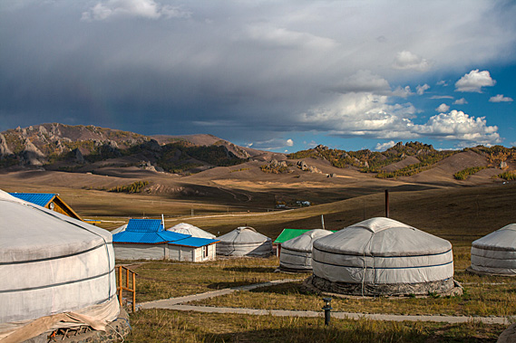
As quickly as the storm arrived, the rain suddenly stopped to be replaced with sunshine streaming through the plastic skylight. I headed outside in the crisp cool air smelling the fresh humus fed by the rain and nitrogen of the short storm.
 |
Sun comes out after storm |
Most of the sky to the west over the hill was completely clear. The sun streamed on the gers. Although there was apparently a bus load of people here, nobody else was around even though they had all returned here before me. Perhaps they were up at the temple and Turtle Rock.
 |
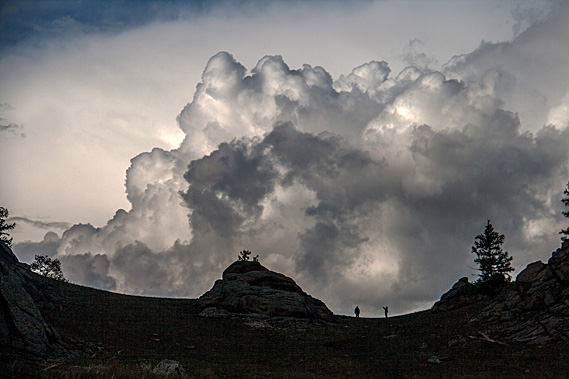
Storm over the mountains |
The cloud and rain had crossed the valley and were already disappearing behind the hills on the other side of the valley. I say they are hills, but some were approaching 2000 metres high. The valley floor was over 1400 metres above sea level, so a 600 metre high hill here would be over two kilometres above sea level. No wonder the winters are so cold here.
 |
Receding storm |
A short segment of rainbow appeared over the hills on the other side of the valley. An eagle flew through the rainbow in search of its prey. The bus load of people returned and a few of them explored the hill.
 |
More clouds |
The sun didn’t last long. An enormous bank of puffy cloud formed over the back of the hill. Fortunately this cloud passed behind the top of the ridge, no doubt dumping a good lot of rain in the valleys beyond the temple.
 |
Another storm passes |
It was nearing dinner time, so I headed across to the log cabin, looking at the spectacular wood carvings and paintings on the walls.
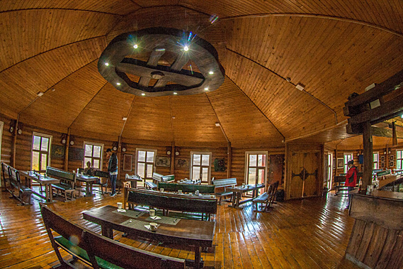 |
Inside the dining hall |
They were all traditional Mongolian artworks blending in very nicely with the chalet style log cabin building. The building seemed very large on the inside, with two octagonal sections side by side rising to quite a high ceiling.
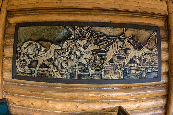 |
One of the carvings |
It was furnished with very solid timber tables and chairs stained a very dark brown. The tables were already set with cups, cutlery and serviettes.
|