|
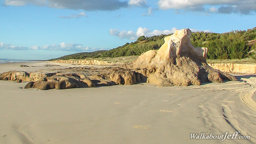
ABOUT half way up the 35 kilometre long exposed eastern coast of Moreton Island is Camel Rock, a rare outcrop of sandstone. This is just one of two solid outcrops that I have found on the island, the other being along the north coast.
At some point in the past a very high sandhill stood here. The weight of the sandhill compressed the sand at the bottom of the dune into solid rock. At some point the sand dune was blown further inland and the coast line has advanced to the west leaving the solid compressed stone formation of Camel Rock exposed to the elements on the beach.
|