|
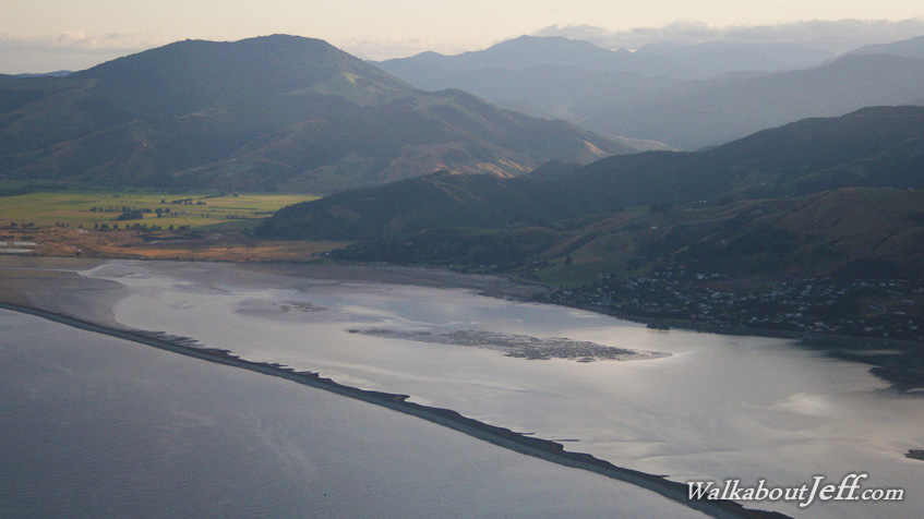
FLYING out from Nelson towards Auckland on my way back home to Brisbane, I pass Nelson's Boulder Bank.
This is similar to a sandspit except the strong currents here ensure the deposits are instead large boulders. The boulders conceal a large estuary which floods with the incoming tide. When the water drains away it leaves a large mud flat.
Beyond the mudflats are a series of steep hills upon which Nelson is nestled under. Significant fault lines run along the bottoms of these hills which have been thrust up in recent geological mountain building processes. Around here the hills are around a kilometre high, but towards the east coast these rise to over two and a half kilometres high.
|