|
||||||||||||||||||
|
||||||||||||||||||
Home > Diaries > 2013 > 337 |
||||||||||||||||||
|
||||||||||||||||||
|
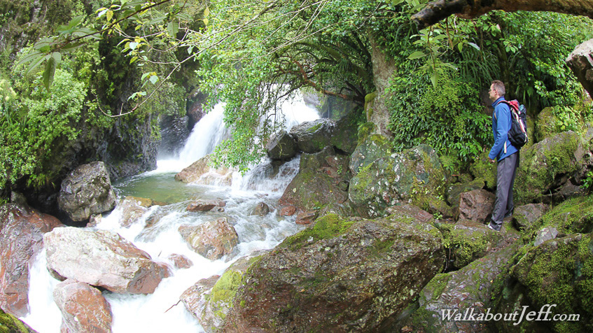
WHILST on a short trip back to New Zealand, I returned to the location of the my first ever bush walk. I first did the Sharplin Falls walkway in 1982, and returned twice since, the last time in 1986. All three times I walked through some of New Zealand's prettiest forest following the trail beside Bowyers Stream until it abruptly stopped at a precipitous gorge with vertical cliffs on either side and the stream cascading down large boulders. The waterfall was somewhere above the gorge, but neither time in my previous attempts had I succeeded in reaching the mysterious waterfall. Today it was fourth time lucky. Thanks largely to an improvement of the trail with the rocky gorge climb now replaced with a very long stairway reminiscent of Mount Kinabalu followed by a narrow gantry sidling around the precipitous gorge cliff face, after all these years I was finally rewarded. After a long ascent over the gorge followed by a short descent into a forested grotto, I arrived at the waterfall. The entire hike in this most magical of forests was a profoundly beautiful experience. Over the coming weeks I will be doing a full blog on this amazing place, and you will see why this place inspired my trekking addiction. Blog from today: |
||||||||||||||||||
|
||||||||||||||||||