|
STARTING from Manorina in the early morning, I followed the Morelia trail rising gradually uphill through mixed rainforest and eucalypt forest towards the top of Mount Nebo three kilometres away. The trail must be very old as I saw two milestone stakes in the ground giving the distance in either direction in miles.
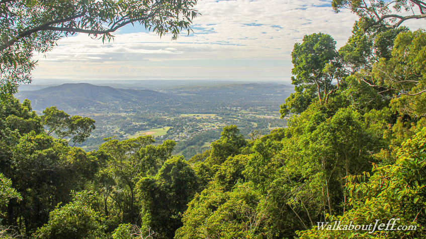
The forest was thick throughout the entire trek until the very end where the trail ended atop a large rock affording a clear view through the forest over Samford Valley and out to Moreton Island which seemed to hover over the bay in the distance.
I returned along a forestry management trail which crossed the 617 metre high summit of Mount Nebo about 300 metres behind the lookout. There were no signs here confirming this was the summit and I had to confirm this was the correct summit on a map. From there I returned to the main trail back towards Manorina but diverted along the 1 kilometre Atrax walking track where the forest floor was covered in small ferns over much of the distance.
|