|
||||||||||||||||||
|
||||||||||||||||||
Home > Diaries > 2014 > 384 |
||||||||||||||||||
|
||||||||||||||||||
|
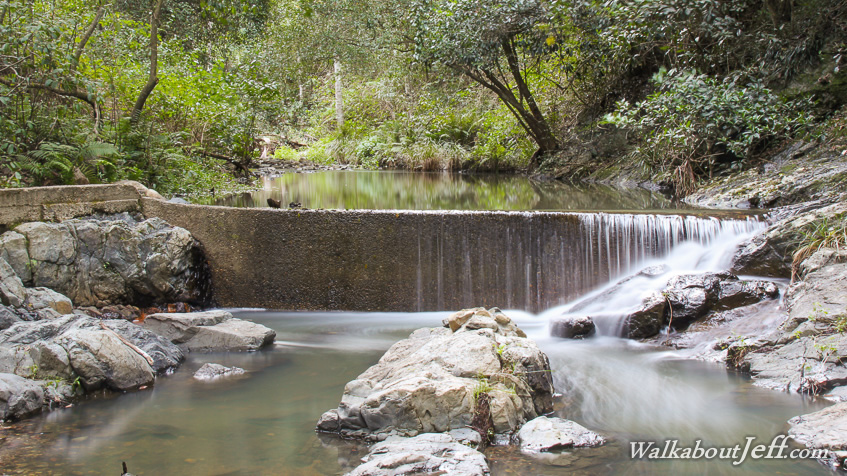
HEAVY rain had fallen overnight, the first in months. This rare dry season downpour reinvigorated the local streams including the South Pine River shown here near its source. A small weir crosses the river creating a reflective pond behind it. Water flows over one end of the weir in silver braids to tumble down to the rocks below and run into a natural cascade downstream. |
||||||||||||||||||
|
||||||||||||||||||