|
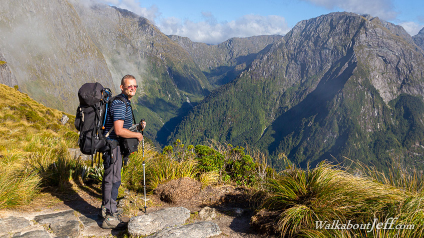
LEAVING from Mintaro Hut in the early morning a steady climb switch backing across a steep forested slope near the back of the spectacular Nicholas Cirque up onto Mackinnon Pass, a thin plateau with phenomenally high cliffs dropping off either side and towering obelisk mountains shrouded in mist at either end.
Here I am pictured near the top just a short distance from a large stone monument looking into the headwaters of the Arthur River, a full vertical kilometre below me.
From here the track followed along the top of the plateau, reaching its highest point at 1140 metres before dropping off down the far end along a steeply descending track all the way to Dumpling Hut at the bottom of the valley.
|