|
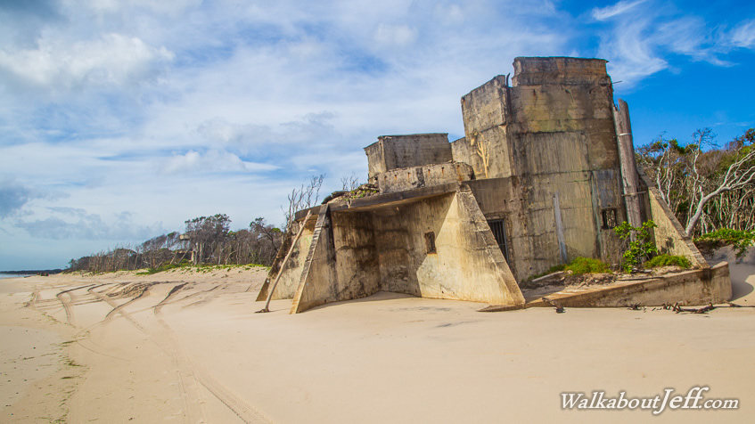
NEAR the top of Bribie Island is the eroding remains of several large military concrete buildings. They were strategically set up where the deep water channel the ships navigate their way towards Moreton Bay comes very close to the island.
The channel follows the Brisbane River where it flowed when sea levels were lower during the last ice age. The channel provides clear access in between the otherwise complex maze of submerged sand banks just beneath the surface.
The fort provided defence at the entrance of Moreton Bay during World War II. In the decades of peace following the war, the buildings of the fort have been eroded by the sea into ruins, partially buried by the sand.
|