|
WINTER had suddenly set in with a vengeance with a severe frontal system bringing snow down south. The overnight temperature here plummeted to around five degrees making for a very cold sunrise over the Nerang River at sunrise.
Once sunrise was over I headed around to the start of the Federation Trail heading up the middle of "The Spit, the natural and uninhabited northernmost section of the Gold Coast. I reached the top where a wide channel separates the mainland from South Stradbroke Island. Heading out onto the rocky breakwater under some of the clearest cloudless skies I've ever seen here, I could clearly see all the way up to Point Lookout (where I was last weekend) about 60 kilometres to the north, and down to Point Danger about 34 kilometres to the south.
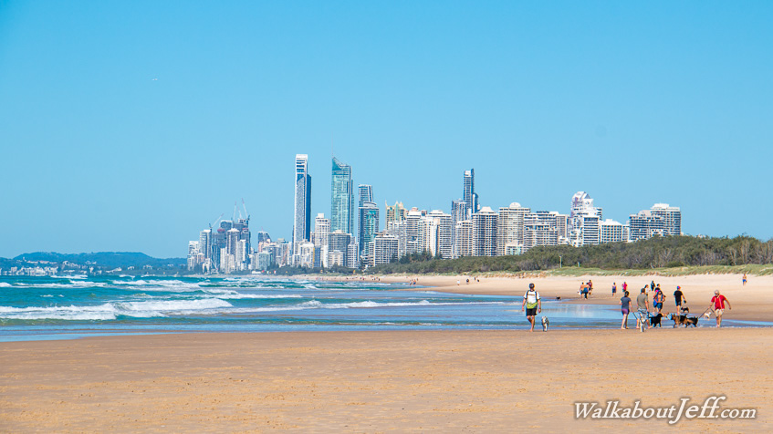
From the breakwater I followed the beach down to the bustling centre of Surfer's Paradise. The midday temperature was in the low 20s, but the beach was still quite crowded as it always is.
|