|
THE REMOTE lower third of the island has a lot of wildlife. As the sun came over the horizon numerous large grey kangaroos were grazing on the dunes, some coming out on the beach. Birds of numerous species were also foraging the beach. Apparently there are 260 species of bird here, though many would have long migrated back to Siberia and Alaska for the northern summer.
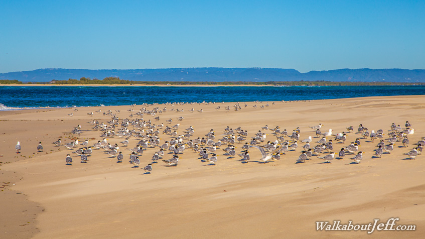
I reached the bottom of the island mid morning, at the narrow deep channel now separating North and South Stradbroke Islands. A large area of exposed sand had hundreds of crested terns and silver gulls watching the rapid tidal currents for fish to catch. On the other side of the channel was the top of South Stradbroke Island, where I had been exploring less than two weeks ago. Beyond that was the mainland framed by the high flat plateaux of the Tweed Volcano, a large extinct shield volcano.
Returning up the beach towards my campsite and Point Lookout 38 kilometres away, the beach was initially quite narrow with the high tide, but gradually widened as the tide went out. Numerous people had set up camp in the 15 camping grounds along the lower half of the island, so the beach had quite a few 4-wheel drive vehicles running along it. Resting up on the sand dunes every couple of hours, I was at one point rewarded with seeing several whales offshore on their annual northward migration.
|