|
||||||||||||||||||
|
||||||||||||||||||
Home > Diaries > 2022 > 946 |
||||||||||||||||||
|
||||||||||||||||||
|
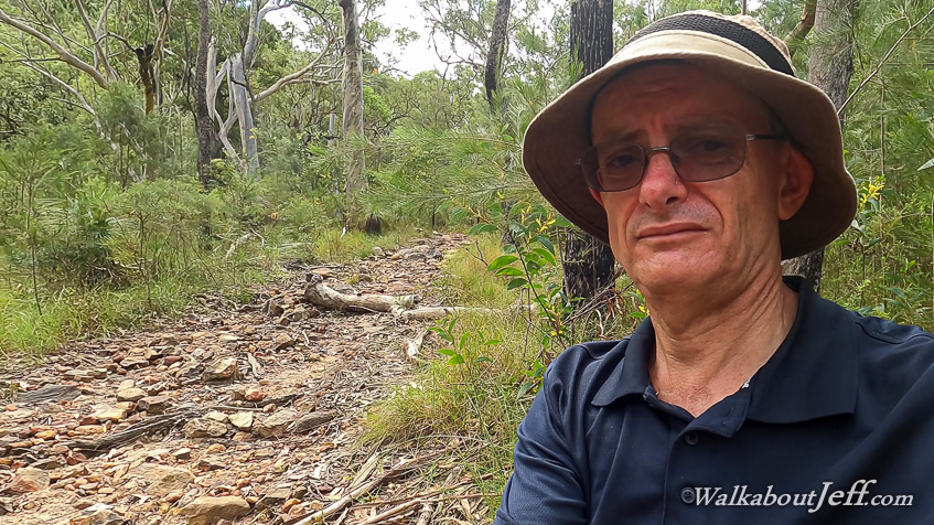
I TOOK the train up to Elimbah Station, then followed the path along Smith Street to Old Gympie Road where the track I had followed from Caboolture ended. From here I crossed the road and continued following it passing Mount Elimbah (which I had climbed last year) and continued along the gravel road to see how far it went. The road eventually descended into a ford across six mile creek, now crossable but still with a lot of water going over it. An abandoned ute sat mostly submerged in the creek about twenty metres downstream from the ford. It had attempted to cross during the flood and was carried downstream and stuck amongst the debris unable to be retrieved. I crossed the ford and continued along the steep rise as the road headed towards a junction. It was now following a row of pylons through a wide clearing through the Beerburrum State Forest. Once across the sealed road, Old Gympie Road turned into a dirt track only suitable for four wheel drives. The dirt road was a bit damaged from the flooding, but people were still able to drive on it. I hiked along the side of this dirt road with pine forest growing to the right and the forest to the left been very recently cleared. I started following the road with a clear view of the twin peaks of Mount Tunbubudla a little to the left of straight ahead. I continued following the road for two kilometres before reaching the junction where another dirt road followed the side of the cleared forest heading up the hill closer to the twin peaks. They were now hidden behind the tall forest, but the trail was definitely heading uphill. I could now see back to Mount Elimbah poking above the distant forest. I had to take a big detour as part of this track was closed due to the clearing of the pine forest to the left. The detour took me deep into the pine plantation to where I eventually found a rough track heading towards the twins and followed that some distance before reaching another dirt road. I followed this dirt road to the junction of the dirt road I was originally following. Upon reaching the junction I looked for a track heading up the twins. It was initially hard to find, but easy to follow despite being mostly overgrown in the scrub. I followed this track for about fifteen minutes before reaching the junction with the main walking track heading up to the saddle between the twin peaks. I followed this track, being quite washed out in places from the recent flooding. Fortunately I was able to progress along it well with only one small diversion near a creek crossing. Once over the creek the track began a moderately steep ascent towards the saddle with each peak of Mount Tunbubudla towering on either side. The track was a bit rough, but I eventually reached the flat saddle between the two volcanic plug peaks. A track steeply rose from either side of the saddle towards the summits of each peak. I didn't have time to attempt to scale either of these, and the scrambles would be too slippery from all the recent rain anyway. They will definitely be worth an attempt to climb during the dry season later this year. After resting at the top of the saddle, I started the long descent down the other side. After an initial moderately steep section, the track continued dropping along a gentle slope with a couple of short diversions around where it had washed out. Eventually I reached a dirt road at the bottom of the hills. Here I turned right and followed the track towards Beeburrum. After a kilometre I returned to the row of pylons cutting across the hills. Here I rested for a while before continuing along the track through the forest a short distance before reaching Old Gympie Road. It was a lot rougher at this end and a few four wheel drives and motorbikes were attempting to negotiate it, but all had to turn back due to a big washout a little ahead and a big tree having come down a little past the washout. I could reasonably easily walk and climb along that section of road, but none of the vehicles could pass through from either side, so they all turned back. Just before the washout was a junction where I followed a rough dirt road mostly overgrown with grass. The track passed through the dense pine forest eventually reaching one of the main gravel roads, which I followed passing over an old quarry and continuing until I reached another junction and followed a dirt road up a steep section heading towards Beerburrum. I found another partly overgrown track to the right and followed that the final two kilometres into Beerburrum. This track descended to a couple of small creek crossings, spotting a large red bellied black snake at one of the crossings. It poked its head up before scurrying away into the dense grass. About another two hundred metres I reached a sealed road at the start of the residential area of Beerburrum. I followed this a short distance before reaching one of the main roads which I followed along a footpath into Beerburrum town to watch the sunset behind Mount Beerburrum and catching the train back home. |
||||||||||||||||||
|
||||||||||||||||||