|
||||||||||||||||||
|
||||||||||||||||||
Home > Diaries > 2023 > 1036 |
||||||||||||||||||
|
||||||||||||||||||
|
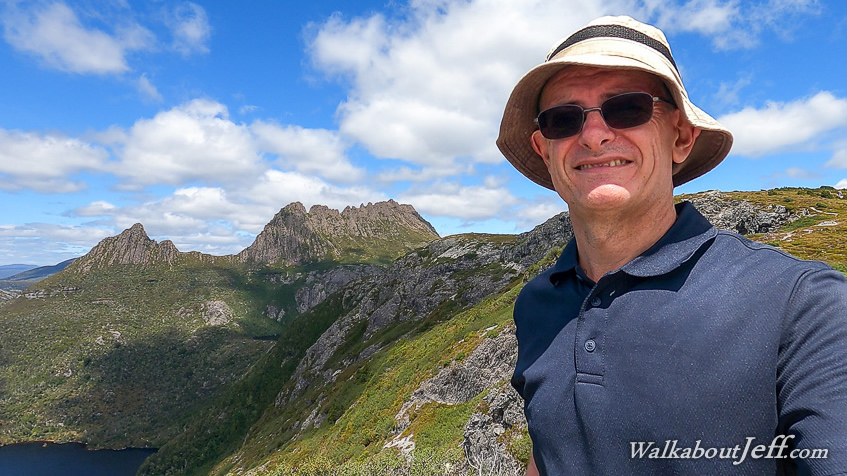
I arrived at the abandoned Macpac store in Launceston just after sunrise, where I met up with the guides and fellow hikers before embarking on our journey westwards towards The Overland Track, Australia's premier alpine trek. The journey across the top of the island took a couple of hours. We crossed Mersey River, about 30km upstream from the ferry terminal in Devonport, and made a stop at Bossimi's Bakehouse and Cafe in Sheffield, from where we enjoyed an impressive view along High Street towards Mount Roland. Leaving Sheffield behind, we headed around Mount Roland, starting our climb through the forested hills towards the highlands. We crossed Forth River, which reaches the coast to the west of Devonport about fifty kilometres downstream. Part of the track followed the upper reaches of this river. After crossing the river, we headed up a longer hill to a plateau over 700 metres above sea level. While much of the land here was cleared grassland, there were still many ancient windswept trees littering the plateau towards the distant forest on either side. This was a stark reminder that we were heading into subalpine territory. We pulled into the Cradle Mountain Visitor's Centre carpark and stopped at one of the shelters to pack our final essentials, including four days worth of food and our tents, which added significant weight to our packs. Once we were all packed, we went into the visitor centre to pick up our trail passes. Our driver left to pick up another group who were finishing the trek today, and transporting them back to Launceston, a nine hour drive all up. Once we had our passes, we caught a large shuttle bus into the park. Apparently, cars are not allowed along this road. Following the Dove River upstream, I noticed several excellent walking tracks leading from each of the frequent bus stops. I made a note to return here when I'm next around to do some of these shorter walks. We got off at Ronny Creek, the third bus stop on the way to Dove Lake under Cradle Mountain, which we had already glimpsed in the perfectly clear morning. Here we crossed the road and posed for photos at the large sign at the start of the track at 870 metres above sea level. We set off along the boardwalk heading around the side of a large heathland swamp against the side of a low rise. This was a pleasant and easy start to what I figured would later be quite a bit more challenging. After ten minutes, we crossed a bridge over Ronny Creek at a four-way junction to take the ascending track, starting a long uphill towards Marion Lookout. A gravel stairway led out of the heath into the forest of gnarly trees alternating with scrub. Not long passed before we entered a forested gully and climbed a wooden stairway up Crater Creek until reaching Crater Falls, where we stopped. Here we had a look at some of the trees, including the Tasmanian Myrtle (Nothofagus cunninghamii) and the deciduous Fagus/Tanglefoot (Nothofagus gunnii), neither of which I had ever seen before. They are both closely related to the beech trees of New Zealand and Patagonia. Following our stop at the waterfall, we followed a steep stairway out of the forest into scrubby heathland up to the creek's source at Crater Lake, at 1050 metres above sea level. A little boat shed sat at the stony edge of the mirror-smooth lake perfectly reflecting the two hundred metre high wall of rock surrounding most of the lake, presumably giving it its name. This isn't a crater though; it is a small glacial valley where the pre-Cambrian folded base rocks were carved out during past ice ages. This lake and Dove Lake on the other side of the ridge are Australia's best examples of remnant glacial lake. After our break at Crater Lake, we started trekking along the track rising up under the left hand ridge. The stony track started as a moderate climb, but steepend as it approached the top of the ridge and continued rising towards the top of the hills. The track steepened with a stairway rising through the low scrub revealing amazing views of the dark Crater Lake below us. At one point we had to pull ourselves up by a chain beside the irregular stairs. Most of the other people here were day hikers without the heavy packs we were lugging up this steep section of hill. I was very envious of them. After a long climb, we reached the top of the steep section where we rested briefy before continuing up another moderately steep section of track through the pale rock and heath until reaching Marion's Lookout. From here we had excellent views across the dark blue waters of Crater Lake and Dove Lake two hundred metres below us as cloud began to cover the sky above us. Behind Dove Lake rose the spectacular Cradle Mountain, a spectacular formation of volcanic dolerite intruded into this area during the Jurassic. The mountain is just a tiny part of an enormous dyke of volcanic dolerite which at the time covered an enormous area over this region even though none of it ever reached the surface. In the millions of years since, the land has eroded hundreds of meters washing away much of the dolerite, leaving only the craggy summits of Tasmania's highest mountains. The dolerite had distinctive vertical columns making the mountaintop look impossible. Looking across the jagged summit of Cradle Mountain, it dropped steeply to another rise of dolerite called The Horn. Beyond that was a huge wedge of rock remnant of a Permian deposit lain over the otherwise common pre-Cambrian deposits. Looking further past the moutnain were more distant hills and mountains, including Mount Roland which we had passed earlier today. Looking back I could see along the boardwalk track to where we had started walking today, and along the road up to the edge of Dove Rock. After resting at Marion Lookout, we continued our journey along the Overland track, heading towards a saddle behind Cradle Mountain. Fortunately the big uphill was behind us, and although we were still gaining altitude, the rise was very gentle alternating between pale gravel and boardwalk. We were just a few minutes out from Marion Lookout when one of the guys in our group blew out one of his boots with half the sole coming off. Fortunately a bit of duct tape provided a nice temporary fix but we wondered whether it would last the whole six days of the trek. The track continued becoming nice cobblestones reminding me of the Inca Trail as we progressed towards the right hand end of the Cradle Mountain dolerite formation. Rising to today's highest point at 1270 metres, the track dipped a little into a low valley I could see a small hut at the other end. We approached the hut and rested here for lunch. This was Kitchen Hut, now an emergency shelter facing the mountain at 1240 metres above sea level (the mountain is 1540 metres above sea level, the 6th highest in Tasmania). Curiously the hut had two doors, one on top of the other in case deep snow drifts block access through the lower door. Looking up the mountain I could see a rough track where some of the fitter hikers (particularly some of the day trekkers) were heading up for their summit attempts of the very steep mountain. Heavily laden with our packs and with only having hiked half way to today's destination, attempting to climb the mountain wasn't an option for us. After eating our packed lunches, we continued following the track heading uphill a little along boardwalk to the junction of the summit track, then continuing along the track of large rocks alternating with boardwalk heading around the back of Cradle Mountain a below the start of the dolerite formations. Another dolerite peak appeared in the distance. This was Barn Bluff which will be a dominant point of navigation over the rest of today and throughout tomorrow It is a little higher than Cradle Mountain. To the right of Barn Bluff a deep valley opened out with Fury River flowing unseen to the west towards where it flows into the Pieman River on its journey through several dammed lakes towards the west coast. Continuing southward under the face of Cradle Mountain, we stopped at a creek to fill our bottles, from where my camelbak sprung a leak quickly emptying but fortunately not getting anything inside the pack wet. Eventually the ridge above us dropped and approaching the flat ridge running between Cradle Mountain and Barn Bluff, we stopped just short of a very cute dome emergency shelter. Continuing along the ridge, we could see further south along the park at the mountains we will be passing through over the next few days. To our left was Mount Emmett, once Tasmania's highest mountain, now worn down to 1410 metres and dropped in rank to Tasmania's 41st highest. To the right of Mount Emmett, were the other high mountains in the 1400s to 1500s with the highest being Mount Ossa rising to 1617 metres high. All the mountains were topped with the extremely steep dolerite formation which covered this entire area. Continuing towards Barn Bluff we eventually reached the junction where a rough track led towards the summit and the main track headed to the left along a spur to start a long descent back into the gnarly forest. The track negotiated its way through the steep terrain. It was in great condition though, except one small steep part where it passed over some curious conglomerate looking like large stone set in concrete. Not long afterwards, the track started easing off as the forest opened up into a heathland hanging valley. Ahead were the almost black buildings of Waterfall Valley Hut with a turnoff to the campsites and toilets. We continued along the track passing another junction towards tomorrow's destination at Windermere Hut, reaching an old hut beside which another short trail led up some stairs to the group campsite at 1030 metres above sea level where our group was staying. Exhausted from our long trek with heavy packs today, we put up our tents, prepared dinner and explored the area. The campsite was set up on wooden platforms with a small wooden shelter. It was a great site except the only toilets were behind the main hut about five minutes away. After our dinner of pasta, very fresh (Tasmanian) vegetables and fish, I met another group who was settling into the old hut, which was full of character and history. We otherwise relaxed in the campsite until sunset when I headed out to photograph the glowing clouds over peak of Barn Bluff behind which the sun had set. We climbed into our tents and quickly fell asleep. |
||||||||||||||||||
|
||||||||||||||||||