Introduction to today's journey
Today's journey takes me from Murchison heading down the lower Buller Gorge until reaching Westport at its mouth. Heavy rain begins falling but we set off again along the remote Karamea Highway heading north along the coast, diverting into the Mohikinui Hill before reaching Karamea. From there we continue north to the very end of the road where the Heaphy Track starts. From there I follow the Heaphy Track along the coast too perilous to ever build a road. Heavy rain falls nearly flooding out the track, but I successfully reach the shelter of Heaphy Hut at the mouth of the Heaphy River.
Today's Journey
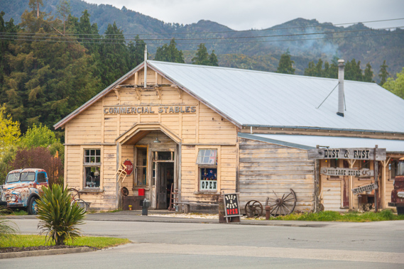 |
A historical building once used as a stable and now a museum in the remote Murchison. |
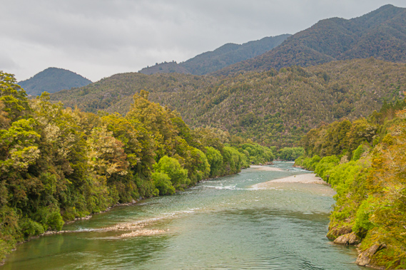 |
Departing Murchison, I follow the Buller River passing the Maruia River before continuing downstream. |
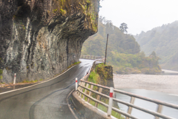 |
Once through Inangahua we follow the lower Buller Gorge. Here we are passing through the single lane Hawke's Crag as steady rain now falls. The road here was cut into the vertical cliff in 1869 linking the remote communities of the Buller River with the West Coast. |
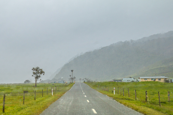 |
We reach the coast at Westport before turning northward heading over the Mohikinui Hill. We return to the coast at Karamea before continuing further north along some of New Zealand's most remote coast to the Kahurangi National Park. |
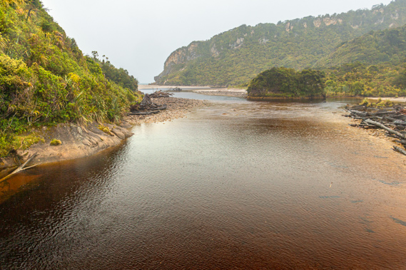 |
The Kohaihai River at the start of the Heaphy Track. This river and the bluff at its mouth has prevented any roads being built beyond this point. From here it is all walking track for 78 kilometres towards Golden Bay. |
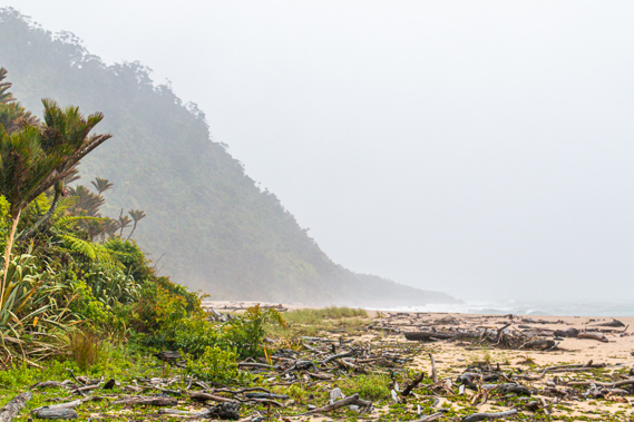 |
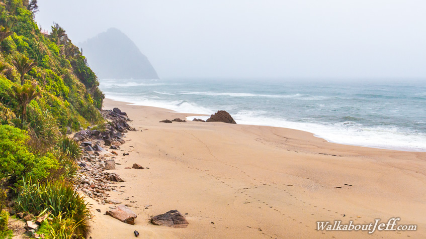
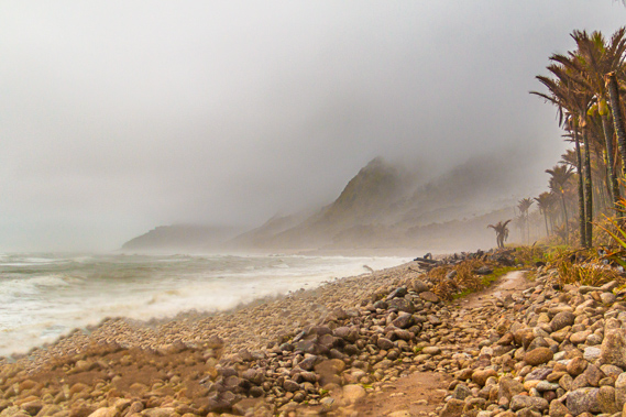
Following the rough Heaphy Coast on the other side of the bluff. Here the mountains drop directly into the rough sea. |
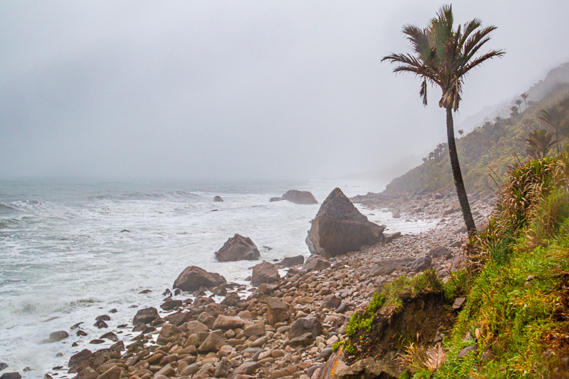 |
View of Mid Point in the distance as the threatening sea boils and rain falls. The shelter at Mid Point marks the half way mark between the Kohaihai River and the mouth of the Heaphy River where I will be staying tonight if I can get through. |
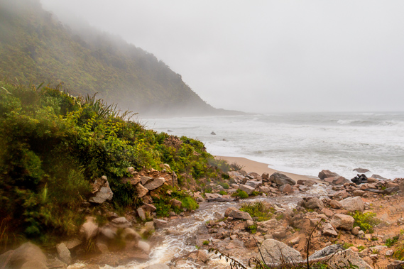 |
Once past Mid Point the rain falls heavily as streams tumble off the steep mountainsides. |
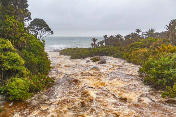 |
Crossing the bridge over the swollen Wekakura Creek. It is normally a small stream, but now it is a roaring torrent draining into the sea. I successfully cross the bridge guaranteeing I'm able to continue to the Heaphy Hut as there are no more major streams to cross. |
 |
Fortunately the rain stops falling and the clouds peel back off the steep mountainsides as I approach the shelter of Heaphy Hut following five hours of hiking in the stormy conditions. |
|