Introduction to today's journey
Today's journey heads upstream along the Takaka River into marble country, starting with exploring Waikoropupu Springs and the Waikoropupu Springs Walkway along an old gold mining sluice. From there we head up to the top of the Takaka Hill, doing the Takaka Hill Walkway and Ngarua Caves before descending into Tasman Bay and exploring the Riwaka River Resurgence.
Today's Journey
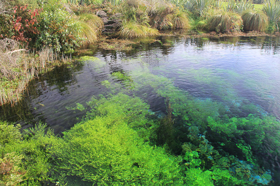 |
We head up the Takaka River in the early morning reaching Waikoropupu Springs. This is some of the clearest water in the world gushing up at 11 cubic metres per second having travelled underground for several kilometres from the Takaka River. |
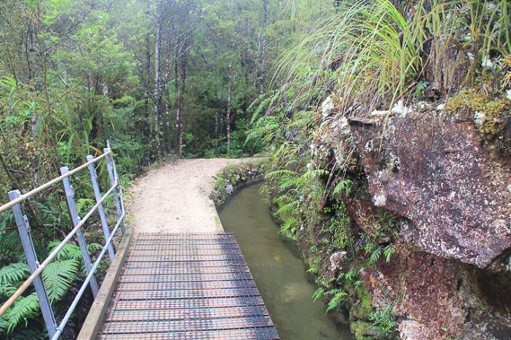 |
From the springs we head to the nearby Waikoropupu Walkway which follows a water channel dug out around the steep hills initially to be used as a gold sluice, but later was used to supply the water to a small power station which is still in operation. |
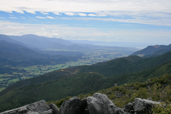 |
We leave the valley following the road zig-zagging up the mountainside to the top of Takaka Hill from where we have this spectacular view back over Golden Bay. |
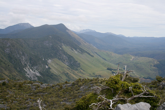 |
View up the upper Takaka Valley into the Kahurangi National Park - the other side of the park from the Heaphy Coast. From here the Arthur Range extends along the left hand side of the valley. These mountains are made from marble. I'm hoping to climb Mount Arthur, the tall mountain at the back after exploring the Abel Tasman National park which is just behind me. |
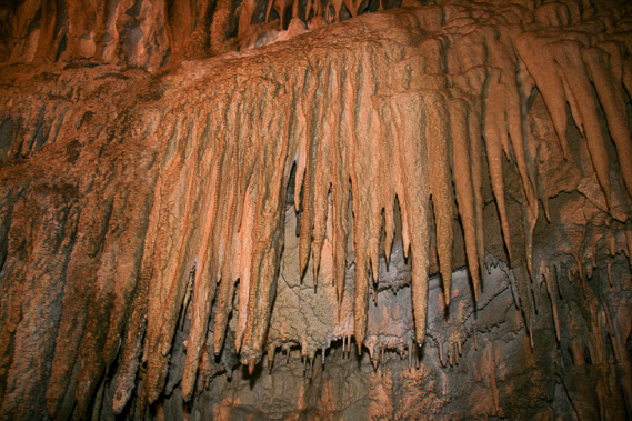 |
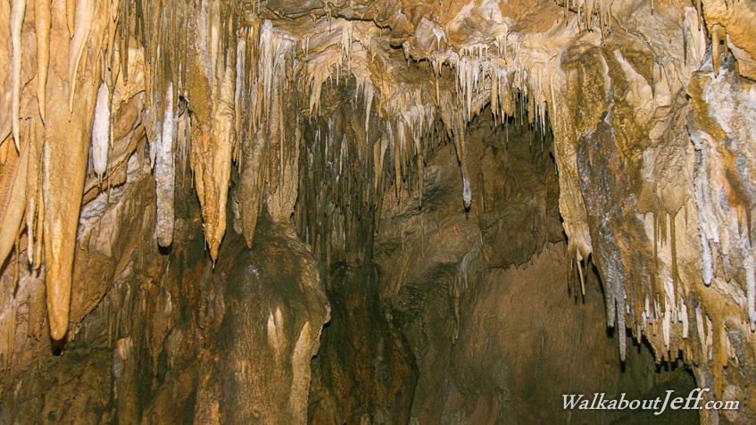
Just over the top of Takaka Hill is the spectacular Ngarua Cave which I explore. The whole of the Arthur Range is full of caves like this making it the largest cave system in the Southern Hemisphere. This is the only cave with easy access. |
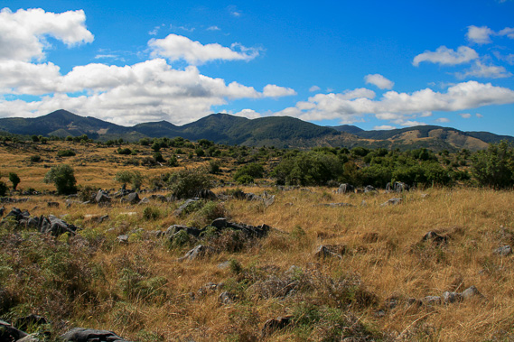 |
View along the Canaan Downs and the Pikikiruna Range in the Abel Tasman National Park from the exit of Ngarua Caves.
|
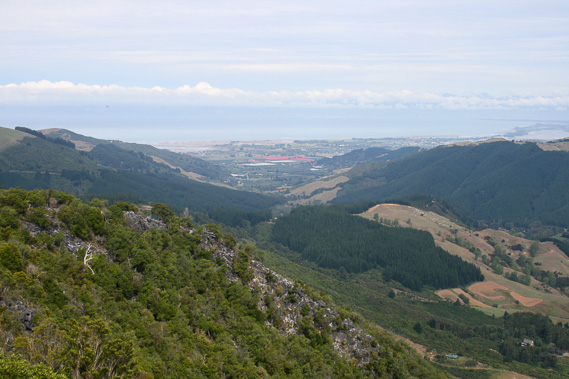 |
View from nearby Hawke's Lookout into Tasman Bay, looking down the Riwaka River. |
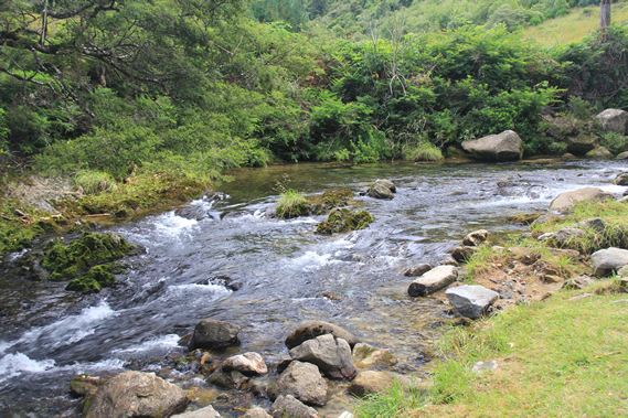 |
Heading down the long hill, we reach the Riwaka River and follow it upstream to a short walking track. |
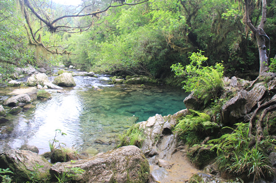 |
We follow the river upstream here to Crystal Pool, a deep pool of very cold water at 11 degrees all year round. |
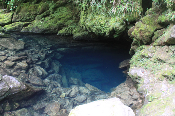 |
Continuing a little further upstream we reach the river's resurgence, where it flows out of a submerged cave. The water accumulates in sinkholes on the top of Takaka Hill about 600 metres overhead and seeps through caves to re-emerge here. |
|