Introduction to today's journey
Today's journey continues my exploration of Nelson (now the weather has cleared). I reach the centre of New Zealand and explore the city before heading up the Waimea River and over the Spooner's Saddle to the clear waters of Lake Rotoiti.
Today's Journey
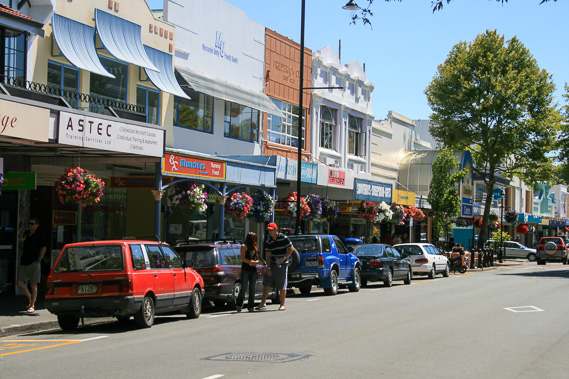 |
A sunny morning in the middle of Nelson City as I explore its quiet streets of stores. |
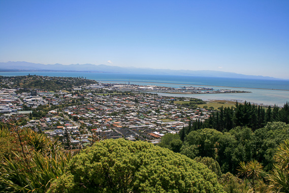 |
Heading uphill to the "Centre of New Zealand" on Botanical Hill. The actual centre is in the mudflats in the distance across the bay. Mount Arthur is to the left on the horizon with the Arthur Range extending to the right tapering off in the Abel Tasman National Park to the right. Nelson City is directly below. |
 |
Looking the opposite direction from the same lookout up the Maitai Valley. |
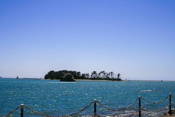 |
Heading out of Nelson passing Fifeshire Rock and Haulashore Island at the entrance to Nelson Harbour. |
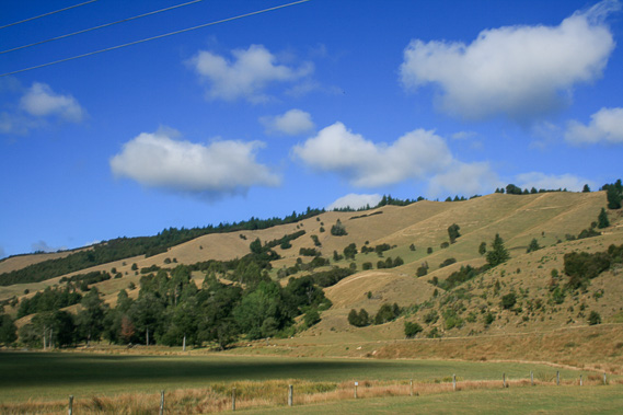 |
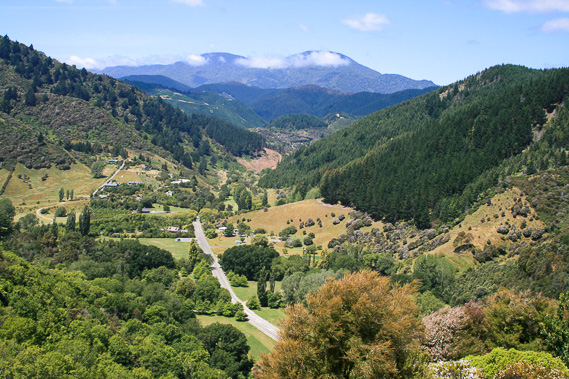
Reaching the hills past Wakefield crossing Spooners Saddle into the upper reaches of the Motueka Valley. |
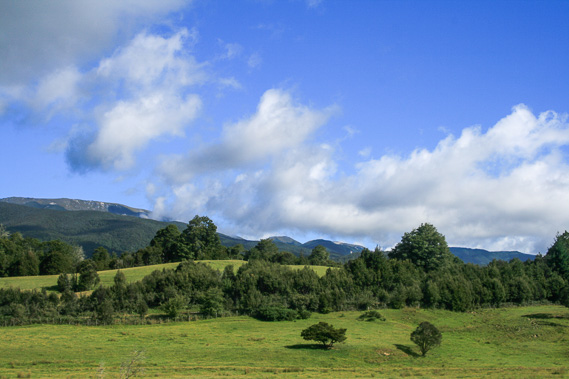 |
Passing under Red Hill as we cross a low pass to descend towards Lake Rotoiti. |
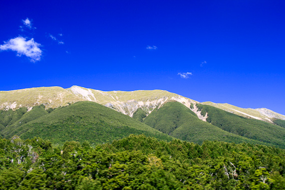 |
Entering native forest now following the alpine fault under the St Arnaud Range, part of the South Island's main dividing Southern Alps. |
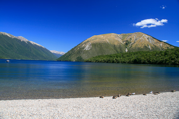 |
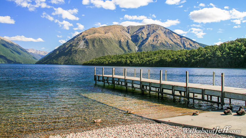
Reaching Lake Rotoiti at the terminus of an old glacier flowing down the valley in the distance. The alpine fault crosses the lake here. The glacier flowed out towards Tasman Bay, but the lake now drains to the right into the Buller River. |
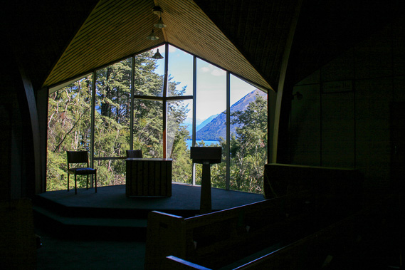 |
Exploring the small village of St Arnaud, I discover this little chapel with a spectcaular view across the lake. |
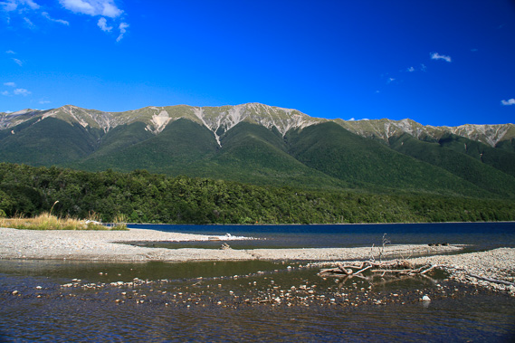 |
Returning to the lake beside a stream looking up the St Arnaud Range, the highest peak I climbed back in 1988, being the one peak on the Southern Alps I have summitted to date. |
|