Introduction to today's journey
Today's journey takes us from El Calafate following above the shore of the lake stopping off at a farm before heading into the mountains to the southern end of Glaciers National Park and onto the spectacular Perito Moreno Glacier, coming down the valley from several 3.5 kilometre high mountains into the lake. We take a boat to the front face of the glacier before returning to land and climbing a bluff over its terminus. After exploring the area we return to El Calafate to do an Argentine cooking class.
Today's Journey
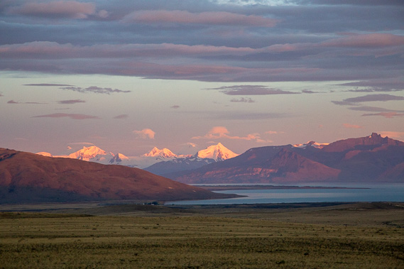 |
Leaving El Calafate in the early morning, the sunrise captures spectacularly on the high peaks of the Andes as we once more approach the great ice cap of Glaciers National Park. |
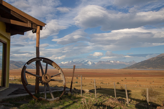 |
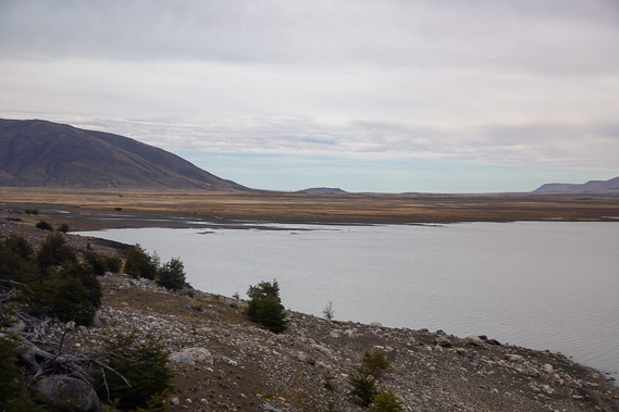
We stop for morning tea at the Estancia Rio Mitre ranch overlooking the dry land at the edge of the lake. Much of this land was flooded when the Perito Moreno Glacier blocked this side of the lake in recent years. |
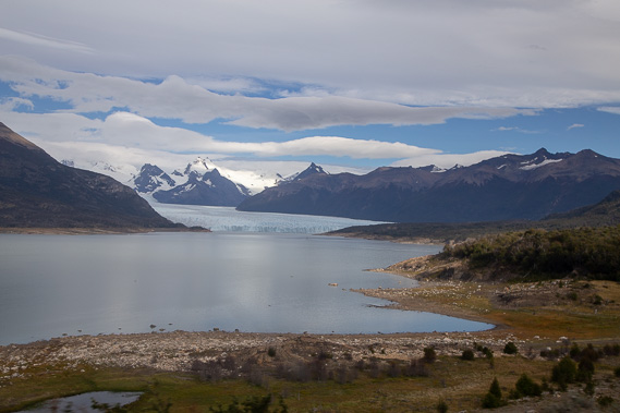 |
Continuing up the valley beside the lake, we stop at the Mirador del Glacier Perito Moreno lookout for our first view of the glacier. From here we hike down to the lake and follow its edge around the bays. |
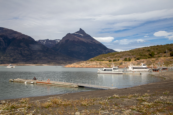 |
After about an hour we reach the small port from where we catch a boat to the base of the glacier. |
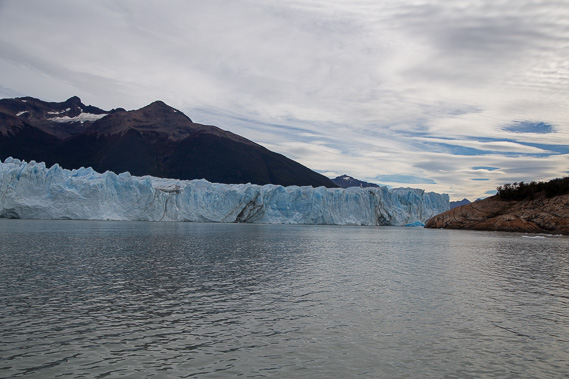 |
Cruising out towards the glacier, hoping to see some of it crumble. This is one of the world's fastest glaciers moving at 1.8 metres per day down from its 3400 metre high cirque basin. A few years ago the advancing glacier blocked the bluff to the left causing this part of the lake to flood rising about thirty metres. |
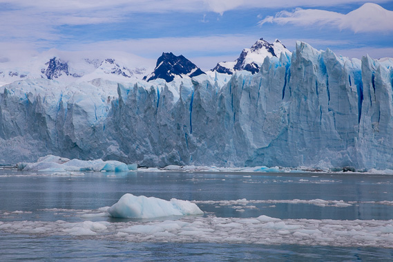 |
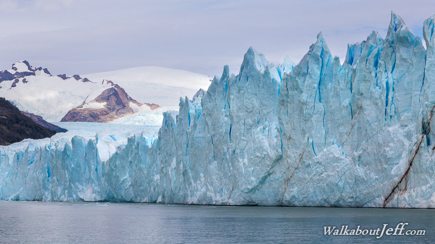
Close to the front of the deeply crevassed 70 metre high front of the glacier with the high mountains towering above it. There are no significant collapses of ice during our time cruising along the front of the glacier, so we return to the port. |
 |
From the port we head up the bluff which almost separates the glacier into two. From one of the lookouts I capture this spectacular collapse of ice in the distance sending out a ring of waves three metres high. |
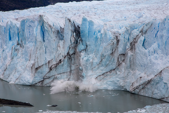 |
Another collapse of ice much closer this time where the glacier almost reaches the bluff. The collapsing ice sounds like thunder. |
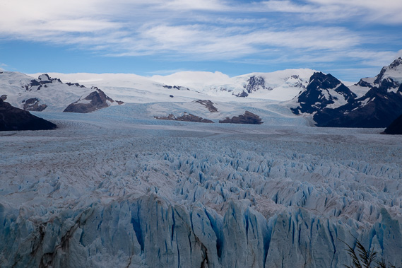 |
From the top of the bluff I can see over the top of the glacier along the valley it flows down from the 3400 metre high peaks in the distance. Apparently seeing blue sky and the mountaintops is rare. |
 |
Returning towards El Calafate, we reach the end of this corner of the lake where it is at a much lower level than when the glacier had blocked this side of it off. During the ice ages the glacier had extended down the valley on either side creating the depression of what is now Argentina's largest lake, Lago Argentina. |
|