Introduction to today's journey
Today's journey takes us from Yunkachimpa camping ground higher into the back of the valley before crossing the 4215 metre high Dead Woman Pass, the highest point of the trek. From there we descend down the perfectly preserved stone stairs to another campground deep in the valley for lunch. From there we head up the mountain over the second pass and descend to a mysterious ruins in the clouds from a time long before the Incan empire. We stop the night at a nearby camping ground at Concha Marca.
Today's Journey
 |
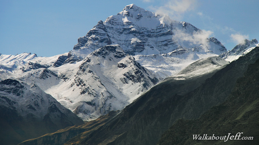
We set off early in the morning from the camping ground. Rain fell overnight with snow down to 4500 metres above sea level. It is strange seeing snow so close here in the tropics. |
 |
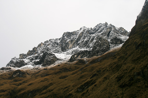
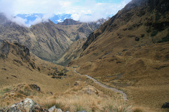
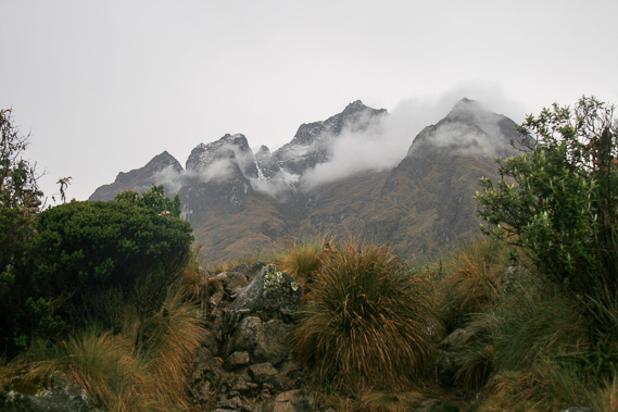
Passing 3800 metres above sea level, the thin air makes the going tough but the highest pass on the trail is clearly visible now. |
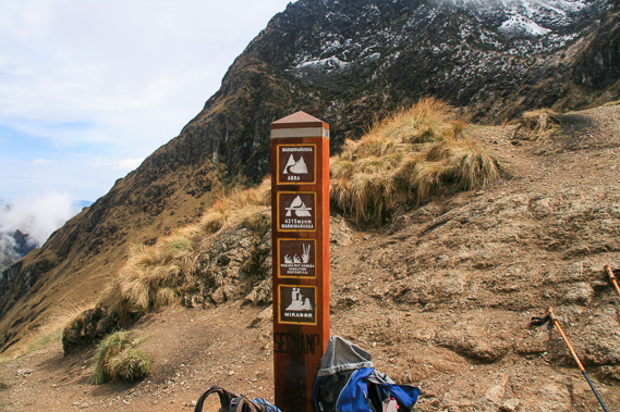 |
Reaching the top of Dead Woman Pass at 4215 metres above sea level. We stop here and rest a while. |
 |
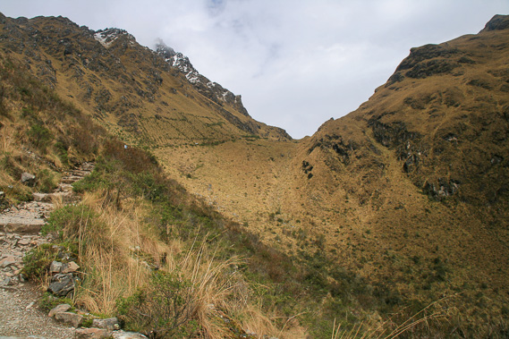
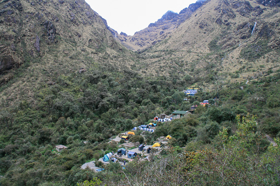
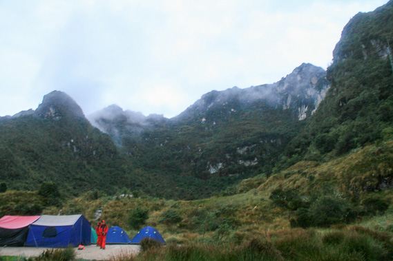
Descending the other side of the mountain towards our lunch stop at Pacaymayo Valley Campsite at 3600 metres above sea level. |
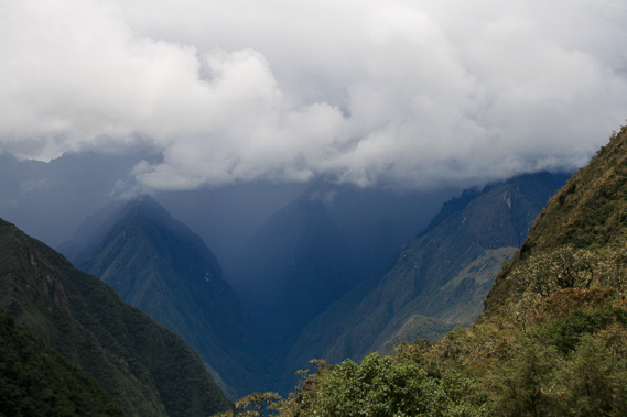 |
A gloomy storm approaches as we are having lunch. The mountain weather at this altitude is very unpredictable especially as we approach the humid Amazon Basin. |
 |
Heading up the other side of the valley with the campsite hanging in the valley behind us below the pass. |
 |
Reaching the circular ruins of Runkuraqay fortress as the storm hits with small hail falling on us. |
 |
We continue up the mountain to Runkuraqay Pass at 3950 metres above sea level. We stop here at a small ruin now the rain has stopped falling and the clouds are clearing from the mountains. |
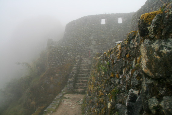 |
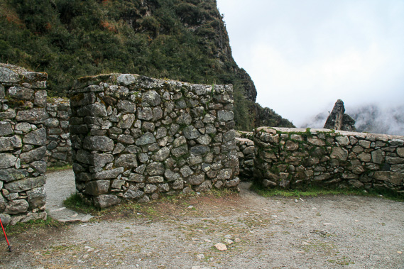
We descend the pass into the rising cloud eventually reaching the pre-Incan ruin of Sayacmarca in thick fog. |
 |
Rain begins falling again so we head to the nearby Sayacmarca Camp where our porters have already set up our tents. Here we stay the night. |
|