This week in South East Queensland
27 August - 2 September
THE MOUNTAINS inland from the Sunshine Coast are made from Jurassic sandstone, deposited as sand along what was the subantarctic coast of Gondwanaland. The the main fault line between the Australian and Zealandia continents ran just a couple of hundred kilometres offshore when the two continents split apart when Gondwanaland split apart into the modern continents around 60 million years ago. At some point following the initial split, the major fault line almost completely sealed with a new fault line formed down the middle of the Zealandia Continent as it was pulled in all directions sinking most of its land underwater. The new fault line formed what is now New Zealand, with the Australian plate now moving northwards in a collision course with South East Asia. Earthquakes along the old fault line are now rare, but they do still occur.
Today's trek takes me along the beach before heading inland over the lower everglades. From there I take a ferry across the Noosa River to Tewantin and head back downstream to Noosa Beach. From there I hike over the Noosa Heads to Sunshine Beach.
Today's Journey
Distance hiked today: 27.8km
Total distance hiked to date: 133.7km
 |
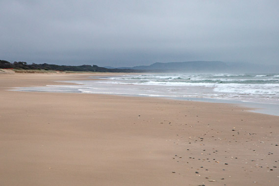
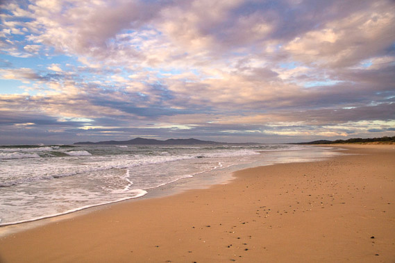
06:01 - The morning dawns very gloomy. No rain had fallen overnight but the cloud was very thick. Not a very sunny start to the Sunshine Coast. |
 |
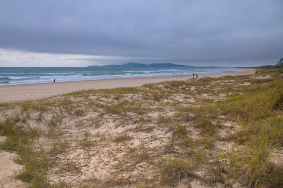
06:05 - Waves break on the beach as I wait for the sunrise that didn't happen. The cloud is too thick to the east to show any colour, but it does appear to be thinning. Looking northward where I came from yesterday, the sandmass is covered in salt haze. |
 |
06:12 - Even Noosa Heads looks quite gloomy. Will it be this cloudy when I hike over these headlands later today? |
 |
06:46 - I return to the beach once packed up. It's amazing what a difference 15 minutes makes. The clouds are quickly breaking apart and letting through the colours of the fresh sunrise. Maybe the Sunshine Coast will live up to its name today. |
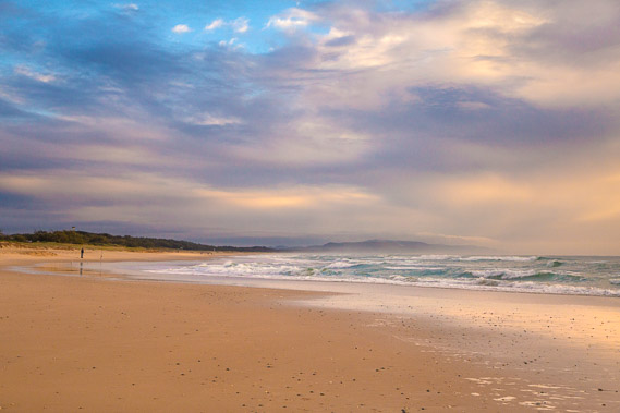 |
06:58 - I pass a sole fisherman as the sweeping clouds light up brilliantly over the sandmass. |
 |
07:11 - Zooming into Noosa Beach. The whole beach is above the horizon now with the buildings of Hastings Street above the far end of the beach. The right hand side of the beach tapers off where the Noosa River comes out. Although the town is only a couple of kilometres away, I need to take a long detour to get there today. |
 |
07:12 - The sun now shining on the Noosa Headlands. the golden beach of Granite Bay is now visible. |
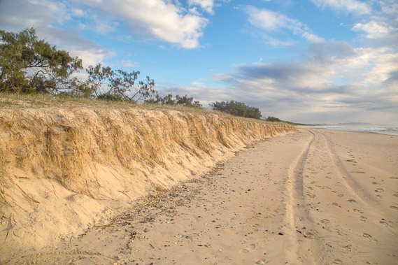 |
07:14 - This part of the beach is eroding the low sand dune similar to what I saw several days ago at the other end of the beach. The sun now filters through lighting up the golden sand. Spinnifex grass hangs over the eroded edge of the eroded sandhill as I head towards the great walk track. |
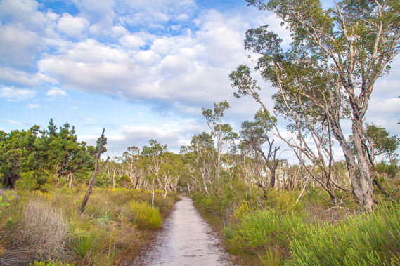 |
07:20 - The last part of the Cooloola Great Walk heads inland from the beach, initially crossing the Wilderness Track Road (the first sealed road I've seen since leaving Rainbow Beach). The track heads across the flat paperbark heathlands of the Noosa North Shore. |
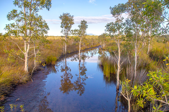 |
07:49 - The original track is in parts flooded with a dark pool of water. A new track goes around this pool, and more pools along this section of swampy heathland. |
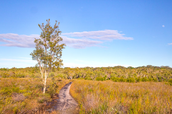 |
07:52 - The clouds are quickly dissolving in the sky. The heathland opens out quickly before entering the forest again crossing a small stream. |
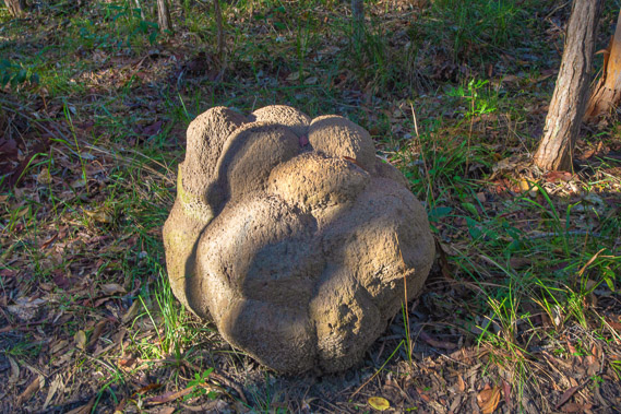 |
08:20 - Once across the stream, the forest closes in as the track rises a little above the swampy everglade. A large termite mound looking like the dropping of a giant beast. There are quite a few of these termite mounds around this part of the forest. |
 |
08:23 - The end of the Cooloola Great Walk. From here I return to civilisaton with my route following the road towards the Noosa River's only crossing. |
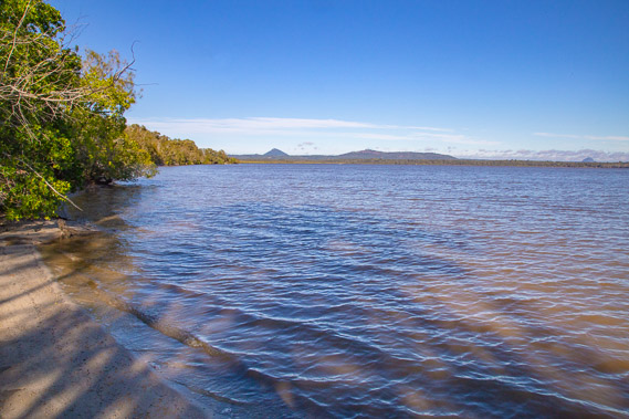 |
08:48 - Before starting along the road, I head down the grassy slope of a small park to the edge of Lake Cooroibah. Looking south from the lake's edge. The Noosa River drains from the lake about two kilometres away. |
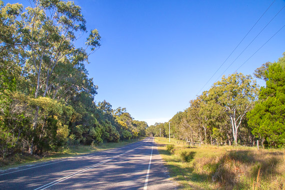 |
09:01 - The 2.4 kilometre road walk through the impressive forest towards the Noosa River. The clouds have cleared very quickly this morning bringing on typical clear, calm winter weather. |
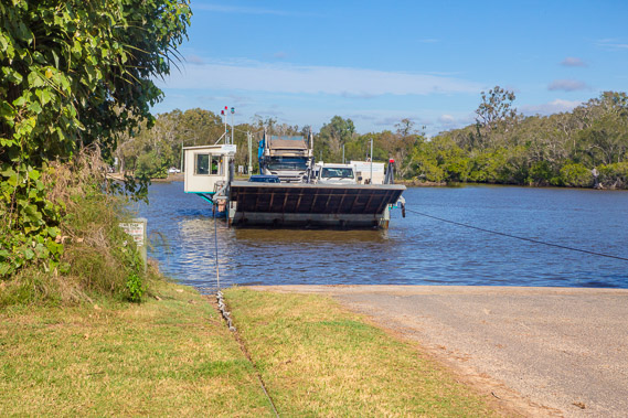 |
09:37 - The road suddenly ends at the river's edge. A small cable driven ferry is the only way across the river. There are no bridges across the river, so this is the only way to cross to the north shore. No bridges have been proposed because the locals want to keep the north shore pristine. Once unloaded, I hike onto the ferry behind two cars. The crossing is $1 for hikers. |
 |
09:40 - Looking upstream from the ferry as it pulls its way across the river. Two kilometres upstream is Lake Cooroibah. This is the final stretch of river flowing into the sea at the northern end of Noosa Beach about seven kilometres downstream. |
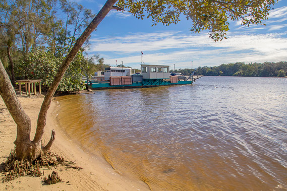 |
09:44 - One last look at the ferry before following the sealed footpath for two kilometres uphill into Tewantin. |
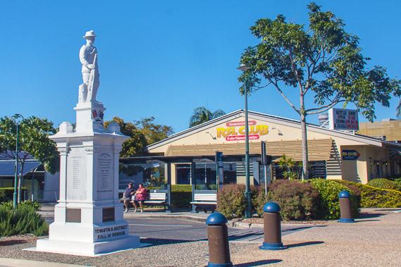 |
10:38 - Tewantin war memorial in the middle of Tewantin outside the Information Centre. The main road had been very busy after the long solitude down the Cooloola Sandmass, but this is a relatively quiet street. |
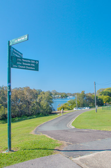 |
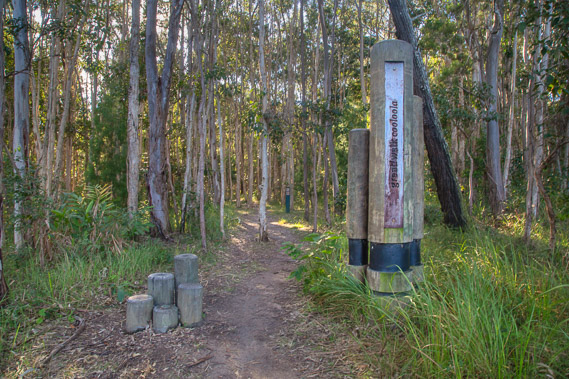
10:50 - Start of the Sunshine Coast walkway near the Tewantin information centre. This is a continuous track along the length of the Sunshine Coast to Bell's Creek about 96 kilometres away. My journey down the Sunshine Coast will roughly follow this track, with a few diversions to all the headlands, and following the beach where possible so my journey will be a bit longer. |
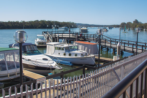 |
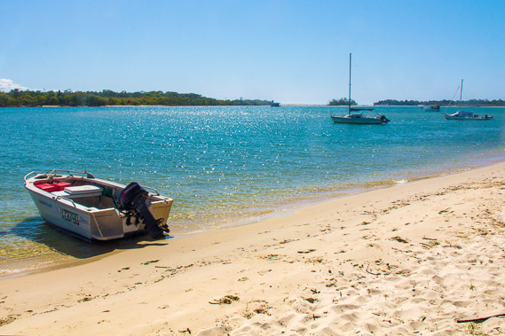
11:01 - One of numerous small marinas along the lower reaches of the Noosa River. |
 |
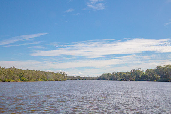
11:12 - Looking across the road to the start of Lake Weyba, yet another lake draining into the Noosa River. The volume of water coming down the river has never been enough to fill these lakes with sediment after the sea rose following the end of the last ice age. |
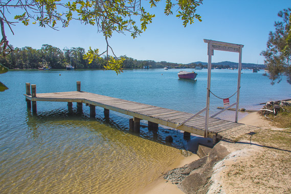 |
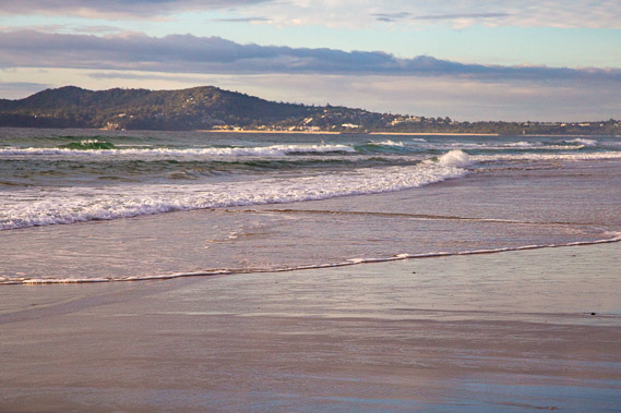
11:20 - A private wharf stretching out over the river at almost full tide. The two hills in the distance are part of the Noosa Headlands where I'm heading this afternoon. |
 |
11:44 - Pristine waters near high tide with the mouth of the river now starting to come into view. Around here I leave the main track to divert to Noosa and its headlands. The main track heads inland to behind Noosa Heads to come out again somewhere on Sunshine Beach on the other side. This misses some of the most pristine beach on the Sunshine Coast, so I will definitely take the detour. |
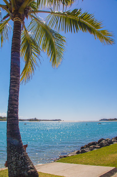 |
11:54 - Palm tree overlooking pristine waters with a view to the mouth of the river. Here the path leaves the main track to divert to Noosa and its headlands. The main track heads inland to behind Noosa Heads to come out again somewhere on Sunshine Beach on the other side. This misses some of the most pristine headlands and beaches on the Sunshine Coast, hence my decision to take the detour. |
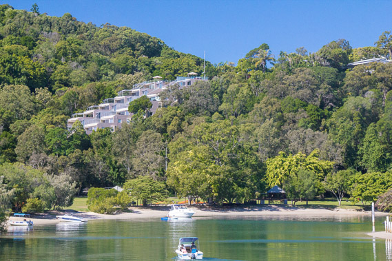 |
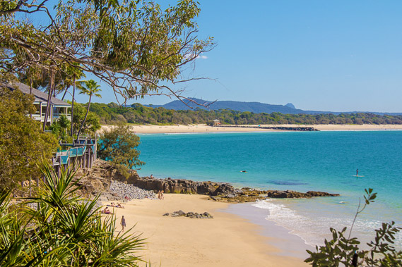
12:20 - Luxury resort nestled on the back of Noosa Head above one of the canals separating the beach from the river. The cabins are tightly packed together nestled in a gap in the forest. |
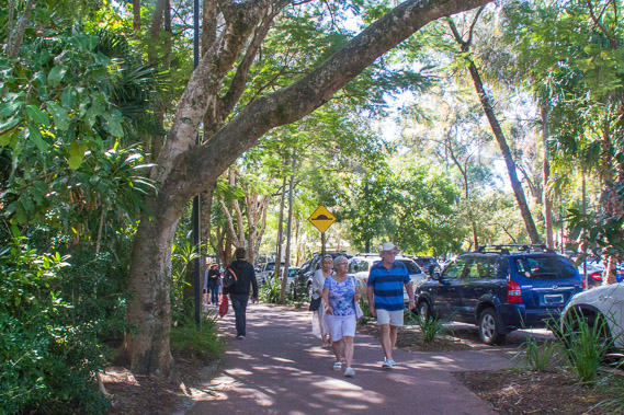 |
12:30 - The leafy cobbled path into Hastings Street. The broadleaf canopy shelters the path from the strong sun. |
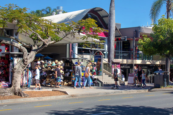 |
12:33 - Part of Hastings Street. This is an upmarket tourist area of luxury accommodation and boutique shopping. This exclusive area was once quite hard to get to, but has become quite crowded in recent decades. |
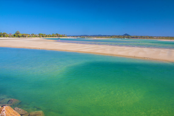 |
12:48 - From the end of Hastings Street, the sandbar suddenly enters forest. Following the river side of the sandbar looking across to the clear turquoise waters of the the Noosa River. |
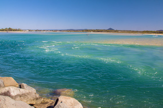 |
12:57 - The tide is now going out, draining the Noosa River through a deep channel contained by a row of boulders at the end of the sandbank. The tide goes quite a long way up the river (I don't think as far as Dutgee though), but certainly the lower lakes are tidal, so a lot of water passes through this channel either day. |
 |
13:03 - People are fishing as the swift water flows out to sea. The movement of the water has been captured on this long exposure shot. |
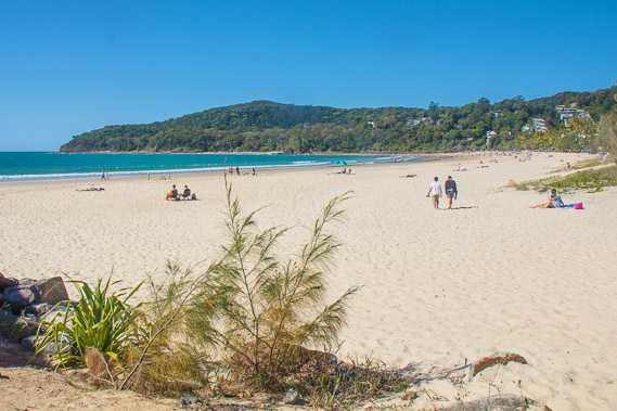 |
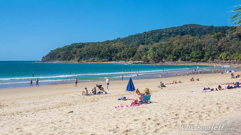
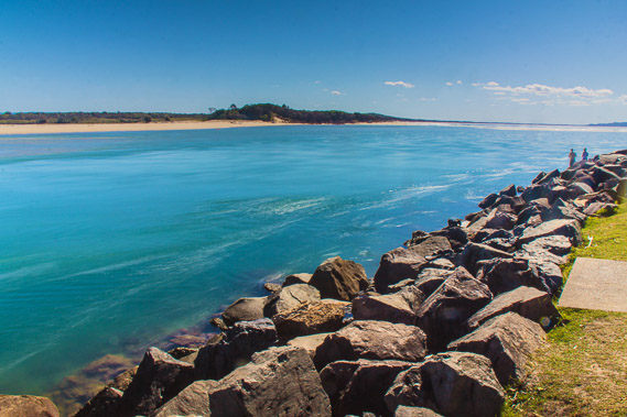
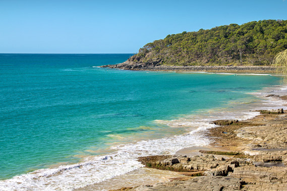
13:27 - Noosa Beach from near the end of the rock wall. The headlands are very close, sweeping out into the turquoise water at the other end of the beach. These headlands stop most of the prevailing south easterly winds making for the perfect sheltered beach. |
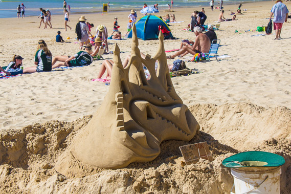 |
13:35 - Somebody has built a very nice sandcastle on the beach in amongst the crowds scattered over the golden sand. |
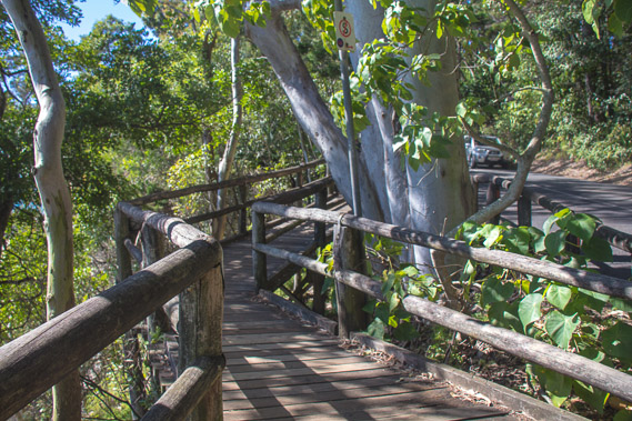 |
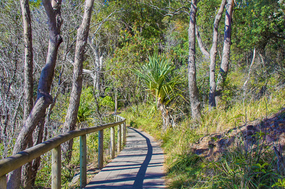
13:45 - A wooden boardwalk follows the road around the steep forested headlands towards the start of the Noosa National Park. |
 |
13:48 - View back to Noosa Beach from the boardwalk. The rock groyne in the middle of the beach pulls sand out of the beach on either side. A few secluded holiday homes perch nestled in the forest above the beach and below the track. |
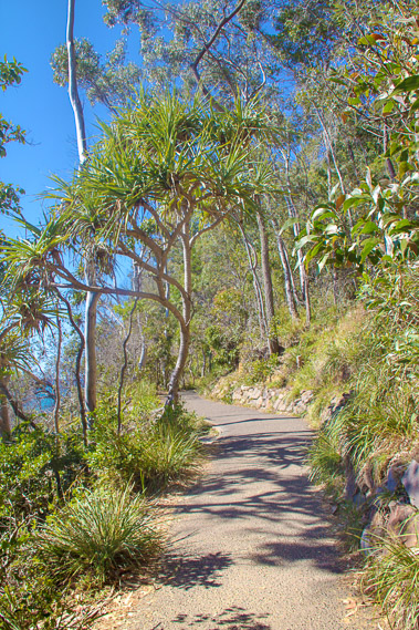 |
13:59 - The road ends, but the track enters the Noosa National Park. The first kilometre of track going through the windswept forest is sealed and wheelchair grade. This is the second of many national parks along the coast. |
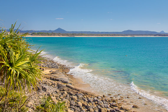 |
14:02 - View back to Noosa Beach. This is the first time I've had a good view of the hills inland of the everglades from low down. The triangular hills are volcanic. Some of these headlands are volcanic as well, but it is mostly sandstone from an enormous dune once covering this area. The water here is almost transparent. |
 |
14:11 - Rocky coastline at The Boiling Pot. The headland at the end of the rocky beach. As I stop at this point, largest earthquake in Queensland's recent history strikes about 100km north east of Double Island Point. Apparently the magnitude 5.0 quake is felt over much of Brisbane and down to the Gold Coast, but I don't feel it here though. |
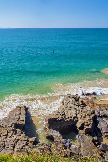 |
14:13 - The boiling pot. The sea is quite calm today so the water isn't "boiling" through these caverns. The quake was far too small to create any tsunami. Double Island Point is just visible on the horizon. |
 |
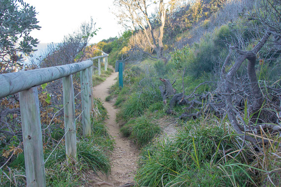
14:22 - The track winds around the back of the bays through the scrubby grassy forest above the cliffs. I look for koalas as they are commonly found here, but they are hiding very well today. |
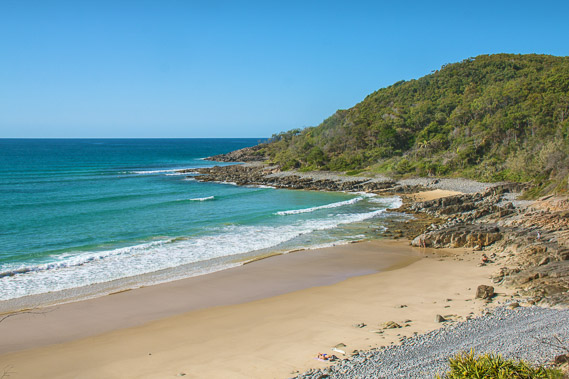 |
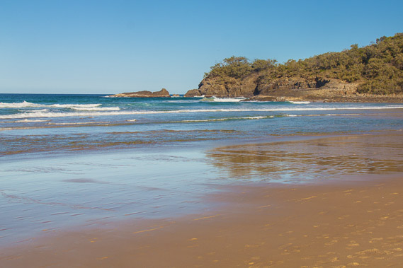
14:40 - Granite Beach. I could just see the sand of the beach this morning, and wouldn't have guessed the sky would be almost completely cloud free by now. The weather is perfect now. |
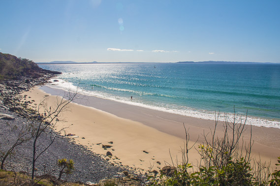 |
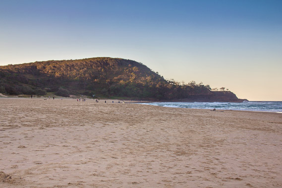
14:42 - Looking the other way along Granite Beach, with the Cooloola Sandmass stretching out on the horizon. Teewah Village is at the first dip in the range. The Noosa Valley is the very wide low area in the middle of the picture. So few people would have been there despite its close proximity. |
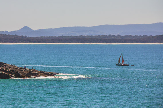 |
14:48 - A yacht heads around the headland from where several people are fishing from. I'm now climbing above a high cliff, the biggest I've seen since Double Island Point. |
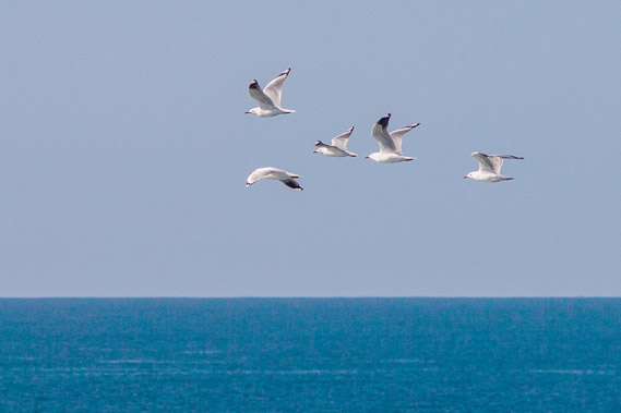 |
15:15 - Sea gulls fly past the cliff no doubt searching for a large school of fish for their next meal. |
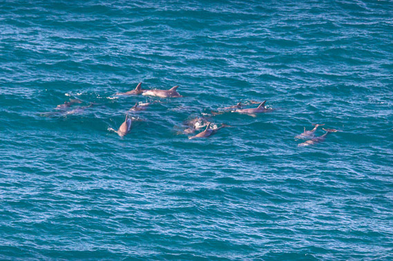 |
15:21 - A pod of dolphins swim past the heads. The dolphins live along the coast permanently, but are often seen making their way up and down the coast looking for fish to eat. This is quite a large pod of dolphins. |
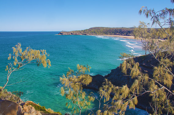 |
15:25 - View from Hells Gates across to the secluded Alexandria Bay. From here I'm at the end of the sweeping Teewah Beach and from here the coast stretches southward along the Sunshine Coast. |
 |
15:43 - From Hell's Gates, the track drops moderately into Alexandria Bay. This is the only nudist beach along the coast, so I'll put the camera away and advance quickly as there would most likely be some nudes about 2/3 of the way along the beach. |
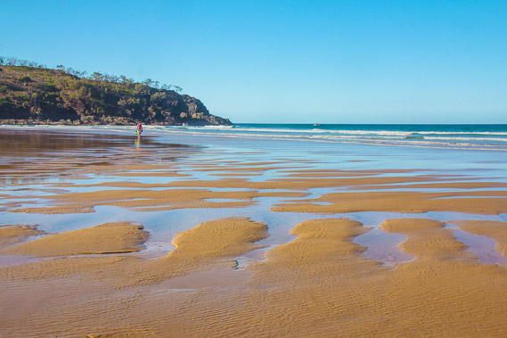 |
15:50 - The tide is low now, revealing interesting wave carved sand patterns as I look back towards Hell's Gates. |
 |
15:58 - Near the end of Alexandria Bay looking towards Devil's Kitchen This is the last headland I need to negotiate today. |
 |
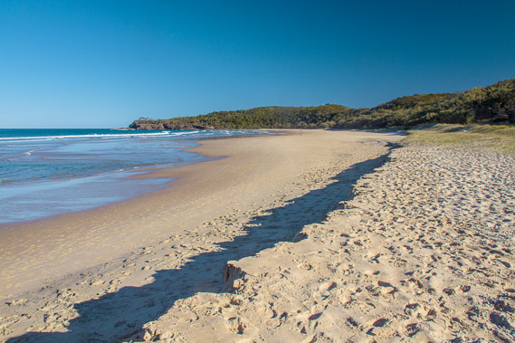
16:08 - Final view of Alexandria Bay before heading up into the scrubby Devil's Kitchen. This is probably one of the most scenic beaches along the Sunshine coast. |
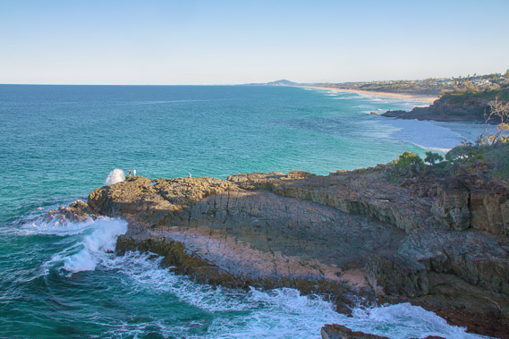 |
16:21 - The steps head up the steep headland. Not many people take this track, so it's quite rough. At the top of the first rise I head off the track a little to get this spectacular view across Devil's Kitchen down the Sunshine Coast from the highest part of the track crossing Devil's Kitchen. There are more headlands in the distance. |
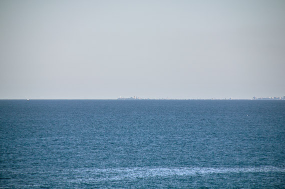 |
16:22 - Zoomed further to as far as I can see along the coast to the headland at Point Cartwright. It is quitea long way away, but I hope to get out there for a sunrise or a sunset in a few days' time. |
 |
16:34 - But those headlands are far away. I need to focus on negotiating the narrow track across Devil's Kitchen and find a place to end today's trek. In previous days my destinations were set out for me, camping grounds with endless track between them. Once I'm down on the beach, there will be access points every couple of hundred metres. |
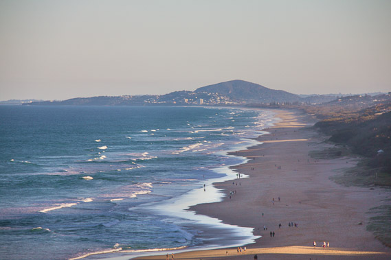 |
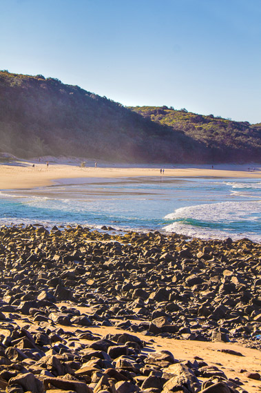
16:50 - After some time traversing the headlands, the first major beach of the Sunshine Coast comes into clear view. A steep stairway down the rocky hill will take me onto this beach. The sun is very low now, so I won't be able to get far along today. Here I'm zoomed in on the entire beach from half way down the stairs. I think I'll aim for Point Arkwright to the far left for tomorrow, and a climb of Mount Coolum the next morning if I'm up for it. Not sure exactly where I'll end up today though. |
 |
17:00 - View of Noosa Heads from the beach after having successfully made my way down the long stairway. |
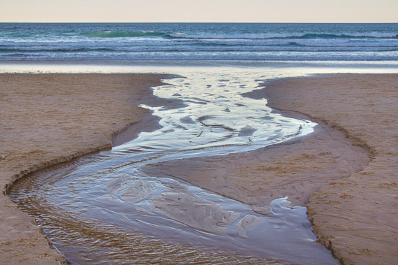 |
17:02 - A stream flowing into the sea. Flowing water has been a rarity on the trek so far, so this is quite a novelty. It drains from a stream fed by underground waters of Lake Weyba about a kilometre inland. |
 |
17:11 - I'm now a bit further along the beach with the sun still shining on the headlands. The air is quickly cooling and the sun quickly setting. At least I've seen some sun on Sunshine Beach. |
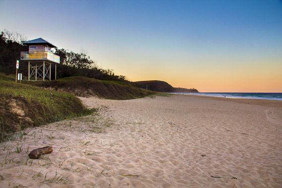 |
17:33 - At the Sunshine Beach surf lifesaving tower. This is as far as I'll go today. The sun is setting unseen behind the hills giving the clear sky some bright colours. |
|