This week in South East Queensland
10 - 16 September
THE BEGINNING of spring is perhaps the nicest time of year for going out and exploring the countryside. It is close to the end of the long dry season and the summer heat hasn't arrived yet. Down south the Brisbane Festival starts this week, effectively being a celebration of the river which I will later be exploring and joining in similar festivals towards the end of the year.
Today's hike takes me from Point Arkwright, initially climbing Mount Coolum, before returning to the beach and following its length around Mudjimba Point before heading up the Maroochy River. I cross over its first bridge, before returning downstream into the middle of Maroochydore, the main centre of the Sunshine Coast City.
Today's Journey
Distance hiked today: 29.7km
Total distance hiked to date: 183.0km
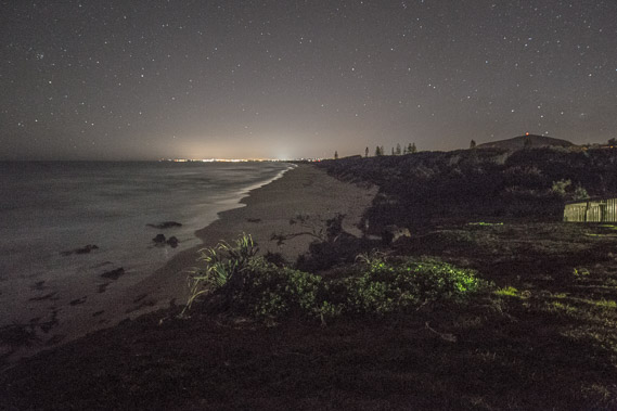 |
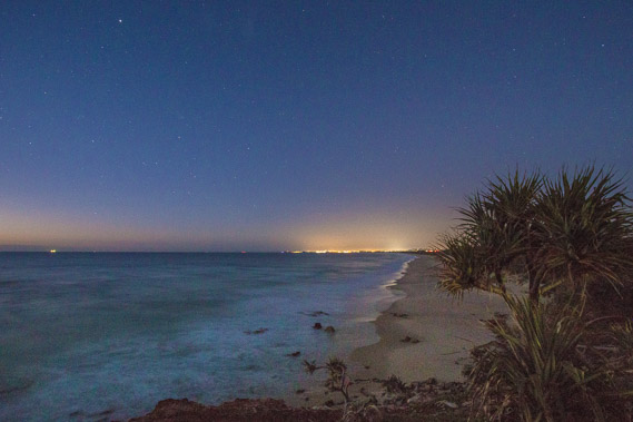
04:07 - Looking southward along the coast before first light towards the glow of Maroochydore. Mount Coolum is visible to the right with the red light at its summit required as the Sunshine Coast airport is very close. There are no more signs of yesterday's bushfire so it looks like it has completely burnt itself out. |
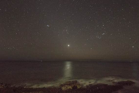 |
04:14 - Venus rises above the horizon casting its silver light over the dark waters of the Coral Sea. |
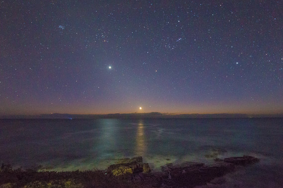 |
04:43 - The almost new moon rises over the horizon following Venus on its angled ascent into the sky. The constellation of Orion is just above the moon. The first hint of daylight is colouring the horizon picked up by the 30 second shot, but invisible to the normal eye. |
 |
05:03 - The beach begins to get light with the lights of Maroochydore, the centre of the Sunshine Coast, shining brightly. A ship sails in the distance to the left heading along the coast towards Brisbane somewhere still over the horizon. |
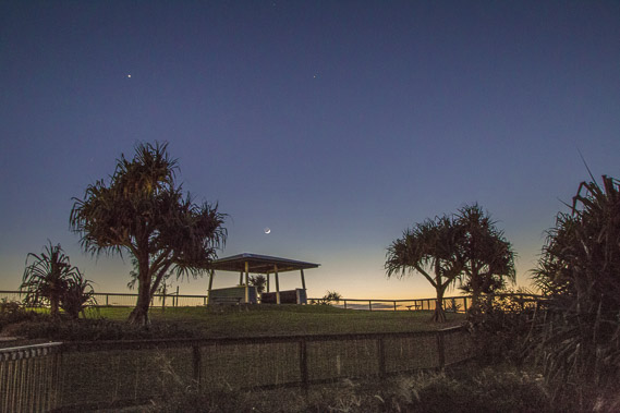 |
05:17 - Last view of the Point Arkwright park as I head down towards the beach to start the long trek towards Maroochydore. |
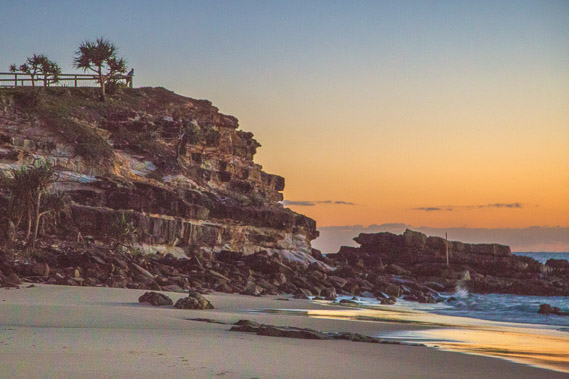 |
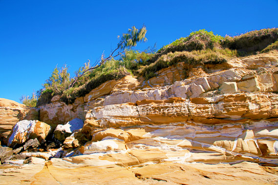
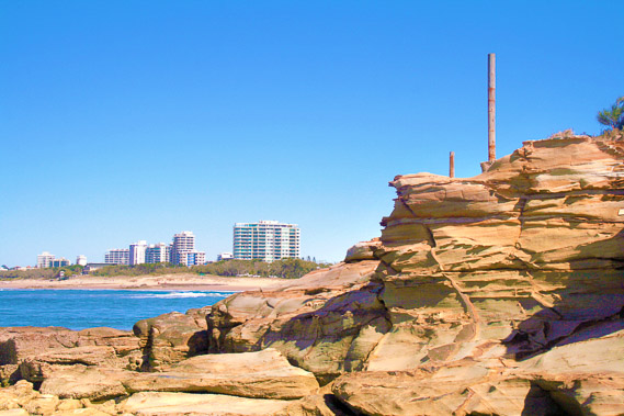
05:23 - Point Arkwright viewed from the beach. The layered volcanic rocks are amazing. A photographer takes the spot where I was earlier, to capture the sunrise. I've decided to come down here to the beach to get a more dramatic sunrise over the waves. |
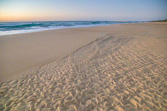 |
05:35 - Ripples left in the sand after the overnight high tide. These capture the dawn light very well. |
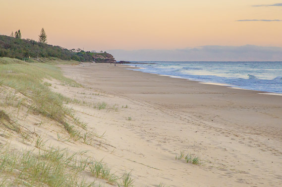 |
05:42 - Point Arkwright from the newly forming dunes. The spinnifex grass grows over the sand stablising it allowing more sand to be blown onto it building the dune. |
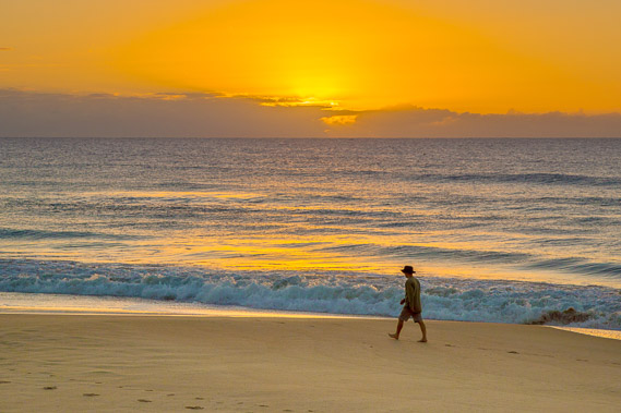 |
05:50 - The sun rises behind the distant clouds over the continental shelf sending streams of light into the orange dawn sky. A man on his early morning walk passes the rising sun. |
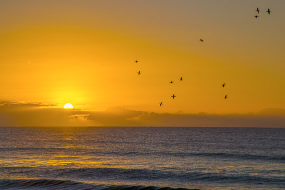 |
06:02 - A flock of birds fly along the beach as the sun rises above the clouds. |
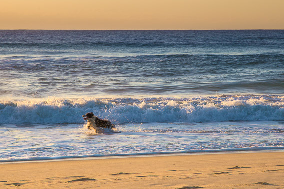 |
06:24 - A dog frolics in the water behind its master. The water has started warming up now with the increasing air temperatures at this time of year. |
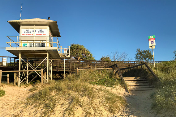 |
07:05 - I reach the 96th track entrance (I believe there's over 300 along the length of the Sunshine Coast). The lifeguard tower isn't open yet but there's a nice wooden walkway which I decide to check out. |
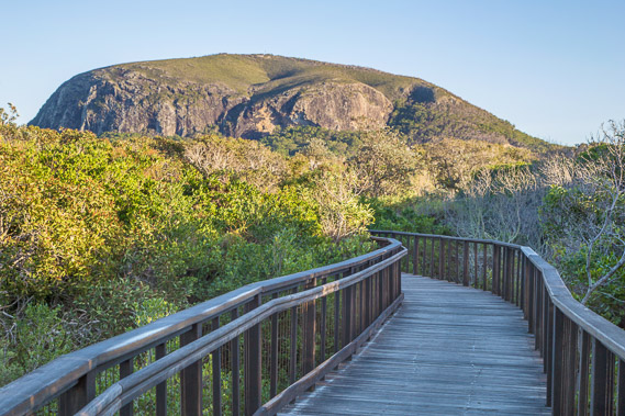 |
07:14 - The walkway crosses above a swampy forest behind the dunes. Directly ahead is Mount Coolum, just over a kilometre away. Although this is already a slightly longer trek than previous days, I decide to divert and head towards the hill, as it's the most formed volcano along the coast. |
 |
07:45 - The boardwalk spirals down to a wide concrete path through the coastal forest. It stretches parallel to the beach for a couple of hundred metres causing me to backtrack about a third of what I had hiked earlier. |
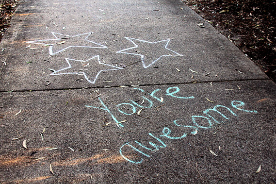 |
07:58 - Apparently there's going to be a run along here later this morning. The path has all sorts of encouraging enscriptions chalked onto the concrete paving. As corny as these are, they help me on my quest towards Mount Coolum. Perhaps this is meant to be. |
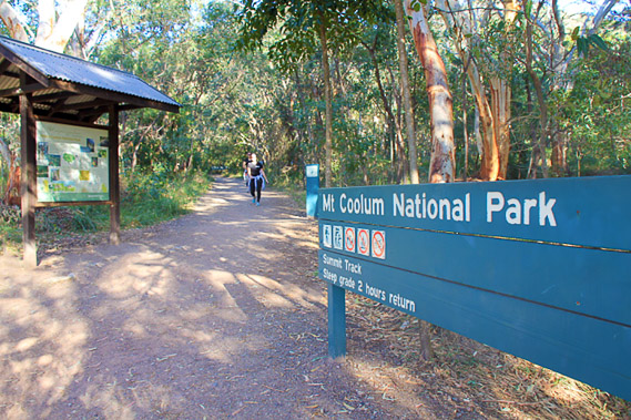 |
08:14 - After nearly a kilometre of concrete track and crossing a major road, I reach the entrance to Mount Coolum National Park, the third of many national parks on my trek. |
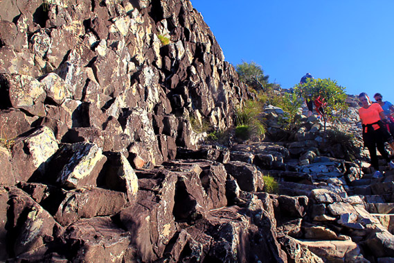 |
08:30 - Steps set into the side of the hill climb steeply towards the summit. It turns out this track is quite popular. The track passes one of numerous exposed rocky cliffs, with enormous crystals having solidified in the middle of what had once been a much larger volcano. |
 |
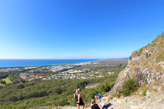
08:36 - Above the cliffs I get a good view northward although the sky is a little hazy now. I can see along the beach I walked along yesterday to Noosa Heads. The hills of Noosa Heads hides Noosa town and Teewah Beach, but the Cooloola Sandmass is visible as the faint range to the left of the Noosa Heads hills. |
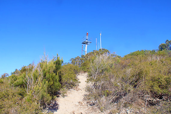 |
08:50 - Approaching the summit, towards the large red light I could see on top of the hill earlier this morning. This is very high up at over 200 metres above sea level, but not as high as much of the Cooloola Sandmass. |
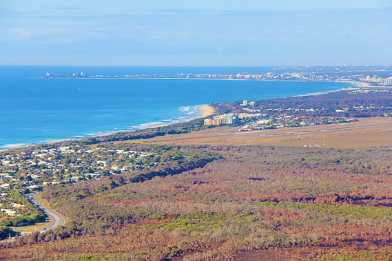 |
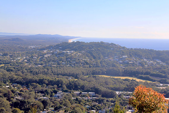
08:54 - View from the summit looking southward. The forest in the foreground was the source of yesterday's bushfire, with only the slightest remains of smoke rising from it. The acrid smell still lingers in the air. Behind the forest is the runway of the Sunshine Coast airport. Behind that the coast juts out to Mudjimba Point, with the beach continuing up to the mouth of the Maroochy River just visible to the top right. From there it sweeps across Mooloolaba Beach to Point Cartwright, then extends down to Calounda near the bottom of the Sunshine Coast. |
 |
09:40 - Heading back down the mountain back towards the sea. |
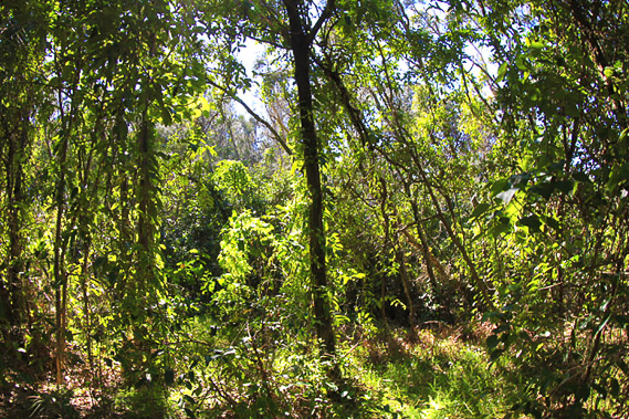 |
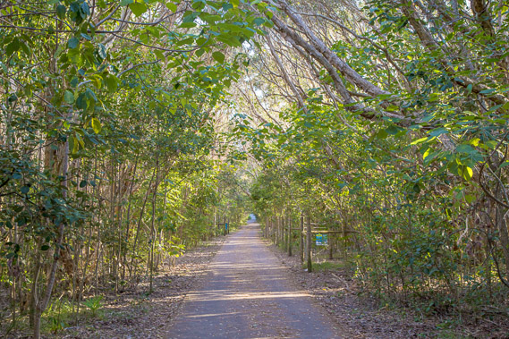
10:39 - The bright spring sun filters through the leaves of the scrubby coastal trees as I follow the path behind the dunes down the beach. The foliage still looks lush even though this is the height of the long dry season. I decide to continue following the path as this is part of the official Sunshine Coast Coastal Walkway |
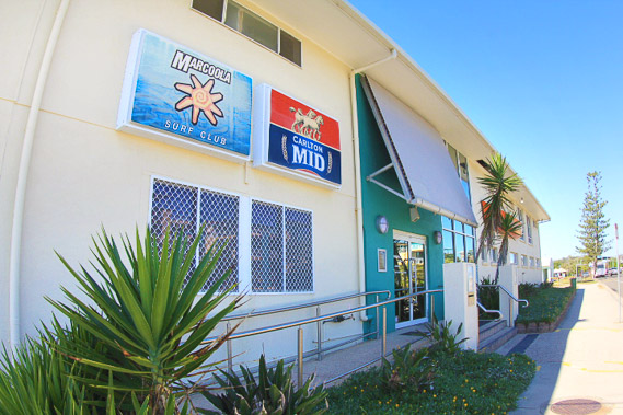 |
10:48 - Reaching the Marcoola Surf Club. I've been following the path for a while, so decide to head back to the beach. |
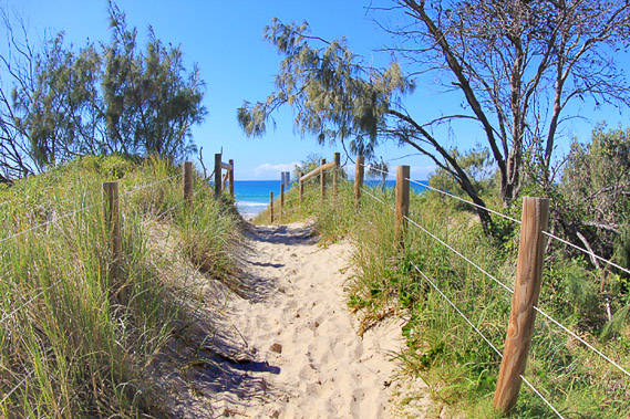 |
10:51 - The narrow path from the surf club over the dunes towards the beach. The dunes are fenced off on either side partly to protect them to revegetate, and also because snakes lurk in the undergrowth. They have come out of hibernation and it is breeding season, so they are more dangerous than usual. Most of the snakes along the coastal areas are eastern brown snakes, the second most venemous of all land snakes in the world. Although they are normally timid, they can attack at this time of year, so I hurry towards the beach. |
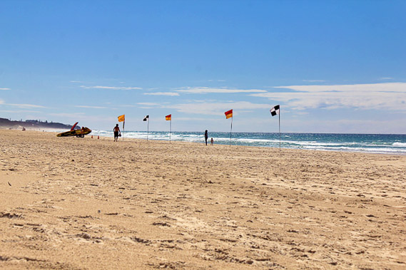 |
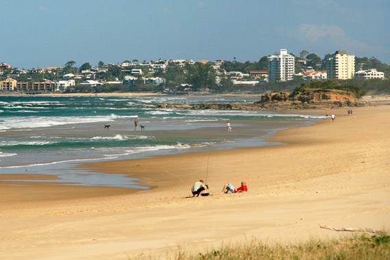
11:22 - Passing another swimming beach, where lifeguards have determined a safe area to swim. Passing another surf club with Point Arkwright a long way in the background. The tide is in making progress a bit slow as I hike along the soft sand. The hard sand exposed only at low tide is much easer to walk along. |
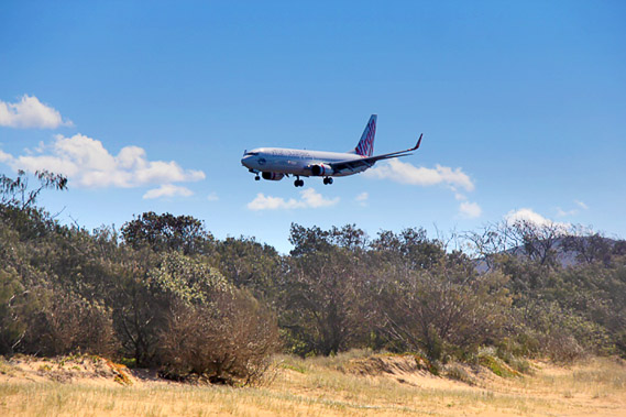 |
11:49 - A plane hovers very low to land on the nearby runway. Mount Coolum is to the right, very close to the runway. |
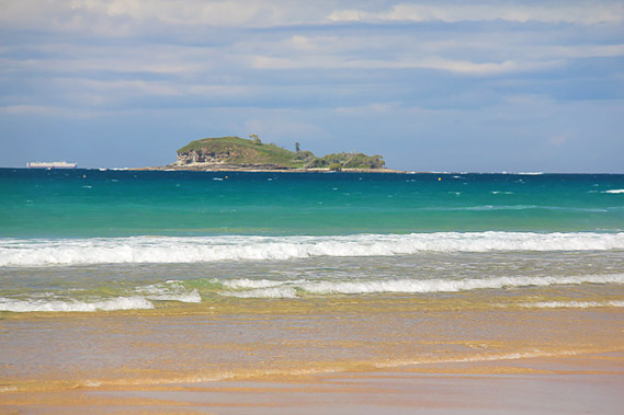 |
11:51 - Mudjimba Island from near Mudjimba Point. A ship heading towards Brisbane sails in the distance. |
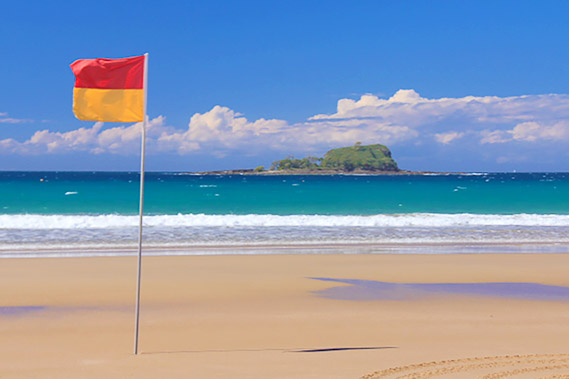 |
12:27 - A flag at the start of the safe swim zone erected in front of the volcanic Mudjimba Island. When the sea level was lower, this was a hill, but the rising sea had covered all the land surrounding it turning it into an island. Offshore from the island lies the sunken remains of the HMAS Brisbane, an old war ship I once boarded in New Zealand in 1983. It was decommissioned in 2oo1 and sunken here as a diving reef. Its bridge and guns were removed and now displayed at the war memorial in Canberra. |
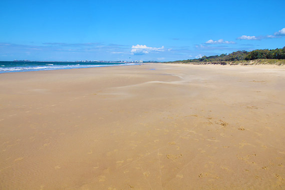 |
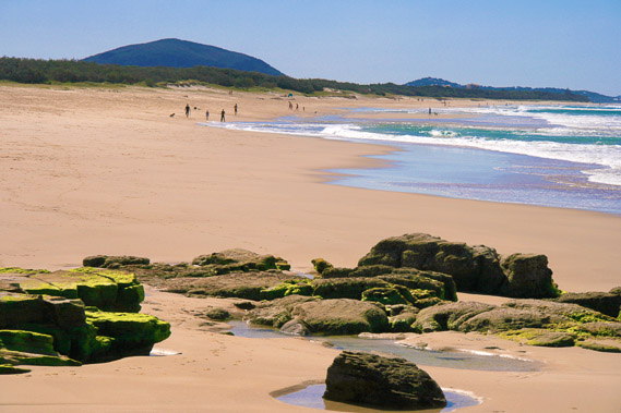
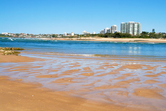
13:12 - The tide is quickly going out leaving a wide beach once past Mudjimba Point. Maroochydore is visible at the end of the beach, but there's a long detour to take to cross the river. |
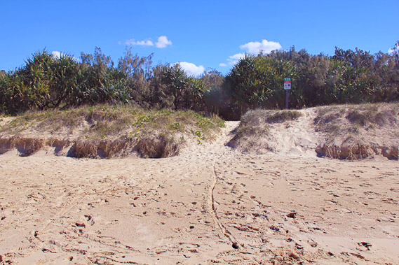 |
13:14 - Track leading up out of the beach. |
 |
13:27 - I return to the wide path following a road through the forest near Twin Waters Resort. |
 |
13:32 - I return to the beach at track entrance 132. Zooming down the beach I see Pincushion Island at the mouth of the Maroochy River with the buildings of Maroochydore behind it. |
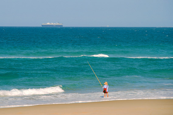 |
13:43 - A man fishes in the sea as a ship heads out to sea having left Brisbane at high tide heading out of Moreton Bay. |
 |
13:51 - The spectacular formations of Pincushion Island. |
 |
13:53 - Looking back to Mudjimba Point and Mount Coolum. |
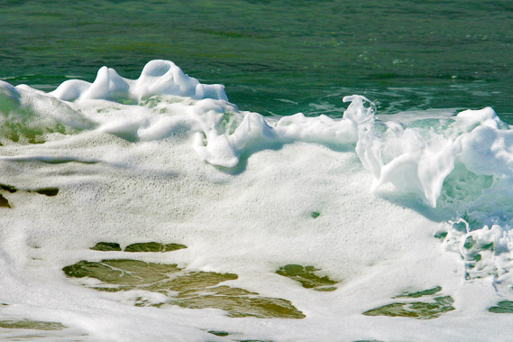 |
14:01 - Foamy waves breaking at Pincushion Island. Although it is called an island, the sand bank connecting it to the mainland is a good metre higher than the high tide line. This only becomes an island if the river flooding coincides with a particularly high tide. |
 |
14:08 - I head around the rocks of Pincushion Island to the mouth of the river. Approaching the mouth of the river with the high rises of Maroochydore just a few hundred metres away, but a long way to walk. |
 |
14:22 - Mouth of the Maroochy River, with breaking waves running upstream. |
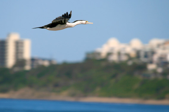 |
14:33 - A bird flies by heading upstream. |
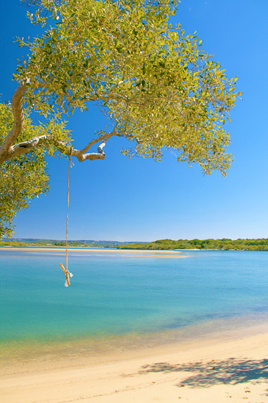 |
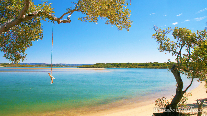
14:37 - A swing at the edge of the pristine river. |
 |
15:16 - Heading back into the bush around Twin Waters Resort back to the main track heading towards the bridge. Occasionally it would cross a canal leading off from the main river. |
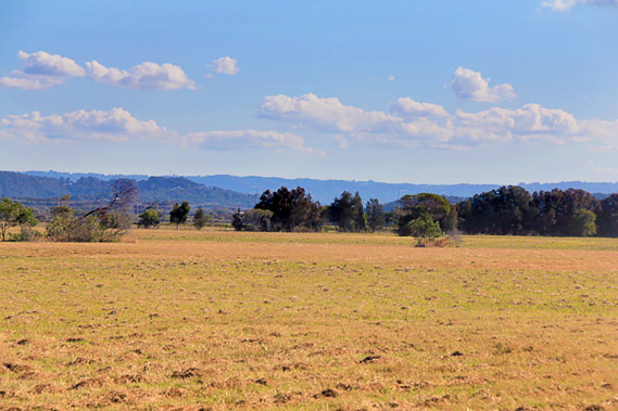 |
16:01 - After leaving the canal I suddenly arrive in low farmland. Cloud is coming from the south east now. I had seen a big bank of cloud to the south earlier, so perhaps it is going to completely cloud over. |
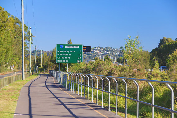 |
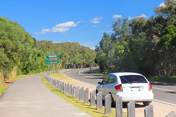
16:32 - After going inland a couple of kilometres, the track reaches the side of the Sunshine Motorway, and turns towards the river. Just another five kilometres to do today (I've already done 24). Brisbane City is 105 kilometres by road along motorway, but likely well over two hundred kilometres away and about another ten days' hike for me following the coast. |
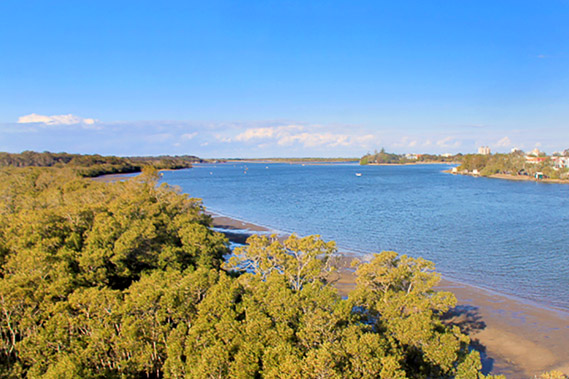 |
16:42 - The Maroochy River, with mangroves growing along its muddy edge. The bank of cloud is building. Will this mean I will miss the sunset along the river? |
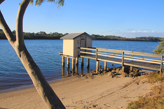 |
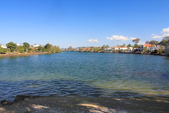
17:21 - Following the south bank of the Maroochy River back towards its mouth. A private jetty juts out into the dark water. |
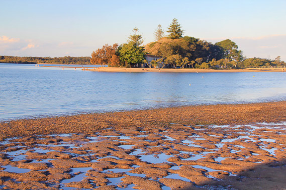 |
17:24 - The tide is out as I pass a small island as the cloud rolls in overhead and the sun sinks low. |
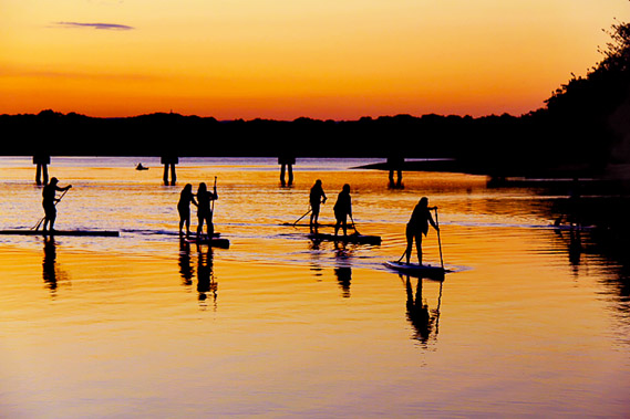 |
17:34 - The paddleboarders return downstream capturing the last sunlight before the clouds close in. |
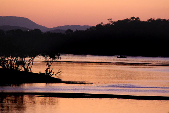 |
17:40 - The last colours of the day as the clouds sweep across the sun as it sets. From here the track turns in from the river heading past some of the high rises of Maroochydore. |
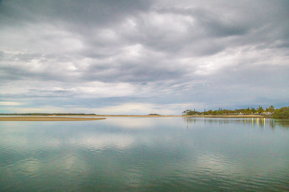 |
18:10 - By the time I return to the coast at Cotton Tree Point, the day has all but gone. Thick clouds hover over the mouth of the river as a gentle rain begins to fallt. |
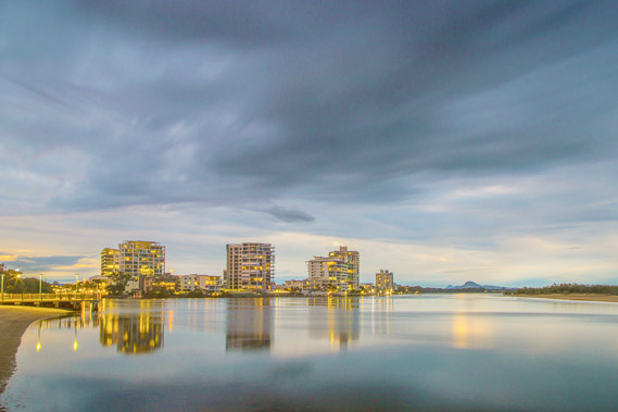 |
18:12 - The rain is very short lived as the sky darkens and the lights come on in the apartment buildings overlooking the river. |
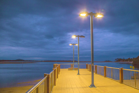 |
18:22 - A little viewing platform over the river, though it is getting a bit too dark to see across the river now. |
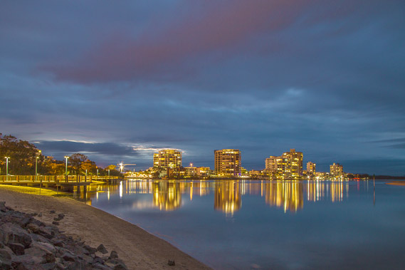 |
18:28 - Night sets in at the mouth of the Maroochy River as the cloud begins to break up over the golden buildings refected in the dark water. |
|