Introduction to today's journey
Hidden away in the scenic hinterland, Wamuran reveals itself as a quaint village steeped in history and charm. Originally inhabited by the Indigenous people of the region, Wamuran's early settlement traces back to the nineteenth century when European pioneers ventured here in search of fertile land. The village flourished as farms and orchards were established. However, it was the introduction of the railway in the late 19th and early 20th centuries extending from the main line at Caboolture inland to Kilcoy that transformed Wamuran. For many years the railway line transported the produce from these rich lands until it was eventually abandoned and dismantled into today's rail trail.
Today's journey descends from Dahmongah Lookout Park through Delaneys Creek State Forest into Wamuran Basin. I follow the basin down to Wamuran and cross the D'Aguilar Highway to follow the recently opened rail trail to Caboolture, where I watch the sunset from Centenary Lakes Park to close off the first section of this trek.
Distance hiked today: 30.4km
Total distance hiked: 214.7km
Today's Journey
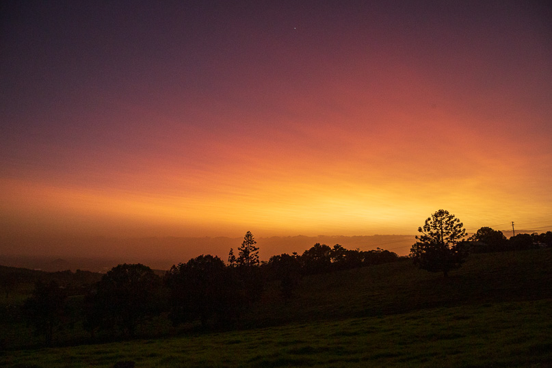 |
The sky is dawning a brilliant red at Dahmongah Lookout, painted by the ash from the Hunga Tonga-Hunga Ha’apai volcano eruption a few weeks ago. This volcanic ash has dispersed across the upper stratosphere, casting a vivid hue over the entire southern hemisphere. I take in the breathtaking view, with the distant lights of Wamuran and Caboolture twinkling like stars on the horizon. These towns will my destinations for later today, once I descend from the plateau. The air is crisp and cool, and the landscape is bathed in the soft, early morning light. |
 |
I depart Dahmongah Lookout shortly after sunrise briefly following the bustling Mount Mee Road before turning off onto the much quieter Pedwell Road. This road winds its way through lush farmland of vibrant green fields thanks to the recent rains. The air is filled with the scent of fresh earth and blooming wildflowers, and the gentle sounds of farm life create a peaceful soundtrack to my journey. |
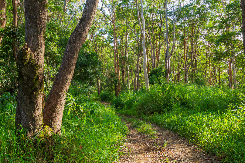 |
As I continue trekking, the sealed road changes to a gravel road going to the edge of the plateau. Here, the journey takes a more rugged turn as the path continues as a dirt firebreak, winding its way up the hill into the dense greenery of Delaney Creek State Forest. This forest is a haven of biodiversity, with Delaney Creek beginning its journey to my left, eventually joining Neurum Creek further downstream. Together, these waters form the main stream that feeds into the expansive Somerset Dam. Upon reaching the top of the hill, I follow a horse trekking track descending the ridge into the Wamuran Basin. |
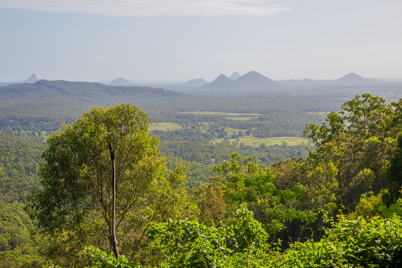 |
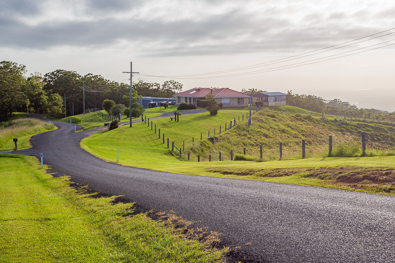
The track ends at the top of R Williams Road, which continues a moderate descent, winding its way down through the lush landscape through private acreage farms. As I descend, the road gradually eases off, revealing an awe-inspiring view of the Glasshouse Mountains in the distance. These ancient volcanic peaks will be the focus of the next leg of my trek. I continue my descent, turning into R Samson Road, leading me deeper into the Wamuran Basin until reaching the bottom at Jackson Park. This park was once an early settlement camp with a bubbling brook passing by. |
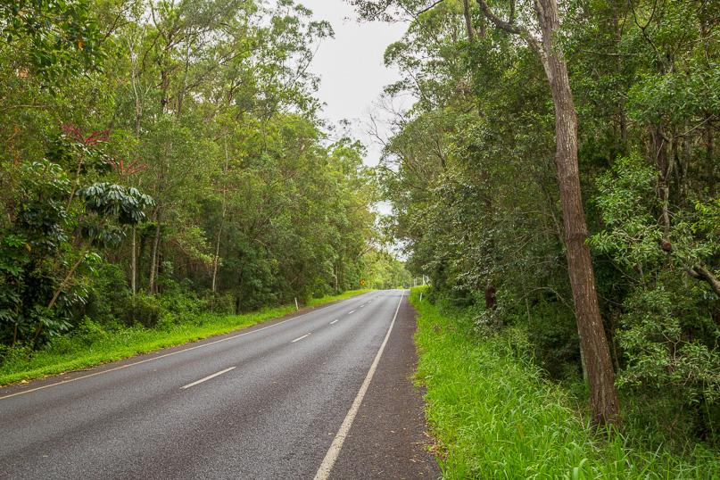 |
After departing the park, I follow Basin Road through the tranquil basin, I reach Campbell’s Pocket Road, the main artery descending from the Mount Mee Plateau. This road is notoriously narrow and winding, making it too dangerous for pedestrians. Fortunately, my earlier discovery of the route through Delaney Creek State Forest provided a safer and more scenic alternative. Now, at the bottom of the valley, I am finding that there is enough verge along the side of the road to follow safely towards civilisation. |
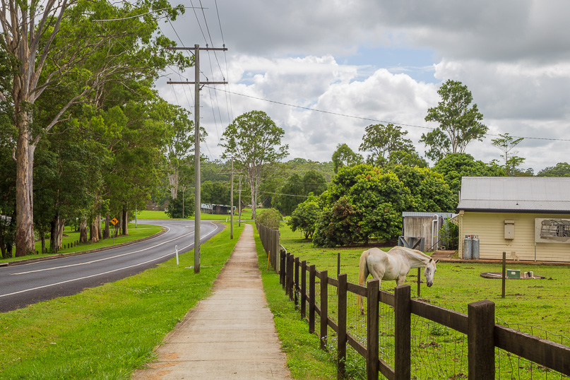 |
Fortunately, after a short distance, the verge widens into a broad footpath, making for a much more pleasant and safer walk. This path meanders through the picturesque Wamuran Valley, where lifestyle farms dot the landscape. |
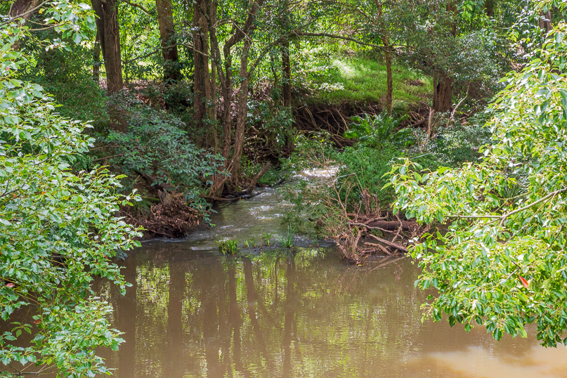 |
Shortly before reaching the quaint Wamuran Village, I cross the bridge over the upper Caboolture River. The opaque brown river is swollen from recent rains. From this point onwards, I will be following the river downstream. Once across the river, I reach the very busy D’Aguilar Highway. This major roadway stretches inland from Caboolture towards Kilcoy and beyond, serving as a vital link for the communities nestled in the hinterland. Following seven days in wilderness, the noise is a bit overwhelming but I press on crossing the road and walk through the village. |
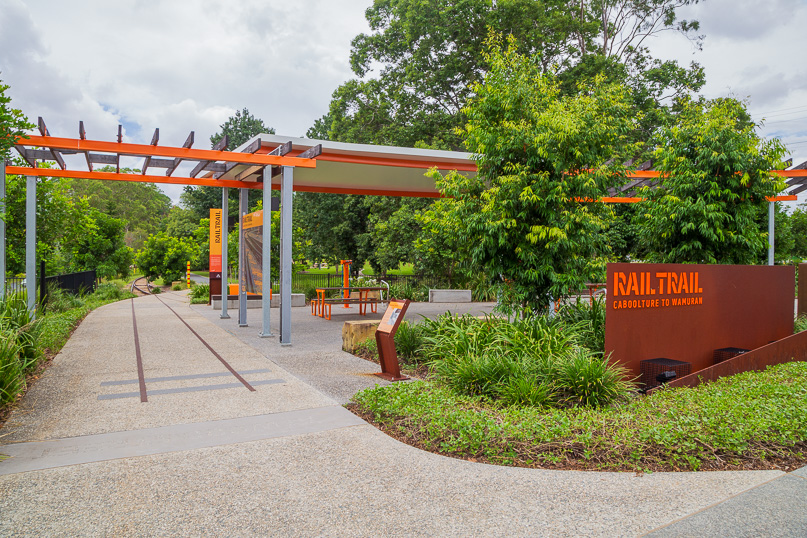 |
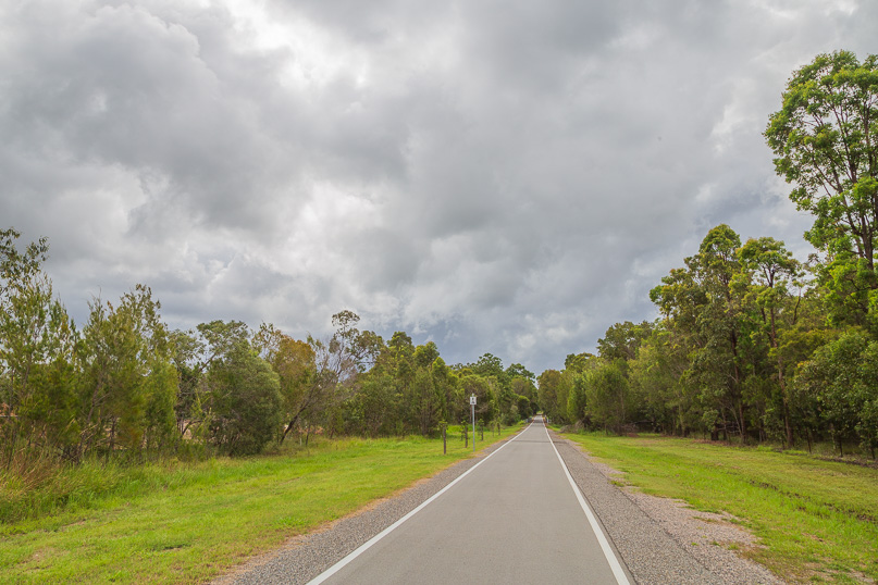
Wamuran was once a bustling sawmilling town, with a railway line extending from Caboolture to transport the abundant logs into Brisbane. This railway closed in 1996 when tracks were dismantled and the route transformed into a beautiful parkland. Today, a newly opened walking track winds through this parkland giving me an easy path to follow over the final eleven kilometres of this leg into Caboolture having already trekked just over two hundred kilometres from Brisbane. |
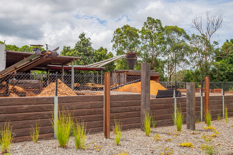 |
I begin following the very level track along the old railway. The new walking track is freshly sealed making a welcome relief from the undulations of the ranges in recent days. The track passes under the highway before going through a cutting in a small hill to reach a sawmill. This is the final operating remnant of what was once a thriving timber industry in this area. In its heyday, this mill was a bustling hub where timber was loaded onto trains bound for Brisbane. Today, the scene is quieter, and the timber is transported by road. Trucks rumble along the D’Aguilar Highway just on the other side of the mill. |
 |
As I am walking, the track straightens and the landscaping becomes more elaborate, with manicured gardens and native plants lining the way. The rolling hills of Wamuran gradually give way to the residential suburbs of Caboolture, where the flat terrain of the flood plain offers a different kind of charm. |
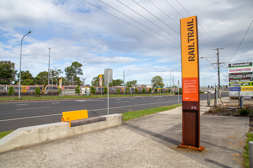 |
I reach the end of the rail trail just across the road from Caboolture Railway Station. Here the old railway joined the main trunk line which stretches up and down the Queensland coast. The station across the road is bustling with activity and numerous commuter trains are parked, ready for tomorrow morning’s rush into Brisbane City, a little less than 50 kilometres away via a direct route, over four times the distance I have hiked through the mountains. From here, I turn right for a short walk into the heart of Caboolture town centre. |
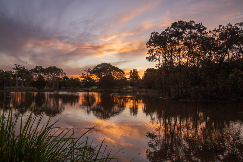 |
After hiking through the bustling Caboolture town centre, with its mix of modern shops and historical buildings, I head a little further to Centenary Park, nestled on the banks of the Caboolture River which I have followed downstream from Wamuran. This park is a serene oasis, offering a perfect spot to end the first leg of this journey. |
|
