 |
03:41 - Starting where I left off heading downstream towards the mouth of the Maroochy River. The buildings of Maroochydore are still clearly visible above the sandbar under a bright full moon. A dredge creates the strong red light. |
 |
03:53 - Looking across the river through its deep channel. The current of the outgoing tide forms submerged sand formations. A stray obviously lost dog keeps me company for a while before deciding to head home. |
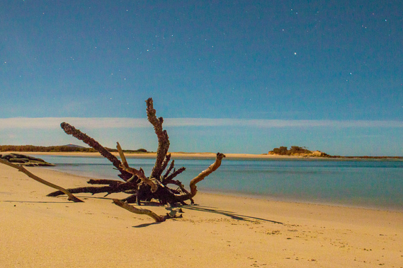 |
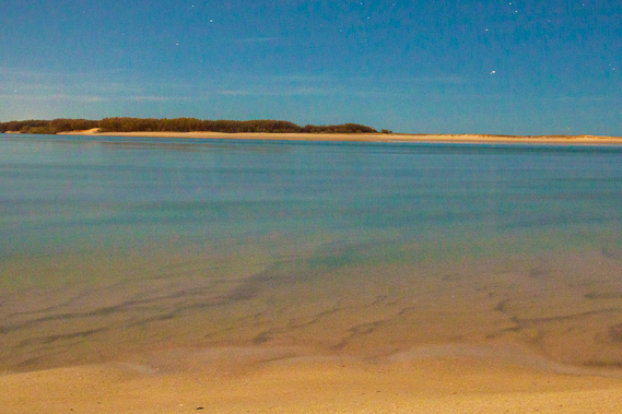
04:06 - A driftwood tree washed up on the beach at the mouth of the river with Pincushion Island clearly visible on the other side. The small waves wash onto the beach during this long exposure of the river mouth. |
 |
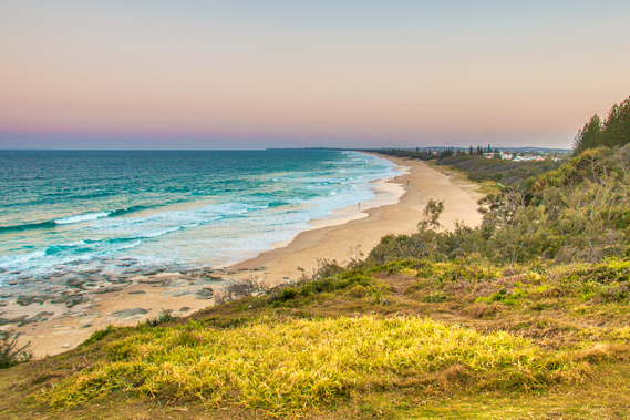
04:28 - Looking down Maroochydore Beach towards the high rise apartment buildings overlooking the shore. These residential towers rise above the main commercial centre of the Sunshine Coast. |
 |
04:44 - The first light of dawn off the coast from Point Cartwright on this crispy cool morning. |
 |
05:00 - Maroochy beach and the lights of Alexandra Headland in the distance as I start making my way along the beach. |
 |
05:04 - The sky lightens off Point Cartwright with the eternal bank of cloud running along the edge of the continental shelf. |
 |
05:14 - The tide is right out leaving some small pools left from wave action from the overnight tide. The pools form patterns in the sand as the tide just starts to come in again. |
 |
05:26 - The Maroochydore Surf Lifesaving Club. Although it is closed up at the moment, shortly it will open and the beach will spring to life as it does every morning. |
 |
05:43 - The sun rises through a gap in the clouds as another wave sweeps in over the golden sand. |
 |
05:56 - A ship heads off towards the sunrise heading across the vast Pacific Ocean having left Brisbane a few hours ago. |
 |
06:12 - The first rays of sunshine on Alexandra Headland and Point Cartwright. |
 |
06:18 - Zooming back to Maroochydore Beach towards its high rises as a group of kayakers paddle out into the calm blue ocean. The sea is at its calmest at around this time of year, so they are making the most of these conditions before the prevailing south east trade winds start to blow in later in the year. |
 |
06:19 - Looking up the coast, the sun is shining on Mount Coolum. No doubt there will be people climbing it this morning. Going to the right of Mount Coolum, there is Point Arkwright, Noosa Heads and Mudjimba Island. |
 |
06:22 - Looking across the rocky foreshore of Alexandra Head across to Point Cartwright where I'm aiming to reach for sunset tonight. |
 |
06:56 - Looking back over the rocky Alexandra Headland from the start of Mooloolaba Beach. |
 |
07:25 - People walk along the peaceful Mooloolaba Beach with Maroochydore in the distance. I'm now half way along the beach. |
 |
07:40 - I reach the end of Mooloolaba Beach and start following the rock wall keeping the channel of the Mooloolah River open. Another rock wall runs parallel on the other side of the river. |
 |
07:54 - A couple of kayakers paddling past the mouth of the river with Mount Coolum in the distance. About twelve hours ago a huge earthquake struck the Mexican coast. Such quakes send tsunamis across the Pacific Ocean. Fortunately the tsunami hitting the coast at about now wasn't at all noticeable. A much bigger quake would have caused quite a destructive wave along this coast even though it would have been generated half a world away. |
 |
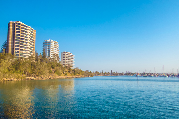
07:55 - A bird flies in front of the towering apartment blocks of Mooloolaba. |
 |
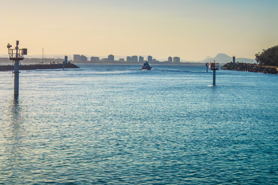
07:57 - Small tower at the end of the rock wall. There is one on either side with lights to navigate the boats into the channel. |
 |
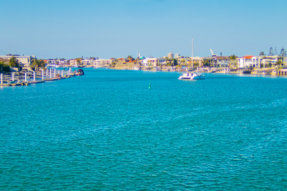
08:00 - Maroochydore in the distance, with two volcanic hills in the distance up the Maroochy River. |
 |
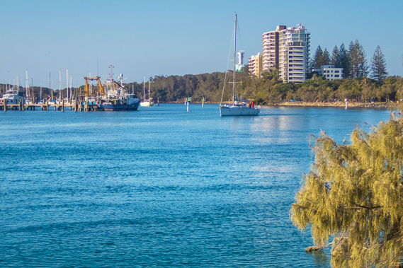
08:07 - A yacht heads out onto the blue ocean. |
 |
08:22 - Kayakers heading up the Mooloolah River as I start my journey upstream to head towards Point Cartwright. Although the lighthouse is only a couple of hundred metres away, it is going to be a long hike around numerous canals and across the river to get to it. |
 |
08:28 - Last view of the pristine Mooloolaba Beach. |
 |
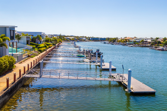
09:02 - A boardwalk path follows the middle of the narrow sandbar behind Mooloolaba Beach. To the left of the boardwalk is a large marina near the mouth of the river. |
 |
9:39 - Upon returning to the end of the sandbar, I reach the main road and start following it through the Mooloolaba town centre heading upstream towards the canals. |
 |
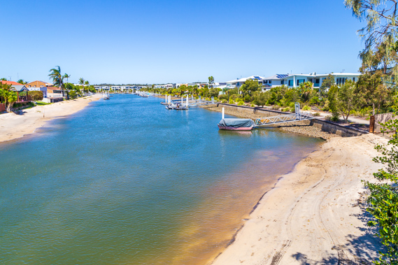
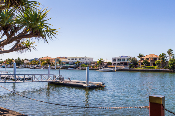
10:56 - View from the bridge over one of the numerous canals. In the distance is one of many canal estates quite common around here. Hopefully the sea level won't rise too fast over the coming years. Although the water looks very inviting, large bull sharks lurk in its turquoise waters. |
 |
11:14 - I follow a path briefly leaving the canals to head under the Sunshine Coast motorway. |
 |
11:30 - Back beside the canal estates along the Mooloolah River heading upstream. |
 |
11:38 - A canal estate with its own beaches and boat ramps. |
 |
11:44 - A wide path leads the way around the canals. |
 |
12:10 - Compact living along the canal as a sea breeze starts blowing. The canals are a peaceful setting as I continue following the path. |
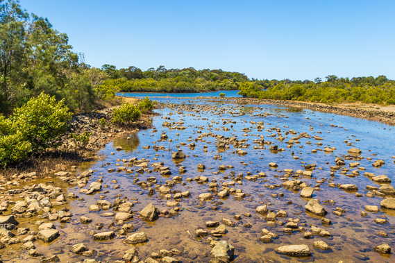 |
12:22 - The canal ends at a weir feeding into the Mooloolah River. The highest tides add a bit more water into the canals and the weir prevents water escaping, drying out the channel facing the river. |
 |
12:38 - Fishing on the Mooloolah River with the high rises of Mooloolaba still in view. |
 |
13:17 - Having crossed some parkland, I cross a bridge over the Mooloolah River to explore the other side and start making my way back towards the coast. |
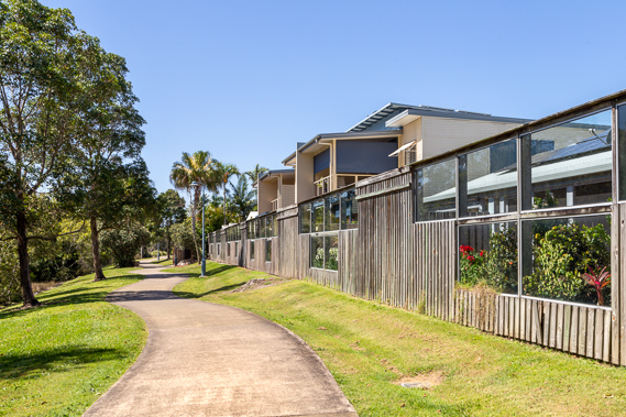 |
13:21 - Path following the Moololah River mangroves and the back of a townhouse complex. |
 |
14:08 - The track eventually reaches another canal estate, passing one of many private pontoons with boat access to the sea. |
 |
14:13 - View back along the canal as I cross a bridge to head towards Point Cartwright. |
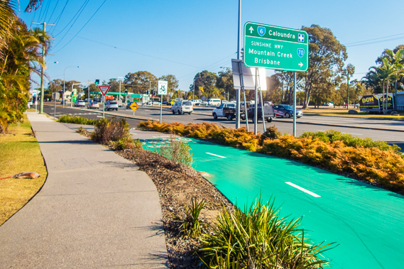 |
14:39 - Reaching Nicklin Way, the main road heading along this section of the Sunshine Coast. Here I am back on the main coastal walkway. |
 |
15:04 - The canal estate from the middle of the bridge crossing the Maroochy River. From here I just need to head downstream back to Point Cartwright a few kilometres downstream. |
 |
15:23 - Following the Maroochy River downstream. Point Cartright is behind the apartment buildings. |
 |
15:53 - Mouth of the Mooloolah River with Maroochydore in the distance. The rock walls on either side of the river are visible on either side. |
 |
15:56 - High rises reflected in the ruffled waters of the Mooloolah River near its mouth. |
 |
16:06 - Path to the end of the rock wall - appearing almost identical to the wall on the other side of the river this morning. |
 |
16:32 - Looking the other way for my first clear view of Point Cartwright. The sun is quickly dropping towards the horizon but I've still got time to head up to the lighthouse before the sun sets. |
 |
16:40 - Looking across the channel to where I was standing earlier today and Mooloolaba Beach. Amazing I was just a hundred metres away on the other side eight hours ago. A fishing boat heads out of the Mooloolah River heading towards an offshore reef. |
 |
16:55 - Heading up the hill following a path towards the Point Cartwright Lighthouse. |
 |
17:07 - A ship heads offshore to cross the Pacific Ocean after leaving Brisbane on the high tide early this afternoon. |
 |
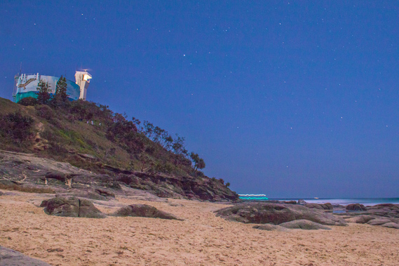
17:09 - The Point Cartwright lighthouse and water tower. |
 |
17:34 - A couple walk their dog along the beach viewed from the lighthouse. |
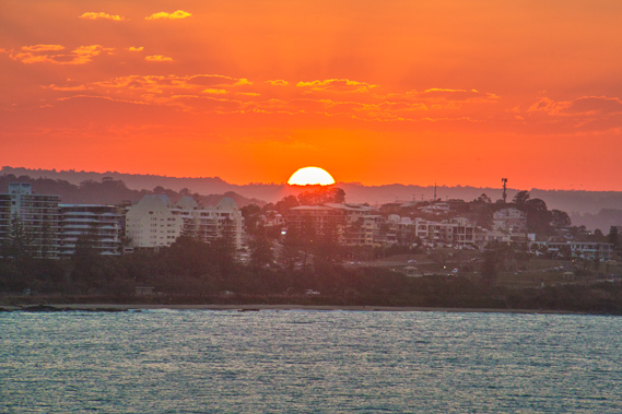 |
17:40 - The sun sets behind Mooloolaba, due west in tonight's spring equinox. |
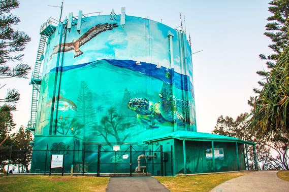 |
17:43 - The big water tower behind the lighthouse as I follow the track towards Kawana Beach as the sun officially sets hidden behind the western horizon. |
 |
17:44 - Darkness is already falling over the beach as I head down towards the rocks, initially along a sealed path before descending a wooden stairway to the long sweeping Kawana beach. The headland in the distance is Moffat Head with the Caloundra town centre on the other side. |
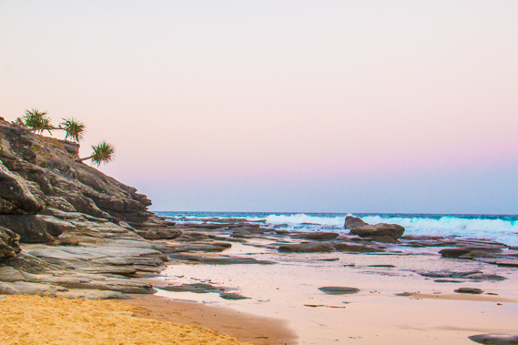 |
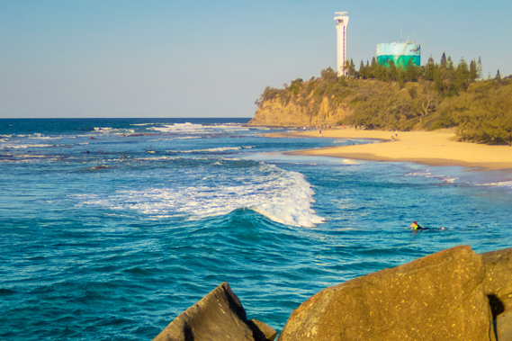
17:52 - The rocky Point Cartwright from the bottom of the wooden stairs down to the beach. There are some very interesting rock formations, so I decide to stay here at the point for some long exposure photography. |
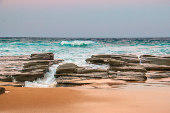 |
17:53 - Waves break over the sandstone rocks at Point Cartwright. |
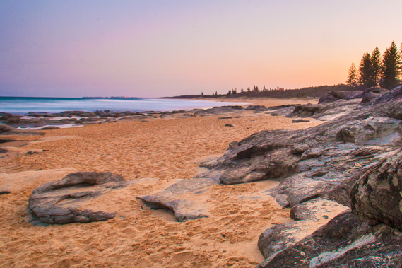 |
18:01 - Last light looking along the beach towards Caloundra. |
 |
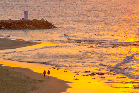
18:28 - Starting the evening walk along the beach. The lighthouse is illuminated and the lights of a boat bounce along as it heads out to sea from the mouth of the Mooloolah River. |
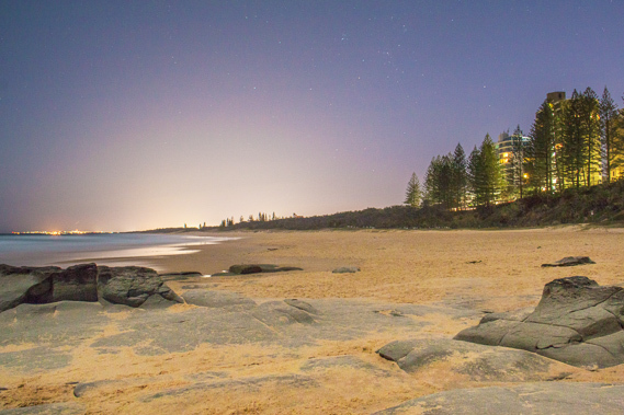 |
18:30 - Looking down the beach. The palm trees block out most of the light from the apartments overlooking the Mooloolah River on the very narrow headland. The lights of Caloundra are visible to the left, and the large glow straight ahead is the light pollution from Brisbane. |
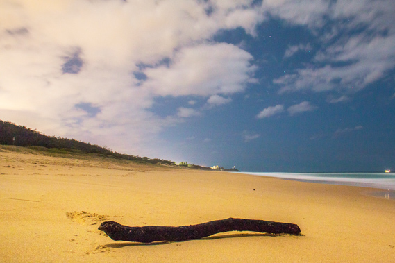 |
19:43 - A log washed up on shore several kilometres along the beach from Point Cartwright, already looking distant. Clouds have come in brightly reflecting the light pollution from the nearby suburbs. |
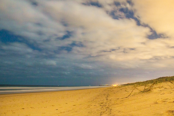 |
20:38 - About two hours down the beach from Point Cartwright, I stop here at Bokarina. I have one last look down the beach where I'll be heading tomorrow morning. Caloundra is around ten kilometres away and the far end of the Sunshine Coast is less than twenty kilometres, so I should be able to complete this leg before tomorrow's sunset. |
|
