|
|||||||||||||||
|
|||||||||||||||
Home > Travels > Terelj > 2 |
|||||||||||||||
|
|||||||||||||||
|
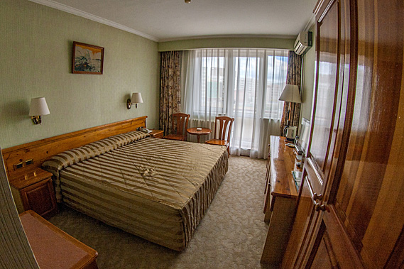
MY RIDE arrived right on schedule. One of the local unofficial taxi drivers pulled up in front of the hotel. I had met the driver Batu yesterday, along with my guide Dougie. They had met me at the station upon my arrival from the overnight trip from Beijing, letting me know they will be my guides today as they dropped me off at my hotel.
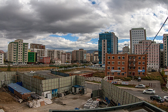
Batu was alone this morning. He mumbled to me in Mongolian, with his English as non-existent as my Mongolian. He quickly phoned Dougie on his smart phone and after talking for a few moments he gave it to me. Dougie was running a few minutes late due to some traffic jam. The city was struggling with its growing pains, or maybe some of the drivers weren’t used to the rain – apparently a rare phenomenon here. One of Ulaanbaatar’s growing pains was pollution. With the inversion layer and little wind being at the bottom of the valley, the wood and coal burners everyone uses to heat their homes during winter makes this the second most polluted city in the world. Only Ahvaz in Iran is worse. The city air was reasonably clean at this time of year, with the only pollution coming from the cars, and the smoke of a large power station just outside the city. Otherwise there was little pollution with no heating needed. It was hard to believe this remote city has dirtier air than Beijing.
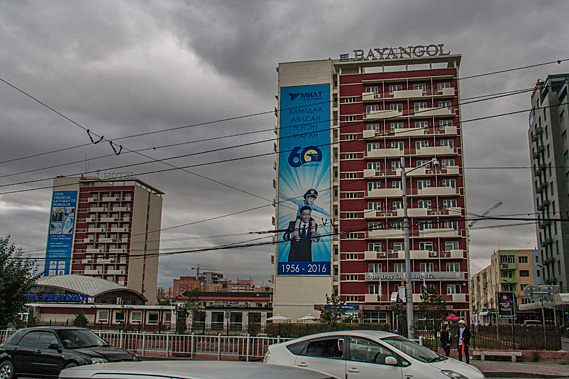
I would later discover taxis in Mongolia aren’t regulated like they are in the West. If you need a lift anywhere you could just put out your thumb (hitch-hiking anyone?) and some random person would stop, negotiate a fee, and they will take you to your destination. It works out to be a very cheap way to get around, and if you are even vaguely organised, it’s a very effective way to keep unnecessary cars off the road. Dougie was coming to meet us in one of these informal cabs, but they had been stuck in traffic. I was sitting in another one. Dougie would have met Batu at some stage in the past whilst guiding someone else. They had gotten on very well and they agreed to work with each other henceforth, bringing Batu a lot of business. I have seen this before in other parts of the world. I recalled this in Sandakan at the top of Borneo where my guide had a close association with a rather bubbly guy we all knew as “The Main Man from Sandakan” who had a lot of business from groups led by the guide. Batu wasn’t quite as bubbly though, but that comes with a barrier in communication. After a few minutes Dougie did arrive and slunk into the back of the small unmarked taxi. Now we were on our way. The car was very small and good for the city, so I was wondering how it would cope out in the Terelj wilderness. Clearly they had done this trip many a time before with other clients, so all should be good.
The highway was in good condition. At one point we stopped at a small shop on top of a rise in the valley before continuing on, crossing the Tuul River 37 kilometres from the city turning off shortly afterwards on a rough and bumpy road of concrete blocks heading towards the narrow opening of a valley. The rain had stopped falling by now but the cloud overhead was still thick with no signs of blue sky. The Tuul River is famous for being the location of what had been The Black Forest where the Wang Khan palace was located and where the emerging Ming Dynasty defeated the Mongols in 1372 to take back the Chinese empire.
The Tuul River drains this part of Mongolia flowing 704 kilometres to the north to Orkhon River, then the Selenga River to flow into Lake Baikal in Siberia, the world’s largest body of fresh water. From the lake, the water follows the Angara River for a further 1800 kilometres into the Arctic Ocean over 3000 kilometres downstream from Ulaanbaatar. The name Tuul is from the Mongolian word for to wade. The river runs through the middle of the city forcing its early settlers to wade through it when it wasn’t frozen over. The tiny car bumped heavily along the road following the Terelj River upstream, but the guys didn’t seem at all perturbed. Perhaps this what all the roads were like here in Mongolia, a land of one city surrounded by very remote wilderness.
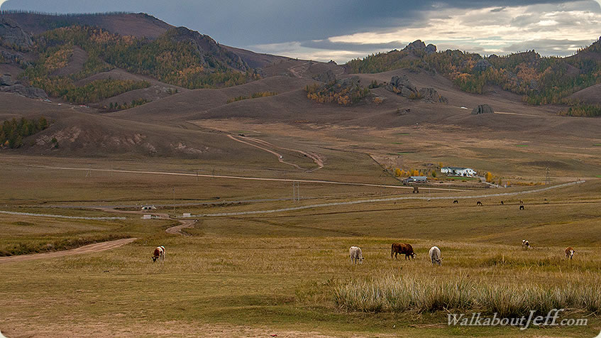
The bumpy road headed towards a narrow entrance between two granite bluffs, broken from heavy weathering from the ice of the harsh Mongolian winters. Although we were in a valley, we were about 1400 metres above sea level, with the temperature about 8 degrees cooler than if we were at sea level. We were around 1500 kilometres inland though, far away from the moderating effect of the sea. Here the Siberian winters hit extremely hard. They are brutal. The valley was very quiet, at the end of the normally busy tourist season during the short summers. Spectacular granite ridges towered above either side of the valley, sheltering it from the harshest of the biting Artic winds. Villages of ger tents were scattered around the valley. These were the homes of the nomadic peoples of the Terelj region. Not constrained by land titles, they were free to migrate as they see fit.
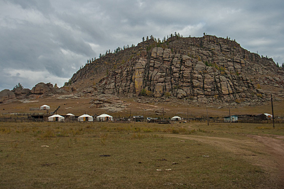
Terelj is the Mongolian word for the local creek rhododendron, the Adams Rhododendron or known locally as the Terelj Dali, it is a very hardy species of rhododendron found in mountainous areas around here, eastern Siberia, and in Tibet. It is a 30-50 centimetre high shrub with white flowers. It is found in dense and damp larch and cedar-larch forests. Also found in mossy bogs, goltzy and screes. The flowers and leaves are used traditionally for treating lung diseases, coughing, and to enhance energy and to increase appetite. We turned off the main road onto an even bumpier gravel road to a small cluster of six gers. It was serviced by a few old power cables but otherwise free from civilisation. Behind the village towered a steep broken face of granite, with deeply scarring vertical lines making the layers of plutonic deposition when the rock was formed deep underground many millions of years ago. The lines were broken with horizontal breakages from thousands of years of freezing and thawing of ice leaving quite a bit of rubble at the bottom of the cliff. The top of the rounded cliff was framed with a scattering of pine trees, perhaps the start of a forest running down the other side of the mountain.
The gers stood on a small plateau a couple of hundred metres in front of the cliff face, close enough to be reasonably sheltered from the coming Arctic winds, but far enough away not to be in the path of any falling rocks. The bottom of the valley was quite some distance about twenty metres below the gers, so they were well above the flood line. We pulled up in front of the gers, getting out into the fresh mountain air in this very remote valley. The air was still heavy with dampness, but little rain had fallen on this side of the mountains. It was hard to believe the bustling city of Ulaanbaatar was just fifty kilometres away. |
|||||||||||||||
|
|||||||||||||||