|
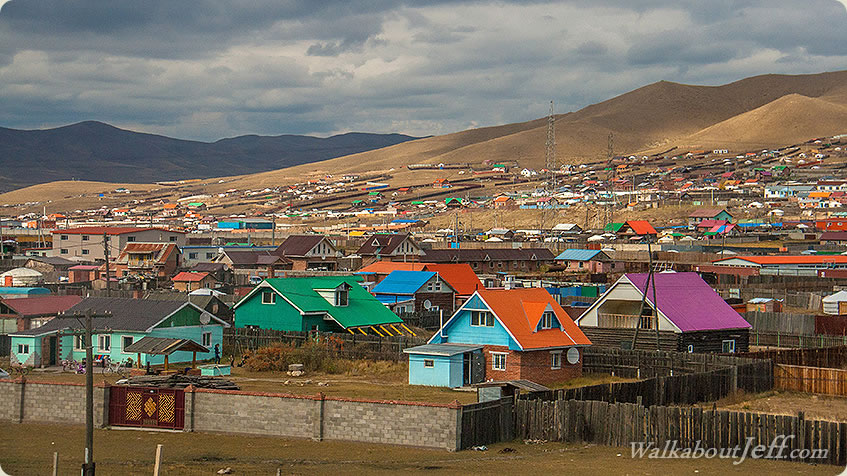
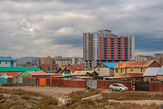
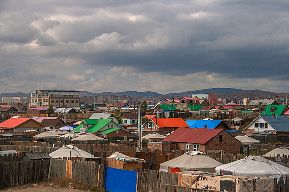
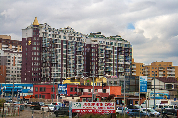
THE VIBRANT mining city of Ulaanbaatar was already bustling with commuters heading into the city from their brightly coloured houses of suburbia. The morning had dawned overcast with drizzle falling. The skyline was filled with the glass towers of modern high-rise buildings, and cranes building more glass towers, a testament to Mongolia’s recent success in mining. Mongolia is a very remote country sandwiched in between two of the world’s great superpowers. To the south across the desert is the resource hungry China. To the north is Russia, a country so enormous it spans two continents.
 |
Ulaanbaatar |
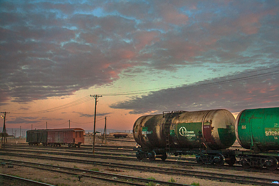
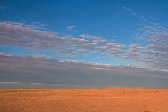
I arrived in Ulaanbaatar late yesterday, having travelled by rail following the centuries old tea route from Beijing. The long journey from Beijing had taken me across the Gobi Desert, one of Earth’s most inhospitable and barren places. Fortunately, the railway was in excellent condition thanks largely to the numerous trains carrying various minerals and chemicals extracted from the different mine sites around Mongolia.
 |
Sunrise on the Gobi Desert |
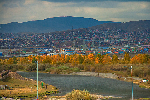
It had been spectacular watching the desert. The sun had risen over a completely barren wasteland. As the day progressed, the desert very gradually morphed into grassy savannah before the train descended from the plateau into Tuul River Valley. Mongolia’s capital city Ulaanbaatar occupied part of the bottom of the valley where the Tuul met the Selbe River.
 |
Gobi Desert |
The railway line had followed the old tea route between China and Russia, where Siberian furs were taken across the desert to Beijing to be traded for Chinese silk and tea. The route opened in 1727 following the Treaty of Kyakhta. Ulaanbaatar was conveniently located about half way along the trading route. This allowed it to become a very important resting and trading post.
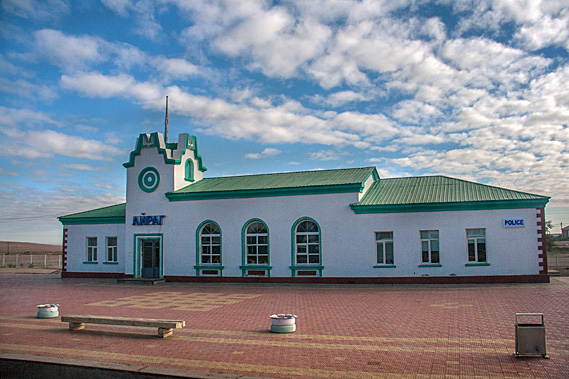 |
Station on the desert |
For those travelling north, Ulaanbaatar marked the end of the gruelling journey across the desolated Gobi Desert, having often encountered extreme cold, and severe dust storms. For traders travelling south, Ulaanbaatar marked the final resting place before commencing the epic leg of their journey across the desert before descending into China.
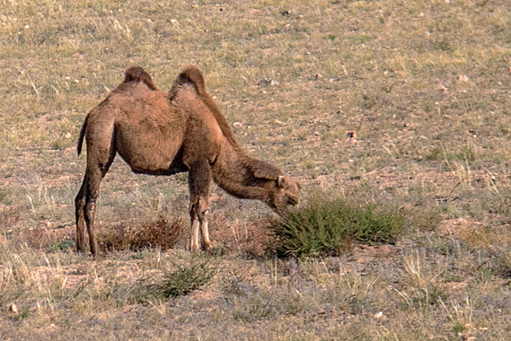 |
Grazing camel |
As the city grew, nomads moved here contributing to its expansion as suburbia of gers filled the valley. In 1921 Mongolia became independent of China, but closely followed the model of the control of the Soviet Union, and over the following decades most of the gers were replaced with Soviet style blocks of flats. Thanks to the help of the Soviet Union, the railway from Beijing through Ulaanbaatar and into Siberia was completed in 1956 allowing the city to prosper.
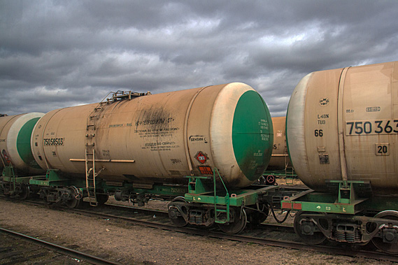 |
Freight carriages |
It was not all good news though. The Soviet rule of the country ensured most monasteries of what had been a deeply ingrained Buddhist culture were destroyed during the revolution of the 1930s. Part of the cost of communism was the purging of all spiritual belief systems in favour of atheism.
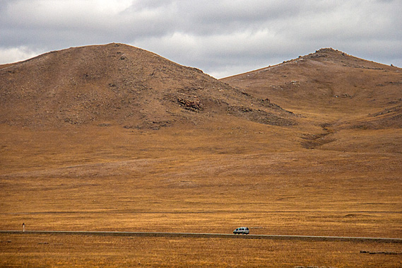 |
The lonely Gobi Desert |
As I travelled across the Gobi Desert yesterday, the train would occasionally pass a herd of camels, horses, yaks, or other livestock being herded by one or more nomadic shepherds. The vast emptiness of the desert would sometimes be broken by the circular white tent gers unique to this lonely corner of the world. They seemed to be such a tiny accommodation.
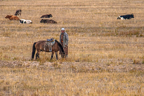 |
A nomadic farmer |
Confined to the train, I had been isolated from the real environment, unable to meet the shepherds, unable to see how three thousand years of nomadic living has allowed them to thrive in this otherwise impossible landscape, unable to see how they lived day to day apart from the brief glimpses as the train hurried past them on its scheduled journey towards Ulaanbaatar.
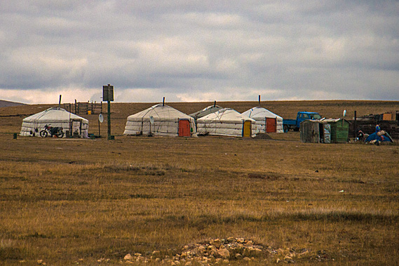 |
A ger village |
Today without the restrictions of any long-distance travel schedule to constrain me, I will be able to have a much better look into the lives of the nomadic Mongolians.
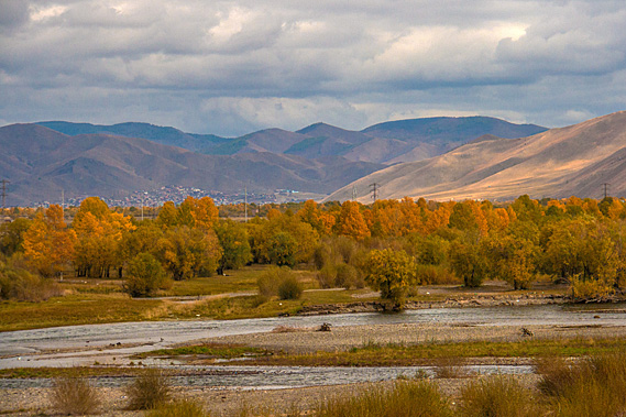 |
Tuul River |
Ulaanbaatar was founded in 1639, well after the peak of the Mongolian Empire. The city was initially a nomadic Buddhist monastery built from a number of gers (then known as yurts). The monastery was moved twenty eight times over the following century and a half reflecting on the nomadic nature of these people living in a barren land sparse of resources. Finally, they settled in the city’s present location at the junction of the Tuul and Selbe Rivers in 1778. By then the temple had grown substantially to a population of around ten thousand monks.
 |
Ulaanbaatar |
Only a few clues stand today of the city’s Buddhist origin, with only one large temple and a monastic academy having survived the revolution of the early twentieth century. Socialism had destroyed much of the city’s religious and cultural heritage in the 1930s, but Mongolia’s return to democracy in 1990 opened opportunities for some of the old ways to creep back into the modern culture.
 |
Ulaanbaatar |
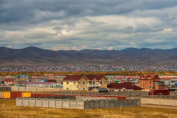
Ulaanbaatar is now a major modern mining city containing about half of Mongolia’s population. About 1.4 million people live here now. It is as densely populated as any other city on Earth with towering glass high rise buildings surrounded by sprawling suburbs of brightly coloured houses and traditional gers. The outer suburbs are known as the ger suburbs. These are quickly expanding as particularly cold winters in recent years have killed off a lot of the nomadic people’s animals, forcing them to move to the city in search for work.
Despite Ulaanbaatar being a thriving city, it sits at about 1320 metres above sea level in a cold semi-arid climate. It is the coldest capital city in the world with an average temperature of -0.4 degrees due to the effects of the Siberian Anticyclone. The relatively shady southern sides of the main valley and gullies have permafrost.
 |
Ulaanbaatar |
The city’s name means “Red Hero”, named after the unknown Red Army soldiers of the Soviet Union. The Red Army was officially known as the Workers and Peasants Red Army, making up much of the Soviet Union’s military. Although Mongolia gained independence and democracy in 1990, the name Ulaanbaatar has stuck to this day.
It is believed this part of the valley has been inhabited for around 300,000 years by nomadic mammoth and woolly rhinoceros hunters – both animals now long extinct, but their bones very commonly found in excavations, such as in the construction site next to the hotel where the foundations had nearly been dug out ready to commence building yet another glass high rise building. Mining creates a quarter of the country’s economy, particularly with some huge gold mines to the north of the city.
 |
Ulaanbaatar and Tuul River |
With the rain falling outside I headed downstairs to the hotel foyer, having had a generous breakfast in the small hotel dining room. There was just myself and one couple staying at the small hotel. It was almost the end of the tourist season with autumn well on its way. Nearly all tourists come through here during the short summer. Ulaanbaatar is the coldest capital city in the world, experiencing some of the most brutal winters anywhere. This serves to keep the tourists away for nearly half of the year.
|