--- Archive files ---
Home > Travels > Tweed > 11 |
Binna Burra
STRONG south easterly winds had blown overnight, so although the road up to Binna Burra wasn’t normally as treacherous as the one to O’Reilly’s it was quite hazardous this morning due to a large amount of vegetation debris on the road. In many places the road was completely covered in leaves blown around by the strong wind. On one corner a tree had fallen onto the road but I was fortunately still able to pass it by going to the edge of the far side of the road. Thankfully there wasn’t much traffic on the road.
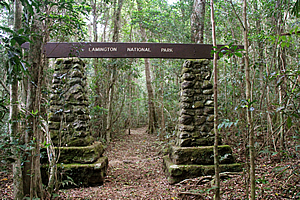
Park entrance |
Eventually I did reach Binna Burra, at 800 metres above sea level. A short shower greeted me but otherwise all was good to go for exploring the bush. Binna Burra is the Aboriginal word for “where the beech trees are”, indicating some stands of Antarctic beech trees growing on nearby summits along the range. These are hidden away well above the main tracks, with only one track leading to an isolated stand at the top of Tullawallal, the nearest of the summits.
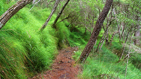
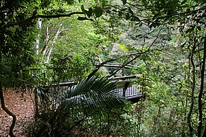
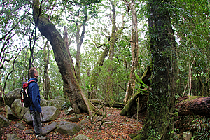
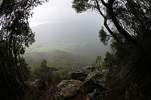
Forest along the border track |
The track leaving the end of the road was the Border Track. This was the other end of the same trail I had travelled along at the O’Reillys end. This track similarly follows the top of the Binna Burra plateau to eventually reach the McPherson Range before follow the crater rim until reaching where I had reached at the Wallangara Lookout. O’Reilly’s is about 22 kilometres from here.
Today I was exploring the area a bit closer to here. Firstly I followed the border track for about two kilometres through the thick rainforest to a junction where two other tracks departed over a low saddle. The first of these was the Coomera Gorge track. The terrain was easy to start with as the track began the descent, but over the following half hour the hillside steepened showing obvious signs of entering a deep gorge like the West Canungra Gorge.
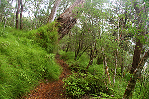
Bright grassy clearing |
The rainforest at one point cleared into a mostly cleared hillside of long very bright green grass. Perhaps there had been a landslide here a few decades ago. There were still a couple of old trees leaning over the track with grass growing up their trunks. It was quite a strange sight.
The track continued to drop towards the gorge. There was still a long way to go because the other side of the valley was still some distance away. There was almost no wind here thanks to the shelter of the plateau behind me.
Lookout |
The track re-entered the dark rainforest as the terrain continued to steepen. It was not long afterwards when a guard rail appeared along the side of the track. I was now following the edge of a cliff. For the first time I could now hear running water – the telltale hiss of a waterfall.
The track opened out into a lookout that had been built over the edge of the cliff. Walking out onto it I could see two waterfalls. One of these was the main stream of the Coomera River which plunged about forty metres into a dark pool about 160 metres below me. It was a long way down the almost vertical drop so it was strange seeing a waterfall from this angle. Across the other side of the gorge a cliff rose to just above my height to some steep rainforest. Directly opposite me a small stream plunged into a waterfall dropping the whole 160 metres. This was possibly the highest waterfall in the park.
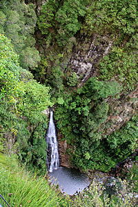
Coomera Falls |
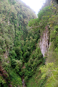
Gorge below the falls |
Looking downstream the gorge continued between the high cliffs down the valley.
From the lookout I continued following the track which descended to the Coomera River where it plunged from one cascade to the next in the very narrow ravine in the dark rainforest.
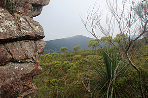
Forest near the gorge |
The stream widened above the ravine. At this point I decided to turn back to explore some of the other local tracks.
It was a long climb back up to the border track. Upon reaching the top I followed the other side track heading towards the top of a hill called Tullawallal. The track ascended around the edge of the domed hill. The wind was still blowing strong up here and at one point I had to negotiate my way around a tree that had fallen along the track. Aside from that it was an easy spiral route up to the top of the hill. The local Aboriginal people consider this a very spiritual place. At the summit was a ring of the northernmost specimens of Antarctic Beech, giving Binna Burra its name as mentioned earlier. The trees seemed to be talking to me as they swayed in the wind, which seemed to be dying down now.
Tullawallal |
I returned from the top of Tullawallal, and upon reaching the border track I continued following it for another kilometre before reaching the junction to Dave’s Creek Circuit. From there I descended from the plateau into a spectacular series of rainforest filled gullies.
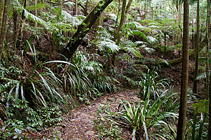
At the bottom of one gully the track reached the junction to the Ship Stern circuit, leading back towards Binna Burra. I stayed on the Dave’s Creek Circuit climbing over the top of a short saddle. It quickly left the rainforest and once more entered the bright grassy open eucalypt forest where a number of large tree ferns and cycads filled the gully. I saw the first of several large black lizards, looking similar to blue tongue lizards and of a similar size at about 400 millimetres and a stocky body.
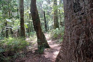
Dave's Creek Circuit track |
The forest cleared into scrub as the track descended suddenly arriving at the edge of a spectacular cliff with views down to a forested plateau below me. Beyond the plateau was another ridge containing a higher plateau up to the top of the McPherson Range. The cliffs were made of soft rhyolite. The plateau layers were harder basalt layers more resistant to erosion. Looking down the plateau below me, a gully deepened towards the Numinbah Valley with the Springbrook Plateau on the other side.
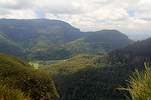
View down Dave's Creek into Numinbah Valley |
By now the wind had mostly stopped, but there was cloud beginning to form over the range, so I continued following the track along the top of the cliff for about ten minutes before a diversion doubled back below the main track to a small cave.
I explored the cave entrance for a few minutes before heading back up to the main track. By now it had suddenly clouded over again and the wind had picked up ready to bring a shower with it. Then I heard the rumbling of thunder echoing through the ranges. This was not a good sign. Thunderstorms are very severe here, especially at the higher altitudes. After all it was a thunderstorm that had brought down the Stinson.
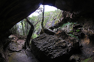
Cave above Dave's Creek |
The sky darkened as I continued heading around the top of the cliff. Then I arrived at a small stream (probably Dave’s Creek) where the track followed it downstream for a couple of minutes then headed back out into the scrubland. The track began ascending until reaching another track where it began to double back heading uphill. Rain was falling now and the sound of thunder was growing nearer. Fortunately this thunderstorm wasn’t severe, but it was scary enough.
Numinbah Valley view |
The track crossed a short saddle before descending into a small gully which once more reached the edge of the cliff. This was the Numinbah Valley Lookout. The plateau below the cliff earlier had passed. The cliff from this lookout dropped all the way down to the bottom of the valley some five hundred metres below. The mist from the rain obscured the view, and I wasn’t too keen on staying around for long as the thunder was still approaching.
From the lookout the track ascended towards a saddle. I wanted to be in lower areas especially with the storm approaching, so we hiked briskly. The scrub turned to wet eucalypt forest as it ascended.
Surprise Rock |
Finally upon reaching the top off the saddle there was a very large outcrop called “Surprise Rock”. I rested here. By now the rain had stopped falling and the thunder sounded more distant. I could see across the small plateau to the edge of the cliff we had been following earlier. The Numinbah Valley was hidden behind the hill the track had been ascending.
From the rock the track descended into a rainforest gully from where the two entrances to the Shipstern Track in quick succession along with the completion of the Dave’s Creek Circuit. From there it was just a walk back up through the rainforest to the border trail, Here the sun came out again with the storm having long cleared. Upon reaching the border track I returned to Binna Burra.
On my descent from Binna Burra the road had been completely cleared of debris. The fallen tree had been removed, so it was a relatively easy descent along the long winding road as I headed further out from the crater towards the Mount Tamborine Plateau.
<< Previous | Next >> |
|
||
About this Page
|
||
|
|
|
Where is Walkabout Jeff? |
|
|

|
|
What is happening in Walkabout Jeff's hometown?
|
|
|

|
|
Who is Walkabout Jeff?Any normal person's idea of going out involves going to the local pub for a drink with a few mates. Walkabout Jeff isn't normal.
|
|
|

|
Follow Walkabout Jeff |
|