|
||||||||||||||||||||
|
||||||||||||||||||||
Home > Treks > Kosciuszko > Day 2 > 2.2 |
||||||||||||||||||||
|
||||||||||||||||||||
|
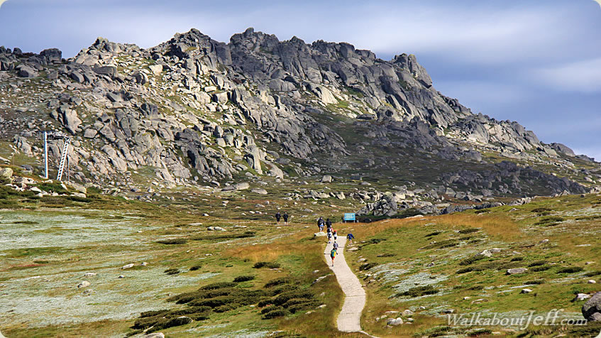
THE FIRST leg of the track gradually ascends for about two kilometres to a place called “Kosciuszko lookout”, from where we will get our first view of the mountain. Unlike other mountains I have climbed in the past, this mountain didn’t stand out dominant above the rest. The reason the lookout exists is because from here we couldn’t see the top of the mountain at all.
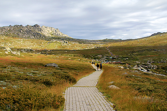
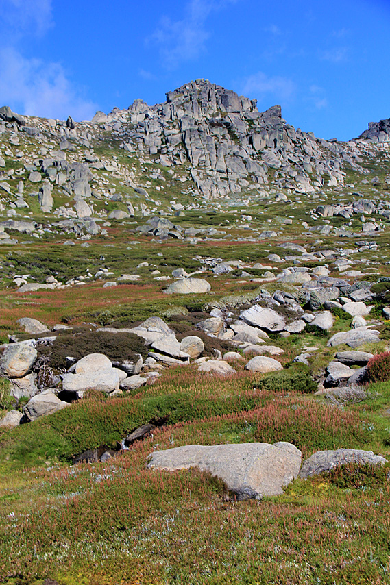
I knew the track towards the top of the mountain was going to be easy, but I was taken aback by the long cobblestone path laid before me. The hills rolled very gently over heathland broken only by the jagged rocky peaks of the Ramshead Range. There was a low saddle ahead of us. The Kosciuszko lookout was at the top of this saddle. The sharp crags of the Ram’s Head Range have been gradually formed when water has filled the cracks in the granite and frozen as ice. The broken off pieces have rolled down the mountain with some having been transported by glaciers during the ice ages or by landslides. Before this area became national park, pastoral grazers for over a century used to bring their livestock up here to graze the grasses during the short summers giving the vegetation in the lower altitudes time to recover and grow to produce enough grass for the long winter. A steady stream of hikers extended out along the cobblestone trail. There was no sign of snow but with the cold head wind it certainly felt like snow could be a possibility up here. It can snow here any time of year. Being the middle of summer though, there was no snow. In between the boulders scattered around the mountaintops healthy green grass grew with scatterings of wildflowers.
Just a couple of minutes out from the chairlift we reached the first track junction, a side track traversed across the side of the range under the craggy peaks of Ram’s Head Range to Dead Horse Gap about four kilometres away. Dead Horse Gap is a low saddle on the divide between the Snowy and Murray River systems. These two rivers drain the snowy mountains. From the top of Dead Horse Gap the track doubles back along the Threadbo River back to Threadbo Village.
By now my travelling companion who wasn’t experienced at all with alpine conditions started complaining about having shortness of breath due to the high altitude. Obviously he wasn’t used to the fresh air up here, but high altitude? I think not. We were still below 2000 metres above sea level. The effects of high altitude don’t even begin until 2800 metres above sea level. For me I hardly notice it up to 3800 metres above sea level.
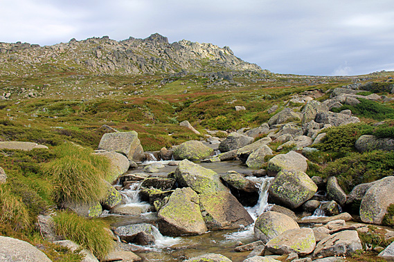
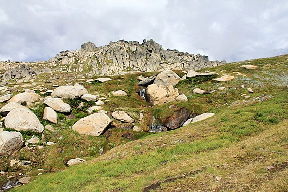
The cobblestone path rose over a very gentle ridge before gradually descending to a wooden bridge crossing over the Merritt Creek, cascading down through boulders. The 35 millimetres of rain overnight swelled the creek enough to give a good display without discolouring as expected when in flood. The stream tumbled down from the low gully spread out under North Ramshead, the mountain appeared quite dominant now. The cold alpine water roared its way between the boulders cascading in gentle leaps beneath the bridge then a couple of hundred metres further before leaping over the edge into a steep gorge in the Threadbo Valley.
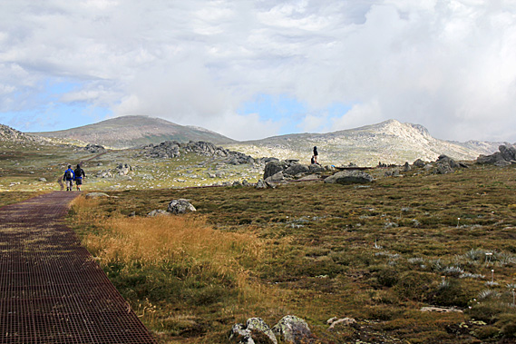
Once across the wooden bridge the trail climbed up a short moderate slope. The cobblestone path had ended at the start of the bridge. From here on the track was a rusting metal boardwalk elevated a little above the ground. The metal walkway was installed over twenty years ago as the traffic along the track was causing a lot of erosion due to the plants getting trampled and the soft soil being churned into mud. In the twenty years since the boardwalk had been installed the erosion had been almost completely healed with the subalpine heath scrub growing right up to and under the walkway. In most places this was elevated enough for small animals to walk under it along their own tracks.
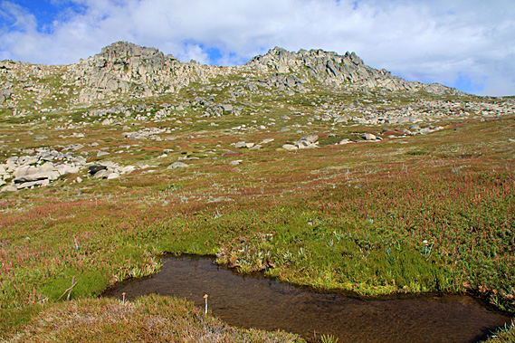
Despite warning signs to the contrary, the metal grating had a very good grip on it. The sign warned that it could be slippery after rain, ice or frost, but the rain hadn’t done anything to make it slippery thank goodness. My boots gripped quite firmly onto it. The tip of my walking pole sometimes got a bit stuck in the gaps though. Perhaps I should have brought the rubber tip that I had used on the Inca trail. The raised trail passed through the heathland where very low scrub sat tightly clustered together in anticipation of the cold winters surrounding small pools of crystal clear water that had formed with yesterday’s rain.
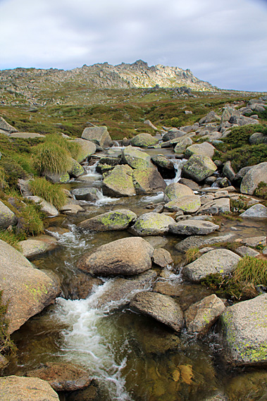
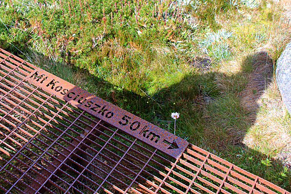
Most of the scrubby plants were out in flower making the most of the very short summer experienced at this altitude. Though it didn’t feel like summer. It couldn’t have been any more than ten degrees here, and with windchill, that dropped it to about three degrees. The track gradually ascended the increasingly rocky terrain towards a low saddle at the top of Ramshead Range. In the metal pathway was a small etched sign saying the mountain was five kilometres away. Along this track would be regular signs showing how far it was to the summit, and back to the chairlift. The track ascended very gradually until reaching the side of a small stream cascading through the boulders and grass. I figured this would no doubt be part of Merritt Creek. From there the track moderately ascended a stairway to quickly head up towards the low saddle.
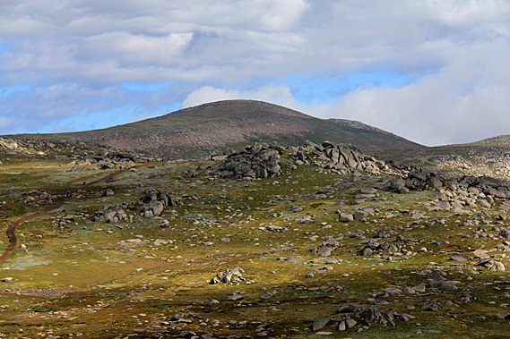
After the short section of stairway the saddle rounded off next to the towering hulk of North Ramshead. Looking ahead over the saddle I could now see the rounded dome of Mount Kosciuszko coming into view. On either side was a rockier summit that actually appeared higher. It was hard to believe the low rounded dome between them was the highest summit on the continent. It was hardly a bump. It was a far cry from Kilimanjaro which I had climbed a few years earlier, and almost nothing compared to Aconcagua, which I had seen out of a plane window flying northwards from Santiago. Those mountains definitely deserved their titles of being the highest mountains of their respective continents. Kosciuszko, on the other hand, was only a hill that stood but a few metres above the other hills of this large plateau of broken granite.
The Snowy Mountains were once a substantial mountain range extending the length of Australia’s East Coast when they were formed some eighty to a hundred million years ago. Towering peaks once rose above the surrounding landscape, but have over the many millions of years since been eroded back by snow, glaciers, and rain into the relatively flat hills we were exploring today. These mountains were now just a shadow compared to the Himalayas, the Andes, and New Zealand’s Southern Alps. This was the highest remnant of the Great Dividing Range. It is one of the few places in Australia covered in snow throughout winter. The snow melts in spring but patches often remain through summer into early autumn. We reached a junction in the track where a short forty metre metal track diversion climbing a few steps led across to the Kosciuszko lookout, our first stop for the day.
Overhead the clouds were quite thin letting patchy sunlight through. Occasionally the cloud would shroud the higher peaks. Below these peaks the plateau dipped from the saddle into a shallow valley. From the lookout the metal track descended into the valley before rising to another low saddle on the other side before disappearing into what I imagined would be the next and final valley before the summit. The route taken by the track followed the grass, deliberately avoiding the large scatterings of granite boulders on the steeper terrain. North Ramshead was behind us now. Its steep face was more obvious from this angle. The gentle saddle now hid the buildings of the chairlift and the Threadbo Valley from view, so from here it was only looking forward as we pressed on towards the top of Australia. |
||||||||||||||||||||
|
||||||||||||||||||||