|
||||||||||||||||||||||||||||||||
|
||||||||||||||||||||||||||||||||
Home > Treks > Sunshine > Day 2 > 2.1 |
||||||||||||||||||||||||||||||||
|
||||||||||||||||||||||||||||||||
|
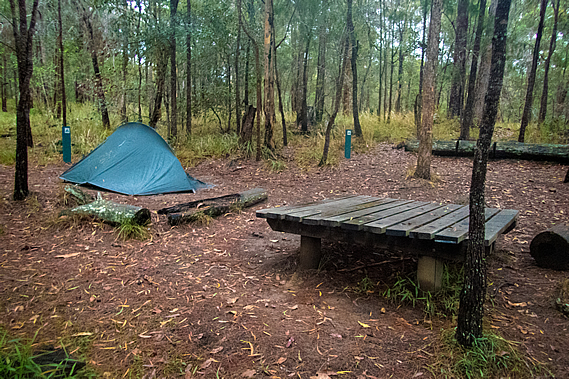
RAINDROPS were still falling from the trees when we got up in the morning. The insides of our tents were dry but everything outside was very wet from the overnight rain. The sun had long risen but the thick cloud cover made for quite a dull morning.
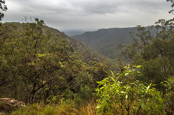
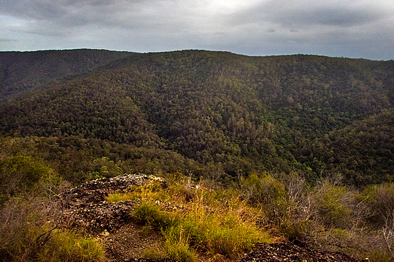
I quickly walked down to the lookout. The view down the valley was clear with the thick cloud hovering clear above the ridges. The air was a lot cooler this morning than it had been yesterday. Fortunately there was little wind even up here on the ridge. From here we could see down the Mary Valley as we had done yesterday. In times past the valley had been home to the ten Aboriginal clans of Kgippandingi, occupying the dense jungle that once covered the Mary Valley before the white people came and cleared it into farmland. These were the most local clans who had the shortest distance to travel to the corroboree at Baroon. The tribes integrated and traded well, having a common language Kgaw’bpidhai’i meaning “nowhere, but of everywhere” indicating the language was not owned or had been originated by any particular clan. This may be one of the earliest languages to evolve into the five known original dialects of South East Queensland.
The ten clans are commonly known as the Ka’bi, but each clan had its own identity and culture. Little is known about these cultures as few of the early researchers ever ventured into this remote area. There were ten clans. The Kyi’kgami were the Cockatoo People of the Woolooga region near Gympie (half way down the Mary River). The Kgai’ya were the scar makers of the Widgee and western range regions west of Gympie. The Kgu’li were the bees wax hunting people of Pie-Eel Creek south west of Gympie. The Kga’pbala were the possum people of the Imbil, Kennilworth, and Conondale areas of the valley and hills to the west of here. The Kgai’yani were the forest dwellers of the ranges west of Imbul and Kenilworth. The local Kgung’wuri were the river fishermen of the upper Mary Valley-Obi-Dhawalli regions of the streams this track explores. The Kguala’wani were the koala hunters between six mile creek and Mary River south east of Gympie. The Kgu’thari were the club hungers of what is now the Gympie/Deep Creek regions. The Kgut’dhirri were the iguana peoples of the Gunalda-Curran’neerdie regions north west of Gympie. The Kga’kgari were the cannibalistic peoples of the Theebine, Gundiah and Bauple regions further to the north west of Gympie.
The valley had originally been known as the Monoboola River. It had been renamed the Mary River When Andrew Petrie travelled up the coast in a flimsy craft in 1842 confirming the discovery of Wide Bay. Governor Fitzroy ordered the valley to be renamed the Mary after his wife who was tragically killed in her carriage at Parramatta west of Sydney when the horse bolted. The town of Maryborough near the mouth of the river was established shortly afterwards. The ridge upon where we were staying marked the start of the Kgung’wuri clan, the keepers of these remote valleys of the upper eastern tributaries of the Mary River, known as the fisherman tribe due to the abundance of fresh water fish in these rivers.
All ten clans were wiped out by around 1885. The few remaining people were elderly and were sent to Cherbourg inland to the north west or worked as servants in the farming stations, the last of the remaining clanspeople died in the 1920s. The clans that had once inhabited these valleys have now gone for good. The dense jungle once occupying the entire Mary River catchment has been completely wiped out and replaced with modern pastures standing bright green in the distance under overcast skies. Heavy rain would have fallen on some of the Blackall Range overnight, but this area had missed most of the downpours.
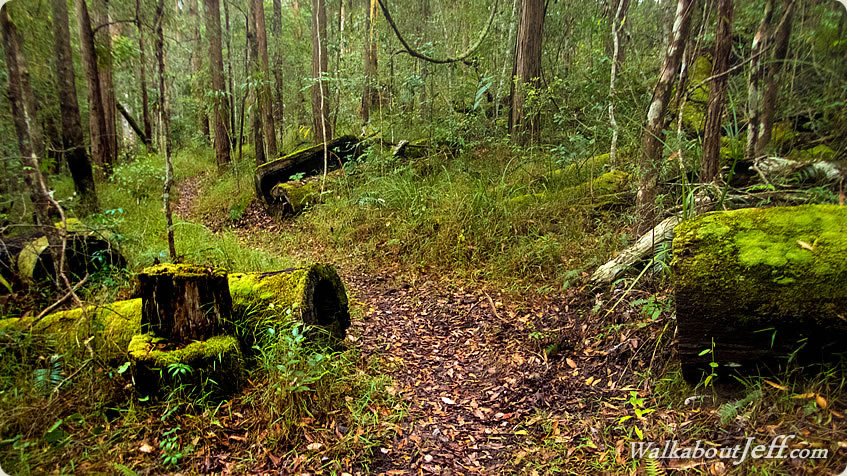
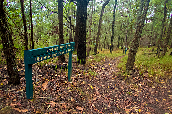
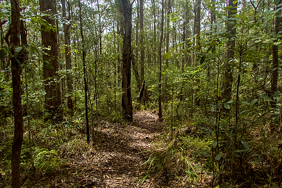
With everything outside being rather wet it was a bit of a slow start to the day, but eventually with breakfast finished and everything packed up we were ready to leave, to continue following the ridge towards the completion of the circuit at Gheerulla Falls about nine kilometres away, expected to take about four hours following perhaps one of the paths of the early tribespeople not hiked on by original inhabitants for a hundred and thirty years. A dirt road led into the camp ending at the picnic tables. This was a service road for the campsite, but the track dropped off on either side of the campground along a fairly narrow path. The track began along the top of the ridge, but gradually dropped off into dense forest similar to that along Leafy Lane, except with a lot more gassy undergrowth. The trunks were blackened from past a firestorm, but the grass was well established, so the last fire through here would have been several years ago.
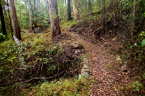
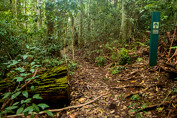
The rain had stopped falling by now, but raindrops were still dripping from the foliage of the canopy high above. The track maintained a fairly level grade winding out with the spurs and back in with the gullies. Moss covered the sides of the tracks and the logs of fallen trees, especially around the backs of the gullies. There were a lot of logs that had been clean cut with chainsaws. They were covered in moss, so they would have perhaps been cut down before the national park was formed, during the dying days of the forestry harvest around Mapleton, when they had cut down all the big trees and there wasn’t enough left to keep the industry going.
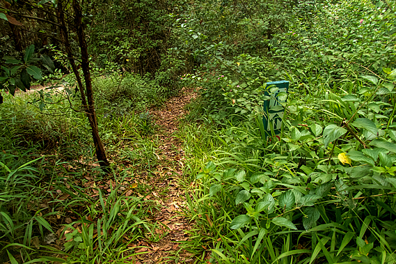
Bracken replaced the moss when the track approached the drier forest at the edge of the valley. At one point about half an hour out from the camp we reached a junction from where a side track to the left took us to the top of a low hill. There was a final scramble over rock through scrub to the top of a bluff.
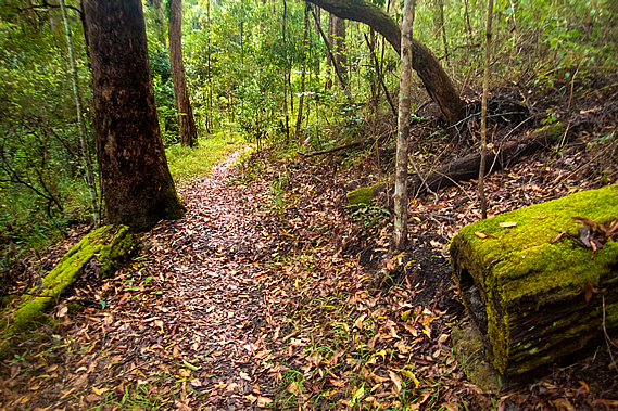
When we reached the top a cliff face dropped down into the Gheerulla Valley. There were views across the forested valley to the rather flat plateau on the other side. The still valley sat silent under the thick layer of cloud overhead. From the lookout we returned to the track and continued heading through the forest. We could hear the occasional four wheel drive car travelling along a gravel road nearby. The undergrowth was too thick to see any signs of the road or the vehicles travelling in it.
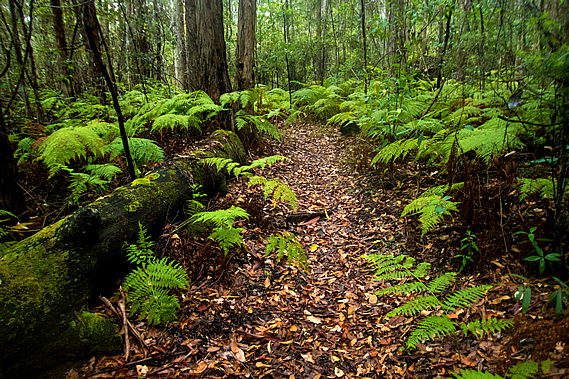
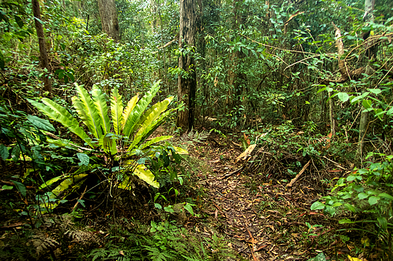
We reached a dry creek bed at the back of a gully. The map showed this often has flowing water in it, but being dry confirmed there hadn’t been much rain along this ridge overnight – most of it had fallen further north. This meant the Gheerulla Falls won’t be flowing much at all, perhaps just a trickle. Upon leaving the gully the track extended back out along the next spur, almost reaching the end when it quickly doubled back following the top of a low cliff giving a limited view of the valley. Once it had cleared the cliff the bush began to thicken, gradually increasing until it became rainforest with masses of piccabean palms. We crossed another two dry creek beds which obviously flowed following heavy rain.
We passed two solo hikers about fifteen minutes apart, both heading towards Thilba Thalba for the night, but they weren’t in the same group. Gradually the track turned southwards and through the dense rainforest we suddenly reached the gravel road.
The road descended moderately towards a saddle through the forest, but the track overgrown with broadleaf plants followed it on the far side, passing farmland briefly. Then the road dropped very steeply towards the saddle about two hundred metres below the ridge I had followed. The undergrowth quickly cleared as the track descended through open eucalypt forest nearly as steeply as the road. It would be quite a difficult road to drive along, but fortunately not too much rain had fallen so the road wasn’t too slippery.
The track followed the route of the original road the pioneers cut to reach the tall forests of the Thilba Thalba Ridge. The locals knew this as the “Hindu track”. It was a long descent going backwards and forwards around the trees. There were no steps making the descent rather slow. The trees would have been no more than thirty years old. Despite that there was a scattering of large chainsawed logs hidden in the scrubby undergrowth showing evidence this area was had once been cleared but had regrown. Following a rather slow descent along the steep track we reached the bottom where a small bridge crossed a dry stream before the track came out on the road just above the bottom of the saddle.
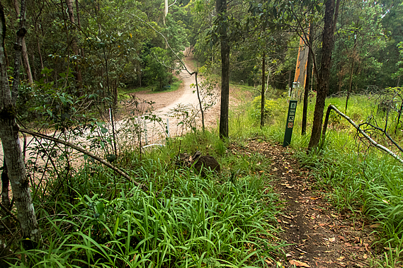
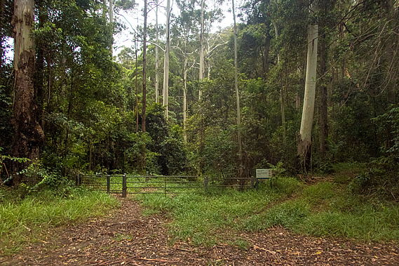
From the saddle the road ascended very steeply in either direction. The road continued heading towards Mapleton. This could be used as a short cut towards Baroon Dam, but we needed to follow the track to complete the Gheerulla Circuit and return up the hill to Ubajee tonight. That being said we will be crossing the road several kilometres away on our way to Flaxton Camp tomorrow. A small car park was on the other side of the road at the junction. From the car park a track headed down the gully passing the gate of a service road and heading into the tall schlerophyll forest of ghost gums and scribbly gums. After briefly resting at the car park where one car did arrive, then continued along the road, we followed the track.
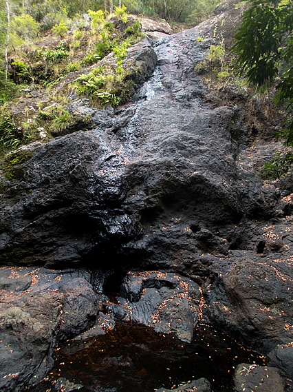
The track descended moderately along the service road above a dry creek bed for about a kilometre before I could see the Gheerulla Stream in a small clearing ahead. A side track turned off to the right though, heading upstream towards Gheerulla Falls. We took off our packs and followed the rather rough track following steps over the rocky terrain through thick rainforest. The stream was still a trickle, so there won’t be much water coming over the falls.
After about five minutes of scrambling we reached the top of a large outcrop from where we could see a dark pool about ten metres below and a large wall of rock towering about twenty metres above on the other side. A small trickle of water was running down the rock face. I then realised this was Gheerulla Falls. A small flat area was half filled with the dark tannin stained water which dribbled under a huge pile of boulders washed down from huge floods in the past. After a massive downpour the waterfall would be very spectacular and the pool would be full, but today it was only a tiny trickle going into a stagnant pool. We didn’t stay very long, instead heading down the route back to the main track.
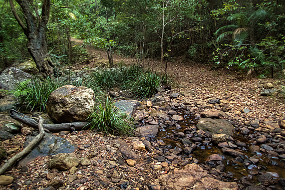
Once we reached the main track we crossed the creek in a ford that didn’t have any concrete in it. The crossing was completely dry aside from the row of small puddles. Between the stones which made for an easy dry crossing. Once on the other side we continued along the wide dirt road for about two hundred metres before reaching the junction with the side track heading up the steep stairs to begin the ascent towards Ubajee. We had completed the Gheerulla circuit. |
||||||||||||||||||||||||||||||||
|
||||||||||||||||||||||||||||||||