|
||||||||||||||||
|
||||||||||||||||
Home > Treks > Sunshine > Day 2 > 2.2 |
||||||||||||||||
|
||||||||||||||||
|
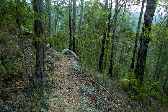
FROM the junction of the Gheerulla Circuit we climbed the spur back towards Ubajee. From here we will be backtracking for the next four kilometres up the hill to Ubajee this afternoon, and then almost back to where we started tomorrow morning before turning southward to roughly follow the Blackall Range towards Baroon Pocket.
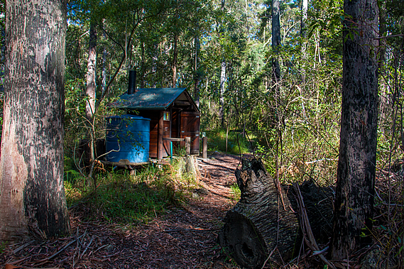
It was a steady climb, not steep like the ascent of Gheerulla Bluff yesterday, and certainly not as hot. The air became very humid and light rain began started to fall as we were traversing across a bluff along the track about half way up. Climbing through the gradually thinning eucalypt forest we eventually reached the lookout. By now the short-lived rain shower had cleared and there were patches of blue sky overhead. Almost at our destination we decided to continue to Ubajee to set up camp and return to the lookout later. We found a well worn short-cut track into the campsite. Our group was the first to arrive, so we set up our tents in two of the back campsites away from the toilet building. The toilet building was just like the one at Thilba Thalba set above the ground with a single pump toilet and a steep corrugated iron roof draining into a nearby water tank.
There were several circular campsites cut in the otherwise thick scrubby undergrowth. Each campsite had a low wooden table at sitting height for keeping stuff off the ground and for cooking. I picked one of the remoter campsites and the others picked the next one along. We all put up our tents as we had done last night. They were still rather wet from last night’s rain, but fortunately they dried out reasonably quickly under the sunshine. For many thousands of years the Aboriginal people travelled through the resource rich Blackall Range. Some lived on the other side of the range exposed to the prevailing south easterly winds resulting in higher rainfall. This suddenly fell apart in the late 1800s and early 1900s when the white settlers came cutting down the big trees for timber and clearing much of the land to farm. The Aboriginal people were faced with conflict with the new settlers. They were driven from the settlers’ land by gunfire, and died from introduced diseases that would eventually wipe out 90 percent of the population. They could no longer hike over these mountains to gather the food from the lands they had occupied for many thousands of years forcing them into starvation.
Most of the Aboriginal people who did survive the shootings, disease and starvation were rounded up and forcibly moved to missions around the Cherbourg, Cairns, Palm Island and Ipswich areas around 1897. They were detained in these areas working in forced labour and domestic servant roles. Fortunately this didn’t last for too many years. Many of the detained Aboriginal people were eventually allowed to return to their homelands to re-establish their traditional way of life. Although much has been lost, their culture and stories of this area have thankfully survived. The name Ubajee means “village”, perhaps as a reminder that the Aboriginal people did have their villages around here. That being said there are no records of people actually living here. They were walking tracks over the ranges, but no villages. They were all down in the valleys.
I couldn’t see any evidence of an Aboriginal settlement here at Ubajee. Any former village would be very hard to find. I have travelled through ancient civilisations where buildings and temples had been constructed from stone, and although abandoned for many centuries, they were still standing, even if in ruins, as clear evidence of their former existence. The Aboriginal people didn’t construct villages out of stone. They used the vegetation that was in abundant supply. If a village is abandoned, the thatched timber huts are quickly decomposed by termites and the trees grow quickly, hiding almost all evidence of their former habitation. I couldn’t find anything to indicate the Aboriginal people had ever lived here, in this place called “The Village”. Maybe this had been a village in the past, or at least a temporary camp for people hunter gathering in the Gheerulla Valley. The other possibility is the camp was named The Village in recognition that the Aboriginal people had lived in this general area and that their past village locations had been wiped from existence when the European settlements were built over them. All that being said, few Aboriginal people lived along the top of the Blackall Range on a permanent basis. Anyone found here would just be passing through due to the ongoing hostilities between the Kabi clans of the Mary River and the Undambi clans of the Sunshine Coast. The Blackall Range marked the boundary between these tribal groups and few would dare to cross at any time apart from the short bunya nut festival.
Perhaps Ubajee had been named as a reminder that temporary campsites were established along the top of the range during the bunya pilgrimage. Like last night we had the campsite entirely to ourselves but only for about an hour after our arrival before a young couple arrived having hiked from Mapleton Falls where we will be passing tomorrow. They had walked several hours along the track to stay here for the night before walking back out the same way tomorrow returning to the falls where their car was parked. Like us they were fairly local, having travelled from Brisbane. By now our tents were completely dry so we were able to take our gear off the low tables and put them into the tents to keep them secure from any animals, not that we saw any. There were a few bellbirds chirping their eerie ringing sound and a kookaburra laughing in the distance. I’m sure there were snakes in the thick undergrowth but best they be left alone. Fortunately the snakes here are very timid, and so long as you don’t go deliberately provoking them, they will leave you alone. The cloud was clearing overhead and the afternoon sun came out with quite a strong intensity. Very tired from the lack of sleep in last night’s rain, every bit of me wanted to crawl into my tent and snooze, but I knew dozing off now would disturb my sleep patterns.
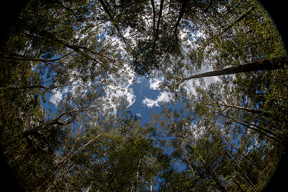
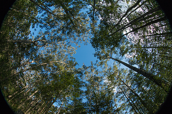
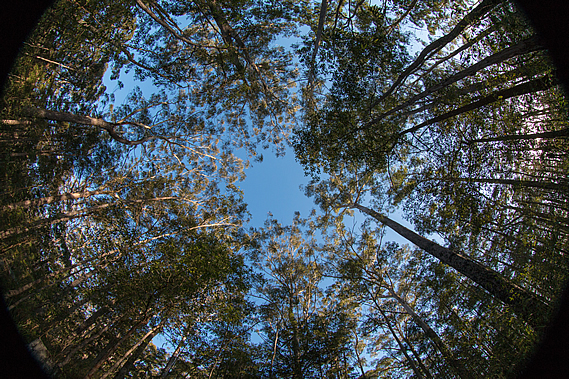
To pass the time I put my fisheye lens on the camera and pointed it straight up to experiment with getting the radial effect of the tall trees in the campsite rising to a vanishing point in the centre of the frame. Here the trees rose almost vertically overhead seeming to point towards the infinity of the blue sky overhead. Large white clouds drifted by from the south east giving the illusion the forest was moving, but it was the air overhead blowing over the range even though I couldn’t feel any wind at all in the shelter of the forest. The others thought perhaps I had seen a bird or snake up in the tree and initially came over to find what I was looking at. Then they realised I was just being crazy doing some random ultra wide angle photography. I think you have to be a photographer to appreciate some of the things I get up to in order to get the interesting shots. I’m always after interesting shots. Although it is quite tranquil being in the middle of a eucalyptus forest, the scrubbiness of the vegetation and the harsh contrasts between sunlight and shadow don’t actually make very interesting pictures. It is in places like this where you need to get really creative to get shots that are worth showing.
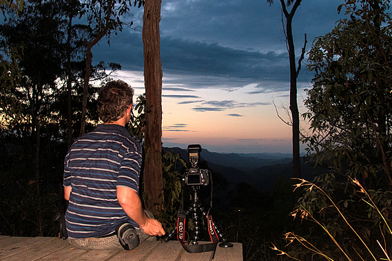
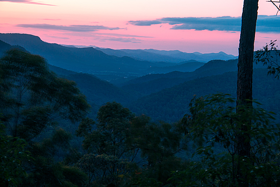
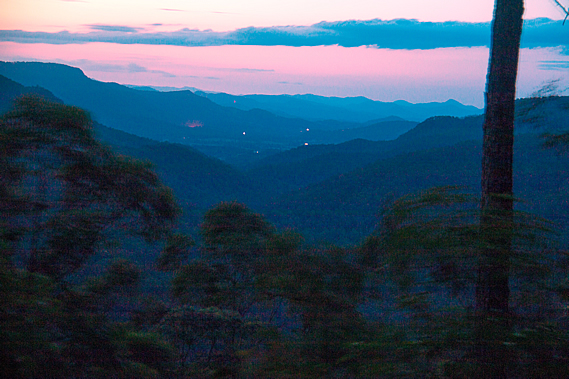
When I was done with vertical wide angle shots, I went to the other extreme with taking macro shots of any insects I could find. Apart from one small spider which didn’t want to pose, the insects were all hidden, no doubt sheltering under the thick scrub with the snakes, or perhaps high in the forest canopy with the elusive koalas. A pair of kookaburra did briefly land in the trees above me, laughing raucously as if to mock me for having the wrong lens – actually I didn’t even bring the telephoto lens with me. That’s far too big to hike with. The sunshine didn’t last too long. As the summer sun started to make a beeline towards the north western horizon, cloud completely covered the sky. With tents up and dinner finished, I headed out to the lookout to watch the sun set over the Gheerulla Valley. The young couple were already there, but it was obvious there wasn’t going to be much of a sunset tonight. The cloud cover was too thick. The couple quickly gave up on looking at a sunset, so I set up the camera to do some long exposure shots to be able to make the most of the dim colours of the overcast sky. Unfortunately it was a little windy up here, so the foreground foliage was going to be moving in the shots.
It was completely dark when I returned to the campsite. The moon was obscured behind the thickening cloud low cloud drifting in from the south east, so we decided to head off to bed for the night. The humid air was still devoid of the sound of last night’s rain drumming on the tent. In fact it was dead silent. I couldn’t hear the other guys, nor could I hear the couple who had pitched their tents over on the other side of the campsite. Even the wild animals that should be roaming around here were very quiet. Exhausted from the lack of sleep last night, I lay on top of my sleeping bag and fell asleep almost instantly. |
||||||||||||||||
|
||||||||||||||||