|
||||||||||||||||||||||||||||||||||||||
|
||||||||||||||||||||||||||||||||||||||
Home > Treks > Sunshine > Day 3 > 3.1 |
||||||||||||||||||||||||||||||||||||||
|
||||||||||||||||||||||||||||||||||||||
|
DENSE rainforest jungle had once covered the valleys along the coast and hinterland. Eucalypt covered the drier exposed ridges and inland forests. Much of this was lost with the arrival of the white settlers who cleared much of the land for timber, agriculture, and the development of the rapidly expanding towns and cities. It became apparent that these vast tracts of rainforest were going to be lost forever, but fortunately some dedicated conservationists stepped in to create the national parks and reserves that remain preserved to this day and beyond.
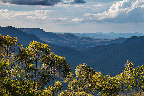
The morning dawned clear at Ubajee. Before breakfast we walked out to the lookout. There was a thin layer of low scattered cloud overhead but otherwise our final view back down the Gheerulla Valley was very clear this morning. The cloud was quickly moving from the south east though, so more rain could be on the way. I returned to the campsite where the sun was filtering through the trees overhead. Thankfully our tents were completely dry this morning, unlike yesterday when they had been damp when we rolled them up. The bellbirds were making their eerie sounds this morning. I had not heard much birdsong over the past two days in the Gheerulla Valley. The birdsong, even with the unusualness of the bellbirds, was a welcome morning sound.
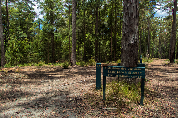
Today we will return to almost where we had started the other day before turning off and heading down a southward direction leaving the Mapleton National Park, then passing through the much smaller Mapleton Falls National Park, before descending off the plateau into Baxter’s Creek. There we will enter Kondalilla National Park before climbing the ridge to the Flaxton Walkers’ Camp. We had plenty of time and were in no great hurry to set off, so we cooked a nice breakfast at the campsite. The couple in the other tent were just getting up now and will be returning to where they had parked at Mapleton Falls. Before hiking back though, they will be heading down to Gheerulla Falls, the little trickle we had seen running down the rock face yesterday. They set off just as we were packing our tents.
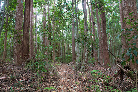
Fortunately the weather had remained dry last night, so the tents had completely dried out. This made for lighter packs today. Once packed up we headed out of the camp hiking back along Leafy Lane. It was very different today. The other day when we had been hiking along this section of track it had been misty and drizzly. This morning is was clear with the sun shining through highlighting the fresh summer growth of the gum trees.
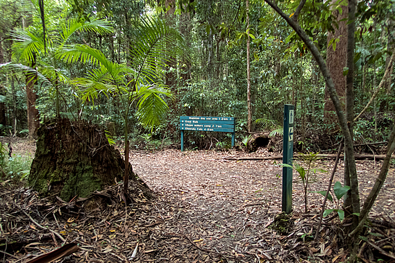
The air quickly warmed up as the summer sun climbed in the sky, but about two thirds of the way along the track the cloud overhead thickened. Nearly an hour had passed after leaving the campsite when we reached the junction just two hundred metres short of where we had started out two mornings ago. We had completed the backtracking and from now on we will be covering new territory.
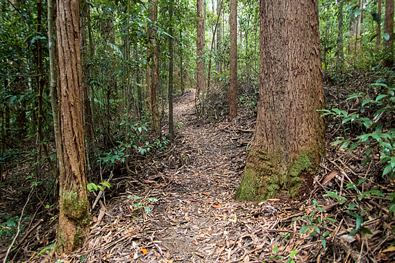
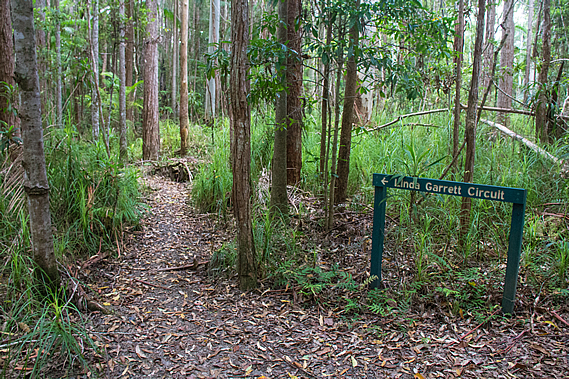
The narrow track headed off to the right of the main wide firebreak track into the Linda Garratt Reserve. Although fairly narrow, the track we were now following was very well formed descending through the thickening gum forest towards a gully of one of the tributaries of the Gheerulla Stream.
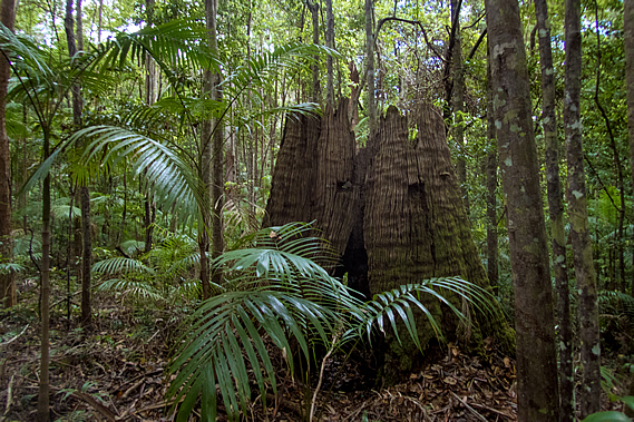
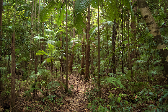
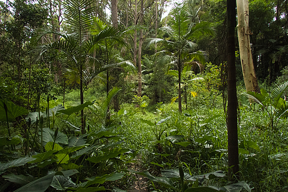
As we dropped altitude we entered a rainforest area of piccabean palms growing in amongst young trees. Scattered amongst them were the stumps of what had been enormous trees cut down during the logging days of well over a hundred years ago. Despite a century having passed, the stumps were still largely intact with the notches still cut in them from where small planks were placed to give the woodcutters enough height to cut through the trunk above the large buttress roots that supported the giant trees.
When the range was initially settled by Europeans, timber cutting was the main industry. The forests needed to be cleared to make way for the pastures of the farming industry which was to follow. Timber was needed to build the houses of the fledgling towns. The settlers saw the rainforests as a great source of timber. The enormous trees abounded plentiful so they were systematically cut down further and further away from the mills where the timber was processed. Eventually whole forests disappeared. Despite that, the Australian forest recovers quickly, so when the wood cutters left the forest began its quick recovery.
Although fully functioning, it will be hundreds of years before the trees grow back to the forest giants that once dominated high above the floor. It was not long before we reached the bottom of the valley where a dried up tributary of the Gheerulla Stream stood deep in amongst the rainforest. I imagined during heavy rain this dry channel would become a raging torrent, perhaps impassable, but today it was just a dry dirt creek bed.
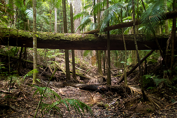
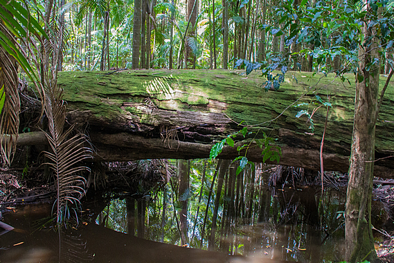
A few metres downstream from our crossing point was a large fallen tree creating a natural bridge about four metres above the creek bed. Although it was covered in moss, it could have been a good bridge to cross had there been a torrent flowing through the gully.
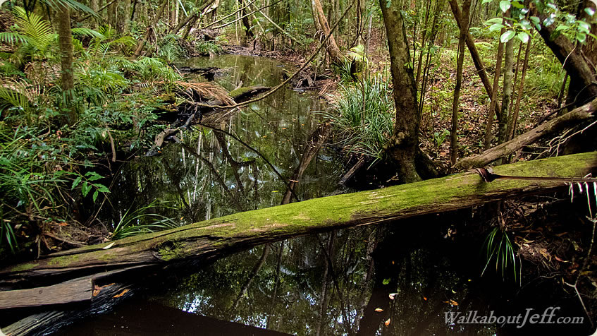
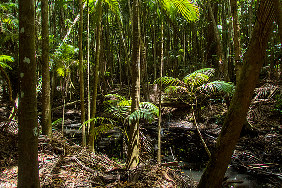
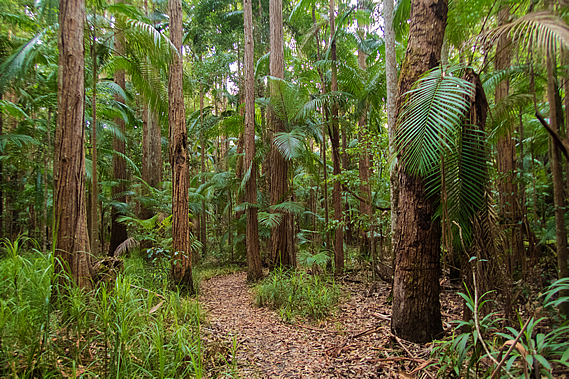
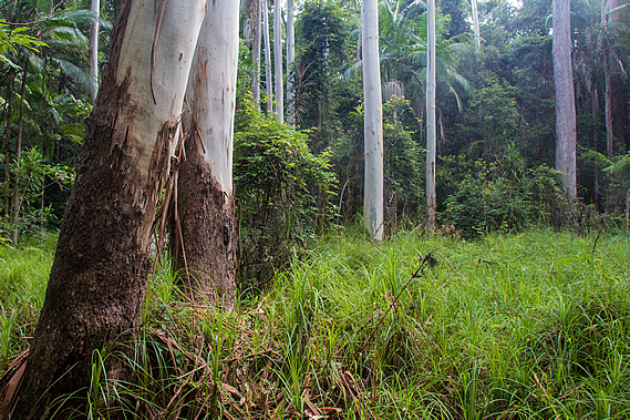
Once across the dry creek bed, the track steeply ascended the bank on the other side before gently rising through a forest of very tall but thin trees. From there it descended to a firebreak track which crossed the main tributary of the Gheerulla Stream. On either side of the culvert was a long black pool with fallen trees across its width under more trees leaning across the water. There was not a breath of wind in the air under the now completely overcast skies, so the water was still, perfectly reflecting the low rainforest growing above it. The forest here was a mixture of blackbutt, terpentine, brush box, flooded gums and piccabean palms.
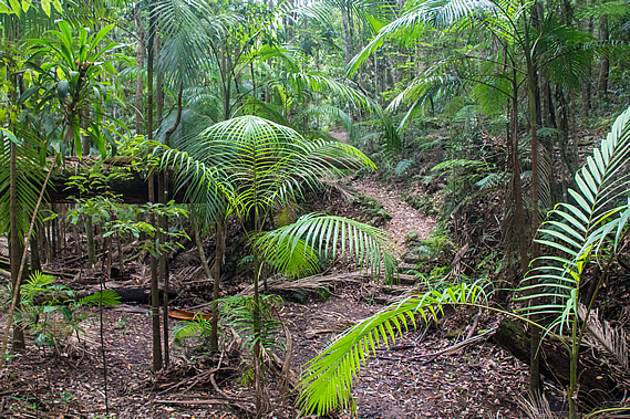
Once across the stream the very well graded track left the firebreak to follow the creek upstream. The dark water stood still in a series of long puddles just as we had seen downstream in the Gheerulla Valley. The only difference was there were no rocks and the puddles were smaller. After a few hundred metres, the track left the stream ascending over a low hill which the stream doubled around. The thick rainforest gradually changed to a dense eucalypt forest before crossing the top of a small saddle. From there the track descended back into rainforest following the creek once more.
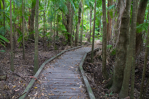
Downstream from here the creek diverts winding its way around a gap around the hill we had just climbed over. The track continued upstream following close beside the winding stream following a wide gully of rainforest. The trunks of a couple of huge trees lay across the creek forming natural bridges over the black still water. Although the water level was at least a metre below the track, we were often walking on boardwalks indicating the gully does often flood and the ground becomes muddy.
The rainforest surrounding the creek was stunningly beautiful. It always has been, but was very nearly destroyed forever by developers as part of the expansion of nearby Mapleton in the late 1980s. Developers had bought the 44.6 hectare block and earmarked it for a large residential development, but local resident Linda Garratt purchased the land for half a million dollars and donated it back to the Mapleton community for preservation.
The reserve is one of the few remaining habitats for two highly endangered frog species, Mixophytes iterates – the giant barred frog, and Litoria pearsoniana – the cascade treefrog. There are also the elusive bush wallabies that I could hear foraging the undergrowth nearby, along with the myriads of birds that live in the canopy. Linda Garratt donated the land 21 years ago in 1994 on the condition it be forever preserved as a conservation park.
The only development that has occurred here since the forestry days were the walking tracks, a circuit that we were now approaching, and the Great Walk extension back to Leafy Lane. Otherwise it remains perfectly preserved to regenerate back into the towering forest that once stood here before the timber cutters came. There are a few other reserves along the Blackall Range. Some have been subsumed by the national parks, others remain as standalone reserves. Another example is the Mary Cairncross Reserve at the far end of the range near Melany. Right on the end of the range facing the Glasshouse Mountains, this reserve was named after one of Queensland’s first conservationists. The impressive rainforest reserve is a tribute to her conservation efforts.
The track left the creek briefly before reaching a junction where the Linda Garratt Circuit reached its furthermost point from its start less than a kilometre away. The main track continued heading straight through the rainforest whilst the other track returned to the side of the creek. With plenty of time we decided to walk the longer route along the side of the creek. At one point a wooden seat looked over a long black pool of the creek. The circuit didn’t quite reach the source of the creek, which seemed to come from a large pond in the middle of Mapleton, about two kilometres away. Although we were so close to the town, we seemed to be a world away in the dense rainforest.
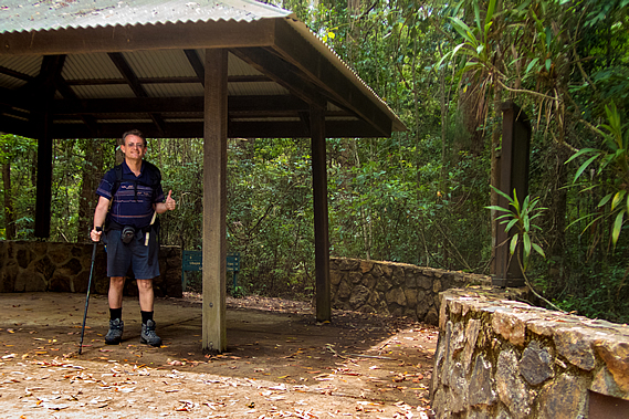
The track diverted away from the creek heading to a small swampy clearing of grass surrounded by ghost gums with their brilliant smooth white trunks. From there the track gradually rose through the forest to complete the circuit meeting the main track again. A short distance from the circuit we reached a large square gazebo with a small car park on the other side. This was one of the official car parks of the great walk. A stone wall had been set up on either side of the gazebo, with the legs of the right hand side sitting on top of the wall and the legs of the other side sitting on the ground in front of the other wall.
There were no cars parked here, even though there often are. The park has parking for about 10 cars set off a gravel road. This was Delicia Road, the same road we had followed for a while between Thilba Thalba and Gheerulla Falls. From the saddle above the falls the road rises steeply going up and down a couple of times before reaching this point and continuing for a couple of kilometres into Mapleton. There was no sign of civilisation here apart from a small cemetery on the other side of the road. A small number of very old gravestones stood heavily weathered amongst short recently mowed grass, each grave containing the remains of someone who would have milled the forest up here.
The track continued through the forest roughly parallel to the road heading back towards Thilba Thalba. It entered the bush passing some interesting yellow puffy bracket fungus and a huge termite mound standing about two metres high. Thick broadleaf undergrowth grew under the piccabean palms and rainforest trees. After about five hundred metres the track turned and climbed gradually back to the road at a small pigsty, to the edge of Mapleton National Park where the town of Mapleton began on a low ridge that had been cleared before the conservationists could intervene. |
||||||||||||||||||||||||||||||||||||||
|
||||||||||||||||||||||||||||||||||||||