|
||||||||||||||||||||||||||||||||||||||||||||||||||
|
||||||||||||||||||||||||||||||||||||||||||||||||||
Home > Treks > Sunshine > Day 4 > 4.1 |
||||||||||||||||||||||||||||||||||||||||||||||||||
|
||||||||||||||||||||||||||||||||||||||||||||||||||
|
HEAVY rain had fallen throughout the night at the campsite, but fortunately the insides of our tents had remained dry and the excess water had run off the ridge down into the deep gullies below.
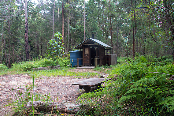
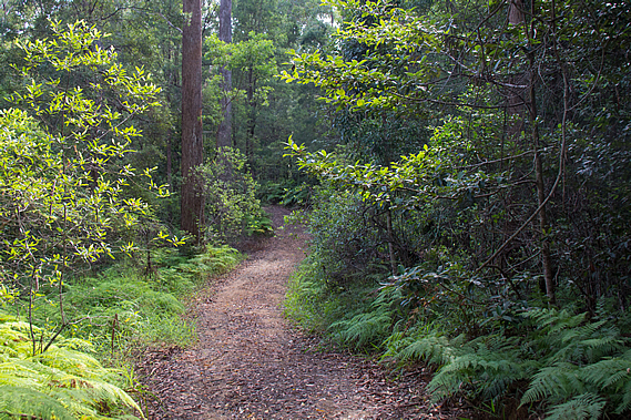
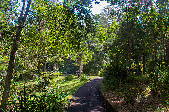
Perhaps this was why the three campsites along the trail were all on top of the ridges. If they were down in the valleys they would have been at risk of flooding, not to mention the rainforest vegetation is fast growing and the conditions very humid. The valleys are also inaccessible. Each campsite has a dirt service road making them easily accessible for maintenance. We packed up the tents drying them off as best we could before heading out of the camp and following the broad service road through the thick bracken. The road itself was clear and in good condition, covered in leaf litter.
The rain had stopped falling and the sun would occasionally come out brightly illuminating the wet foliage, but these periods of sunshine were very short lived. More rain was expected for later today according to one of the other campers who had been staying here last night. He was hiking onto Ubajee today. After half an hour I could see the gravel Flaxton Mill Road, named after a timber mill where the huge trees that had once covered the forests had been processed after being cut down.
The service road went directly to the Flaxton Mill Road, but the track turned off following a narrow trail through the thick undergrowth to the left. After about two hundred metres it passed a huge termite mound standing about two metres high before climbing a short distance to a style at a small car park. This car park wasn’t one of the “official” ones. It was like the one where we had started at the beginning of Leafy Lane. We had travelled 1.2 kilometres from the campsite.
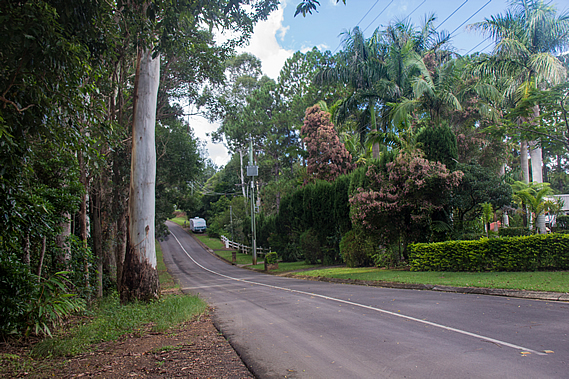
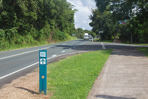
Green signpost arrows directed the great walk along the Flaxton Mill Road. At this point the gravel road became sealed and the bush gave way to a leafy residential area. Flaxton was one of the villages established along the top of the range in the 1880s when timber cutters discovered the rich resources of red cedar, blackbutt and tallowwood. The forest around here was heavily logged. This part of the top of the range is a small town with around 900 people living here.
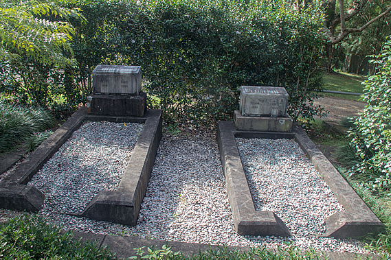
We followed the road into Flaxton. The absence of any footpath meant we had to follow the road, which fortunately was very quiet. Houses sat quietly set back in large well landscaped sections. The greenery was very fresh from the high rainfall the range receives. At one point we passed a tiny cemetery with two graves. They contained the remains of Joesph Dixon and his wife. They were the first landowners here from 1882 when they moved up from Buderim near the coast into their 160 acre holding. It remained bush for the first ten years before being cleared into a large banana and citrus plantation. He named the area Flaxton after Flaxton Hall Farm in the fens of Eastern England.
With the decline in forestry, the farming industry really picked up here and a fruit processing shed was built in 1931. The bananas and citrus has long gone, but there are still a number of avocado farms in the area. The farming has largely given way to restaurants, guest houses and art and craft galleries. The Flaxton Cemetery is considered the smallest in the world by many locals, with the two burial plots right next to each other. A tiny hedge backs the cemetery and the land surrounding it is only just big enough to fit the two graves. The stones were hardly legible, but they read: Joseph C Dixon 1841-1929 and Alice E Dixon 1850-1927.
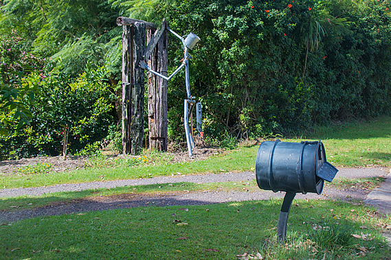
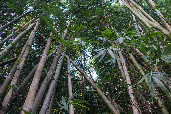
The road then widened and the marker poles crossed to the other side of the road passing more large houses on huge properties set in the bush. It was quite a pleasant walk through this residential area in the middle of Flaxton passing a couple of very interesting letter boxes and spectacular landscaping. Eventually we could see the main road that runs along the top of the range ahead of us. The track entered a grove of very tall bamboo before reaching a wide footpath running along the side of the road.
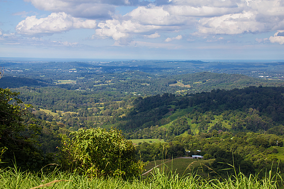
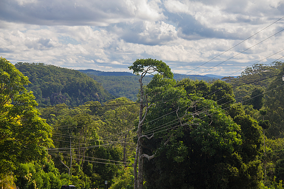
By now the cloud cover had reduced to scattered low cloud. We followed the road heading southwards along the top of the range. For the first time this hike we could see down the other side of the range, with views across to the Sunshine Coast, Bribie Island and even Moreton Island in the distance. The top of the Blackall Range marks the boundary between the tribes of the Mary Valley, and the Kabi tribe of the Sunshine Coast. Few Aboriginal people ever lived on the range. The range was their crossing point on their journey to Baroon Pocket, and back again to feast on the abundant supplies of seafood and fruit following the bunya corroboree.
During the long spells between the feasts, the Kabi were extremely possessive of their land and openly hostile to any trespassing intruders. During drought, the tribes of the Mary Valley refused to cross the range even though there were always abundant supplies of food on the other side. They would rather die from starvation than encounter the hostilities of the Kabi. The tribes of the Mary Valley and Fraser Island warned the early European settlers of the hostile tribe living along the Sunshine Coast. The Europeans moved in showing even greater levels of hostility, completely wiping out this tribe over sixty short years. Most of the stories have been lost to time, but one story tells of a massacre near Lake Weyba where dozens of curious aborigines were lured into a trap and brutally slaughtered. The stream running through the site has now been named Murdering Creek. History records around 700 Aboriginal people in the Noosa Valley in 1894. Ten years later there were none.
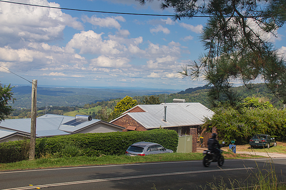
All that remains of this once prosperous tribe are some of the place names, many have a deep meaning and story now wiped from the historical record. The archaeological evidence of their habitation over many thousands of years is no more than the odd midden of sea shells and a few small relics, all to be washed away by the sands of time. On the other side of the roads sections fell down the steep slope holding houses that had the spectacular views from the exposed side of the range. Storms would really buffet this area. The houses were in many cases down below the road allowing for a clear view, and some had very interesting letterboxes.
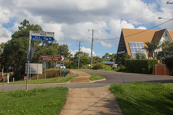
Countless colourful arrays of flowers were out in the weeds on the other side of our pathway. There were masses of yellow flowers on the mowed curb side of the track and on the other side, bushes with purple, red, yellow and white flowers making this the most colourful part of the hike. Although the native forests are beautiful, the variations in colour are very subtle. Here in civilisation where exotic genetically modified house plants prevail, the colours are so much more vibrant especially at this time of year when the flowers come out. Eventually we reached the Kondalilla Falls Road, where the road rose from the main road twisting over the low range top. The paved track crossed the road before following it towards the next forested part of the track.
The blocks in the residential area quickly became larger as the road followed the top of a spur opening up a valley between here and the Flaxton Mill Road spur. Just before dropping from the main range I could see a bank of cloud approaching from the south east. The sunny patchy cloud wasn’t going to last much longer. The spur ended dropping in a moderate gradient. The road continued following this and the track crossed the road remaining as a wide sealed path heading down towards Picnic Creek.
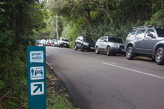
As we continued descending along the road, I could see a row of cars parked along the side of the road. The track crossed the road but didn’t continue. We had to walk past the cars parked along the road to the small car park – the second official one along the track. The car park was full, indicating this was a very popular short-walk area.
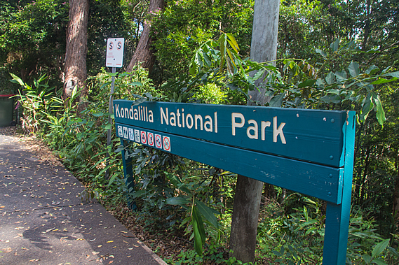
At the end of the car park was a large sign indicating the start of the Kondalilla National Park, the third and final park that the great walk goes through. By now we had hiked over four and a half kilometres from the campsite, with about eleven to go to Baroon Pocket.
From the park entrance a set of stairs descended the moderately steep forested bank to a footpath dropping rather steeply from the basalt capped plateau into a grassy area over much older and softer volcanic rhyolite where several barbeques were set up. There were quite a few people gathered there perhaps claiming their territory for the day for when it gets really crowded at lunch time. I pity the crowds. We were just passing through in favour of a much quieter spot for lunch.
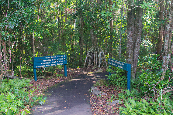
At the end of the grassy slope a curving stone wall directed the track into the forest. A large signboard gave information about the short walks here, namely the Picnic Creek Circuit and the Kondalilla Falls Circuit.
From here the Great Walk follows the Picnic Creek Circuit, a 2.4 kilometre 45 minute easy grade round trip easily geared for the inexperienced. The sign also gave directions about the longer Rock Pools Walk and the Kondalilla Falls Circuit, which the great walk also passes along. Despite the heavy logging in the area, people recognised the natural beauty here and tourists started visiting this area from the early 1900s. A 76 hectare area around here was set up as the Kondalilla Falls National Park in 1906. This turned the range into a tourist destination, marketed as a mountain retreat of cool mountain forests.
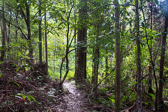
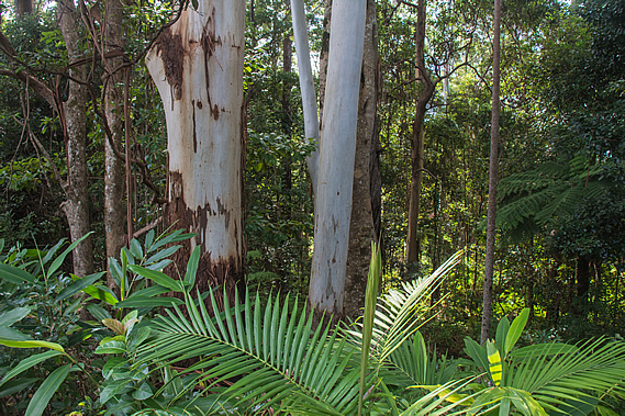
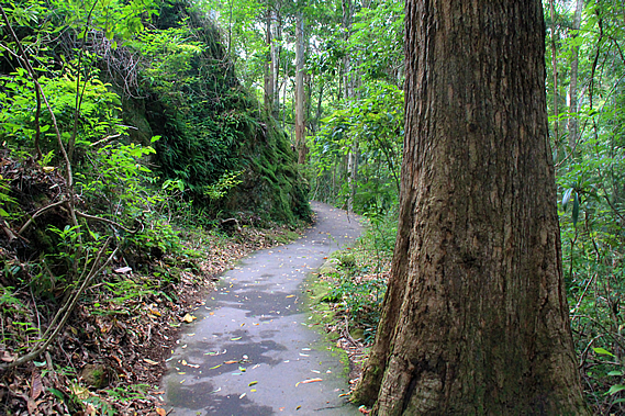
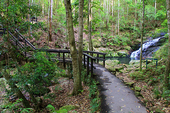
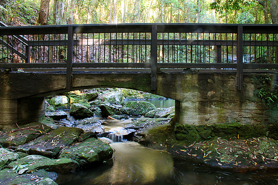
More land was added to the park in 1945, and eventually in 1998 it was combined with the nearby Obi Obi Gorge National Park in 1998 to form a constant protected reserve covering the rest of today’s hike. We entered the forest walking along the sealed track gradually descending through wet sclerophyll forest around a steep gully. I could hear the sound of rushing water ahead. About a hundred metres ahead a bridge crossed Picnic Creek before climbing some stairs over a small bluff on the other side. From the bridge the stream cascaded between dark foliage.
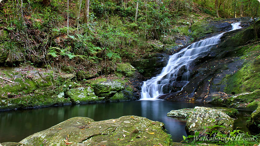
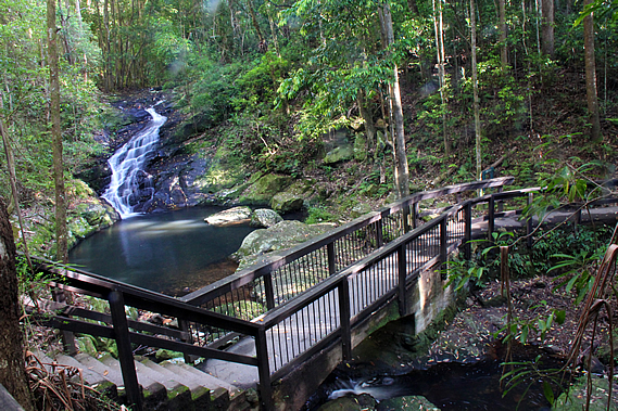
The sealed track was raised nearly half a metre above the ground, which I imagined would be quite swampy even though steep. We reached the bridge and stopped for a few moments as a small group of people talking very loudly in their mobile phones. Clearly they were city folk addicted to their little leashes totally not living in the now. Thankfully they moved on quickly giving us a few minutes of solitude on the bridge. Looking upstream a small waterfall cascading over the layers of basalt dropped into a dark pool. The overnight rain had raised the water level going over the waterfall to a reasonable level, substantial enough for me to get some very nice long exposure shots.
Moss and scrub covered either side of the waterfall, but the middle section had been stripped down to the bare rock from where heavy rain had fallen over the past year. The water didn’t cover this whole area this morning, but it was substantially more than what would have flowed through here before last night’s rain. This was the site of the discovery of the gastric brooding frog Rheobatrachus silus in 1972. It is very rare and hasn’t been seen here since 1979. The tadpoles of this unusual frog develop in the female’s stomach producing a substance preventing the female from secreting her gastric juices.
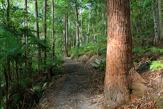
From the bridge we climbed the stairs to a junction in the track. From here it follows a circuit, one above Picnic Creek, and the other higher towards the ridge line. We followed the easier lower track through the cedar forest. By now it had mostly clouded over with only the occasional appearance by the sun. The weather was beginning to close again.
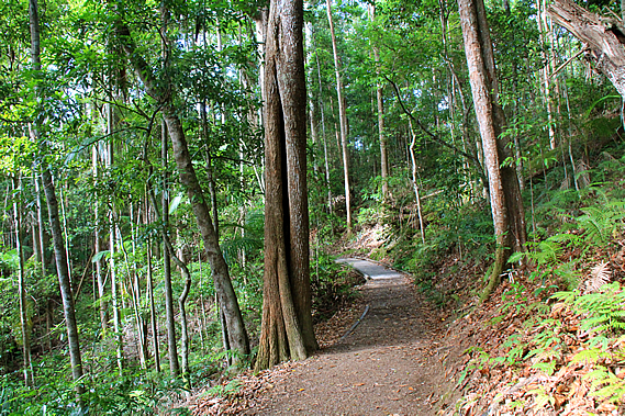
We took the upper track heading towards the top of the ridge. The thick undergrowth quickly thinned to a light coverage of bracken and the trees became mostly pink ash (Alphitonia petrei). Most of the track from the top of the stairs was a wide compacted soil track with the occasional section of boardwalk.
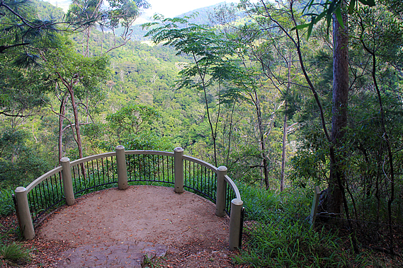
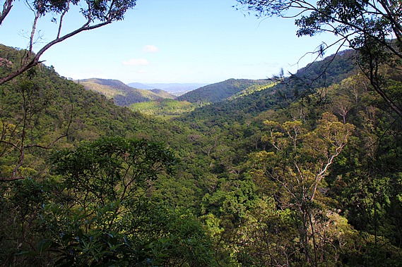
The forest continued to thin until the track reached the top of the descending ridge. A short side track led down some steps to a semi-circular lookout. Taking a break from the main track, we headed down to the lookout.
The sky had cleared enough to get a clear view down the valley of Skene Creek, where we will be following over the next two hours before rounding a point to the left to follow the Obi Obi Creek upstream to the end of the track. The valley itself was a two hundred metre drop from where we were, so there was a long descent ahead of us.
Although we couldn’t see any part of Skene Creek, we could hear it tumbling down the nearby Kondalilla Falls in amongst the screeching sounds of a few sulphur crested cockatoos flying above the trees overhead. |
||||||||||||||||||||||||||||||||||||||||||||||||||
|
||||||||||||||||||||||||||||||||||||||||||||||||||