|
||||||||||||||||||
|
||||||||||||||||||
Home > Diaries > 2009 > 133 |
||||||||||||||||||
|
||||||||||||||||||
|
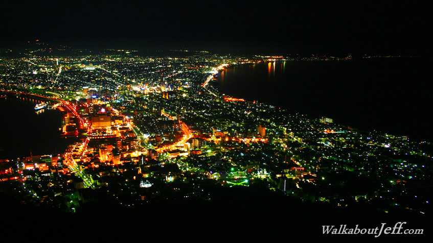
AT THE southernmost point of Hokkaido, the fishing city of Hakodate spans a long sand spit connecting an old volcano with the rest of the island. A gondola ascends the very steep volcano to the summit from where there are spectacular views over the city and across to Honshu. Fishing boats dot the offshore waters. Blogs from today: |
||||||||||||||||||
|
||||||||||||||||||