|
||||||||||||||||||
|
||||||||||||||||||
Home > Diaries > 2009 > 175 |
||||||||||||||||||
|
||||||||||||||||||
|
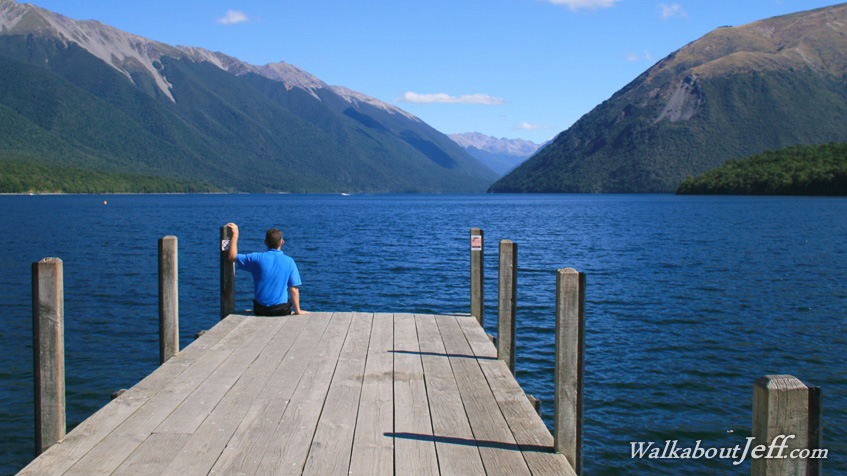
THE ALPINE Fault crosses the mouth of Lake Rotoiti. Here a large glacier once carved its way through the mountains to deposit gravel sediment at its end. The sediment remained after the ice ages ended, creating the spectacular lake. Mountain beech forest rises from the water's edge up the steep slopes of the old glacial valley up to the bushline to the mountaintops which stand out in front of the bright blue sky. I climbed the highest point in range to the left back in 1988. It was my first substantial climb from where the lake seemed to be small and far away a vertical kilometre below where I was standing. Blogs from today: |
||||||||||||||||||
|
||||||||||||||||||