|
||||||||||||||||||
|
||||||||||||||||||
Home > Diaries > 2015 > 413 |
||||||||||||||||||
|
||||||||||||||||||
|
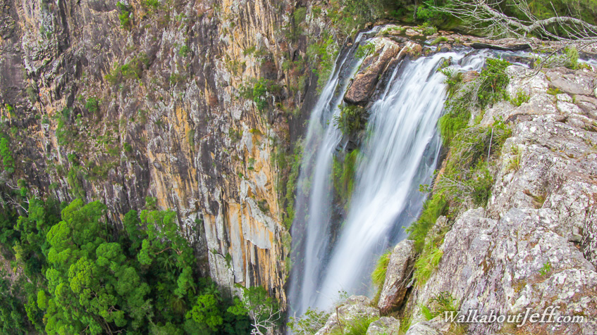
PLUNGING 100 metres down a vertical wall of volcanic rhyolite deep in the forest of Nightcaps National Park is Minyon Falls. Above the falls the Repentance Creek flows gently down a valley of tall gum forest. Below the falls the stream flows through rich rainforest. There is a 4.5 kilometre trail from the top of the falls to a pool at the bottom and another trail following the creek upstream to a campsite. Superblog from today: |
||||||||||||||||||
|
||||||||||||||||||