|
||||||||||||||||||
|
||||||||||||||||||
Home > Diaries > 2015 > 490 |
||||||||||||||||||
|
||||||||||||||||||
|
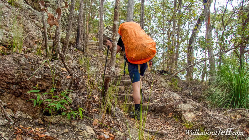
HEADING down the bluff from Ubajee into the bottom of the valley, we followed the Gheerulla Creek downstream. Upon reaching the end of the creek the track turned to follow the top of the southern ridge to the next campsite at Thilba Thalba. Between the creek and the ridge was a brutal 300 metre climb to the top of Gheerulla Bluff in very muggy conditions typically the prelude of heavy rain, but so far there had only been a couple of light showers providing no relief at all. Here I was leading the way up a steep set of stairs just past the 18th switchback zig-zagging its way between the vertical sandstone cliffs precariously holding up the bluff high above the valley. Trek from today: Blog from today: |
||||||||||||||||||
|
||||||||||||||||||