|
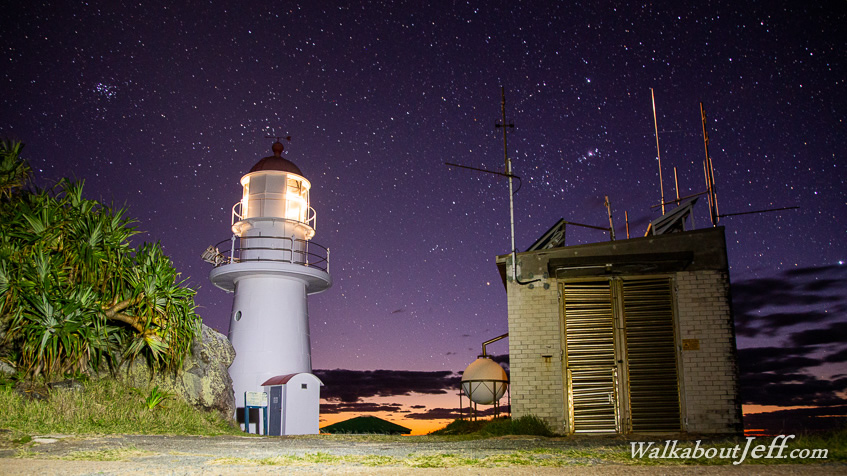
DOUBLE Island Point is one of the most exposed parts of the Australian coast. It was surprisingly calm this morning as the dawn penetrated the brilliant starry sky. The lighthouse provided navigation to the numerous ships heading up and down the Queensland coast, and those turning the point to enter Wide Bay.
As the sun rose I headed down to Teewah Beach sweeping southward for around fifty kilometres to the distant Noosa Headlands just visible from the lighthouse and invisible below the horizon from the beach.
I followed the beach for a couple of kilometres before starting an undulating walking track following the forest behind the top of the Rainbow Beach cliffs until eventually reaching the first few kilometres of the great walk and heading across the Cooloola Sandblow back to Rainbow Beach.
|