Introduction to today's journey
Today's journey takes me from Laban Rata at 2:00 in the morning continuing up the steep mountainside until we eventually reach its 4095 metre high summit just in time for the spectacular sunrise through a gap in the clouds. After the sunrise at the cold summit, we begin our descent, eventually passing Laban Rata and continuing down the very long track to its start from where we travel by van down to Poring Hot Springs at the bottom of the mountain.
Today's Journey
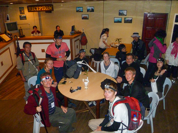 |
We get up at 2:00 in the morning for breakfast having slept well through the night at Laban Rata. |
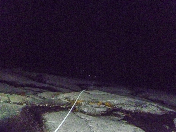 |
Leaving at 2:30AM, we continue climbing the mountain, initially along a track and up a rocky ravine before reaching the mountain dome. Here we follow a white rope up the mountain as the lights of other climbers continue ahead. |
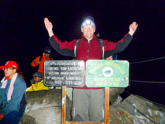 |
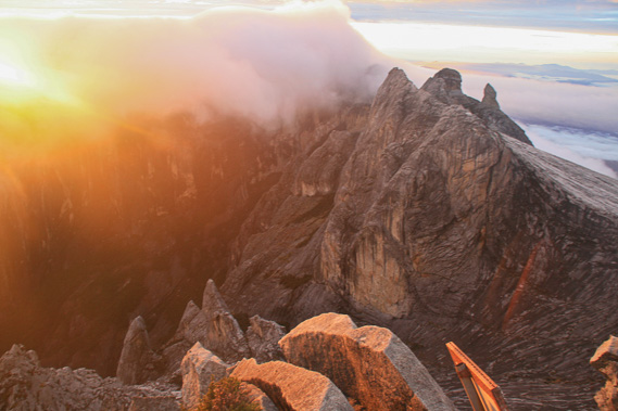
Successfully reaching the 4095 metre high summit of Mount Kinabalu just before the first light of dawn. |
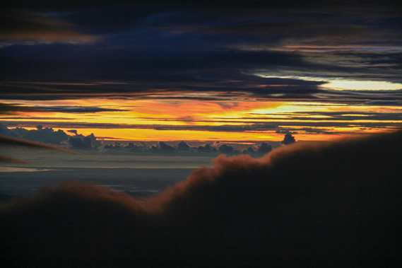 |
It is a very cold seven degrees up here (by far the coldest part of Borneo), so I rest in the shelter of a rock just under the summit as the sky glows between the layers of cloud. |
 |
As the sky lightens an 1800 metre deep ravine drops off right next to us separating the main summit from most of the lower summits of the mountain. This ravine was formed by a glacier during the last ice age. |
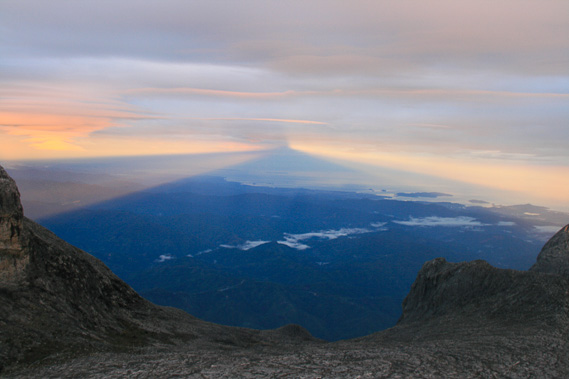 |
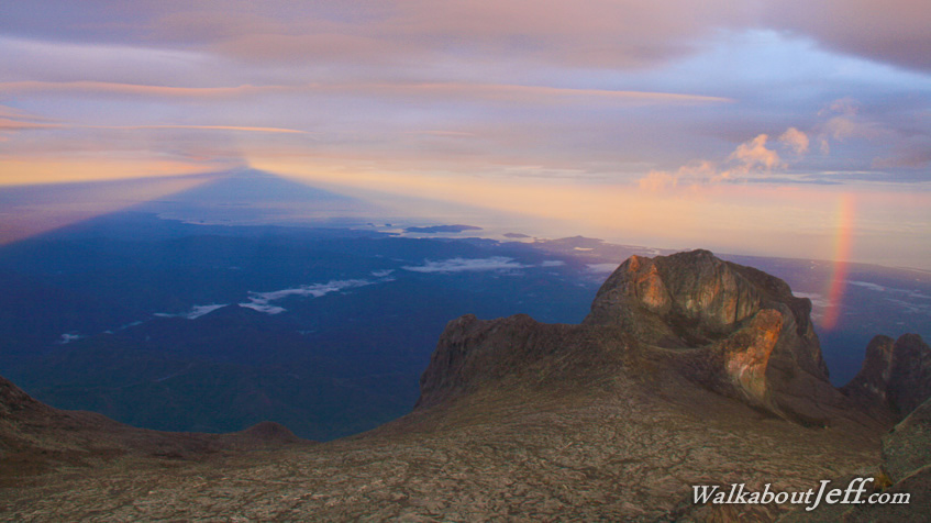
Looking away from the sun towards Kota Kinabalu (and the Dusun village we stayed at on our first night on the mountain), the mountain has created a shadow hundreds of kilometres long. |
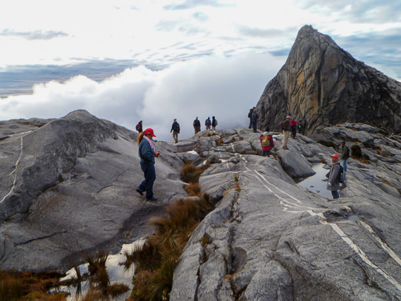 |
We descend the exposed rocky dome of the mountain passing the lower summits. |
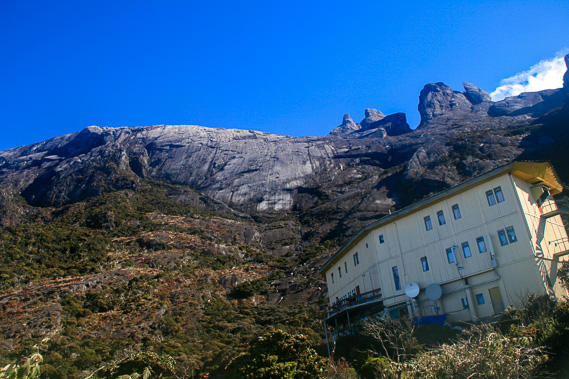 |
The sky is almost perfectly clear when we reach Laban Rata, where we briefly rest and pack up before continuing down the mountain. |
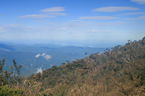 |
The descent down the 1800 metre high staircase seems to pass quickly as we head down the mountain. At the end of the track, we are picked up and taken back to Sutera Sanctuary Lodge where we stop for lunch. |
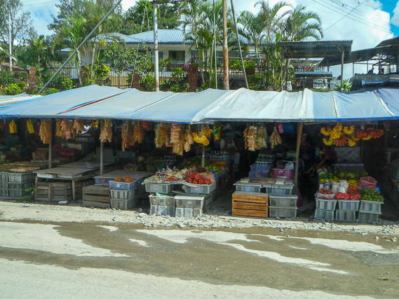 |
After lunch, we head down the mountain and further around the mountain to the hidden steamy village of Poring just 400 metres above sea level. |
|