Introduction to today's journey
Today's journey takes me around Christchurch City when it was intact before the earthquakes. From the city I head across to Lyttelton Harbour crossing the extint volcanic crater to Diamond Harbour. I return to Lyttelton and take the gondola up to the crater rim before returning to the city to explore the arts centre and botanical gardens.
Today's Journey
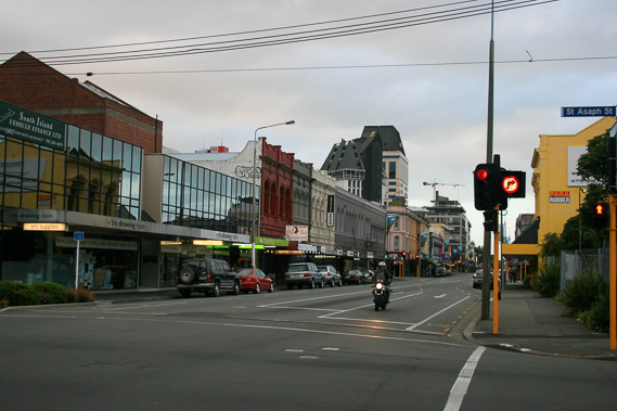 |
Christchurch city centre on a quiet morning as I head out towards Lyttelton. |
 |
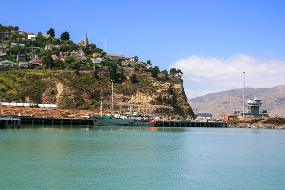
Taking the tunnel through the Port Hills, I reach the historic Lyttelton Harbour in the middle of an extinct volcanic crater. |
 |
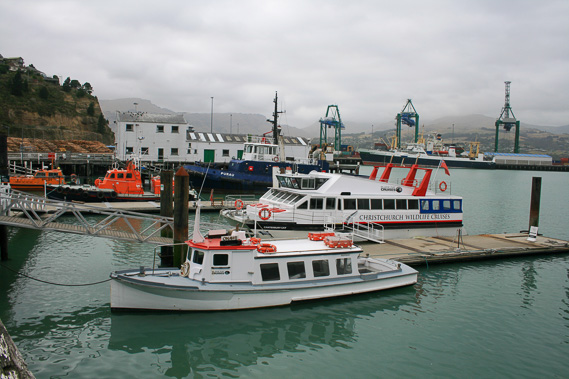
From the harbour, I catch a boat across the harbour (a flooded volcanic crater) to Diamond Harbour. The hills on this side of the harbour are gently sloping as they were the lava flows of a more recent volcano which partially filled the Lyttelton Harbour crater. |
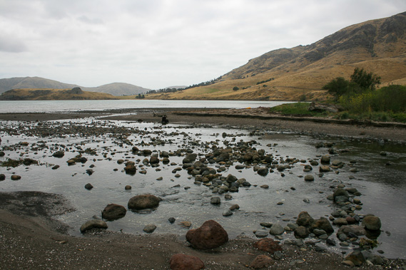 |
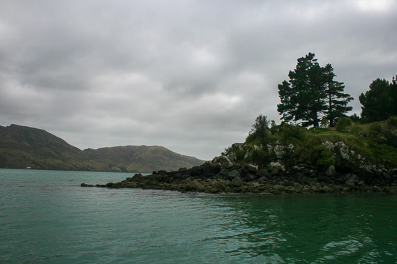
I follow a walkway into the nearby Purau Bay crossing a small stream draining the valley behind the bay. |
 |
From Purau Bay, I return to Diamond Harbour and catch the boat back to Lyttleton as the sky clears. The old timeball station is on the ridge above the harbour. Historically it was used as a timekeeping device for the ships. |
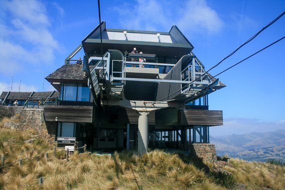 |
I head back through the tunnel before taking the gondola to the top of the Port Hills. The ride is easy, but in the days of early settlement, passengers and freight arriving at Lyttelton Harbour had to be carried over this 445 metre high pass to get into Christchurch until the 2 kilometre long tunnel was built in 1964. |
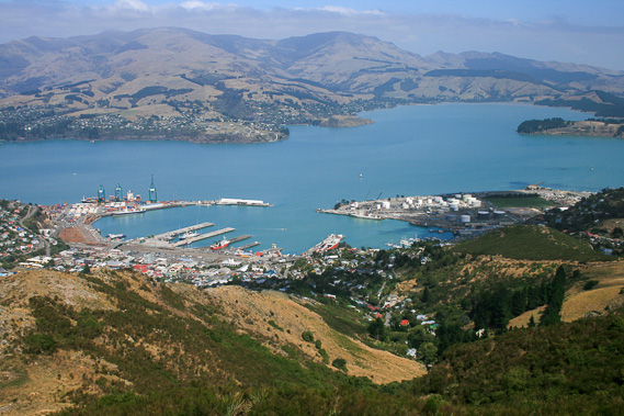 |
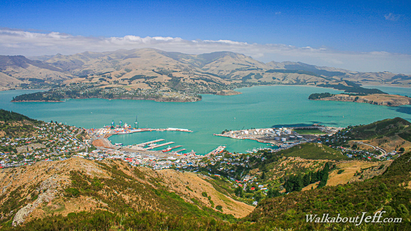
Spectacular view from the top of the hill into Lyttelton and across to Diamond Harbour and the hills of lava which partially filled the old Lyttelton Harbour crater. A total of four shield volcanoes erupted here from a hot spot in the mantle between 11 and 8 million years ago. |
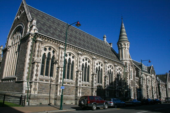 |
Returning to Christchurch, I visit the Arts Centre, amongst an area of stone gothic buildings of English style back in the mid 1800s when Christchurch was first settled. |
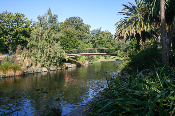 |
I head to the nearby Botanical Gardens through which the Avon River flows. Once a crystal clear stream flowing through native forest, it was the ideal location for a new settlement, and Christchurch was established on the banks of the river. Now almost all native species has long been cleared with exotic species familiar to the English settlers now dominate the city's greenery. |
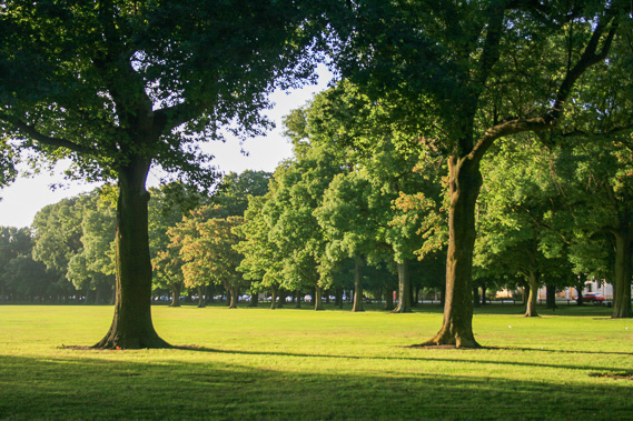 |
I return to my accommodation heading through Hagley Park, a huge expanse of grassy sports fields framed with spectacular oak and elm trees planted by the early settlers when it was established in 1855. |
|