Introduction to today's journey
Today's hike starts early leaving Mintaro Hut climbing the side of the steep valley to the exposed Mackinnon Pass. I stop at the memorial before following the top of the saddle to the shelter where I rest before starting a huge descent dropping a kilometre into the Arthur Valley to Dumpling Hut.
Today's Journey
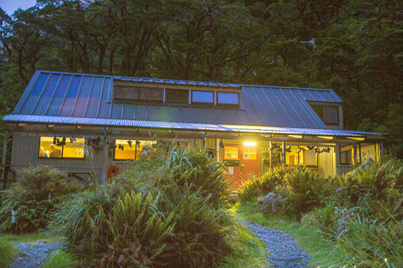 |
First light at Mintaro Hut as I prepare to leave to head over the pass. |
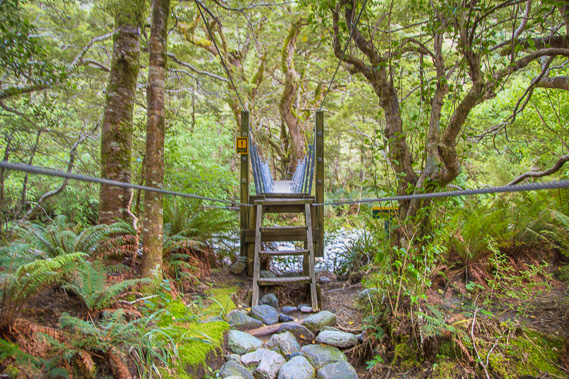 |
Reaching a swingbridge upstream from Lake Mintaro. The stream is a dry bed of boulders here, but it would be a torrent feeding the lake and the Clinton River in heavy rain. |
 |
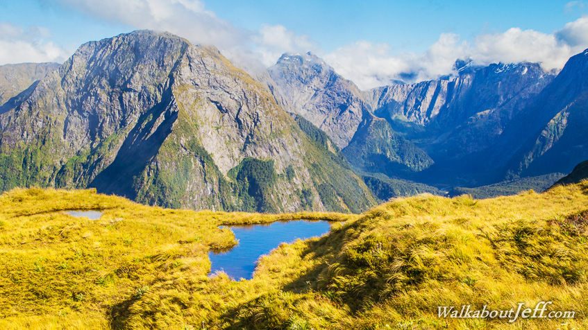
Following the narrow track back and forth across the steep slope rising to the pass. From here I am looking down the Clinton Valley. |
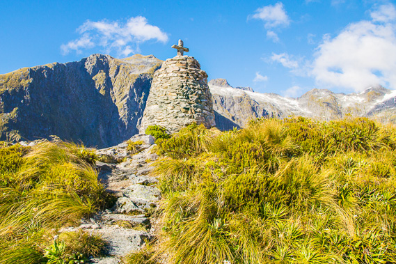 |
Reaching the Mackinnon Memorial at the top of the saddle. |
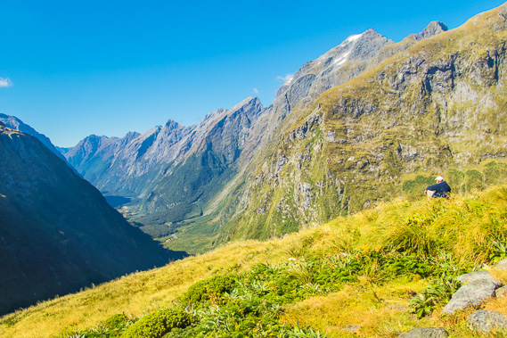 |
I hike for another half an hour along the top of the saddle to Mackinnon Shelter, where I rest and have a spectacular view down the Clinton Valley, as far as Dore's Pass in the far distance. |
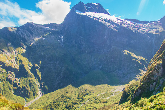 |
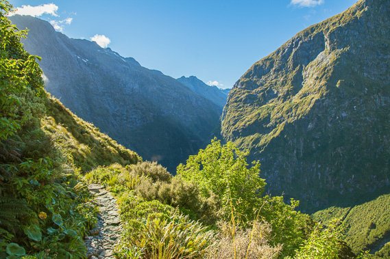
Heading down the other side of the pass towards Roaring Burn. The track precariously negotiates its way down the steep drop towards the cirque at the head of the valley from where one of the main glaciers of the Arthur Valley leading into Milford Sound started. |
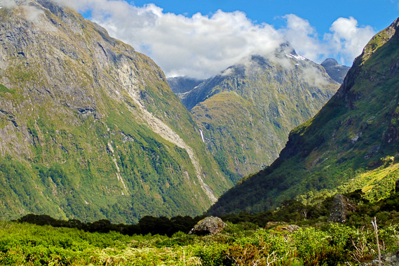 |
Having reached the cirque, the track follows Roaring Burn downstream. At this point just before reaching the bush line, I have a view across to the hanging valley of Lake Quill from where the Sutherland Falls drops spectacularly from. |
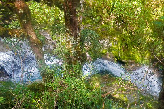 |
View from the boardwalk into Anderson's Cascade as I continue heading down the mountain. |
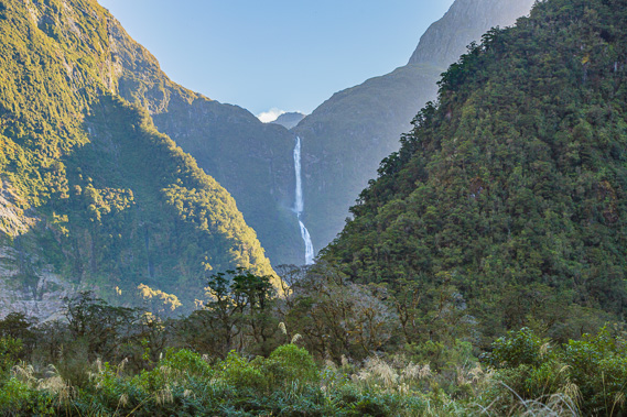 |
In a brief respite from the 900 metre descent just past Quintin Lodge, I have this spectacular view across to Sutherland Falls, the 8th highest waterfall in the world dropping 580 metres. |
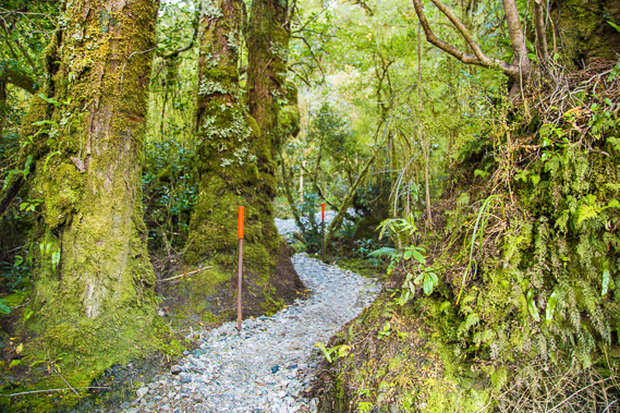 |
From the falls, the track continues downhill eventually reaching the lowlands at Dumpling Hut which I'm glad to reach after a long day hiking over the pass. |
|