Introduction to today's journey
Today's journey takes me from Oban up to the local airport where I catch a small plane across the island to land on the sweeping beach of the remote Mason Bay. From here we head a little inland through the dunes to the hut where we set up before exploring some of the bigger dunes sweeping in from the ocean.
Today's Journey
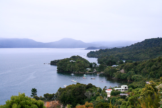 |
Returning to the top of Observation Hill in the early morning, rain haze obscures the hills. I am heading to Mason Bay on the other side of those hills soon. |
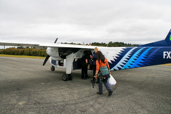 |
I head to the tiny post office which doubles as the island's airport. I meet the group I'm travelling with and we all check in before being taken up to the airstrip by van. There I board the tiny plane - not much more than a combie van with wings. |
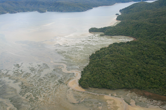 |
The plane takes off the narrow runway and heads westward across the island over Paterson Inlet. Here we are above Freshwater River looking along the remote Southern Arm of the inlet. |
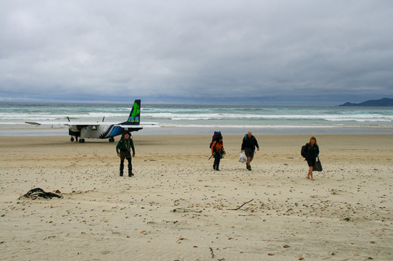 |
The plane makes a surprisingly smooth landing on the exposed Mason Bay Beach. Once off the plane, we make our way across the sand towards the dunes as the plane takes off again heading back across the island to pick up more passengers to take across to Invercargill. |
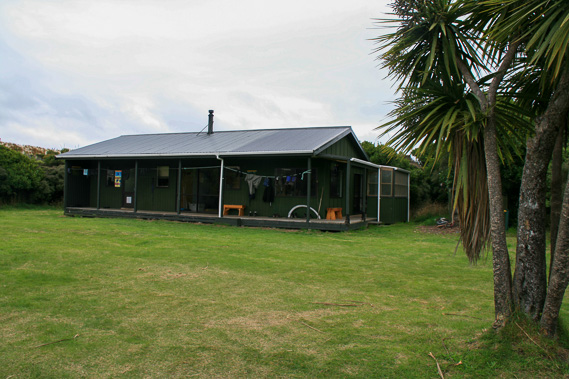 |
About ten minutes hike in from the beach following Duck Creek upstream, we reach the Mason Bay Hut where we are staying tonight. This hut is part of the 11 day North West Circuit and also where the Southern Circuit meets the North West Circuit. |
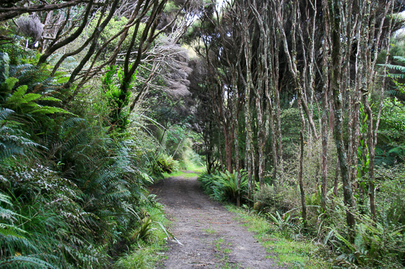 |
Once settled at the hut, we follow the main track back towards Oban to explore the sandhills. From here it is two days' hiking to North Arm Hut where I stayed just a couple of nights ago, and another day to Oban along the track I hike out of the Rakiura Track the other day. |
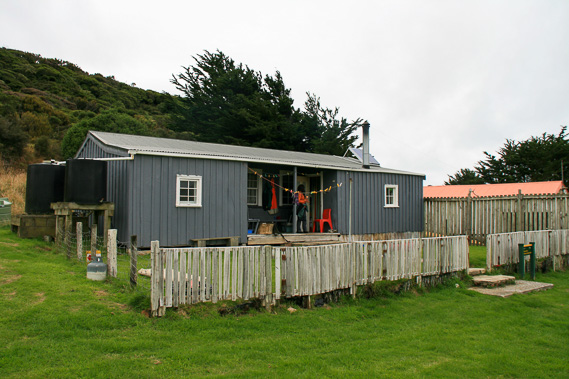 |
Reaching the old Island Hill Run homestead, which the park rangers now use. We explore the old house. A sheep farm was once established here, but abandoned due to the very exposed and harsh climate. |
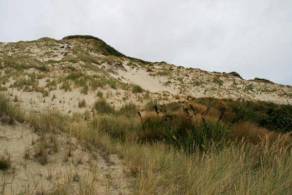 |
From the homestead we climb the 156 metre high Big Sandhill. It is a small granite hill covered in sand blown in from the beach by the constant prevailing westerly winds. |
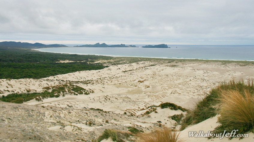
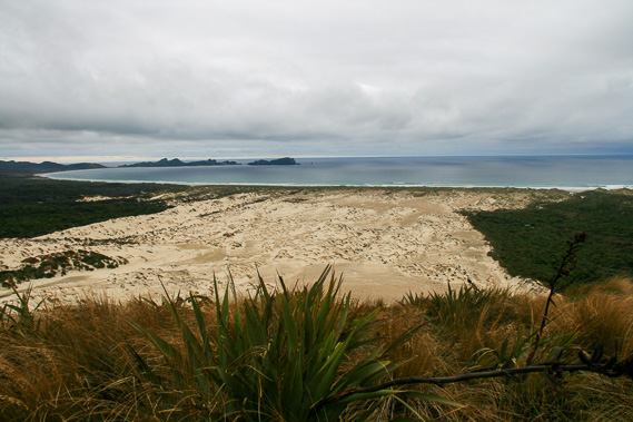 |
View from the top of Big Sandhill looking across the southern side of Mason Bay. From here we descend the steep slope back to the hut. |
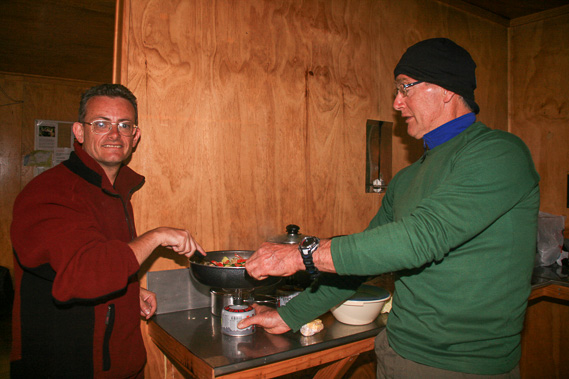 |
Cooking dinner at the hut for an early night as we are setting off very early tomorrow morning to look for kiwis. |
|