Introduction to today's journey
Today's journey departs Mason Bay Hut in the small hours of the morning as we search for kiwis. We continue following the track along a boardwalk crossing Chocolate Swamp before following a stream to Freshwater River, across from Freshwater Hut. From there we catch a boat down the river and along Paterson Inlet back to Golden Bay.
Today's Journey
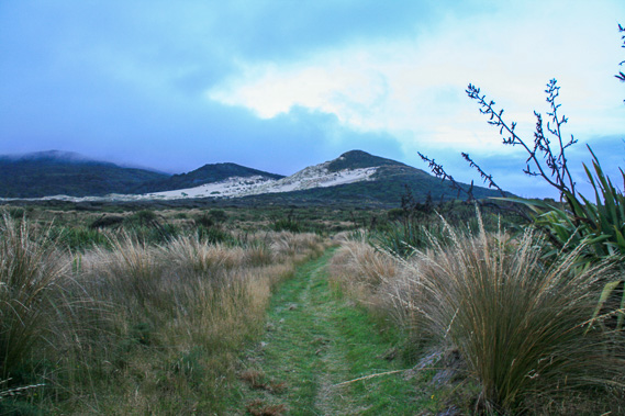 |
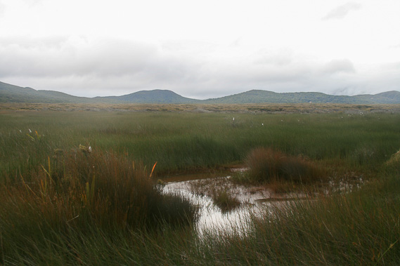
Leaving the hut before dark, we spot a couple of kiwis (though too dark to photograph) and pass the old homestead before the sky starts to lighten. The light reveals we are crossing the middle of a swampy sand plain covered in flax. Looking back some exposed sand hills are still visible. |
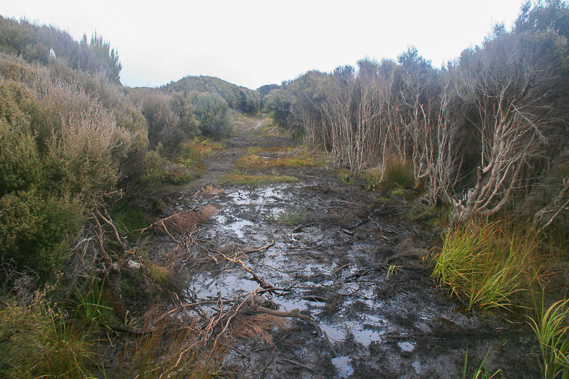 |
The track starts to become very boggy in parts as we pass through kanuka swamp. It rains here two days in every three all year round, so no wonder the farm never took off here. |
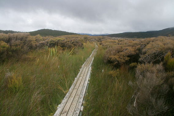 |
Fortunately the track is replaced by an elevated boardwalk giving us dry access over otherwise very boggy swamp. |
 |
The valley is famously named Chocolate Swamp thanks to the very dark mud filling the valley under the reeds. The boardwalk makes progress very easy. |
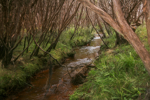 |
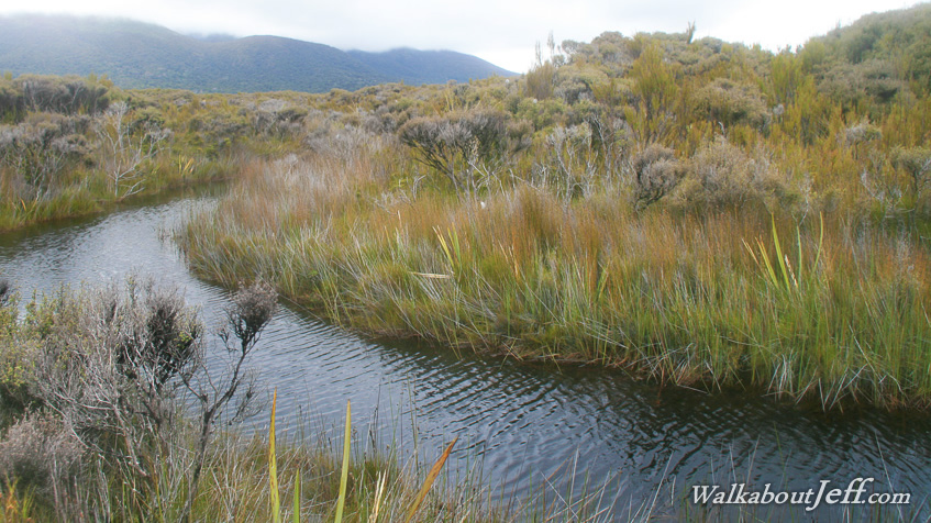
Once across the worst of the swamp, the track follows Scott Burn, a very straight stream obviously cut by the farmers in an unsuccessful attempt to drain the swamp to form dry land for farming. Large kanukas form a canopy over the stream. |
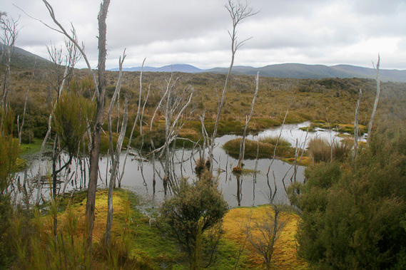 |
The track is dry, but small patches of swampy lake appear beside the track. |
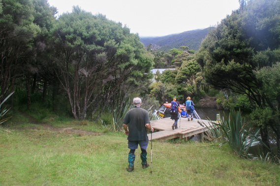 |
About five hours out from Mason Hut, we reach Freshwater River. Freshwater Hut is just visible across the river from where the track continues for another 5-7 hours over the hills to North Arm Hut. We catch the small boat at the jetty back towards Oban. |
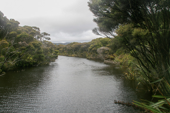 |
We cruise along the tidal Freshwater River meandering its way towards Paterson Inlet. |
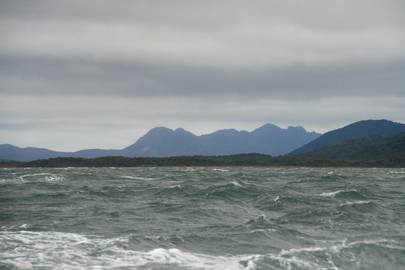 |
A strong southerly wind battles against a strong incoming tide to make for an extremely bumpy ride along Paterson Inlet. This view looks westward over the back of Freshwater River to its source in the Ruggedy Ranges. |
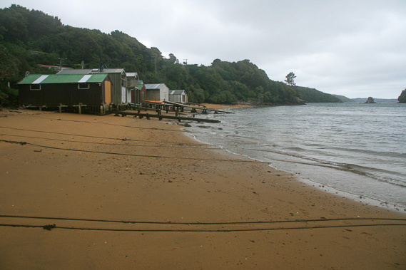 |
We eventually return to the relatively calm waters of Golden Bay, from where I hike over the short hill back to Oban. |
|