Introduction to today's journey
Today's journey continues from Staverley heading around the base of Mount Hutt to Rakaia Gorge. From there we head upstream to Lake Coleridge, before climbing Peak Hill. Upon returning downhill, we head towards Christchurch, which is now in the middle of a sequence of damaging earthquakes.
Today's Journey
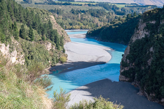 |
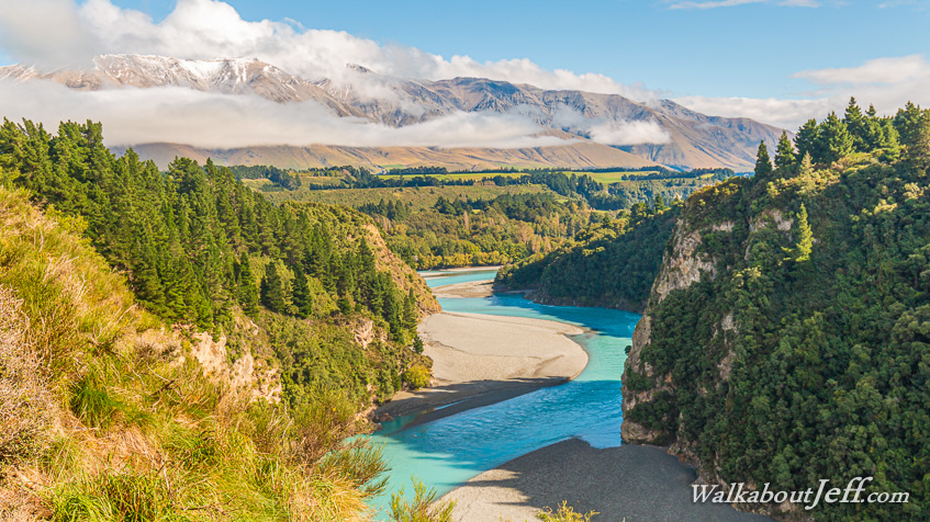
View upstream at Rakaia Gorge below the terminus of an old glacier. The river has eroded into the rock which would have formed a lake behind it when the glacier first retreated. |
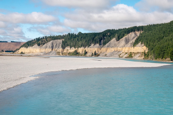 |
Looking downstream the river flows out along the Canterbury Plains as a braided river. The exposed bank shows the different layers of shingle deposited from glaciers in different ice ages. |
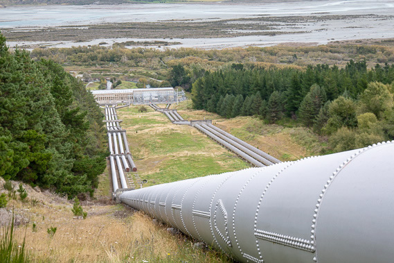 |
We head upstream to the Lake Coleridge Power Station. This once supplied electricity to all of Christchurch before the city grew large and the power grid from the dams down south started supplying the entire country. |
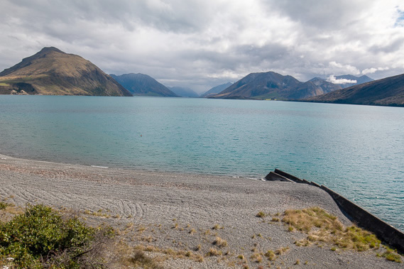 |
The water used to generate the power comes from here at Lake Coleridge, a mostly natural lake left from the last ice age. To the left is Peak Hill, which we decide to climb. Behind the lake is the Wilberforce River, leading to the main divide with Hokitika and the west coast on the other side. |
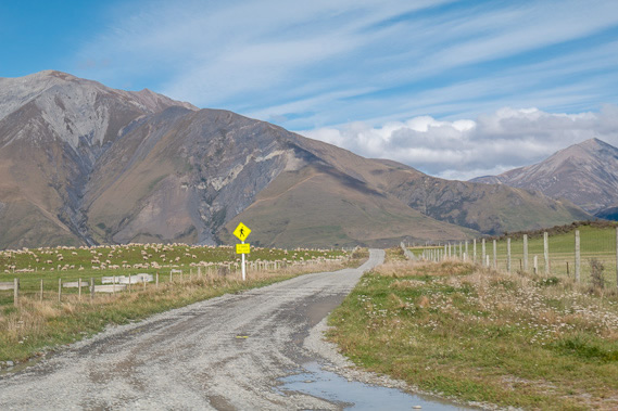 |
Following the road to Peak Hill, now following part of the Te Araroa Trail before it heads behind the mountains ahead to re-emerge over the Rangitata River catchment we were exploring yesterday. |
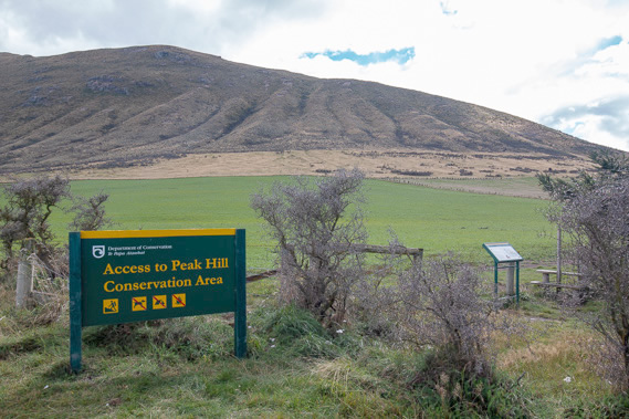 |
At teh start of the Peak Hill track, which heads straight up the hill then along the ridge to the left. |
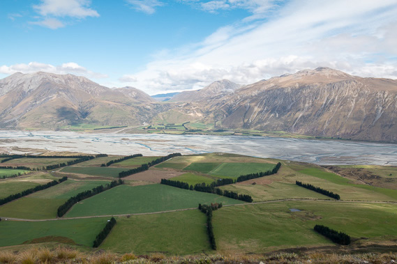 |
View from half way up Peak Hill, looking over the braided upper Rakaia River and the 2100 metre high Mount Hutt to the left. The mountain is covered in snow in winter with good ski fields. |
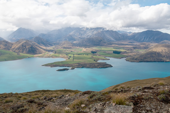 |
View across Lake Coleridge from near the summit of Peak Hill. |
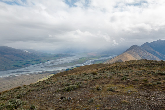 |
View along the upper Rakaia River towards the Southern Alps main divide. It is raining heavily on the other side of the mountains, and some of the rain is heading in this direction. It is time to head down the hill. |
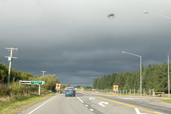 |
We head towards Christchurch as the sky clouds over, but no rain has started falling here yet. We settle in the western suburbs near the airport, having completed a circuit around the lower South Island. |
|