Introduction to today's journey
Today's journey takes me into the middle of Christchurch during the big earthquakes. The city centre is barricaded so I'm unable to enter it. I explore the University of Canterbury near the airport and also head to Sumner, where the damage had been serious.
Today's Journey
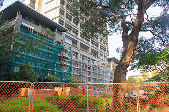 |
On the way to the city I stop at the University of Canterbury where I once studied. Several of the main blocks have closed due to earthquake damage. |
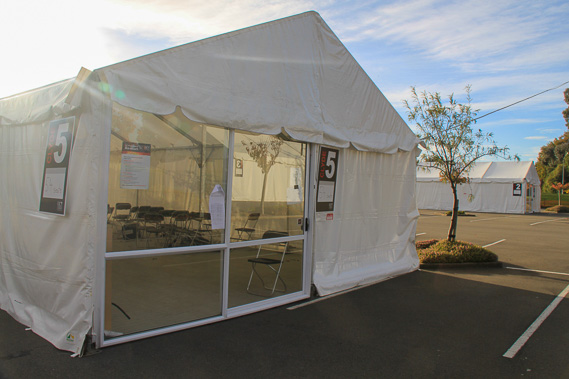 |
Tents have been set up in the car parks as temporary lecture theatres whilst the buildings are repaired or replaced. |
 |
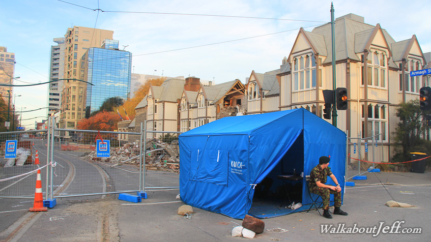
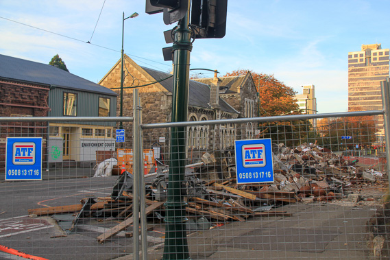
Approaching the city centre which has been barricaded off with soldiers from the army guarding the entrances. It is too dangerous to go into the city due to the ongoing risk of large aftershocks causing more buildings to come down. |
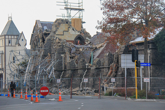 |
One of the Gothic stone construction buildings which collapsed in the original earthquake. Scaffolding was erected, but even that got damaged in a subsequent aftershock. The ongoing risk means these buildings have to be left here until the aftershocks stop. Many of these buildings are Gothic stone constructions from England where there are no earthquakes. |
 |
I reach another barricade blocking off a street littered deep in earthquake debris. |
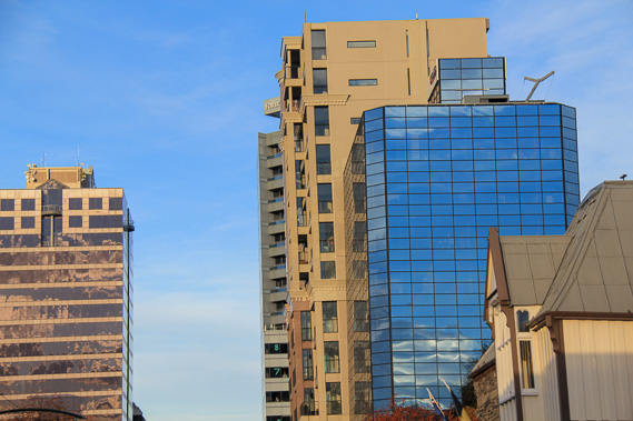 |
Zoomed into several high rise buildings which are all leaning in different directions from structural damaged in the earthquakes. The biggest quake occurred in the middle of a working day, so a lot of people were in these buildings. Fortunately most got out. |
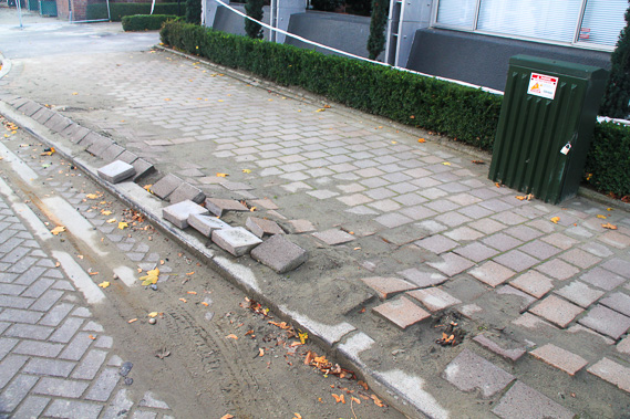 |
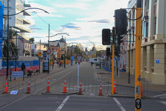
Some paving affected by liquefaction (water and silt) which came up after the earthquakes causing a lot of road and path damage throughout the city. The city is built on 600 metre thick gravel washed down from the old glaciers. This holds some of the purest water in the world. A lot of it created the liquefaction. Much of the city now has road cones directing traffic away from the worst of the damage. |
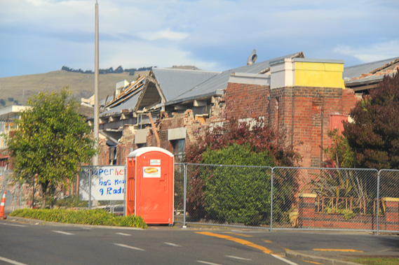 |
Heading through the residential areas where many houses have been severely damaged and temporary toilets have been erected to deal with the many broken plumbing and sewerage lines. |
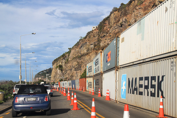 |
Reaching the coastal suburb of Sumner at the edge of the Lyttelton Volcano just a couple of kilometres away from the epicentre of the largest quakes. A lot of landslides came down these cliffs in the earthquakes leaving the prestigious houses on top of them in a precarious position. Shipping containers prevent falling rock from aftershocks from getting onto the road and damaging vehicles. |
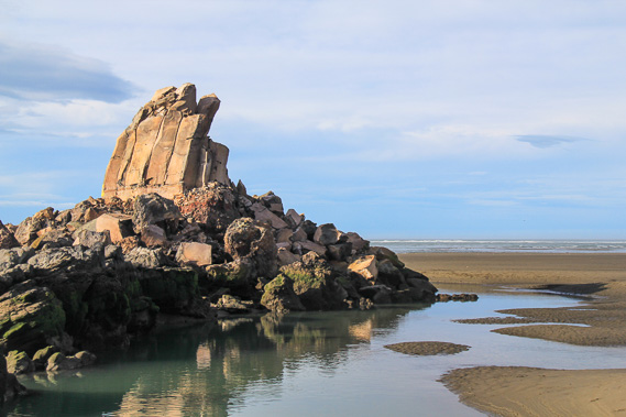 |
Shag Rock at Sumner which has been severely damaged with huge boulders falling off its structure reducing its original size. |
|