Introduction to today's journey
Today's journey departs Ohakune in the early morning heading to the Mangatepopo end of the Tongariro Crossing. From there we follow the valley upstream to South Crater from where we climb Mount Ngauruhoe. Upon returning to South Crater, we cross Red Crater to the Emerald Lakes and Blue Lake before descending past Ketetahi Springs to the end of the track and back to Ohakune.
Today's Journey
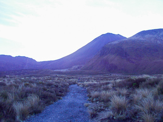 |
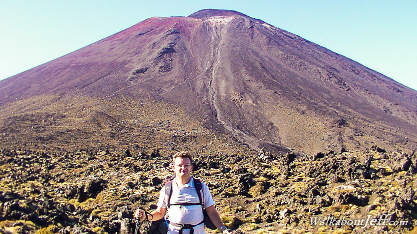
Early morning start at the bottom of the Mangatepopo Valley commencing the Tongariro Crossing heading towards the saddle under Mount Ngauruhoe. |
 |
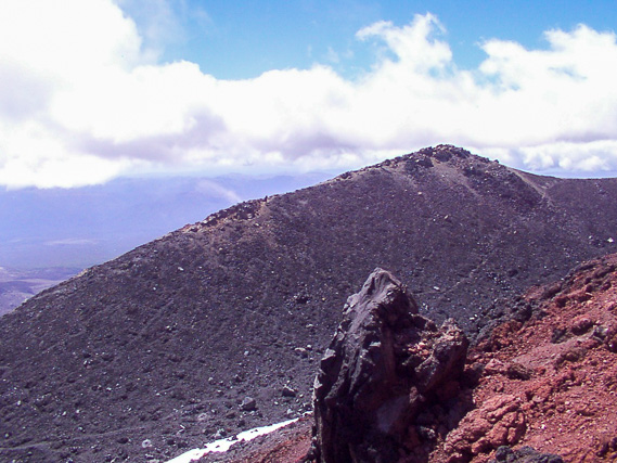
Upon reaching the saddle, we climb the steep volcanic rubble of Mount Ngauruhoe. This view is looking north across Mount Tongariro and along the main trail. |
 |
View across the summits of Ngauruhoe - the 1954 crater viewed from the smaller 1974 crater. The 1974 crater is a crater within a crater. |
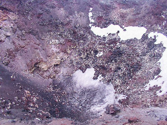 |
Looking down into the bottom of the 1974 crater about 30 metres below. The crater is filled with a mixture of rubble and ice. Who knows when the next erupton of this semi-active volcano will occur again. |
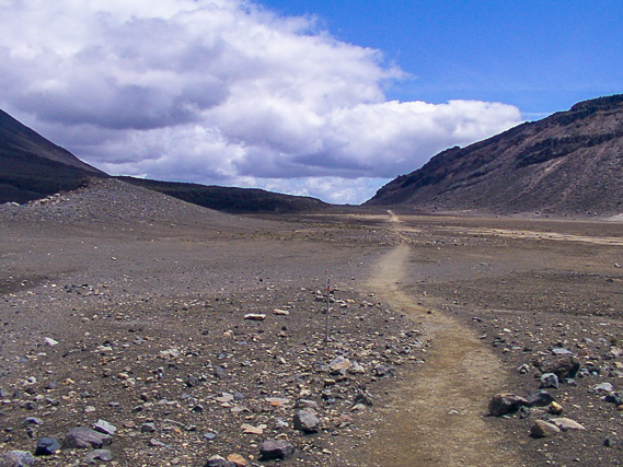 |
After a quick descent down the scree slope, we follow the flat trail. This is looking back into the Mangatepopo Valley as we head towards Red Crater. |
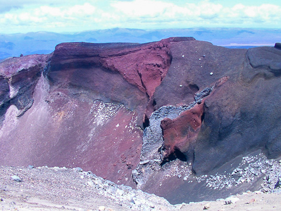 |
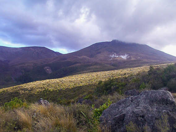
After another steep climb, we reach the top of the active Red Crater, with Mount Tongariro behind us. |
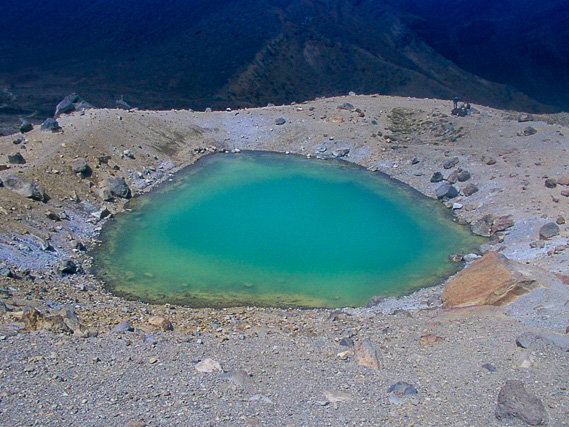 |
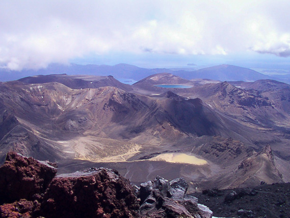
A steep descent off Red Crater brings us to the Emerald Lakes, hot pools of mineral water at the bottom of the active crater. |
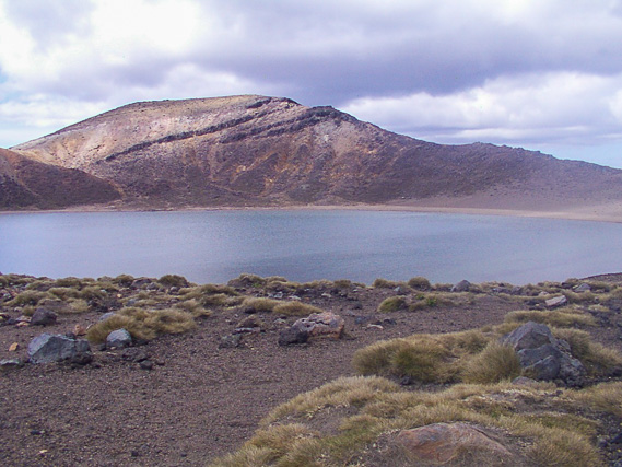 |
Further along the crossing we reach Blue Lake, an old crater full of water. On the other side of the hill is Te Mari Crater, which erupted suddenly in 2012. |
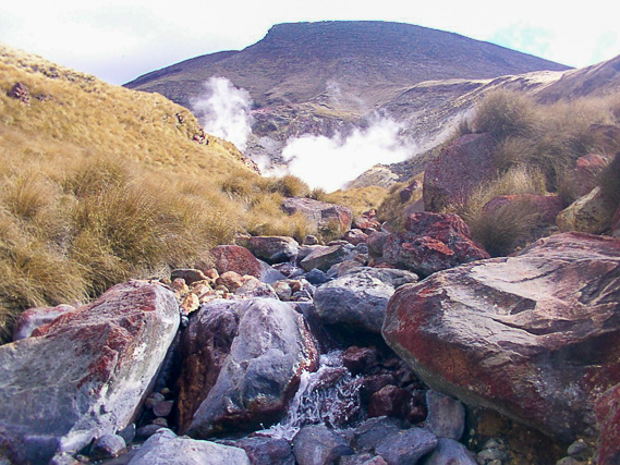 |
Descending from Blue Lake we head around the front of Mount Tongariro, the source of the Whanganui River. Part way down we reach this stream of hot water fed by the steaming Ketetahi Spring further upstream. |
 |
Eventually we reach the bottom of the mountain and travel back to Ohakune to rest before starting our journey down the Whanganui River tomorrow. |
|