Introduction to today's journey
Nestled in the picturesque hills at the Brisbane City end of the D'Aguilar Range, Enoggera Dam stands as a testament to human ingenuity and the resilience of nature. Originally constructed in the early 1860s to supply water to the growing city, the still waters gives a stoic presence amidst the eucalyptus-clad hills whispering stories of reilience and renewal. The lake behind the dam now offers a sanctuary for hikers, cyclists and kayakers alike.
Today's journey starts at Enoggera Reservior, following the Araucuria Trail and continuing around the lake to its far end before following the creek upstream. Upon reaching Holman's Break, I climb steeply to Boundary Road running along the ridge up to Scrub Road Camp near the source of the creek where I spend my first night in the remote bush.
Distance hiked today: 26.1km
Total distance hiked: 54.8km
Today's Journey
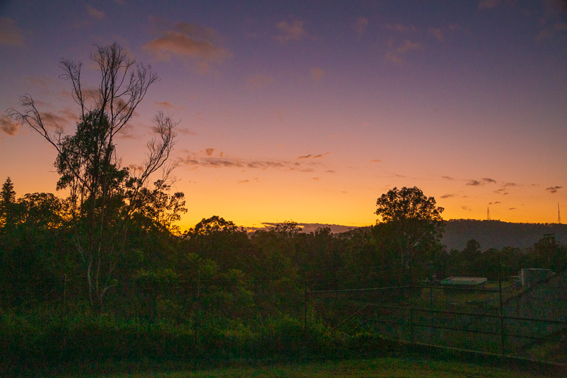 |
I reach the Enoggera Dam viewpoint at first light. The slight hint of grey behind the red lights atop the Mount Coot-tha aerials quickly paints dramatic hues over the silhouetted hills. The thick morning humidity is a sure sign today will be a hot sunny day adding to the challenge of the climb towards the top of the range. |
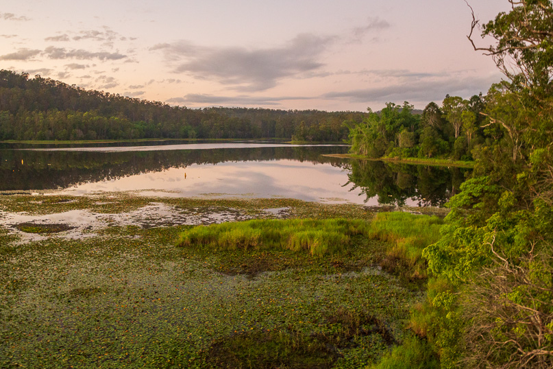 |
The dawn reveals the dam which is a Victorian marvel constructed in 1866 to supply the then growing city. Today it is still a water supply, though only forming a very small part of the thirsty city's appetite. The lake stretching behind the dam is as smooth as a polished mirror. |
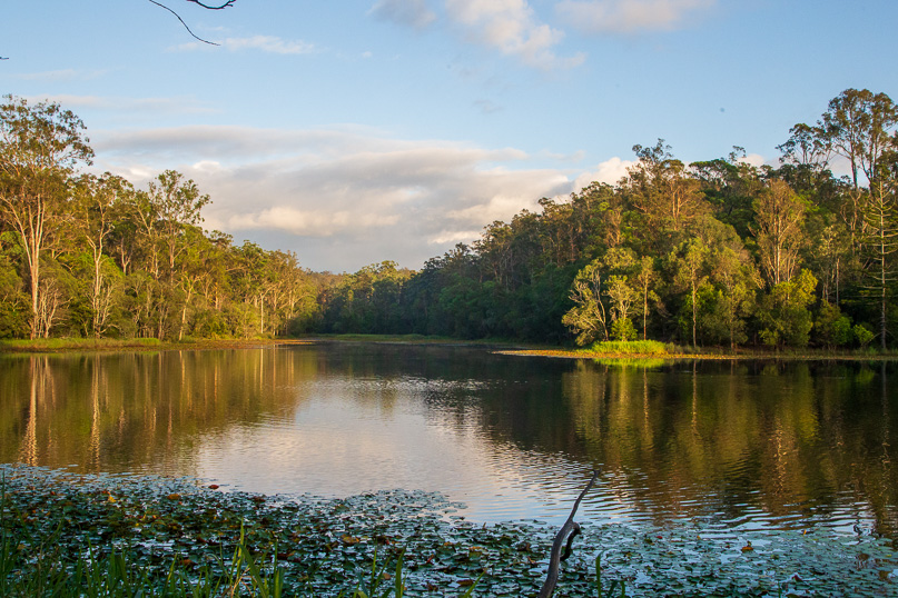 |
I enter the D'Aguilar National park following the Araucaria Track, relieved to be walking relatively soft dirt track as opposed to yesterday's concrete pavement through the city and suburbs. The track stays close to the lake, nagivating its jagged twists, turns and surprises around long peninsulas and into deep coves full of aquatic vegetation hiding all manner of snakes and other dangerous water fauna.
|
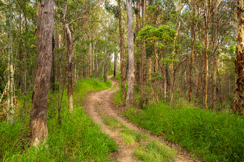 |
Upon reaching the end of the Araucaria Track, I follow one of the firebreak trails continuing along the lake. Unlike the track, the firebreak is wildly undulating rising and falling steeply over spurs and gullies. Here the fitter walkers and runners venture beyond the bounds of the easy walking tracks. |
 |
As I venture deeper into the national park, the busy city becomes no more than a distant memory as I hike in solitude. Here, it's just me, the trees and the birds filling the air with their songs.
|
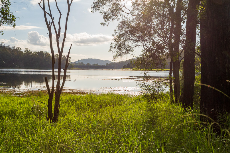 |
Nearing the upper reaches of the lake, I reach a clearing with a view across to the now distant dam wall. The lake up here is a lot narrower with the steep hills now encroaching on either side. Apart from the dam wall, there are now no other signs of civilisation. |
 |
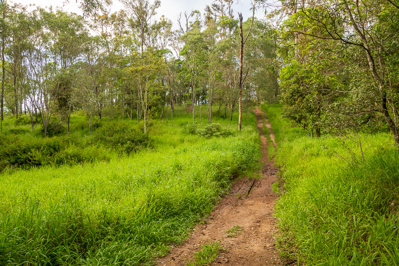
The forest thickens before I reach the upper Enoggera Creek just upstream from where it flows into the lake. From here, several tracks head up to different parts of the top of the ridge. I decide to follow the track less travelled, the Long Range Walking Track. Once a popular track, it has in recent years become forgotten and largely overgrown, I follow it just above the creek as it passes through a pretty rocky gorge in rainforest. |
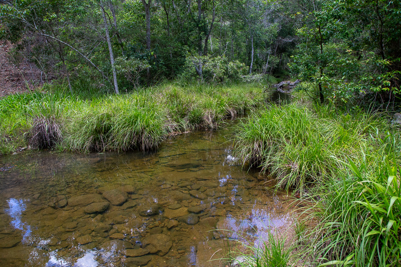 |
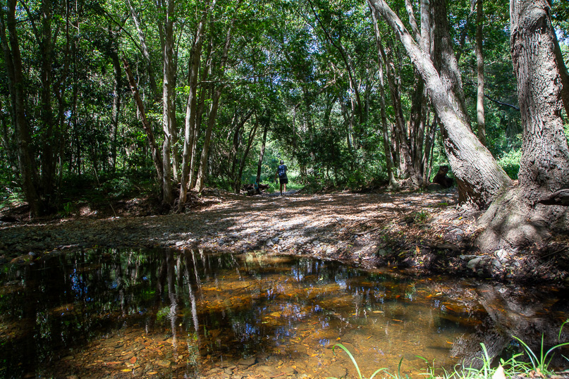
After nearly an hour of following Enoggera Creek upstream, I reach a clearing at Holman's Break, a steep firebreak shooting steeply up the range on either side. Seeing the track I have been following almost completely disappears, I decide to rest here beside the tranquil pool in the creek. |
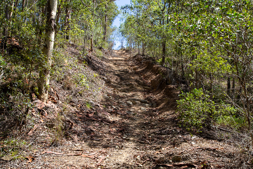 |
After crossing the stream just below the pool before starting the Holman's Break climb, steeply rising up the side of the valley. As I trudge my way uphill, the creek below quickly transforms into a mere ribbon of water, quickly leaving the rainforest as dry eucalyptus forest takes its place. The loose rock underfoot slows progress. Fortunately the track soon changes to a moderate ascent along the top of a spur leading towards the top of the ridge. |
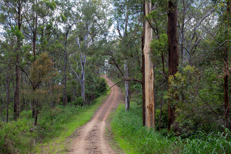 |
Rising over a hundred metres above the creek, now completely hidden, I reach the end of the firebreak, greeted by a T intersection where the four wheel drive track known as Boundary Road runs along the top of the ridge. From here I turn right to follow the ridge uphill, where the occasional cyclist or long distance jogger passes me on this otherwise unused dirt road. |
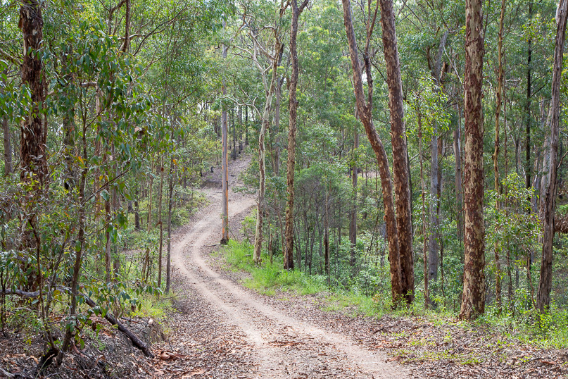 |
Boundary Road track continues to gain elevation as I slowly approach today's destination. The ridge continues ascending towards the top of the range at Mount Nebo. The occasional firebreak and track crosses this track, forming a labyrinth of walking wonders of over seven hundred kilometres in this national park. With a mission to achieve, I resist the call of these side tracks as I continue onwards and upwards. |
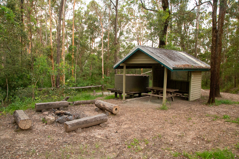 |
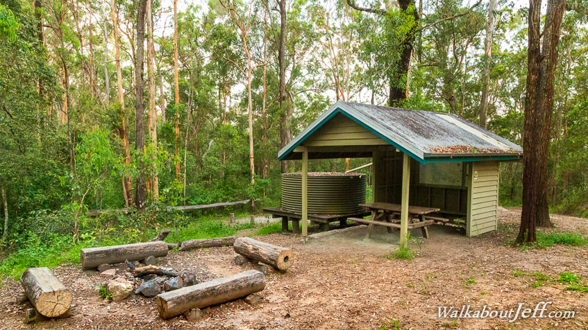
The sun is sinking low when I finally reach Scrub Road Remote Bush Camp. It is perched atop a four hundred metre high rounded hill covered in the same eucalytus forest I have been hiking through all afternoon. Here I pitch my bivvy tent near the rustic shelter before following a side track down to the headwaters of Enoggera Creek. Upon returning I relax and cook dinner in the shelter. Tonight is the first of several nights' solitude as I traverse the length of D'Aguilar National Park. |
|