Introduction to today's journey
TODAY'S journey returns to the Caboolture River to begin this leg heading northward through the Glasshouse Mountains. I hike through Caboolture as the sun rises continuing along the road through forest rising over Round Mountain, then climbing to the summit of Mount Elimbah. Once down off the hill, I continue following the road until it becomes a dirt track through the Beerburrum State Forest. Here I head towards the twin peaks of Mount Tunbubudla crossing the saddle between them. From there I return to the Beerburrum State Forest and follow the trails eastward to Beerburrum Village.
Distance hiked today: 27.3km
Total distance hiked: 242.0km
Today's Journey
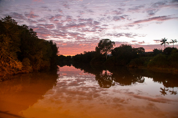 |
I start this leg at the same place I had finished the last leg at the Caboolture River. Here I watch the dawn over the water dirty from recent major flooding before setting off towards the Glasshouse Mountains. |
 |
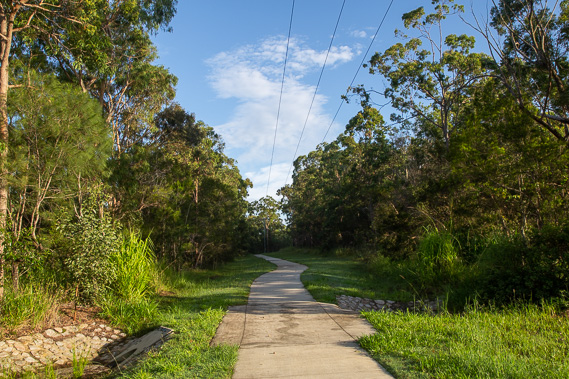
I depart the river and head northward through the town centre in the early morning of what looks like a fine day with some lingering cloud. |
 |
The footpath goes through Caboolture and continues following the road towards Elimbah, crossing the side of Round Mountain, the first hint of the Glasshouse Mountains featuring in this leg. |
 |
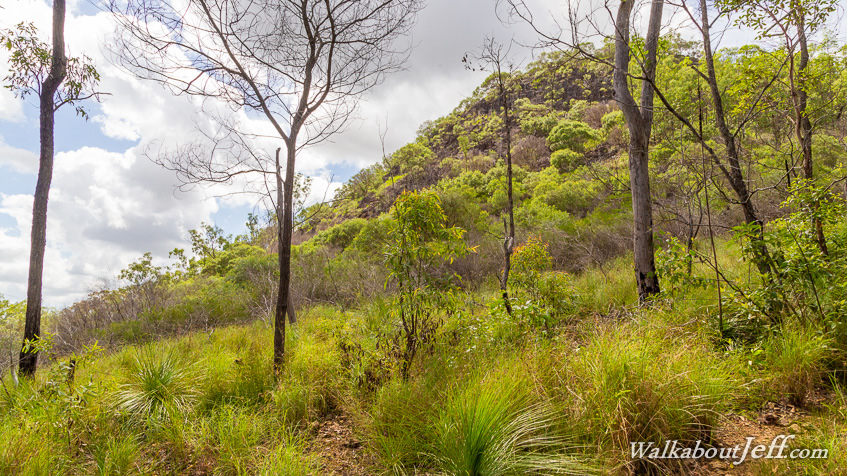
I reach Mount Elimbah and climb its 109 metre high summit in the mid to late morning. This is the first of the Glasshouse Mountains, remnants of a group of volcanoes that erupted here 22 million years ago. |
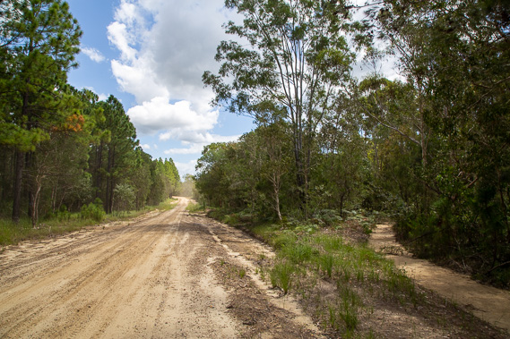 |
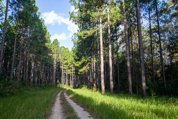
After climbing Mount Elimbah I return and continue following Old Gympie Road as the sealed surface turns to gravel, then to dirt passing through alternating native and pine forest in the Beerburrun State Forest. |
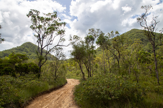 |
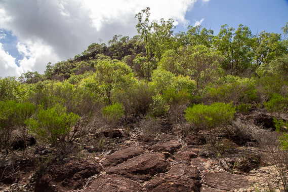
I divert from what's left of Old Gympie Road following a track across the saddle between the twin peaks of Mount Tunbubudla. The eastern peak rises to 338 metres above sea level. The saddle is 129 metres above sea level, the track a little rough in places from erosion but otherwise easy to navigate. |
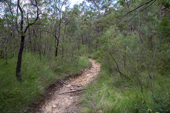 |
After resting at the saddle, I continue following the track down the gully on the other side. It is well marked but badly eroded in places from last week's rain. Fortunately this track is open, but many others in South East Queensland are shut due to being badly damaged. Thankfully I've completed the D'Aguilar Range where many tracks are closed with some areas there getting up to 1500 millimetres of rain in three days last week. |
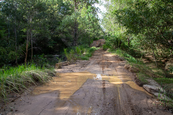 |
The track eventually rejoins Old Gympie Road which I continue following for a short distance before turning off on another track towards Beerburrum. This part of the road is boggy and badly eroded with a couple of trees fallen over it now making vehicle access impossible. Four wheel drive vehicles make it up to here but have to turn around as they can proceed no further. |
 |
After following an old track, I reach one of the main forestry tracks going through the tall pine forest towards Beerburrum as the sun sinks low behind me. |
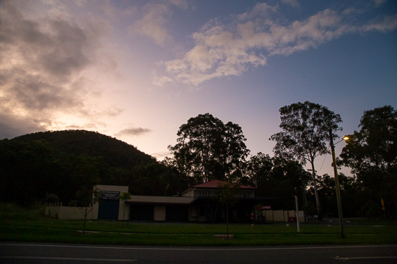 |
I reach Beerburrum at around sunset. The village sits under the shadow of Mount Beerburrum which I will be climbing tomorrow morning. |
|