Introduction to today's journey
Today's journey starts in Mooloolah Village heading into Dularcha National Park following the old railway line through the long abandoned trail before following the Roses Road track up a ridge heading up the southern end of the Blackall Range with a bit of a road hike up to the Mary Cairncross Scenic Reserve where I explore the rainforest before passing rolling farmland into Maleny.
Distance hiked today: 25.0km
Total distance hiked: 336.4km
Today's Journey
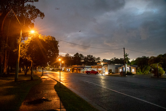 |
Dawn breaks through rainy skies at Mooloolah Village as I depart to head up the Blackall Range. |
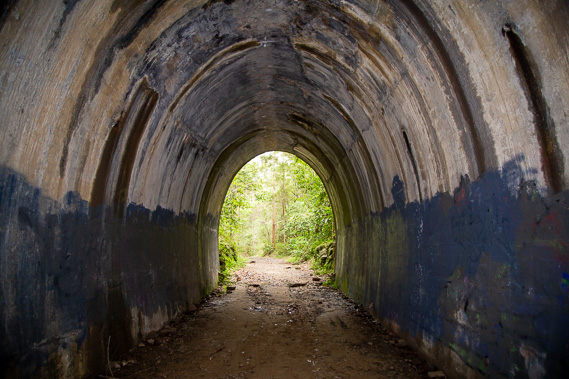 |
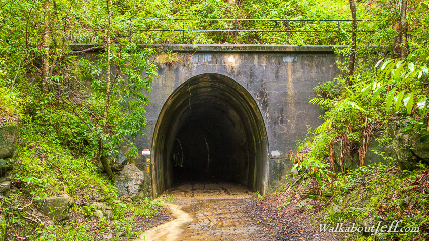
Leaving the village, I follow a trail along the old railway line into Dularcha National Park, reaching the old train tunnel built in 1890 and used until 1932 until the new railway was built through the next valley. It was used for growing mushrooms in the 1940s but has remained unused ever since. |
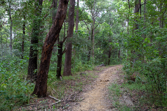 |
After passing through the tunnel, a track takes me up to the ridge above it. Here I follow the Roses Road circuit up the ridge beginning the long climb up towards the top of the range. |
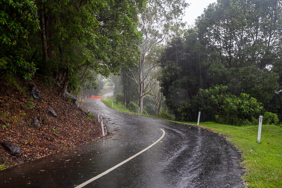 |
The track eventually ends at Old Maleny Road, closed to traffic these days. I follow it to the busy Landsborough-Maleny Road, then along Howard Road back on the original route up the mountain. Part of the road is closed to vehicles due to a small landslide from the recent rains. |
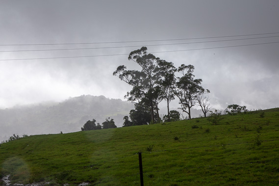 |
I continue ascending along the road as thick cloud envelopes the range and rain falls. The terrain moderates into rolling hills of dairy farming. |
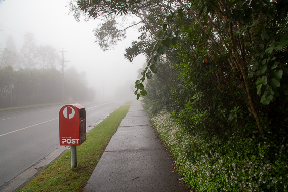 |
Reaching the top of the range, the cloud forms a thick humid fog as I follow the path beside Mountain View Range towards Maleny. The thick fog conceals any views back into the Glasshouse Mountains today. |
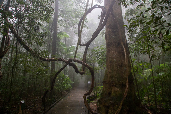 |
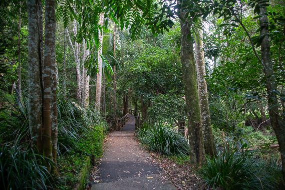
Most of the range has been cleared, but I divert to follow a circuit around the Mary Cairncross Reserve where the original rainforest has been preserved, looking eerie in the dense fog. A couple of centuries ago the entire range would have been like this. |
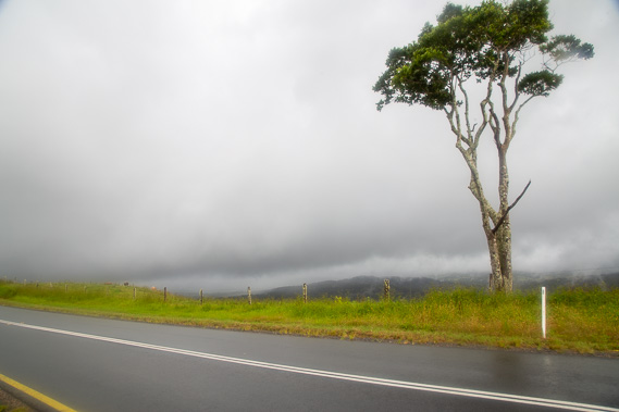 |
After completing the circuit, I continue following Mountain View Road along the top of the range passing through lush farmland. Here I pass the tree at the top of One Tree Hill. |
 |
The cloud eventually clears as I reach the Maleny Showgrounds from where the Maleny Trail begins, the first couple of hundred metres follows Obi Obi Creek towards the town centre. |
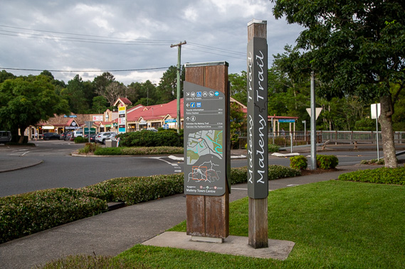 |
I reach the town centre shortly after sunset and settle here overnight. Once a forestry and dairy servicing town, it is now a popular tourist town. |
|