Introduction to today's journey
Today's journey commences at the start of the Sunshine Coast Hinterland Great Walk at Baroon Dam, following Obi Obi Creek downstream through the gorge before following Skene's Creek upstream to Kondalilla Falls. Upon reaching the top of the waterfall I continue following the track through the village of Flaxton before re-entering the bush and heading to Flaxton Walkers' Camp for the night.
Distance hiked today: 16.8km
Total distance hiked: 378.6km
Today's Journey
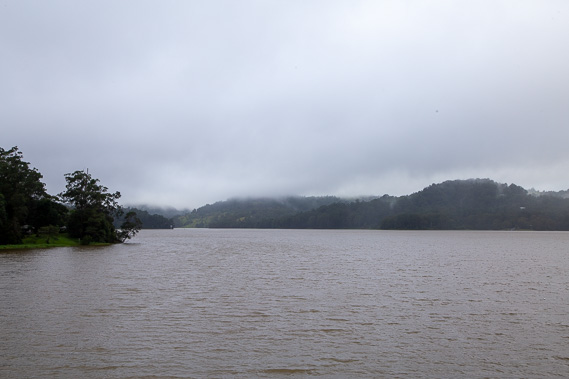 |
A lot of rain has fallen overnight. I start the day at the edge of Lake Baroon as thick clouds hug the hilltops and more rain threatens. |
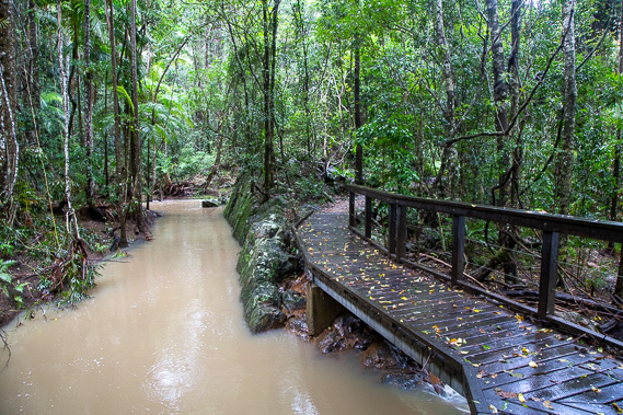 |
Entering the nearby Kondalilla National Park and setting off along the Sunshine Coast Hinterland great walk track, I pass swollen streams through the rainforest. The national park was declared in 1945 and the area has been protected as a reserve since 1906. |
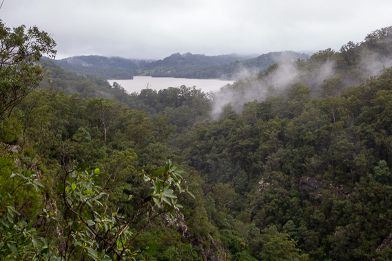 |
The track climbs to a lookout over the Obi Obi Gorge, with a view back to Lake Baroon in between rain squalls. |
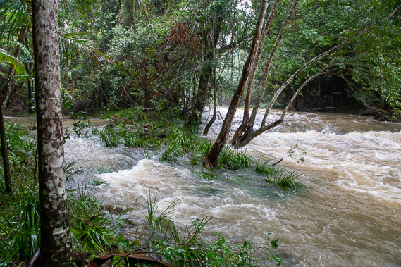 |
The track descends along numerous switch backs down to Obi Obi Creek which as expected, is running a lot higher than usual. Fortunately the track is dry save for a few streams cutting across it and one large landslide from earlier this year which stopped just metres short of wiping out the track. |
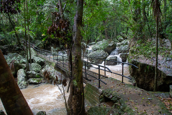 |
After continuing to follow Obi Obi Creek downstream, the track turns to follow Skene Creek (named after the original owner of this area of land) upstream through very dense rainforest, crossing it over a bridge near the bottom of Kondalilla Falls. |
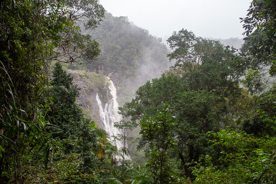 |
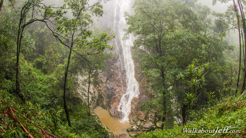
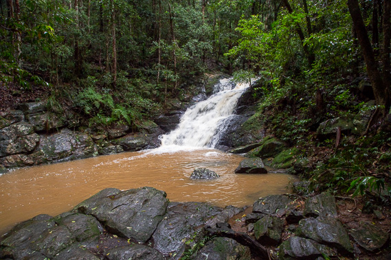
The track ascends the very steep terrain with several views to the spectacular Kondalilla Falls plunging 91 metres into the valley below. Kondalilla is the local Aboriginal word for rushing water. |
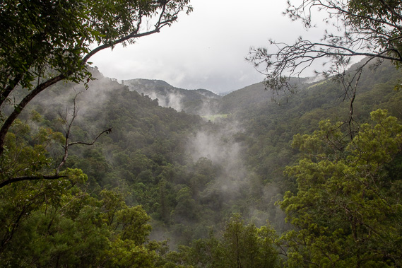 |
From the top of the falls I head up a little further to the lookout, where I can see down the misty Skene's Track valley into Obi Obi Valley which flows to the right to form some of the headwaters of the Mary River. The rain has stopped falling and the cloud is already starting to clear. |
 |
I continue following the track through the forest reaching Pencil Creek (which flows into Skene's Creek a little before Kondalilla Falls. A bridge crosses the creek just below this pretty waterfall. Shortly after the waterfall the track reaches a picnic ground and follows the road into nearby Flaxton. |
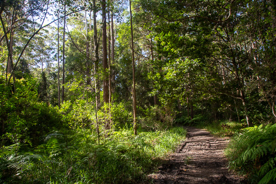 |
The cloud clears and the sun comes out as I follow the path through Flaxton. It is mid afternoon when the track once more enters the forest back in Kondalilla National Park going about a kilometre along the muddy track towards Flaxton Walkers' Camp, the first of three camping grounds along the great walk. |
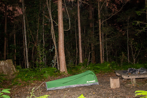 |
Once I arrive at the camping ground, I set up the swag and settle in for the clear night with stars peeking through the cedar forest canopy. |
|