Introduction to today's journey
Today's journey departs Kauri Walkers' Camp heading north through the dense forest to the very pretty Lake Poona before continuing north to almost the edge of the Cooloola Sandmass. From there I follow the old Telegraph Road through the forest to Carlo Sandblow before descending into Rainbow Beach where I complete this leg, and complete the first section of this trek having hiked over six hundred kilometres from Brisbane over 26 days.
Distance hiked today: 19.0km
Total distance hiked: 604.1km
Today's Journey
 |
Setting off from Kauri Walker's Camp in the early morning, the track descends through cedar forest with a carpet of bracken undergrowth as steady rain falls. |
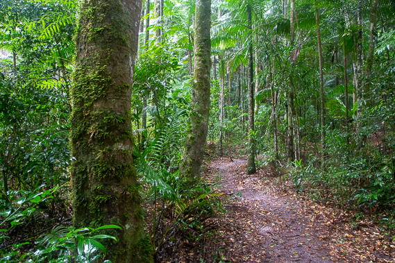 |
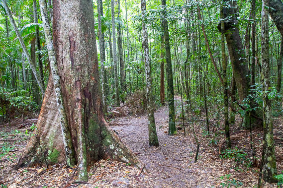
Having dropped over a hundred metres, the track follows the Freshwater Valley through dense rainforest sheltered by the high sand hills on either side. The dunes which this forest sits atop are hundreds of thousands of years old. |
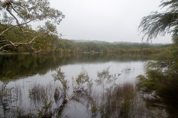 |
Upon reaching the top of the valley, it suddenly opens out into the beautiful Poona Lake, a window lake nestled amongst the dunes 160 metres above sea level. Thick cloud hugs the tops of the hills even though the rain has now stopped falling. I rest at this beautiful lake which is quite swollen with its golden beaches completely submerged from all the rain earlier this year. |
 |
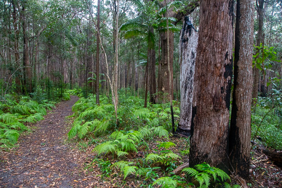
From the lake the track rises continuing northward through the dense rainforest growing in the sand hills. I am now about 230 metres above sea level, amongst the highest hills in the sandmass. These hilltops are quite flat and the tall forest is thick preventing any views of the surrounding areas. |
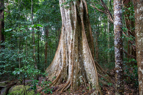 |
Some of the trees here are spectacular specimens, being hundreds of years old. The track gradually descends through the rainforest as it gradually morphs into dry eucalypt forest. |
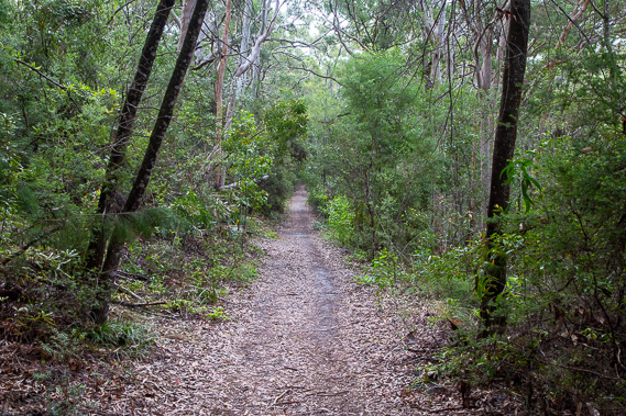 |
Eventually the track meets the old Telegraph Road which runs through the scrubby eucalypt forest along the tops of the sand hills just before they suddenly drop into the sweeping Rainbow Beach. This track rises and falls over the sand hills rising to 160 metres dropping to about 30 metres several times as I head westward approaching the end of the Cooloola Great Walk. |
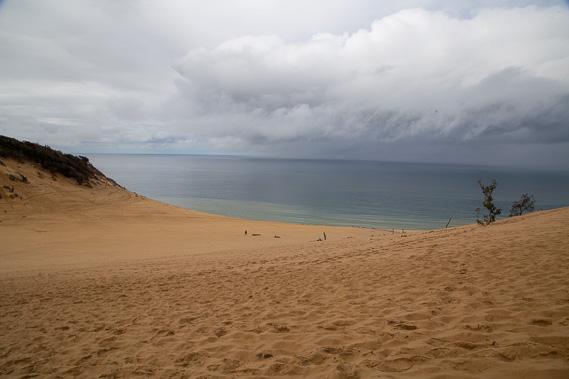 |
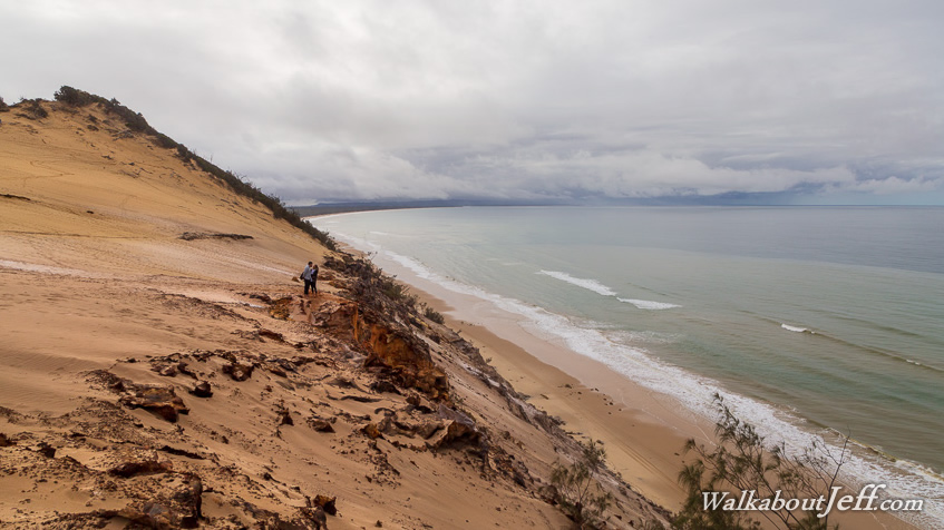
The forest suddenly clears when I reach the impressive Carlo Sandblow. From here I get my first view of the ocean above Rainbow Beach. |
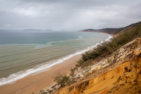 |
I descend the sandblow to the edge of the cliff over Rainbow Beach. Here I look eastward towards Double Island Point where rain is falling. The eighty metre high cliffs below me are too steep to descend, but returning up the sandblow there Cooloola Great Walk continues and finishes at a nearby car park from where I follow a road descending into Rainbow Beach village. |
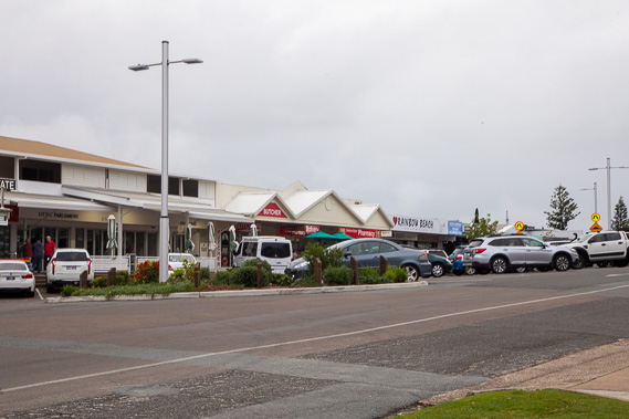 |
I reach civilisation at the busy Rainbow Beach village having hiked through a residential area descending from the end of the Cooloola Great Walk track. It is strange to be back in civilisation not having seen a sealed road since Kin Kin-Gympie Road 95 kilometres behind me and the first shops I have seen since departing Eumundi. |
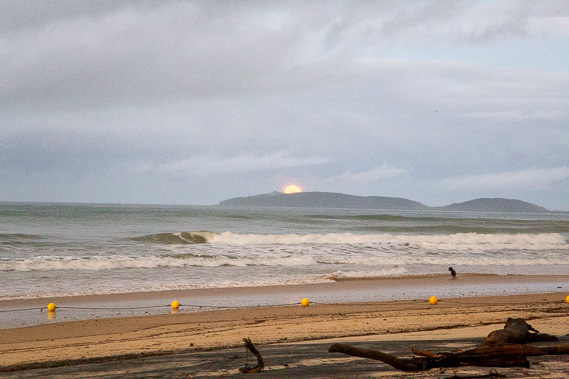 |
From the village, I descend the stairs to the beach where I complete this leg having hiked 163 kilometres from Eumundi, and also complete the northern inland section of the South East Queensland Trek having hiked 604 kilometres from Brisbane. Here I sit on the beach and watch the sun set behind me and the full moon rising over Double Island Point. |
|