Introduction to today's journey
Today's journey takes us inland a short distance to do a hike in the Hanging Glacier area, where we follow the river upstream to a glacial lake. Returning along the track I get a glimpse of the hanging glacier under the thick cloud. From Hanging Glacier, we contine along the road heading northward through Puyhuapi following valleys of spectacular rivers in between tall mountain ranges until eventually reaching a camping ground above the Futaleufu River.
Today's Journey
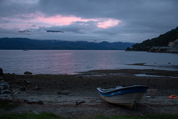 |
A purple sunrise shortly before leaving our camping ground to follow the road a couple of kilometres in the direction we had come yesterday. We turn off along a gravel road and park in the forest near a national park entry point. |
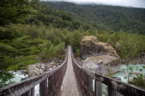 |
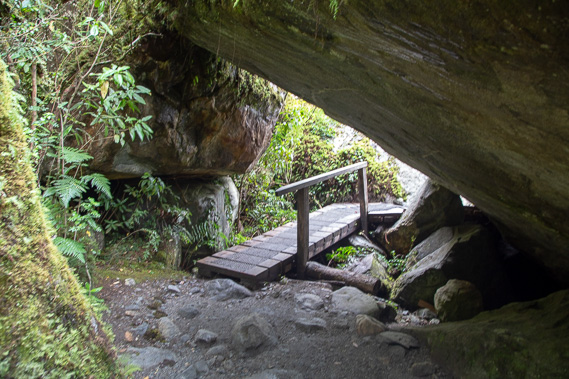
We follow the track through the beech forest before crossing this elaborate wooden swingbridge over a cascading river amongst enormous boulders. |
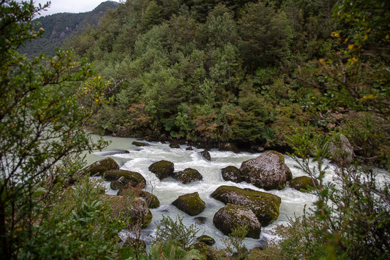 |
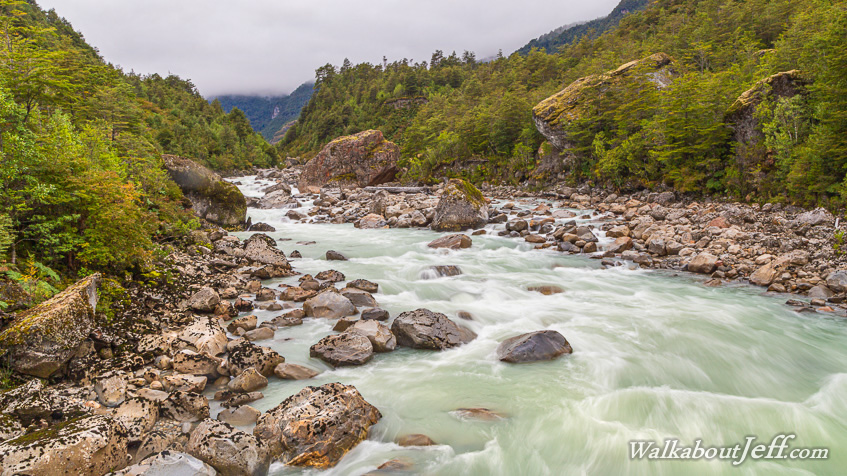
Following the glacial river upstream as it swiftly flows amongst the giant boulders. The track negotiates its way through more boulders brought down by past glaciers from the tall snowy mountains hidden above the cloud. |
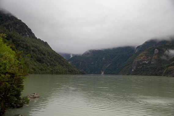 |
Reaching the lake from where we can just see a waterfall plunging out of the clouds from a hanging glacier which is hidden today by the cloud covering these spectacular mountains. |
 |
Returning along the track weaving its way through the boulders deposited by past glaciers. This area is now temperate rainforest with this side of the Andes getting a very high rainfall at these latitudes. |
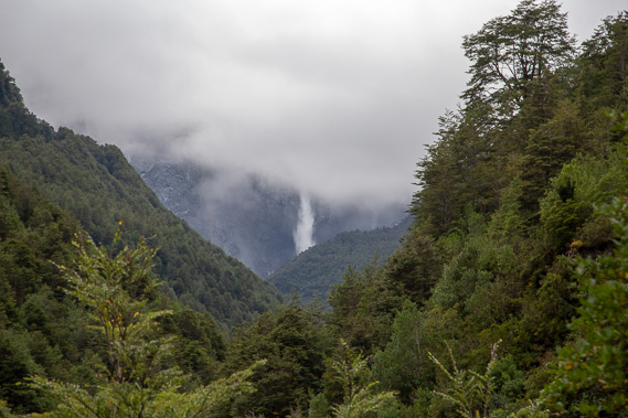 |
I climb to another viewpoint from where I get a better view of the waterfall silently falling from the clouds, draining the hanging glacier hidden in the clouds. |
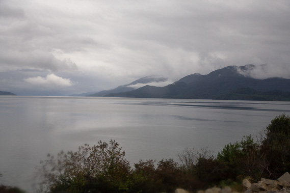 |
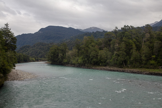
We return to the truck for an early lunch before heading northward along the top end of Puyuahapi Fiord. Here we are at the top of the fiord looking along its long channel running parallel to the coast. |
 |
After crossing a low saddle, we reach the Rio Palena and follow it upstream through the rugged mountains. |
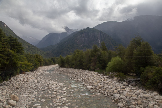 |
Crossing over the Rio Palena again having travelled much further upstream. From here we rise above the river crossing a low saddle into yet another valley. |
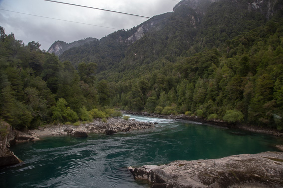 |
After passing a large swampy area we start following the magnificent Rio Futaleufu upstream as it weaves its way through a deep gorge between the towering mountains. Here we cross the river a few minutes before reaching Camping Cara del Indioa with spectacular wooden chalets. We are stopping here for two nights. |
|