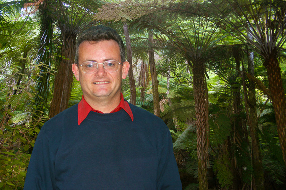
Introduction to today's journey
Keep close to nature's heart, and break clear away, once in a while, and climb a mountain or spend a week in the woods. Wash your spirit clean.
- John Muir.
ALTHOUGH the park is named after Dutch explorer Abel Tasman, one of the first European explorers to discover New Zealand, he saw very little of this spectacular coast. The famous explorations of Captain Cook two centuries later did not map the area very well as they passed Tasman Bay in thick overcast weather and unfavourable winds preventing him from entering the bay. Cook named the area "Blind Bay" and made only a very approximate sketch of the bay on his maps. The first early exploration was done by French explorer Dumont D'Urville who sailed along the coast of Tasman Bay in January 1827, mapping much of it, replenishing his supplies, and naming many of its features. He had good relations with the Maori people who had lived in small settlements along the coast for centuries past. The proximity of the area to the west coast greenstone fields and other natural resources made this a volatle area for the Maori people, with several invasions from different tribes over the years before European discovery.
Today's trek is mostly a boat journey along the coast starting from Kaiteriteri south of the park. The cruise enters the park off Sandy Bay, going through the Astrolabe Roadstead into Torrent Bay, then heading further north where I'm dropped off at Bark Bay. Here I set up camp and spend the rest of the day exploring the estuary.
Today's Journey
Distance trekked today: 2.2 kilometres.
Total distance trekked to date: 2.2 kilometres.
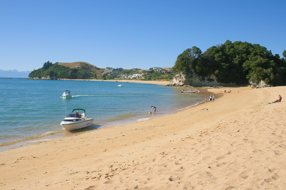 |
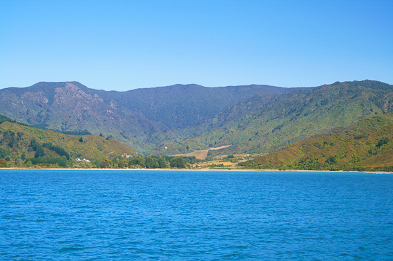
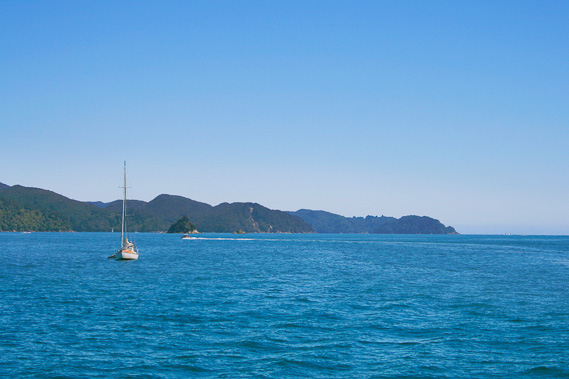
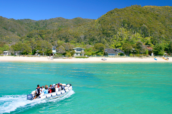
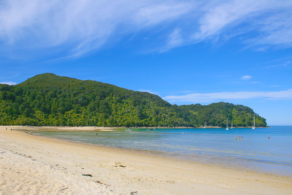
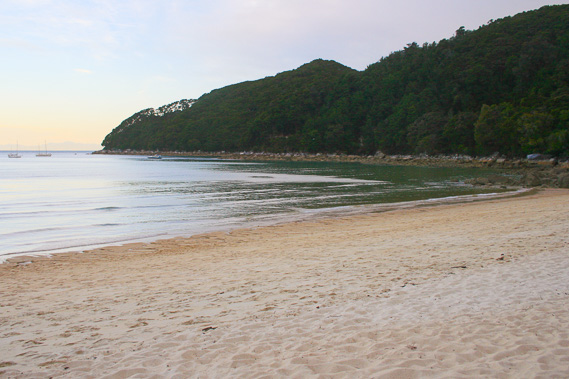
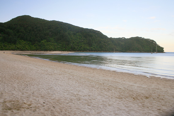
09:20 - I arrive at Kaiteriteri in mid morning. This is probably the most popular beach on the South Island. A few people are out on the beach watching over the small wavelets breaking on the golden sand. The tide is very low but already rising. The bay is cut off at either end by beautiful granite headlands. A bluff in the middle jutts out into the water cutting the bay in half. The headlands contain remnants of the forest once draping the hills now covered in large holiday homes. The name Kaiteriteri means to eat very quickly. One legend is tells of the local Maori having to eat quickly due to an earthquake causing boulders to tumble down the hills. This small bay nearly became the permanent settlement of Nelson City when the area was first colonised by white people. The rugged terrain surrounding the bay made the settlers change their mind and settle in a more liveable valley on the other side of the bay which eventually became the port and city of Nelson.
|
 |
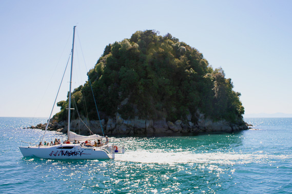
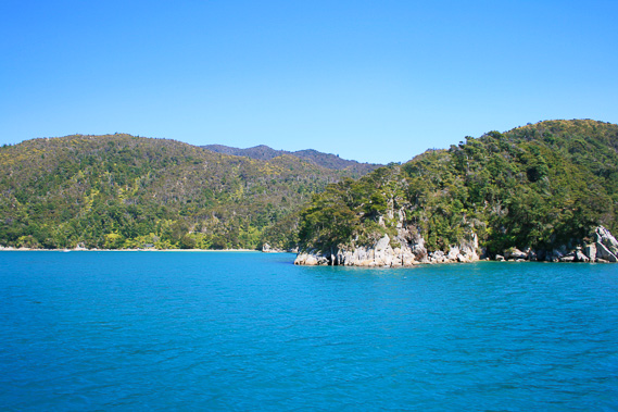
10:05 - The boat arrives. It is an odd shaped boat of two levels, the top level being an outside observation deck. By now quite a group of us is assembled here ready to venture into the park. I join them in walking up the long gang plank onto the boat. Once aboard I walk through the cabin to the stairs heading up to the upstairs deck. Minutes later with everyone on board, the boat’s deep rumbling engines start. The gangway lifts off the sand and the turquoise water turns purple with increasing depth as we depart the beach. We proceed around the northern head of Kaiteriteri, with the sun fading out the mountain range going behind Nelson unseen over the horizon tapering off gradually into the Marlborough Sounds and re-emerging as D’Urville Island in the far distance to the north east. Several small boats are anchored safely under the shelter of the rocky forest covered headland.
|
 |
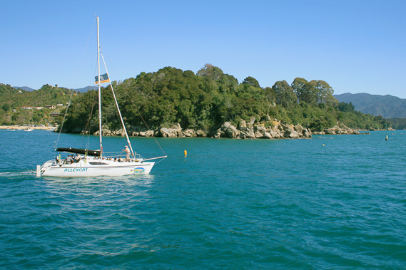
10:07 - The boat overtakes a yacht running under motor as we pass the rocky headland, separated from the mainland by a narrow channel. The channel is so narrow that you can only safely kayak it at high tide negotiating your way around rocks just submerged or sticking above the surface, something I have done before. |
 |
10:10 - We pass Ngaio Island, a scrubby outcrop with three obvious boulder patches near the top. Ahead of us is a long ridge towering to about a kilometre high marking the start of the Abel Tasman National Park. Between us and the ridge is a much lower ridge ending in a headland we are heading towards. Large pale granite rocks cover the headland which sweeps back towards a golden sandy beach. There are numerous kayakers paddling here. |
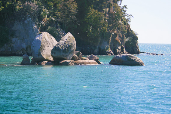 |
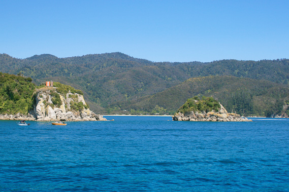
10:12 - We aim towards a rocky area near the beach. The quickly rising tide has already hidden much of the rocky formation. The top of the formation is well out of the water though. It is an almost perfectly spherical rock that has split in half almost down the middle. This is known to the locals as Split Apple Rock. It uniquely sits upon a platform of numerous other granite rocks. The stresses of its irregular base has caused the enormous boulder to split in half. The rock itself has a diameter of about four metres.
|
 |
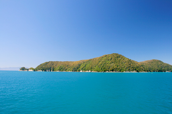
10:18 - After a brief stop at Split Apple Rock, the boat leaves the small bay rounding the point. Here we can now clearly see into the Astrolabe Roadstead. The dark green forested hills sweep around diminishing until being cut off by the higher Adele Island. Before we can enter it though we have a wide bay to cross, the bay of Marahau, meaning windy valley. From here the valley seems to penetrate a long way back to the base of the kilometre high mountains at the back, but only a few hundred metres away is the start of a large tidal flat. |
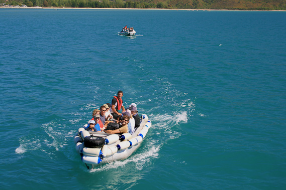 |
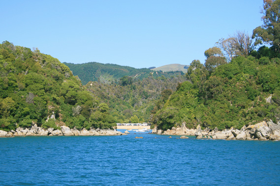
10:21 - At the back of the tidal flat is a small beach which we can see, and a row of small houses. From there two large dinghies are approaching our boat. We stop in the middle of the bay as the first dinghy approaches the port side of the boat. It lets the eight or so passengers on board before getting attached to the stern of the boat whilst more passengers board from the other dinghy. |
 |
10:37 - Once everyone is aboard, the boat continues crossing the purple waters of the bay heading towards Astrolabe Roadstead. As we approach the other side of the bay, it becomes apparent the forest on this side of the bay is little more than scrub, having formerly been a pine plantation, cleared some ten years ago. Thick scrub is growing back here, but it will be a long time before it will be restored to native forest. The estuary at the back of the bay marks one of the ends of the coast track. This is where I will be ending this trek. |
 |
10:38 - Below the scrub a small strip of yellow golden sand appears. This is Coquille Bay, the first of the many beautiful golden beaches in the park. Coquille is named after one of Durmont D’Urville’s two ships. He was the first explorer to chart this area in 1827. |
 |
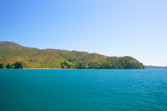
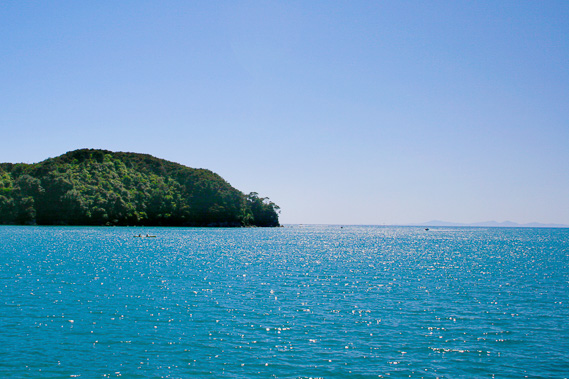
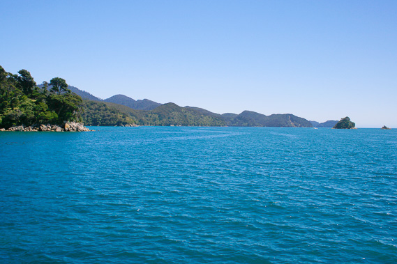
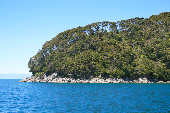
10:40 - Directly ahead of us stands Guilbert Point, the entrance into Astrolabe Roadstead. This marks the beginning of the park, and what has oftentimes been my escape from civilisation. I recall back to my student days, often hiking in the park for up to a week at a time to get away from it all and recharge the mind. The boat changes course to head directly into the roadstead, with the mainland South Island on one side, and the two sheltering islands of Adele Island and Fisherman Island on the other side. Fisherman Island appears for the first time having been hiding in front of Adele Island. It is a very small forested islet obviously with no running water streams, so it is not the place to be marooned. Beyond Fisherman Island is Adele Island, a much larger forested island with two peaks. It is named after D’Urville’s wife. We pass Guilbert Point. Its very steep forested sides plunge deep into the translucent blue water below, with just a row of granite boulders separating the water from the regenerating forest.
|
 |
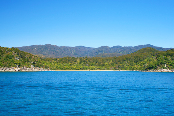
10:44 - Coming around the point a long bay of pale yellow sand stretches out along the base of the rugged terrain to a ridge abruptly cutting it off at its far end. A group of kayakers are heading towards the beach having just rounded the point. This is the curiously named Appletree Bay - there are no apple trees growing here. As we pass the bay a narrow valley opens out towards the far end of the beach, through which any water from the forested tops of the main ridge drains. Dense beech forest fills the valley, a refuge which has escaped the ravages of clearing. |
 |
10:49 - Once past Appletree bay, we pass the next headland to the following beach, Stilwell Bay. The beach is reduced to a thin strip of sand quickly disappearing under the rising tide with thick rainforest above it. At the end of the bay is Yellow Point, named after the yellow lichen growing on the exposed rock at the end of the point. Stunted scrubby trees grow above the exposed rock. The point separates Stilwell Bay from Ackersten Bay now coming into view. |
 |
10:51 - Several small bays appear beyond Ackersten Beach. The first of these is Observation Beach where D’Urville conducted some astronomical observations. This is followed by Cyathea Cove named after the tree ferns growing in its gully, and finally the tiny beach of Watering Cove, where D’Urville had replenished the diminishing water supply of his ship. |
 |
10:52 - We approach the headland of Te Karetu Point entering the start of what local boaties and kayakers call the Mad Mile, a stretch of water notorious for strong winds, strong currents and heavy swells, with nowhere to safely land. The boat begins heaving in the swell. On land the forest cover becomes scrubby, regenerating from farmland which once covered these hills before it was reclaimed as national park. There used to be a Maori village along the top of these hills. Apparently it was a good location from where the locals would catch fish. Despite that the granite soil was very infertile, so it would have been hard to live here. Although the hills are low, they are still clear of any debris rolling down the hills during earthquakes and above the height of most tsunamis cashing onto shore. The high range of hills above the headlands, and Adele Island on the other side of the roadstead provide reasonable shelter from the most severe north westerly and southerly storms. It is still an exposed place to live though.
|
 |
10:54 - On the other side of the roadstead, the large rocky northern headlands of Adele Island appears, very windswept and exposed. Looking back into the Astrolabe, I can see right through it, with the towering Mount Campbell made of marble in the distant background now merging quite nicely with the ridge going down to Guilbert Point. In the far distance southward I only just make out the jagged peaks of the Southern Alps, over which middle level cloud is beginning to form. |
 |
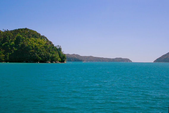
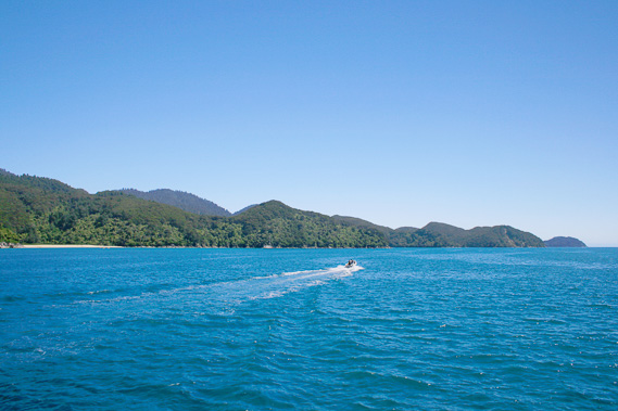
11:01 - Once around Te Karetu Point, we have a clear view up the coast, all the way to Tonga Island and the Awaroa heads beyond. The forest covered hills sweep back rising from their rugged headlands. We are not clear of Mad Mile Yet, but we can at least see the end of it at Pitt Head.
|
 |
11:02 - The rocky hills to the left suddenly open out into a deep cut bay – this is Te Pukatea Bay. The headlands came close together giving the bay its distinctive horseshoe shape. This could have been where the Maori canoes would have beached with tracks heading to the nearby villages. |
 |
11:03 - A little past Te Pukatea Bay we reach the very rocky headland of Pitt Head, the official end of Mad Mile. A couple of small boats are fishing in the rough water. A small island lies off the end of the point, with a notorious channel between them where numerous boats have come to grief over the years. We pass around the island, but looking though the gap a large bay is opening out which the boat is gradually turning into. |
 |
11:04 - The swell instantly subsides as the boat round Pitt Head to enter Torrent Bay. The small waves on the translucent blue water is enough to completely rule out any reflections of the barren scrubby land ahead. Very small tracts of forest still grow on the deepest gullies and steepest headlands. Otherwise the hills are sparsely covered with regenerating scrub over what had once been farmland back in the days when the long sweeping beach ahead of us used to be known as Brown’s Bay. When the land here was sold to the government to become part of the national park, the bay was renamed The Anchorage, as it was the perfectly sheltered place to anchor your boat.
|
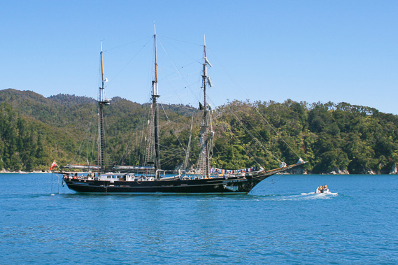 |
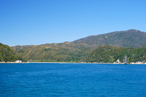
11:06 - We pass close to the tall ship. This is the Spirit of New Zealand, a large ship giving young people opportunities to experience life at sea. It is anchored here in the middle of the bay. I look back at Pitt Head, which now hides the mountains on the other side of Tasman Bay. These mountains are the link between the Southern Alps and the Marlborough Sounds, creating a barrier between this coast and the North Island. The North Island sweeps across the entire bay unseen far over the horizon creating relatively safe waters in what is otherwise treacherous oceans on either side of the island. The Tasman Mountains provide shelter to the west, and the Marlborough Sounds to the East. Here at the Anchorage, the water is usually calm.
|
 |
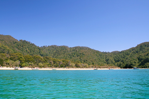
11:08 - We approach the beach at Anchorage, where the first of several huts along the walking track lie mostly hidden in the tall manuka scrub. The only sign of its existence is an array of solar panels mounted on a couple of posts and a dark entrance towards the hut if you know where to look. I will be staying at this hut on my final night on the trek. The entrance to the hut stands on one end of the kilometre long beach, near a low bluff in between the two swampy streams which flow onto the beach. The beach sweeps to the right over a kilometre to a one hundred metre high forested hill separating it from the tidal mud flats of the Torrent River.
|
 |
11:15 - The dinghy drops off a few people on the beach before we set off again, this time heading around the hilly point at the far end of the beach towards Torrent Bay beach. Behind the beach a few houses are visible, part of Torrent Bay village, one of three small communities along the length of the coast. The village sits on the sand bar at the mouth of the Torrent River. |
 |
11:16 - The tide has risen three metres this morning, though it still has over a metre to rise. The mouth of the Torrent River is deep with a blue channel of water flowing in and covering the mud flats. Scrubby hills tower steeply behind the back of the estuary. The shallow water of the bay has a delicious turquoise colour. |
 |
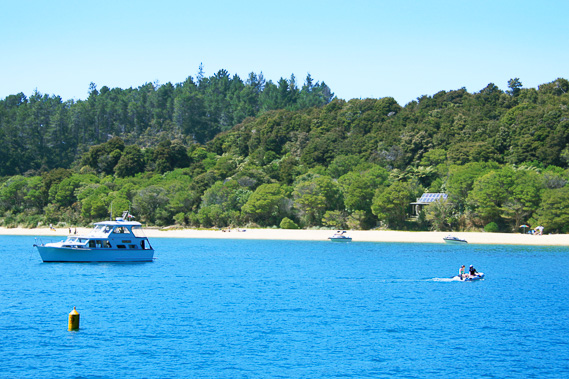
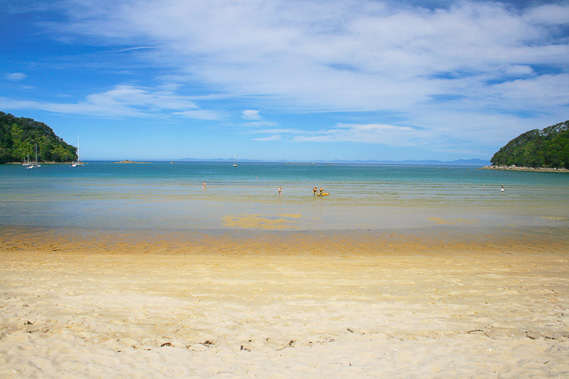
11:20 - We stop fifty metres offshore from the village. A dinghy full of people heads to the beach. From here they will explore the track on a guided walk. Luxurious accommodation awaits them before they start trekking tomorrow. It is very peaceful here with the boat still in the water with the most gentle of swell. The only sound is the humming engine of the dinghy slicing its way through the crystal clear water. From here I see the far end of the beach of Anchorage now two kilometres distant, and Pitt Head just a kilometre directly offshore. A short distance away stands the lonely rocky pinnacle of Ballon Rock, with a few stunted trees clinging onto life on its rocky summit. A large scrubby headland blocks off the end of Torrent Bay from Boundary Bay, the next beach. With the tide in, the beach is split in half. Boundary Bay marks the political end of Tasman Bay and the start of Golden Bay. The geographical boundary is much further up the coast at Separation Point where I am hoping to get to in two days' time.
|
 |
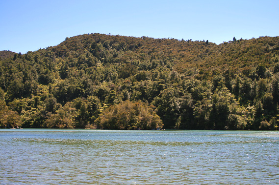
11:39 - With the dinghy still on the beach, we set sail again heading further up the coast. For the first time now it becomes apparent all the hills are leaning over about fifteen degrees indicating the inland side of the granite batholith has lifted higher than this side. There seems to be a very hard layer deposited at the level of the summits of the hills, then softer layers underneath where the rivers and streams have carved their way through the rock. Rounding North Head, at the end of Torrent Bay, we begin to pass more beaches. Here it seems distinctly more remote with the forest coverage being more substantial now.
|
 |
11:41 - We pass Frenchman’s Cove, which I know has a beautiful lagoon behind it which I will later see from the track. From here offshore at sea level the lagoon completely eludes us. A valley goes deep behind the bay. Passing another headland we reach Sandfly Bay, where Falls River flows out from behind the beach through a very deeply scored valley. Offshore on the other side of the boat is Pinnacle Island, a scrub covered triangular island. |
 |
11:42 - The dinghy catches up to us, but instead of attaching itself to the back of the boat, it continues heading up the coast, no doubt to the next stop where I will be getting off. |
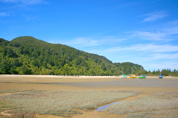
 |
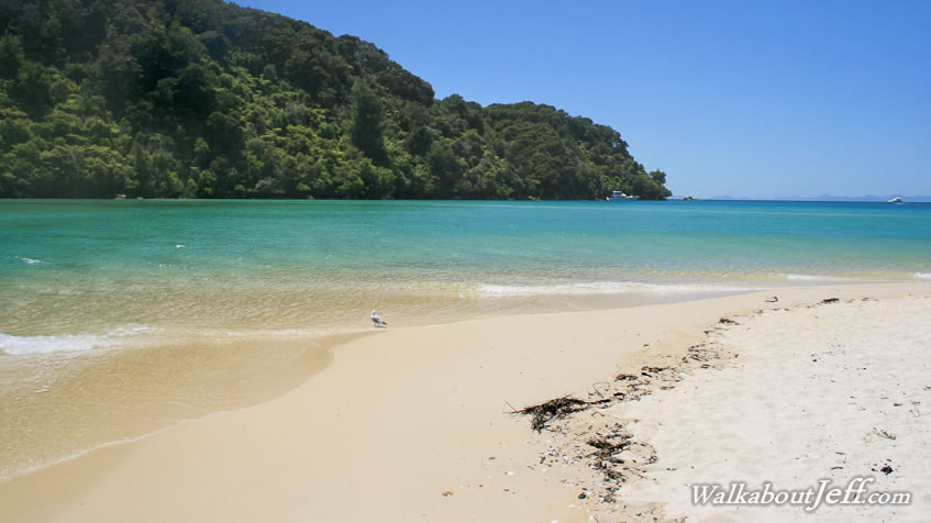
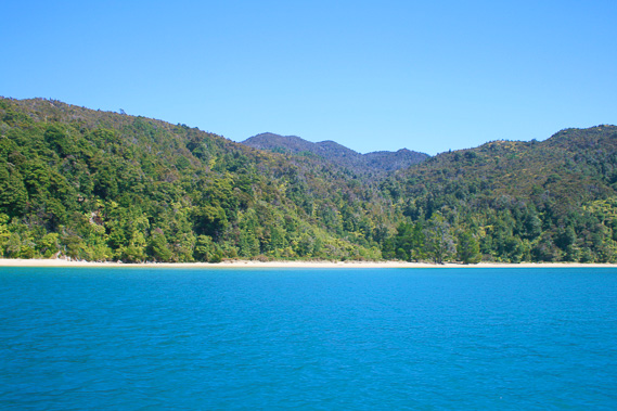
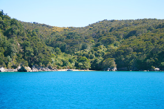
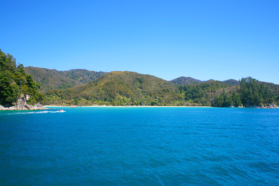
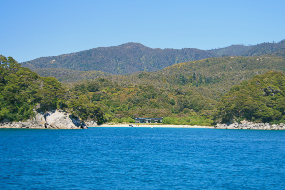
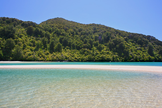
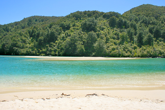
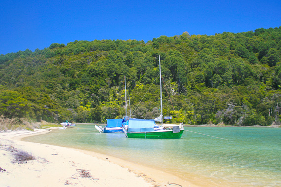
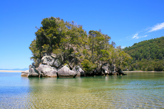
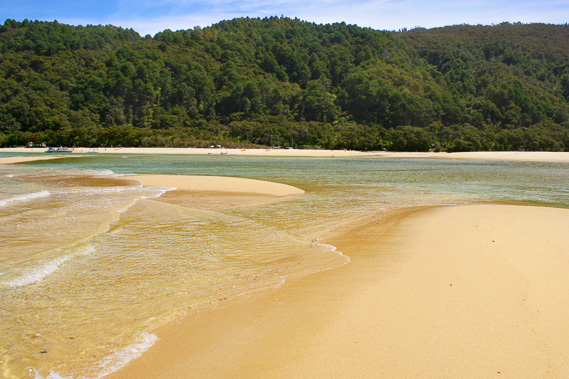
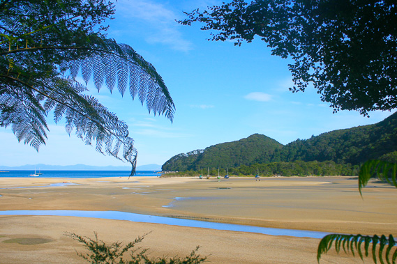
11:47 - We pass another low scrub covered headland to enter my destination – Bark Bay. In my opinion this is one of the most beautiful beaches on the planet. A spectacular creamy white beach spreads out across the bay about a kilometre inland from the two headlands. To the left, about half way in from the headland is another small beach, Medland’s Bay (also known as Meddy's Beach), looking very remote with the dense rainforest rising steeply above it. |
 |
11:50 - The water turns turquoise as the boat reduces its engines. A few other boats are moored along the waters edge. A row of manuka trees cover the sandspit above the beach now appear clearly in view above the densely forested rolling hills beyond. The boat stops and I climb down picking up my pack and climbing onto the dinghy which has just returned from picking up a few people. I climb on board with two others and it motors gently towards the beach.
|
 |
12:22 - The tide is very high, not leaving much of the beach at all. Fortunately there are no large waves breaking on the beach as often occurs here. I get off the boat and walk the three metres to the camping ground and quickly looked around for a good spot under the manuka trees. Being a relatively busy time of the year, several tents are already pitched here. Some are occupied, but overall it is quiet here. A few small camp fires are up using besser blocks, and a few piles of firewood are stacked nearby. The camping ground has been very well used over the years so all the camp sites are flat. I find an excellent spot, and quickly put up my microlight tent. The tent only takes a minute to put up. It is a bit claustrophobic inside, but that is a small price to pay for a very strong tent weighing less than two kilogrammes. I put everything inside it and get my camera bag ready to photograph the amazing lagoon on the other side of the small sandspit.
|
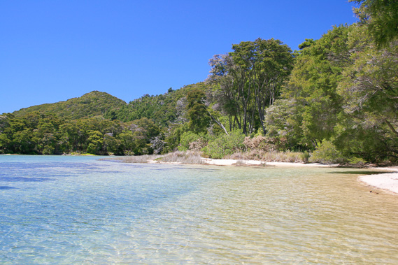 |
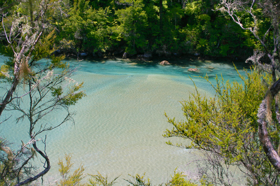
12:23 - The tide will reach its peak soon, and this is one of the biggest king tides of the year, in New Zealand’s most tidal area. With the tent set up in the campsite I walk across the ten metre wide sandspit to the sandflat on the other side. The sand at the bottom of the flat is completely covered in water, but it isn't high tide yet. I can see the water still perceptibly rising with the incoming tide. The water almost touches the red tussock grass on the beach at the edge of the manukas. Across the flat the turquoise water touches the dense rainforest surrounding the lagoon.
|
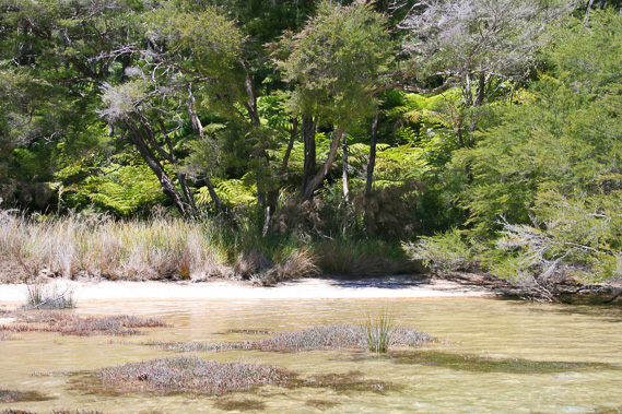 |
12:25 - Nearby are a couple of small yachts which have just arrived and beached on the sandbar. The people staying in them will stay here for a few days. I wade across the cool reinvigorating water towards a small staired bush entrance to the hut, and continue past it around the back of the estuary aiming for the island in the middle of the lagoon. I wade through the deliciously turquoise to sandstone coloured water under the perfectly clear blue sky.
|
 |
12:30 - The water around the edge of the beach is about ankle deep, going through beds of some kind of stunted lagoon weed that seldom flood. As I go further around the water becomes knee deep as I avoid some of the reddish grey reed grass growing in a large mass in the water and just poking above the surface. I look out across the lagoon. It is apparent the water is too deep to head out to the island now, so I retreat back to the sand bar and decide to explore the end of it where the waters of the lagoon breath in and out twice every day, giving it life.
|
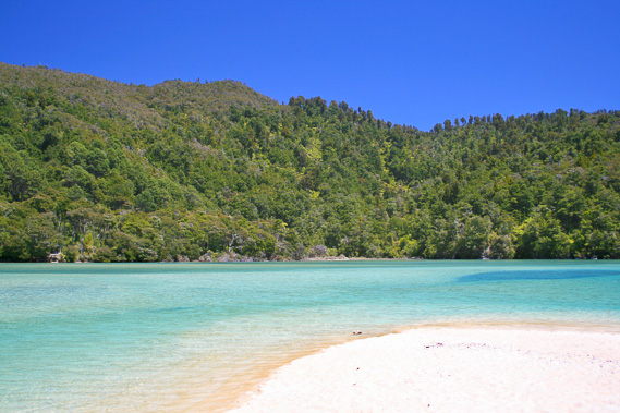 |
12:31 - Upon reaching the end of the trees over the lagoon, the white sand bar continues passing was what had once been a channel now blocked off by the sea leaving a deep bay across the estuary. The sand bar wraps its way around the channel to separate me from the edge of the deep turquoise channel of the main inlet. I walk around the bay onto the end sandbar and look out over the lagoon. A pair of seagulls share the beach with me. Across the lagoon, the northern face of the headland is covered in tree ferns, flourishing there with the minimal sunlight the steep hill gets. The turquoise water covers almost all the land now, apart from a large broken off section of the sandbar which is split in half by a narrow channel. The water in the middle of the channel is at least three metres deep, but already the tide has turned. An obvious outgoing current is already flowing in the channel. The seagulls patiently wait at the waters edge looking for small fish swimming out of the lagoon with the outgoing tide.
|
 |
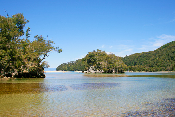
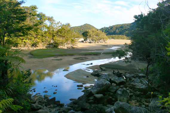
12:45 - I return along the edge of the sandbar to get some good shots of the grass touching the water. Then I crossed over the top of the sandbar to the main beach, where only the tiniest of swells breaks. I then return to the flats on the other side to watch the quickly ebbing tide. Looking out across the turquoise waters, a small island off the end of a spur divides the estuary into two. A stream tumbles out of the rainforest in either side and their channels meet up just before the island to meander towards the sea.
|
 |
13:12 - With the tide still mostly in this means crossing a deep channel to get to the island. I could have easily swum across but having my camera bag with me makes this not an option. The bag has a splashproof rain jacket which will prove very useful later this trip, but it isn't waterproof enough for a swim. |
 |
13:59 - The quickly falling water level has dropped significantly, so I start to wade across to the island. Fortunately the current isn’t strong and I successfully reach the base of the island at the far side from the beach after the coarse gravel across the riverbed gives way to soft sand in the relative shelter between the island and the spur of mainland pointing towards it. Knee deep crystal clear water completely surrounds the island. Large granite boulders surround its base. The island rises steeply around six metres above the water, with scrub covering its relatively flat top lopsided to the right. The left hand side of the island has several huge boulders without any vegetation on them at all.
|
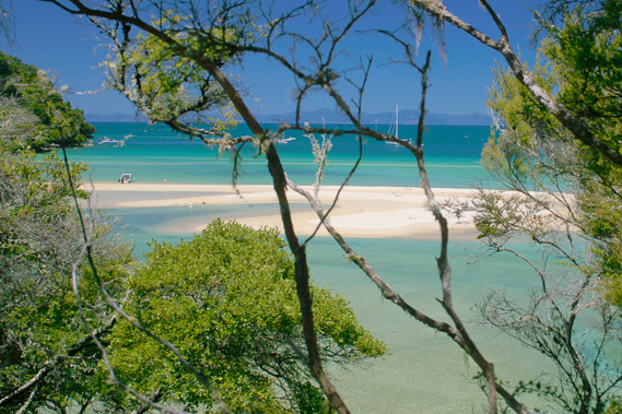 |
14:05 - I see relatively easy access up a tiny gully through the big boulders rocks to the top directly in front of me. I scramble up the rocks to a small rocky ledge at the top. The kanuka scrub at the top prevents any full view of the estuary, but through the gaps I get some very interesting shots of the juxtaposition of turquoise water and the brilliant white sand bar.
|
 |
14:18 - There are also very good views along both channels at the back of the bay, particularly the northern channel where a small waterfall plunges onto boulders projecting its sound across the estuary. Some kayakers are exploring this channel. In front of the waterfall spans a wooden footbridge. This is part of the high tide track. There are two hiking routes across the bay. The first being the low tide route across the estuary from the hut across to where a large orange dot marks the start of the track heading up the steep hill on the other side. Obviously no one will take this route now with the estuary still flooded.
|
 |
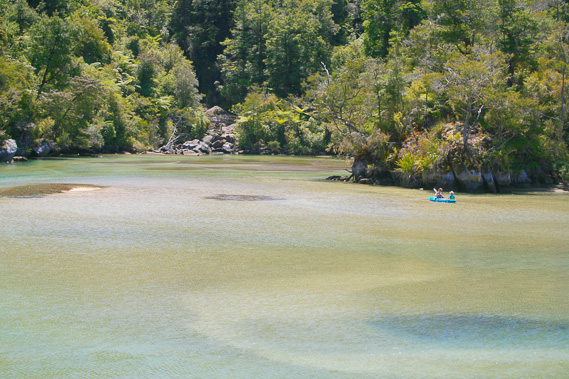
14:21 - The other route was a longer track going around the back of the estuary around the two gullies. The bridge across the waterfall is the only sign of this trail apart from a few cuts in the spur in between. Otherwise the forest is dense around this area. The two tracks meet somewhere up the hill to continue northwards towards Awaroa. I climb down off the island and wade through the shallow water towards the waterfall.
|
 |
14:26 - Under the waterfall the soft turquoise water covers the sand. In between the little channels are large patches of the stunted estuary weed. Worn trails run through the middle of these patches where people have walked over on their way to the waterfall. The sound of the water plunging over the waterfall projects out into the otherwise silent estuary. The other stream coming out of the southern gully is hidden behind the bluff.
|
 |
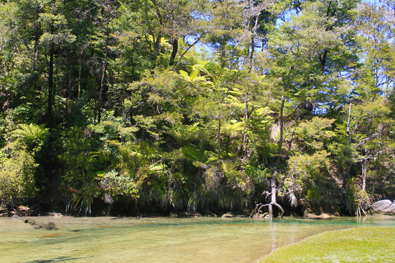
14:27 - From here the beach is very quiet with almost no swell breaking on it. Beyond are the two headlands providing good shelter, and across the bay the blue mountains of the Marlborough Sounds provide a backdrop on the horizon. The rugged hillsides rising from either side of the channel are covered in large tree ferns with stunted mountain beech in between almost touching the water. Being the middle of summer, I am rewarded with a rare instance of the sun shining on the tree ferns, highlighting their bright green foliage. I approach the bridge over the boulders, but the waterfall is hidden in the darkness of the intense shade, so it doesn’t make for good photography. I will need to return this evening, or in several days when I return through here after exploring the northern end of the park.
|
 |
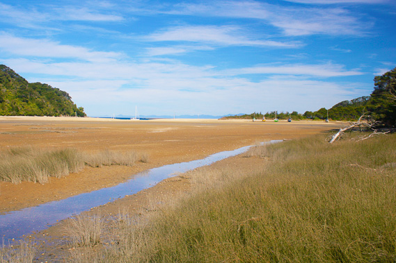
14:57 - The tide is quickly dropping, with the water in the lagoon quickly emptying out into the falling sea. The rate is alarming here at New Zealand’s most tidal coast during a spring tide such as this where the range can be as high as five metres. The water level has already dropped to below some of the higher sand mounds which have been submerged in the early afternoon tide. The turquoise water is now turning a pale greenish brown with the sand flats below now coming through. Small tufts of salt floats on the surface indicating the speed of the current draining out. The tidal level on the beach has dropped significantly. What was earlier a tiny beach has already quadrupled in size, and will get a lot bigger as the afternoon wears on. The warm sun continues blazing down from overhead as I continue watching the tide go out around the lagoon. I look across to a small orange dot nailed to a small black tree. This marks the low tide route which saves a lot of time when the tide is out.
|
 |
15:27 - I find a safe place to cross just downstream from the island and walk onto the sand bar on the far side, the one with the split down the middle that had been flooded. From here I watch the tide continue to ebb out at great speed. Small waves now break on the beach amplified against the strong tidal current. It has been a tiring afternoon out in the strong sun, and I know the sun will be up a long time this evening, so I cross the main channel through thigh deep water heading back to the camping ground. I return to my tent and crawl inside for a snooze. The ranger comes around checking for camping passes, before I snooze for a good hour.
|
 |
16:52 - Upon awaking from my afternoon snooze, I head to the beach. The tide has gone a long way out. The white sand gradually morphs into a fawny brown colour towards the bottom of the steep beach some four metres below the camping ground – a drop of a good three and a half metres below the earlier high tide. Further out the water is shallow with a couple of people wading knee deep at least a hundred metres out in what would have been about five metres deep just a few hours ago.
|
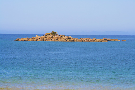 |
16:58 - Swirling high cirrus cloud covers some of the sky. This is a sure sign the weather is going to turn for the worse in the coming days. Sadly a storm in New Zealand is not short and sweet like storms in other countries. When a storm hits New Zealand it lasts for days at a time, sometimes weeks. I cross my fingers. Looking out from the beach, the tiny granite reef only just visible at high tide when the boat dropped me off is now an expansive barren boulder bank of reef made from pink granite. It only has a tiny bit of scrub at its exposed summit. To the right of the large rock is a reef of darker granite which was completely submerged when the tide was high. Now small waves are breaking against it. These reefs would be an excellent supply of mussels and other sea food.
|
 |
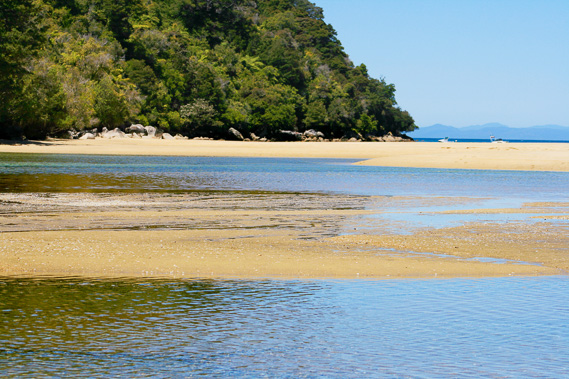
17:00 - The sun is falling low in the sky and the water is now a much darker blue with the sun having fallen below its refractive index angle. In the ten minutes I have watched the beach, the tide has gone out even further, showing the bottom of the bay for a few metres out from the bottom of the beach. The sand bar has absorbed so much water it is running out in small channels eroded into the sand. A sand bar like this, about four hundred metres wide, and a hundred metres across on average and four metres high would perhaps absorb a good thirty cubic metres of water per metre of sandbar during the high tide. That would make a total of around twelve thousand cubic metres of water, or around twelve thousand tonnes of absorbed into the sandspit. No wonder it is creating channels as it escapes with gravity back into the ocean.
|
 |
17:50 - I relax on the beach for a while before deciding the light has reduced enough to get some good photography on the estuary. Just four and a half hours ago it was full of turquoise water. Now it has completely drained apart from the two main strams draining the two small rivers. Aside from the small meandering channel, and numerous smaller channels draining into it like the veins in your body, the estuary has completely dried out. By now most hikers coming from the north would have reached the hut and the campsite having crossed the relatively dry estuary. I walk across the low flats, mostly covered in the spongy mats of tiny weed. They are looking strong from having been flooded and received a good water supply, albeit salty. The four small yachts that had arrived at high tide are now high and dry, with no chance of getting out again until the high tide early tomorrow afternoon. It is a new moon, and with both the sun and moon reaching very high in the sky during the middle of the day ensures a very strong tide. They fall at a much lower angle on the other side of the world at night though, where it will be winter. The pull won’t be anywhere near as strong, so tonight’s tide probably won’t even reach the boats.
|
 |
17:55 - I head further up the estuary to the southern channel where the main river emerges from the dense impenetrable rainforest quite a long way upstream. This is Huffam Stream, named after the only residents to have ever lived here. Bark Bay was named due to the Huffam family harvesting the bark from the trees to create tannin to take across to Nelson where tanneries can use it for tanning leather. The weed turns a reddish colour but soon merges into thigh high reeds as the estuary reaches the shallows where it only floods during the highest tides. The stream now follows a definite channel with banks about a metre high on either side.
|
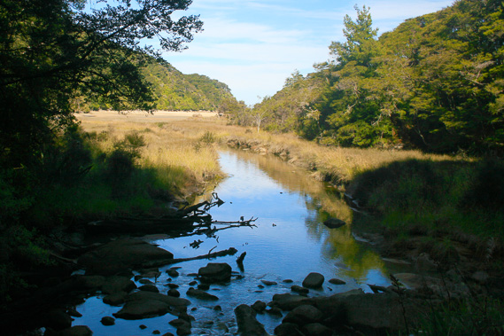 |
18:02 - The banks are very muddy but there is a small track running through the reeds above the stream in most places. The river passes several blackened submerged trees brought down in floods past. They are blackened from waterlogging, and each have a large pool around it where floods have swirled around. Several large boulders are scattered along the river, each has a deep pool surrounding it in the same manner as the trees. The river meanders from the rocky bluff on the other side to the more gentle slope of this side of the stream. A cold wind is beginning to gently blow down the valley, indicating the early evening chill. I now see the long wooden bridge crossing the river ahead of me where the high tide track crosses over to work around the bluff towards the other bridge over the waterfall.
|
 |
18:03 - I climbed up onto the bridge and look back down the valley towards the estuary. Although it is dark and cold in this valley, the sun is still shining on the estuary a fair distance behind me. The sun has fallen below the top of the steep hill above me. Looking upstream the water cascades down large moss covered boulders surrounded by gnarly epiphyte covered small trees. In some areas the stream flows entirely under the boulders that would have been brought down in huge floods. During the ice ages when the sea level was one hundred and twenty metres lower than what it is now, this river would have continued flowing over its rubble of rounded mossy boulders through what is now the estuary, meeting the other stream and flowing down cascades of boulders to the plains of what is now Tasman Bay. The boulders only last about fifty metres above the bridge. Beyond that the forest closes in and the terrain appears to be too rough to explore any further. No wonder the early explorers had considered this now pristine coastline to be amongst the most difficult areas to explore anywhere in New Zealand.
|
 |
18:11 - With no point in exploring the valley, I follow the track around the back of the estuary on the way to the waterfall. As this track is only used during the two hours either side of high tide, it is very narrow and quite rugged. It is still clear and in good condition though. Within five minutes I reach the point at the end of the bluff, where the division of the two arms of the estuary start. Looking out from the track I have a good view of the island I had earlier climbed when the tide was full. It is no longer an island. It is dry with brown sand all around apart from a few placid channels of water meandering on either side.
|
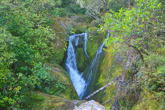 |
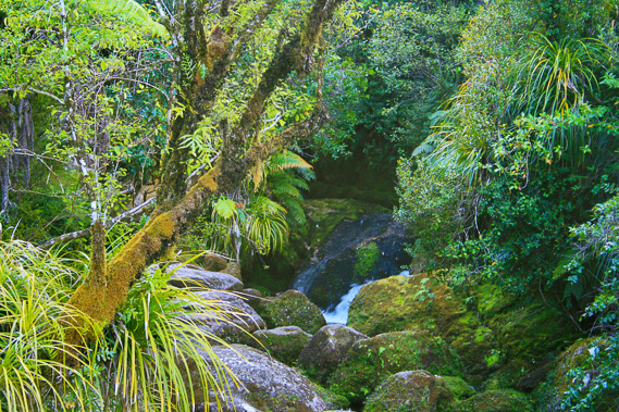
18:18 - A few minutes pass before I reach the back of the northern inlet, where the air is crisp. I cross over to the middle of the bridge. The waterfall itself is only a couple of metres high. The waterfall comes out of a narrow entrance to a fairly flat valley, suddenly plunging down some mossy boulders stripped bare by some big floods a long time ago. Scrubby bush surrounds the rock on either side.
|
 |
18:20 - Looking downstream from the bridge the north arm is enshrouded in shade where the sun had set over the steep surrounding hills. The estuary is still light with the sun still shining on it, though the air will be getting chilled by now. The temperature is quickly dropping here in these dark valleys. |
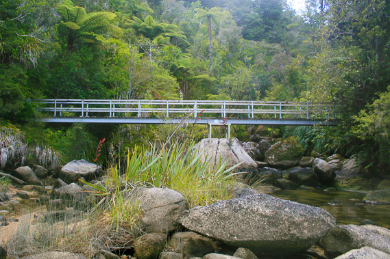 |
18:46 - I return along the trail back towards the hut. When I reached the bridge of Huffam Stream again, I head downstream a short distance to photograph the bridge, which I had somehow missed earlier. The bridge is held together on the bank at either end but the middle it stands on a large boulder in the middle of the stream. |
 |
18:51 - The forest enveloping the track is surprisingly dark, passing a grove of silver tree ferns. These are tree ferns with their undersides covered in silver foliage, a distinguishing feature only known to this particular variety. The silver is accentuated by the particularly dark foliage over the top and the jet black thin trunks. I follow the dark forest another ten minutes over flat land until reaching a small junction. The trail ahead is the main track to Torrent Bay, some two or three hours away. To the left about twenty metres is the hut.
|
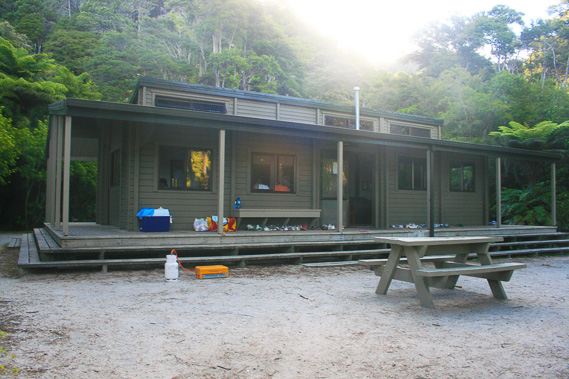 |
19:17 - The hut is a place I have stayed numerous times over the past fifteen years when travelling through here to take a break from civilised life. Here I would meet many people from all over the world. In fact this was the hut where I would eventually become inspired to see the world. The hut had one large central room with a fireplace in the middle at one end, benches around the edges of that end. The other end had large wooden dining tables. There are two bunk rooms with two levels of bunks to fit twenty eight people. Everybody staying here is inside having dinner. From here I walk across the dry estuary to where the streams combined and run across the brown sandy bottom through the narrow outlet past the sand bar. The hut was built on the site where over a hundred years ago Thomas Huffam's house stood. He and his sons were the only people to have ever lived here.
|
 |
20:32 - Upon reaching my tent I have dinner. Once dinner is finished I head to the beach and look out across the bay. During high tide the water almost laps against the edge of the scrub of the camping ground. Now the water is so far out it is as if the entire bay had drained. By now the sun has set over the bay, setting behind the high range sheltering us from the west, but the sky is still bright blue overhead and the mountains across the bay are still strongly reflecting the sunlight. The tide is already on its way back. Much of the bay is now flooded again and the water almost up to the start of the bottom of the beach, where channels of water are still draining out of the sandspit. The bay is very beautiful by day, but by night, it has an amazing mysteriousness to it.
|
 |
20:37 - Cloud is building up overhead, so hopefully the temperature won’t drop too low. I know from experience the temperature can drop to seven degrees even in the middle of summer. I return to my tent and fall asleep for a couple of hours. Then I wake up and it is completely dark outside. The estuary will be filling again, which means magic. The still air was crisp with coldess. The cloud cover and lack of moon means it was totally dark outside. A very small laminar swell is breaking on the beach of coarse sand with an almost metallic sound. I walk along the dark sandspit just above where the waves are breaking. Fortunately there is no breeze as there usually is by now. It is dead calm. Once I reach the end of the sandspit scrub, I look over the inky black estuary spotting phosphorescence in the wavelets. With a big day ahead of me tomorrow I return along the beach to the entrance to the campsite. Somehow I manage to make it back to the tent, crawling into my warm sleeping bag to sleep.
|
|