Introduction to today's journey
It is good to have an end to journey towards; but it is the journey that matters in the end.
- Ursula K. LeGui.
AWAROA is a remote settlement accessible by sea, track, and a rough road ending at the far end of the large estuary. It has always been an isolated settlement, but has quite a history with several sawmills and small farms operating on both sides of the inlet between 1855 and the 1930s. This created quite a flourishing community along the southern side of the inlet. In the early days Awaroa was had a good ship building industry using timber milled locally and imported from other parts of the country. Although the logging has long finished, many remnants of this past still linger on the shores of the park's longest tidal inlet.
Today's trek departs Bark Bay heading northward over a hill to Tonga Quarry, where I divert a short distance back along the coast to Arch Point. I then continue along the track, following the sweeping Onetahuti Beach before heading over the long Tonga Saddle track into the vast Awaroa Inlet. I spend much of the afternoon exploring the historical relics of the inlet before crossing over when the tide retreats going over The Portage to the camping ground just behind the beach at Waiharakeke Bay.
Today's Journey
Distance trekked today: 19.2 kilometres.
Total distance trekked to date: 21.4 kilometres.
 |
06:13 - It is first light when I wake up. The air is cold and damp, indicating overcast skies overhead. I quickly get up and eat the muesli bar breakfast I set aside last night as I packed everything into my pack including my tent. Despite numerous tents being pitched on the sand bar under the Manuka trees, there is no sign of activity. Everyone else staying here is still asleep. I pack up very quickly and quietly so as not to wake anyone. I know within an hour the campsite will be abuzz full of activity and want to get away before then. Now packed, I am ready to venture north. Getting to today's destination Waiharakeke will involve three tidal crossings, the first one very shortly over the nearby Bark Bay estuary. This is followed in a few hours time by a smaller estuary crossing, then the large estuary at Awaroa which will be flooded by the time I get there. The plan for today is to explore the Awaroa area and cross over in the early evening when the tide does go out.
|
 |
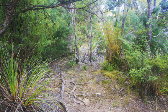
06:28 - I quietly creep through the campsite carrying my heavy backpack taking the nearest exit to the beach. As expected the tide is mostly out. The water is a deep greenish grey colour under the large bluish grey clouds sweeping across the sky in a roughly north south direction like waving horsetails. I walk along the beach down to the main channel, crossing the ankle deep cold water from the two streams merged perpetually flowing across the estuary. Once across the narrow channel, I continue walking across the damp sand to the mossy boulders to put on my boots. The puddle I have just crossed is mirror smooth perfectly reflecting the cloud above against the black silhouette of the far headland. There is a short scramble in between a couple of boulders up a step to where the track mysteriously appeared above the high tide line in amongst the dense tree fern and scrub foliage, heading to the right towards the headland. Aside from the large orange marker showing hikers where to go, there is absolutely no indication of the existence of a track, whereas here a well maintained track straddles the very steep side of the bluff.
|
 |
06:52 - The dull light filtering through the foliage overhead does little to lighten the forest, even though the sun rose at least half an hour ago. The track moderately ascends towards the bluff for about a hundred metres before doubling back in a hairpin bend. It continues heading up the steep terrain now starting to moderate. Although the estuary and beach are directly below me, only the slightest glimpses are afforded through the thick rainforest. The track starts turning away from the estuary before reaching the junction between the high and low tide tracks. I am already a fair way up the hill, heading towards a distant saddle unseen. Here a large black beech tree with its distinctive sickly sweet honeydew smell has a small sign in front of it pointing the different directions. A well graded track heads moderately downhill to the right to eventually reach the bridge over the waterfall in the north arm of the estuary before continuing to the hut. The main trail heads steeply uphill. The ten minutes immediately following the junction are steep, requiring a slow steady pace. The track is very well graded, and the terrain is getting less steep. The dense rainforest is giving way to tall manuka scrub now this is an area which gets the afternoon sun. The track continues gradually turning to the right, heading around the hill as it approaches the saddle on the other side.
|
 |
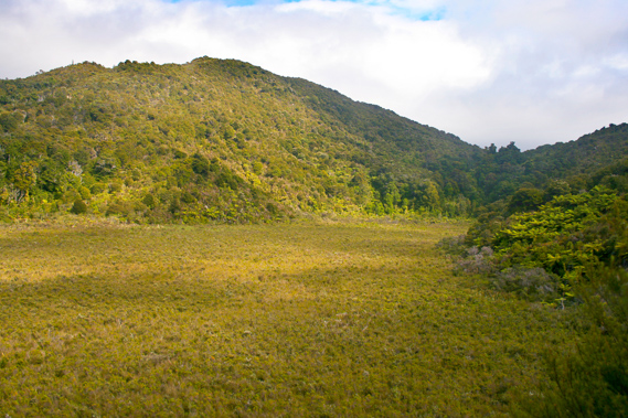
06:53 - By the time I reach the saddle, the forest has reduced to a three metre high kanuka scrub. There is a seat at the top with a clear way going up the gradual ridge. Numerous branches are deliberately laid across it to indicate the track was closed nearly ten years ago. This track used to be the long way to Awaroa, going over the summit of Stony Hill. I have never done this track before, but I imagine there were no views at the top. This track took four hours to hike compared to the main track which only takes three hours. The stony hill track closed about ten years ago. Looking along the main route the well graded track commences a gradual descent increasing in steepness as it negotiates its way around a couple of deep dark gullies where small streams of water flow unseen under the rocks. The track continues dropping steeply until reaching a long section where the scrub is very thin. About fifty metres below me is a long swampy valley filled with scrub. The valley follows the direction I am heading before turning out towards the sea and suddenly dropping into Mosquito Bay hidden from view on the other side. Mosquito Bay is a small double beach with a small island in between. The island is broken off from the beach perhaps only during the highest tides. There is no track down to the beach, so the campsite can only be accessed by kayakers who are now becoming a lot more common here in the park. The trail gradually descends towards the swamp below. Upon reaching the level of the swamp the track follows the gradual uphill slope up the top of the swamp. I head into scrubby bush crossing over the top of a rounded low saddle to a steep drop down the other side. The track clings to the side of the bluff heading to the right, before doubling back in a hairpin bend dropping through the now dark forest of low trees.
|
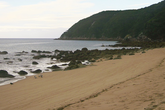 |
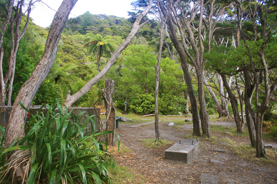
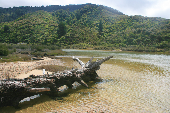
07:46 - I hear the bubbling sound of a stream nearby, and sure enough the track continues to round the steep hillside into a dark gully. Just before it meets the stream, in the midst of a big mess of fallen tree fern fronds, the track turns to the right and follows the creek downstream for a hundred metres before arriving at a small campsite where one tent is pitched, but the occupants aren’t up yet. I have arrived in Tonga Bay. Some old concrete slabs and bunkers sit in the campsite evident of some kind of industry here in years past. I walk through the small campsite past a layer of flax bushes on the low dunes onto the beach.
|
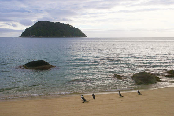 |
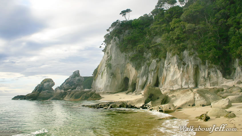
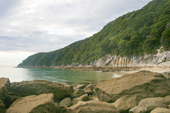
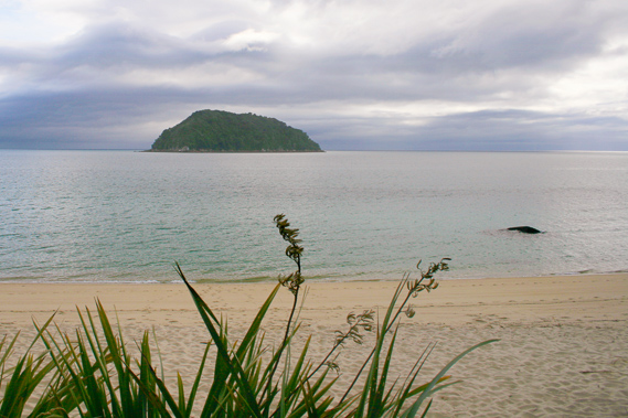
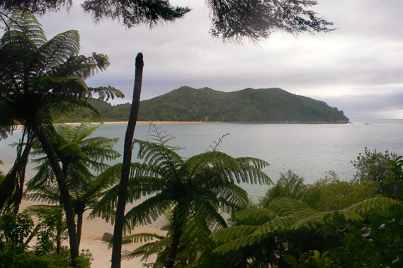
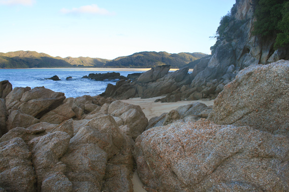
07:47 - Directly ahead of me is the dark mass of Tonga Island, a small triangular island out on the silvery water. A few exposed rocks poke above the ruffled water just off the beach. A few gannets forage in the sand for their breakfast. To the left the beach ends about fifty metres away just past the mouth of the stream. Beyond the end of the beach stands a high rocky headland which was once a quarry for the pure granite found here. Large buildings in Nelson were constructed from this granite. Dark boulders sit in the swirling grey water beneath the quarry. Beyond the headland is the long sweeping beach of Onetahuti, with Awaroa heads at its far end looking lonely and mysterious. To the right the end of the beach is littered with numerous rocks heading out into the water. Beyond the rocks is Arch Point, where I have decided to explore before the tide comes in too far.
|
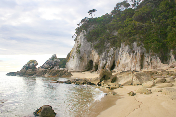 |
08:12 - I walk along the coarse sandy beach, evident of the exposure of this beach to the large northerly swells sometimes breaking here. As I approach the white cliffs at the end of the beach I see a few caves carved into the rock. The beach ends forcing me to negotiate my way over numerous boulders above the water line. Perhaps when the tide is right out there is beach along the entire distance to Arch Point, but not now with the tide now starting to come in.
|
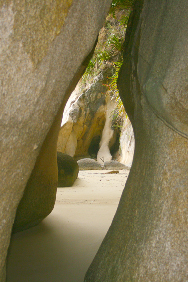 |
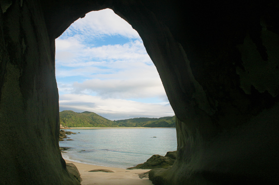
08:15 - A small beach appears past the boulders just before the point. Upon closer examination I see the holes in the headland go right through the narrow headland giving Arch Point its name. |
 |
08:19 - Once through the arches, I reach a large field of huge boulders preventing any further progress. I stop here and look out across another small beach to the continuous rocky coastline to Foul Point now about four hundred metres away. As its name suggests, this area is very exposed to the incoming northerly swells. I briefly rest on the beach before heading up to Arch Point. Despite the point’s name, the dark turquoise water here is almost mirror smooth, save for a small laminar swell breaking on the beach. |
 |
08:21 - After a few minutes at Arch Point, I return along the small beach and the boulders back towards Tonga Beach. The waves are getting bigger and the tide is quickly rising. Within an hour this will all be flooded. |
 |
09:02 - By the time I return to the entrance of Tonga campsite, the boulders I had earlier seen at the waters edge have mostly disappeared. Dark clouds still cover the northern sky and Tonga Island is still almost black. |
 |
09:03 - I return to the campsite. The couple staying in the tent seem to be getting up now, so I don’t linger. I cross a wooden bridge over the stream before continue following track steeply ascending over the large quarry. This is one of the steepest and most precarious sections of track, very narrow and clinging to the edge of the cliff face. Trees somehow manage to anchor themselves into the near vertical terrain holding the hill together. The track crosses a few small board walks over where small landslides have come down in storms past.
|
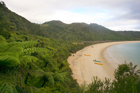 |
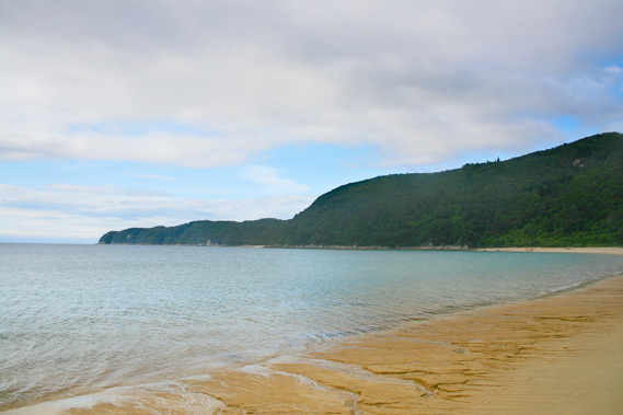
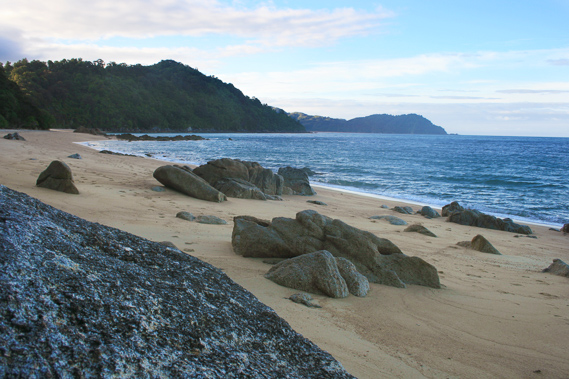
09:22 - Once over the top of the quarry, the track moderately descends around the bluff which is not as steep on this side. A couple of minutes pass before I get a spectacular view of the sweeping beach of Onetahuti – Maori for “beach to run along”. I certainly am not in any position to be running along any beach, but being a good kilometre or two long, it is a beach where a running race can occur. The sand here is a dirty white colour, with soft waves breaking from the turquoise silver water. Several kayaks are beached at this end indicating their occupants haven’t packed up their camp ready for today's action exploring the coast. Thick manuka scrub extends above the high tide mark up into the low sweeping hills beyond. The beach sweeps right around the bay to the low hills of the Awaroa Heads. The sand becomes increasingly golden as it approaches the far end, indicating the presence of a small estuary. Behind Awaroa Heads I can see a dip in the hills. This is Tonga Saddle which I will be crossing later today before descending into Awaroa.
|
 |
09:24 - The track steeply descends to the grassy campsite. I walk out onto the end of Onetahuti Beach and begin the kilometre long hike towards the low hills of the Awaroa Heads. I walk just above where the lethargic waves break out of the silver water. The blackened silhouette of Tonga Island looms to my right.
|
 |
09:37 - Braided channels of water seep out of the sand and the long estuary behind the sandbar creates a continuous slightly uneven surface to walk over. Tonga Island is changing shape as I head around it. No longer is it a lopsided triangular shape. It is more regular but a separate low headland is appearing to the left side of it, exposed to the northern swells. There is a seal colony on the island, and occasionally penguins. I saw a penguin on the beach at Tonga some years ago, but beach landings are rare.
|
 |
09:38 - The cloud begins to clear and the sun is coming out. I now see the beach of Tonga Bay in the distance behind me, with Foul Point at the end of the long ridge behind the beach. In between the beaches I can just see the white face of Arch Point, now starting to flood with the tide.
|
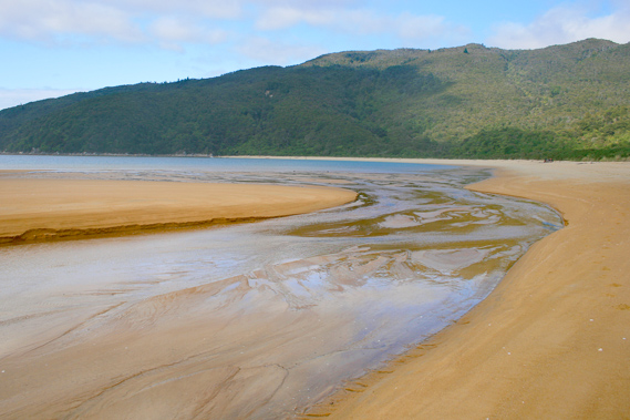 |
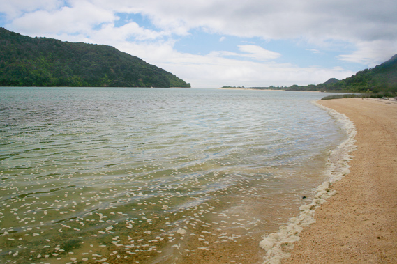
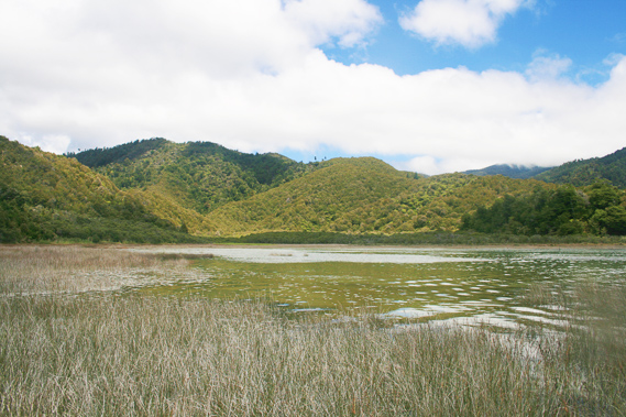
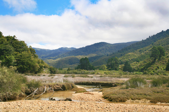
09:45 - I reach the estuary at the far end of the beach. Here a sepia toned stream, coloured by ochre from the large Richardson Swamp, is running out in braided ankle deep channels about ten metres wide. The stream turns around almost one hundred and eighty degrees coming out of the long estuary the other side of the sandbar running the length of the beach. The estuary goes as far as the eye can see up to the base of Stony Hill. It is very long and narrow, and full of reeds obscuring the view of more than a few hundred metres. I have explored it in past trips through here. It is full of numerous random channels from where it had broken through the sand bar in times past, but otherwise is fairly stagnant with a permanent body of knee deep water held in by the entrance of the estuary where I now cross. During spring tides it floods and fills into a sparkling estuary of crystal clear turquoise water. It doesn’t have the character of the estuary behind Bark Bay though.
|
 |
09:50 - The tide was still well out now, but in a couple of hours the estuary will flood with the water rising to about a metre deep. During the biggest spring tides the water can get anything up to two metres deep here. I have seen people delayed here in midday tides. There is much advertised about the crossing times at Awaroa and Bark Bay, and also Torrent Bay further south, but not much is said about the estuary here, especially as there is no high hide alternative route. Fortunately this estuary is only flooded for about two hours at the most. (a new bridge has been built across the estuary a little upstream of this crossing some years after this trek). I find a completely dry section of sand where the channel goes completely under the sand. So I cross over to the start of the dirt road on the other side, the trail leading over the hill towards Awaroa.
|
 |
09:54 - The dirt road leading from Onetahuti is different to the narrow track I followed from Bark Bay to the other end of Onetahuti Beach this morning. The track rising out of this end of Onetahuti towards Tonga Saddle is easily wide enough to drive a quad bike, and maybe even a four wheel drive vehicle. The track initially rises on a moderate grade, quickly rising up above Onetahuti Beach. A few minutes pass before I reach a small gully which has the remains of a short track heading through to Shag Harbour, the site of on old camping ground which closed years ago due to the fire risk in the scrubby headlands. This area was once been cleared for farmland, but it was abandoned due to the poor granite soil and rough terrain. Forests here in the cool New Zealand climate take thousands of years to fully regenerate. Looking back towards the beach a small plain spreads out swinging around and heading a fair way inland. This is Richardson Swamp, the largest swamp in the park, being a good square kilometre. The track is rising around the edge of the swamp. Across the swamp I now have a good view over Stony Hill. The swamp is covered in thick heathland scrub, so there is no way of telling how wet it is down there. The surrounding hills rise out of the swamp as if it were a small green sea.
|
 |
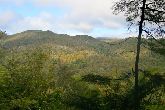
09:56 - Ahead there is a low point in the hills about a hundred metres above the back of the swamp. This is the top of Tonga Saddle. I am already a good sixty metres above sea level. From here the grade of the track reduces to a gentle rise continuing towards the saddle. Whoever built this road must have constructed it from Awaroa on the other side and had underestimated the grade needed to get down to sea level. This resulted in the last part of the track I have just done being quite steep. The manuka scrub thickens denying me of any more view of the Tonga Roadstead, where I have spent the past two and a quarter hours. The tide would be half way in by now. It is very quiet up here, devoid of bird life and too far away from the small waves breaking on the beach. There are no flowing streams up here, just low dry fords at the end of each small gully.
|
 |
10:39 - After a long walk up the dirt road track, and not having passed anyone yet today, I reach the top of the saddle in amongst a few tall trees blocking any view. From here the track divides into two. The old track follows the gully straight down the hill. This was once the only track, passing through private land towards the Awaroa Lodge where I will stop in a couple of days time. The new track continues at the same altitude, about a hundred metres above sea level (topographical maps say Tonga Saddle is one hundred and two metres above sea level). It was built about eight years ago when the owner of the land in Awaroa didn’t want the increasing traffic of hikers going through there any more. The new track stays at the high altitude up to Venture Creek. The farm must have eventually changed hands though and now hikers are once more allowed to go through the shorter route through the farmland.
|
 |
10:47 - I follow the new track knowing there are better views from here. The scrub is very thin. The track was constructed about eight years ago by a small bulldozer, and is still in excellent condition with minimal maintenance. There had been talk back then for the entire track to be cut like this for easier maintenance. The narrow track I had hiked this morning from Bark Bay to Onetahuti is harder to maintain, requiring access by foot or occasionally by motorbike to maintain. About ten minutes after leaving the saddle I reach the highest point of the track, at about a hundred and twenty metres above sea level. At this point I am at the end of a small spur with a park bench at the edge of a good view towards the northern coast of the park.
|
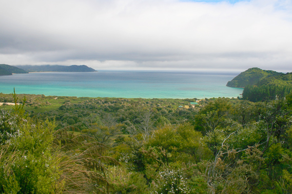 |
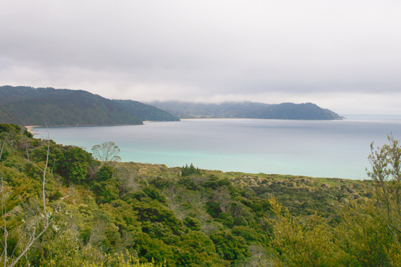
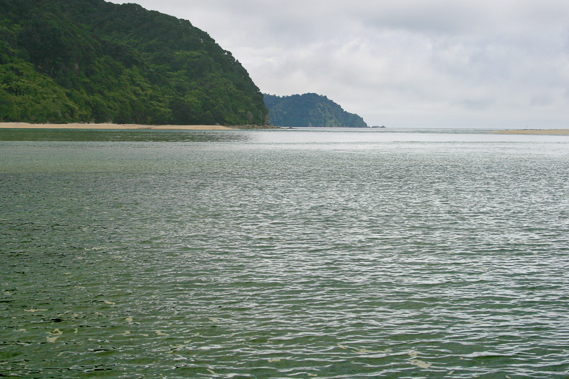
10:48 - Directly outwards and below is the long sweeping forested sandbar of Awaroa Beach. The tide is already too far in to see any of the beach over the scrubby sandbar, but beyond it are several sweeping hills going into the sea. From here I see Waiharakeke Bay and Goat Bay, with their steep headlands. I will be hiking along these beaches early tomorrow morning. Further along the coast is the long sweeping beach of Totaranui, under the Anapai Headlands with cloud hanging low over them. Hidden behind the headlands is Anapai Bay, where I will be setting up a base camp tomorrow night to explore the more northern parts of the park. The sky is now completely overcast. The promising sun which had successfully broken through at Onetahuti is now elusive again.
|
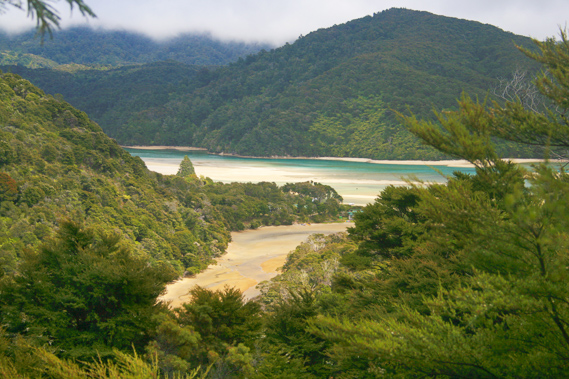 |
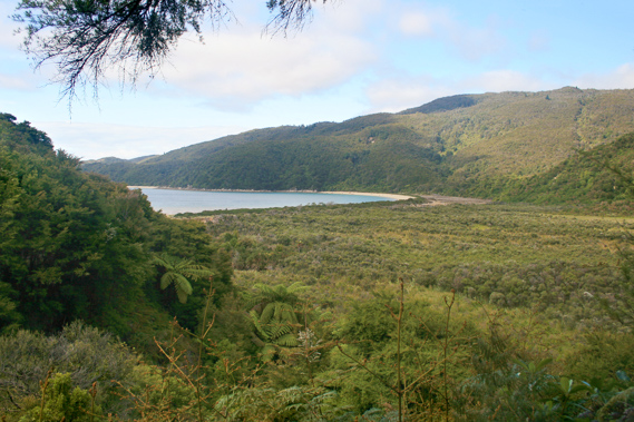
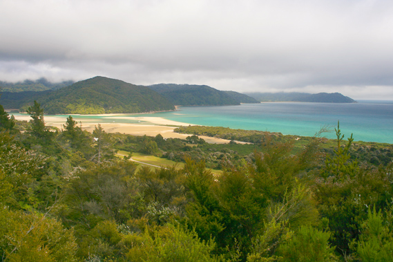
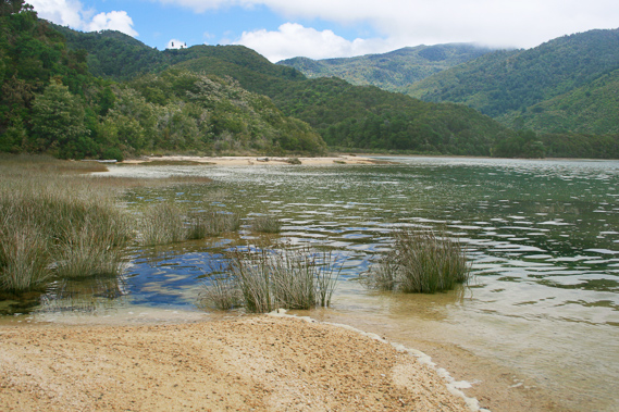
10:59 - I continue walking along the track which has started a very gradual descent. I go around the back of another gully, and upon reaching the end of the next spur, I once more have a clear view. This time I see the front end of the Awaroa Inlet, by far the largest estuary seen to date. The sun is now shining in the estuary highlighting the very bright yellow sand and the very inviting turquoise water now flooding it. I can also see Abel Head, at the end of the Awaroa Heads. Further around the track is another clearing. The view across the bay has gone, but I have a clear view of Venture Creek below me, flowing around a small forested sandbar into the main estuary.
|
 |
11:03 - I continue along the track where I get a good view up the long forested ridge towards the top of Stony Hill, where the old track from Bark Bay used to cross over. |
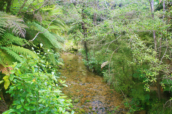 |
11:17 - The track suddenly starts a steep descent into a long gully. The scrub quickly gives way to a forest of large trees and a subcanopy of tree ferns. After a few minutes of steep decent, I see a large crystal clear stream gently running over a bed of large stones. This is Venture Creek. A long well constructed wooden bridge with bird netting over the boards to prevent any slippage marks the end of the steep section on the track. I walk across it over Venture Creek before following the somewhat rougher track above the far bank for about a hundred metres until reaching a placid sandy mud flat.
|
 |
11:35 - I climb down a short wooden staircase into the small side estuary quietly flooding from the incoming tide. Very gentle waves lethargically flow upstream adding more water to the inlet. In front of me are four small yachts beached on the dry muddy sand, but not for much longer.
|
 |
11:36 - A few people are exploring the other side of the flooding stream. These are the first people I have seen all day. It seems strange to be returning to civilisation. I can see houses in the scrub above the estuary now, and more on the sand bar. As I continue downstream the water flooding the estuary confines me tighter to its side.
|
 |
11:39 - I pass the remains of the Venture, a local ship built here servicing this area over a long time giving this creek its name. Long retired, it sits in the sand now submerged in water. The rib cage of the large boat is all that remains, and even this has been worn down almost to the sand line.
|
 |
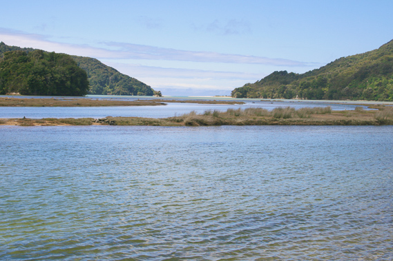
11:41 - I round the sand bar separating Venture Creek from the main estuary. The mouth of the estuary is completely flooded now, with just a thin slither of sand rising in front of Cave Point at the other side. It is a steep headland. When the tide is very low, you can hike straight across the inlet from here. A successful crossing here saves a lot of time climbing over the Portage where I will be going late this afternoon. |
 |
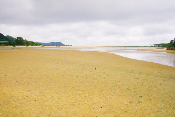
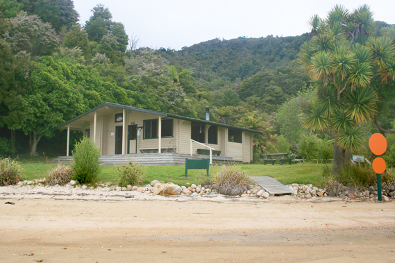
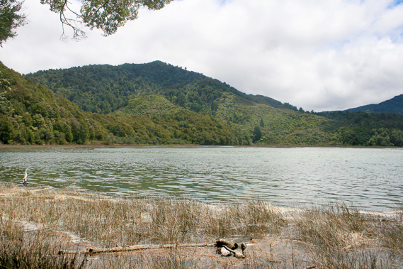
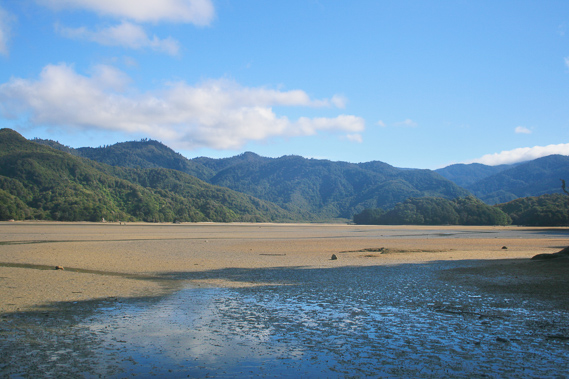
11:48 - Ten minutes pass before I finally see the hut. I have gone around Sawpit Point, a featureless scrubby point which once housed a saw mill. There used to be quite a sawmilling community living here. Now it just contains holiday homes. I have often passed here, but have never explored the area. Today I am going to explore the estuary upstream. Now it stands large in front of me, going a couple of kilometres upstream. I can see where the smaller Awapoto River is coming out. There are more houses across the inlet in the distance, around some flat land. That is the end of a road heading across the northern Pikikiruna Range to the junction of the Totaranui Road just past the saddle then over into Golden Bay. This is the only way vehicles can come here. The longer Awaroa River is hidden out of sight behind a large rocky headland and hill marking the start of Stony Hill, where the track comes out.
|
 |
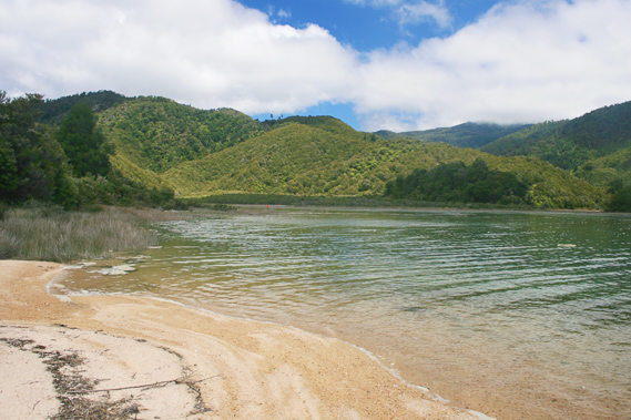
12:23 - Ahead of me is Awaroa Hut. Shallow water has already flooded between me and the hut, so I waded through the water over soft sand. The water is no more than knee deep, but will be far deeper in the main channel now, perhaps a good two metres deep. The hut is in direct view across the turquoise grey water. Beside the hut are two large orange markers each about half a metre in diameter standing on a single post. These can be viewed from across the other side of the estuary. The driftwood from recent tides comes up the beach almost reaching the bright green grass surrounding the hut. Looking out from the hut I can see the high forested hills of the other side of the channel of deep water. Across the other side is a large triangular orange marker, appearing no bigger than a large dot from here. Nearby is a smaller marker on a small orange beach showing the start of the track across the portage to Waiharakeke. Before the tide goes out there is no way of crossing over without a boat.
|
 |
12:29 - I stop at the hut for lunch. There is no one else there. Everyone has either ventured south earlier this morning, and had either taken the shorter track from the lodge over the saddle, or had left earlier and passed me when I was Arch Point. Everyone heading northward would have left the hut in the early morning to cross the estuary when the tide was still out. The route from the south is flooding now, so no one is likely to come from Bark Bay until this afternoon. Anyone coming from Totaranui won’t be coming across here until early evening. |
 |
13:10 - There is a small headland just past Awaroa Hut. The water is already knee deep when I leave the hut. Once I reach the point, I can see up the main estuary to where the Awaroa River comes out, having drained much of the ranges in behind Stony Hill up to the main Pikikiruna Range. Looking south westward the sky seems to be clearing. Hopefully this will mean fine weather for the next few days, but at these latitudes at this time of year who knows?
|
 |
13:12 - Once around the point I head towards a small gravely beach with reed grass growing out of the water. Here I am out of sight of what is now the main village behind me, but there used to be a thriving community up here. There used to be a school and numerous houses back in the days when the timber from the extensive surrounding forest was logged. The big forests have all gone now. Unlike tropical rainforests, the forest here will take thousands of years to recover. |
 |
13:44 - A high tide track used to go around the back of the estuary through the regenerating forest and the farmland on the other side. It used to take a good three hours to get around the estuary and the track was eventually closed when it became apparent almost all hikers cross the estuary saving themselves a good two and a half hours even if it means long waits in between the tides. |
 |
13:58 - I follow the short beach towards along its length to its far end. From here I wade through knee deep water along submerged tracks in between the reeds. The water here is a bit murky. The sun suddenly comes out with the clouds quickly clearing. This requires my polariser. I pulled out the little case and opened it. Then the polariser suddenly pops out and falls into the muddy water. I spend the next minute foraging around before finding it. I pull it out and carefully dry it before putting it on the camera.
|
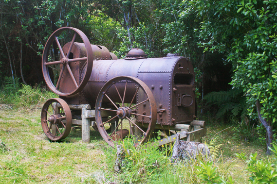 |
14:11 - The mudflat extends into a gully. I see a small track heading towards one side of the gully, so followed it out of the water to a an entrance through the scrubby bush. A few metres into the forest I reach a small clearing with a rusting steam traction engine sitting in one side. This is one of the few remnants of machinery left from the prosperous days of Awaroa. |
 |
14:43 - I return to the reeds and wade out to just past their boundary. I then wade through the thigh deep water around a sweeping bay. It is quite a long way to the end of this bay. A few kayakers are heading up the other side of the estuary nearly a kilometre away. They disappear behind a small island and reappear out the other side. Low cloud covers the sky again, so I put the polariser away and continued heading up the huge estuary. Eventually I reach an area where it is reeds all over the place, but I still haven’t reached the main river. The tide no longer seems to be coming in. In fact it is probably starting to drain now. I walk along what seems to be a trail through the knee deep water until eventually reaching a small headland at the end of the low ridge.
|
 |
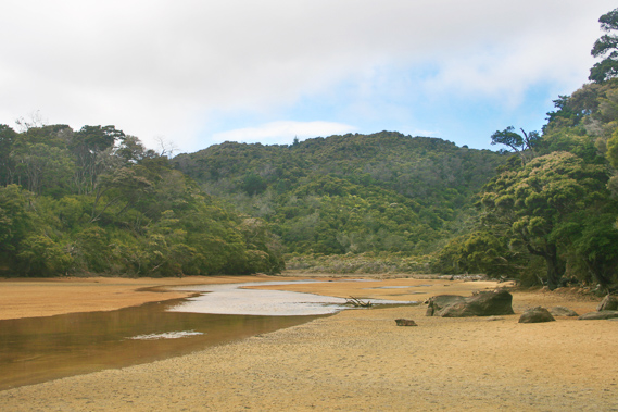
15:12 - At the end of the ridge is a long deep pool indicating a former channel of the river. I am not far from the river now. I wade through the roughening terrain until reaching an area where the soft sand turns into gravel. I reach a golden gravel bank where numerous pieces of waterlogged driftwood have accumulated around the tufts of reed. Here I see the main river. It is still flooded but the tide is definitely heading out. The water here is cold and crystal clear, as expected from water coming off the mountains. Two kayakers pass me heading downstream with the outgoing tide. The remains of several large trees lie on the banks on either side of the river. I wade across to the other side. Once on the other side of the river I can see the river meandering upstream into a grassy valley in between the forested rolling hills towering into the flat Pikikiruna Range standing over a kilometre tall.
|
 |
15:24 - The tide is dropping revealing a huge ecosystem of low grass on the estuary flats. It is very different up here away from the salt water downstream. Most of the water up here is fresh with minimal salinity. It will take a couple of hours to continue exploring upstream, but it is time to head back to the hut to cross the estuary to Waiharakeke. Here time is dictated by the sun and the tides. You can’t force yourself against nature.
|
 |
15:48 - With the tide heading out, I can now take a short cut across the vast flats directly towards the point just before the hut. I follow the river downstream until it sweeps away towards the other side of the estuary. From here I cut directly across to the small point. The water is no more than knee deep, but it quickly shallows with the tide sweeping out faster than than me. Wading with the outgoing tide actually assists me. |
 |
16:44 - It takes nearly an hour to get to the point and the hut just beyond. The estuary here is still flooded most of the way across, so it will be a while before I will be able to cross. By now the cloud has almost completely cleared, apart from some lingering over the Marlborough Sounds and a thick layer of low cloud still enveloping the Pikikiruna Range. Tired from having walked continuously for nine hours I find a dry spot on the beach near the hut and watched the tide drop in the estuary.
|
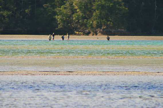 |
17:26 - After resting nearly three quarters of an hour pass before I see some people on the other side of the estuary attempting to cross. They are slowly making progress across the submerged channels up to their hips at times, but they are making good progress. |
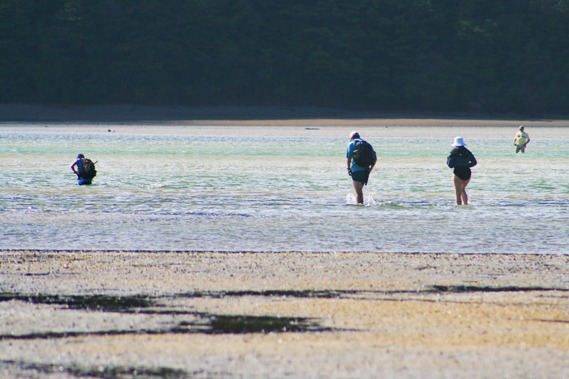 |
17:33 - Quarter of an hour passes and another group came from my side and starts crossing over. Again they are up to their hips in the near channel, but clearly the water level is dropping fast. I get up, put on my pack and commence the crossing. By the time I reach the first channel the water is thigh deep. A steady current is draining the water out of the estuary. I pass the people coming in my direction but they are a quite a way downstream from me. The estuary is covered in coarse sand and shells with some mud.
|
 |
17:58 - I eventually reached the main channel, but by now the water is only knee deep. This channel is filled with small stones. Once through the main channel, it takes about a minute before I am on completely dry flats with small puddles left on the surface. I walk past these puddles until reaching the small headland on the other side with the huge triangular marker. The crossing took half an hour.
|
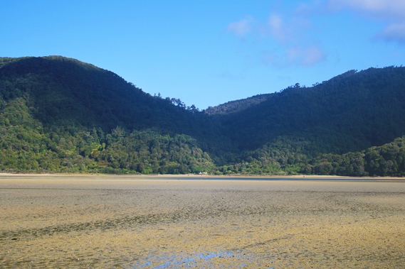 |
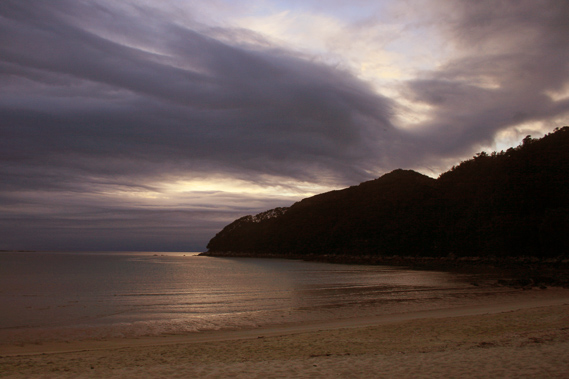
18:02 - The cloud has by now cleared from most of the sky, and shines brightly despite the air starting to feel a little chill. With the crossing complete it is time to head across to Waiharakeke and set up camp. Looking across the estuary it has dried out into a large mud flat with only a couple of small channels marking the path of the river now free to flow into the sea. The hut with the two orange marker circles and cabbage tree in front are far away now, almost impossible to see. The hut stands in a small gully under a pass between Stony Hill and Tonga Hill, appearing very picturesque and remote.
|
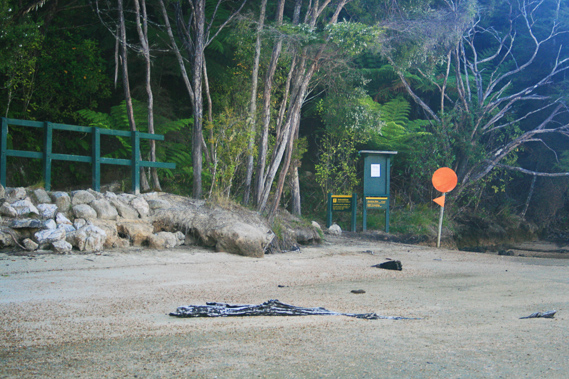 |
18:03 - I turn around and hobble up to the smaller marker peg at the start of the portage stream where the track heads into the forest. I sit on a rock to put on my boots. A large noticeboard shows the tide times here, along with a toilet and small picnic area for people who would be waiting for the tide to be low. A small stream runs through the gully in between the low forested headlands on either side. They conceal any view of the sea. There are no birds in the trees, so it is deathly silent here. New Zealand has lost most of its birdlife in recent years due to the proliferation of stoats.
|
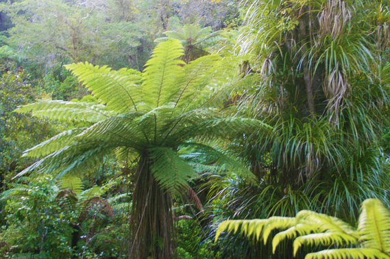 |
18:22 - I put on my pack and start walking along the trail which follows the small bubbling stream out of the back of the gully into dense forest. This area is perhaps one of the best area of forest in the park. Large Rimu trees tower in amongst the masses of tree ferns and epiphytes. |
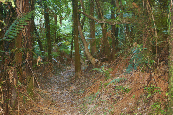 |
18:45 - There is a real jungle feel to this area. Despite the common use and what had once been a forestry tramway running through here, the forest thrives unlike any other place I have seen here in the park. |
 |
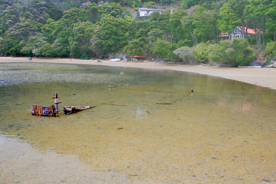
18:52 - The stream silently meanders beside the track, though large cuts where previous storms had hit were clearly evident. The track follows the path of an old tramway now overgrown with ferns. Soon the valley widens and the stream is flowing through a flax swamp. The large flax bushes give the place its name – Waiharakeke is the Maori name for flax in water. |
 |
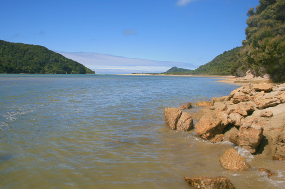
19:20 - After a few minutes of setting up camp, I return to the track and continue following it for a couple of minutes before coming out onto the beach. From here I have a clear view across to the remote headlands of Abel Head and the other Awaroa Headlands blocking the view from Tonga. |
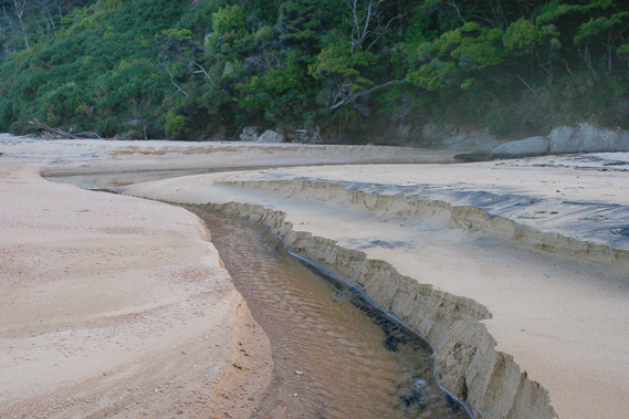 |
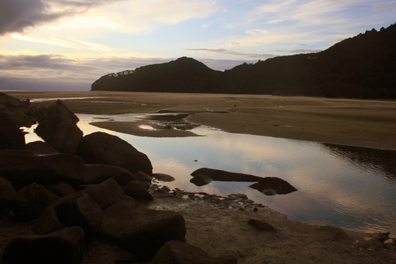
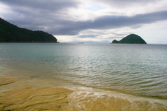
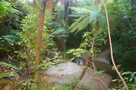
19:30 - The stream nearby cuts a deep channel through the sand in terraced layers. The sand is mostly a creamy golden colour, but there are patches of pure ironsand deposited in the areas of rapid flow.
|
 |
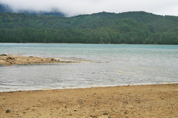
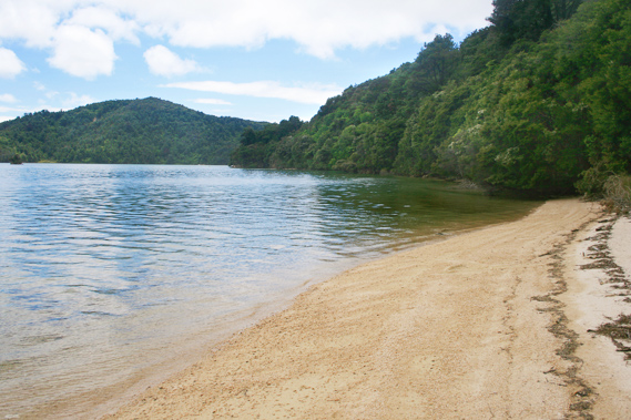
19:31 - The tide is right out now, so I follow the beach back towards the mouth of the Awaroa Inlet reaching the huge boulders of Cave Point. From here I can see the large headlands up to the Anapai Heads just past Totaranui. There is no significant cave at Cave Point worth mentioning, so I return to the campsite and cook dinner. A couple of other tents are set up on the other side of the camping ground. The air is getting very cold now, so I crawl into my sleeping bag and wait as the sky starts to darken. Then exhausted after such a long day I fall asleep. |
|